


Mount Cevedale from the Forni
Poziom trudności: T4
Zdjęcia naszych użytkowników
-

 © InfoUtworzono dnia 08.03.2026
 -
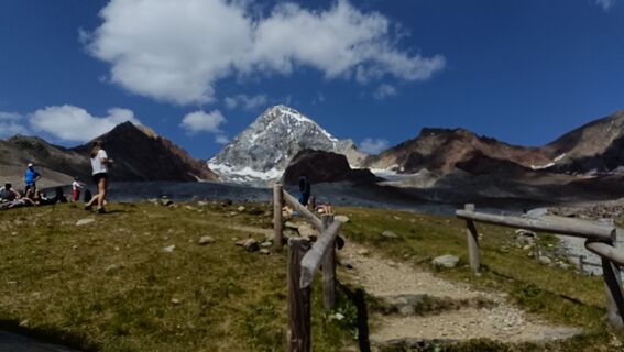
 © Maurizio Dell'acquaUtworzono dnia 10.08.2025
 -
 © Maurizio Dell'acquaUtworzono dnia 10.08.2025
 -
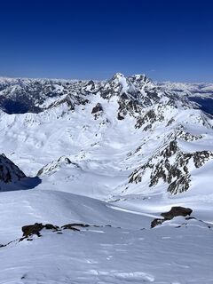
 © Christian RaabUtworzono dnia 20.03.2026
 -
 © Christian RaabUtworzono dnia 20.03.2026
 -
 © Christian RaabUtworzono dnia 20.03.2026
 -
 © Christian RaabUtworzono dnia 20.03.2026
 -
 © Christian RaabUtworzono dnia 20.03.2026
 -
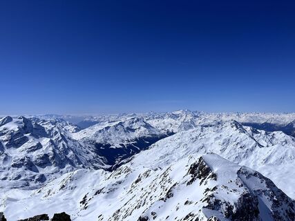
 © Robert FritzUtworzono dnia 13.08.2025
 -
 © Robert FritzUtworzono dnia 13.08.2025


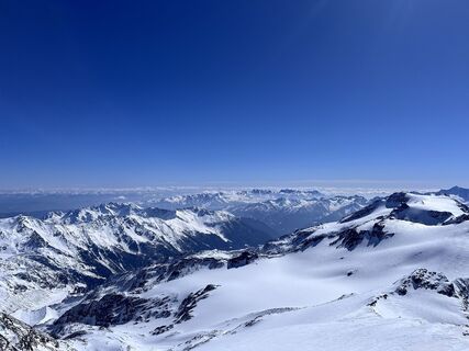
Mount Cevedale is one of the great peaks of the Ortles-Cevedale group and is one of the most popular glacial climbs in the central Alps.
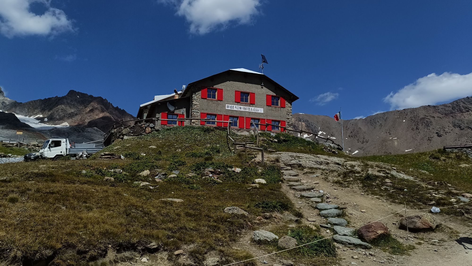
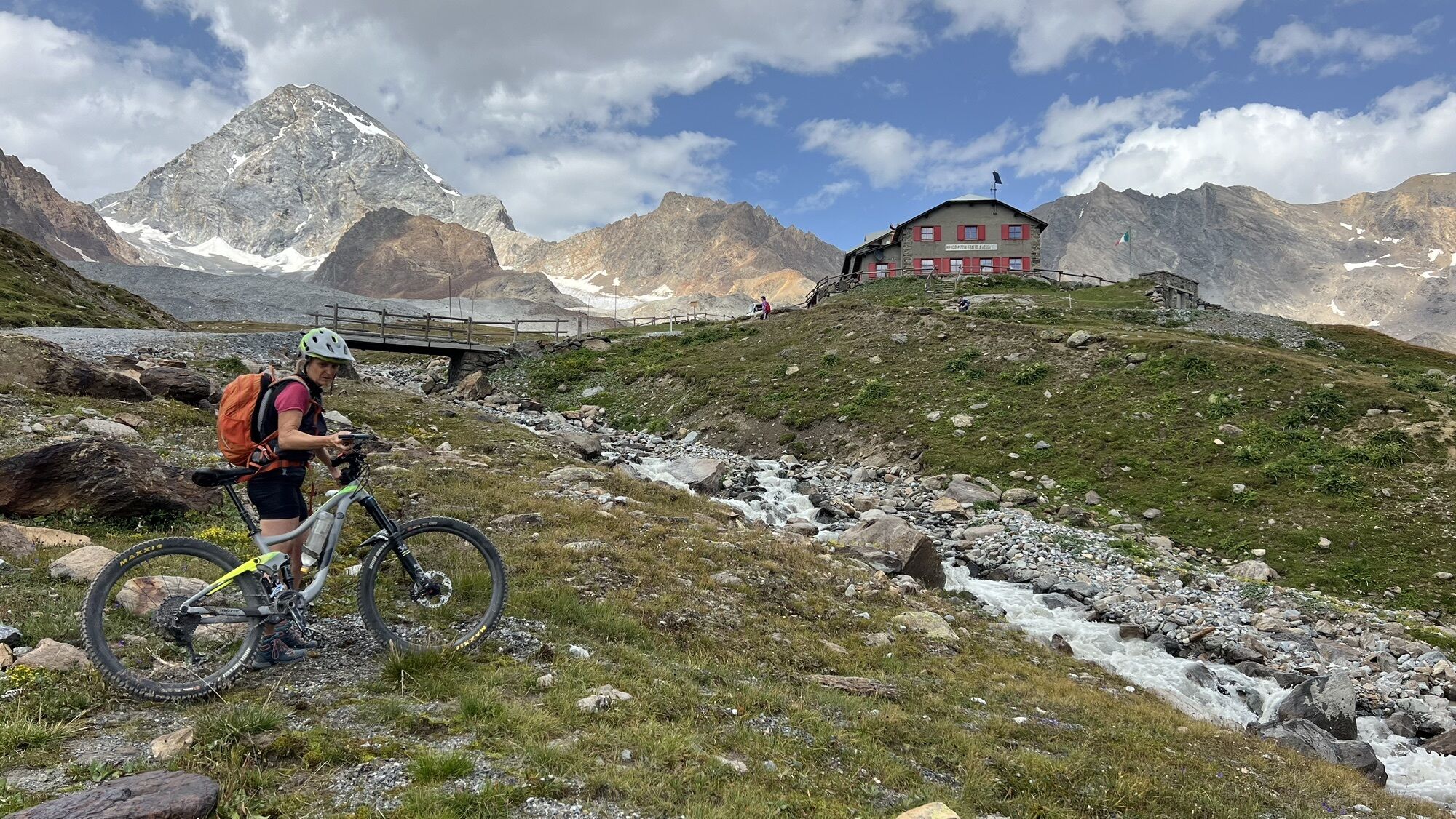
The classic route unfolds from Rifugio Pizzini, quickly entering...
The classic route unfolds from Rifugio Pizzini, quickly entering the glacial environment.
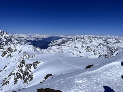
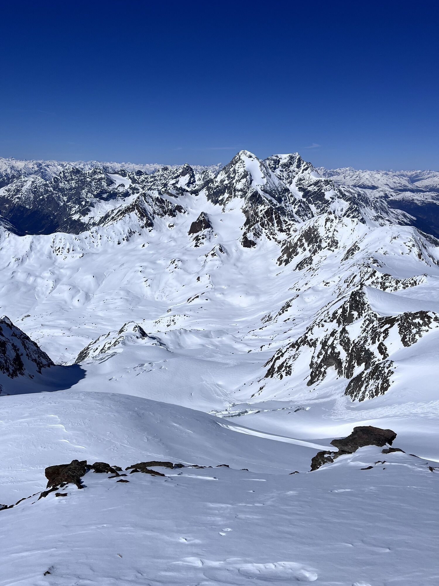
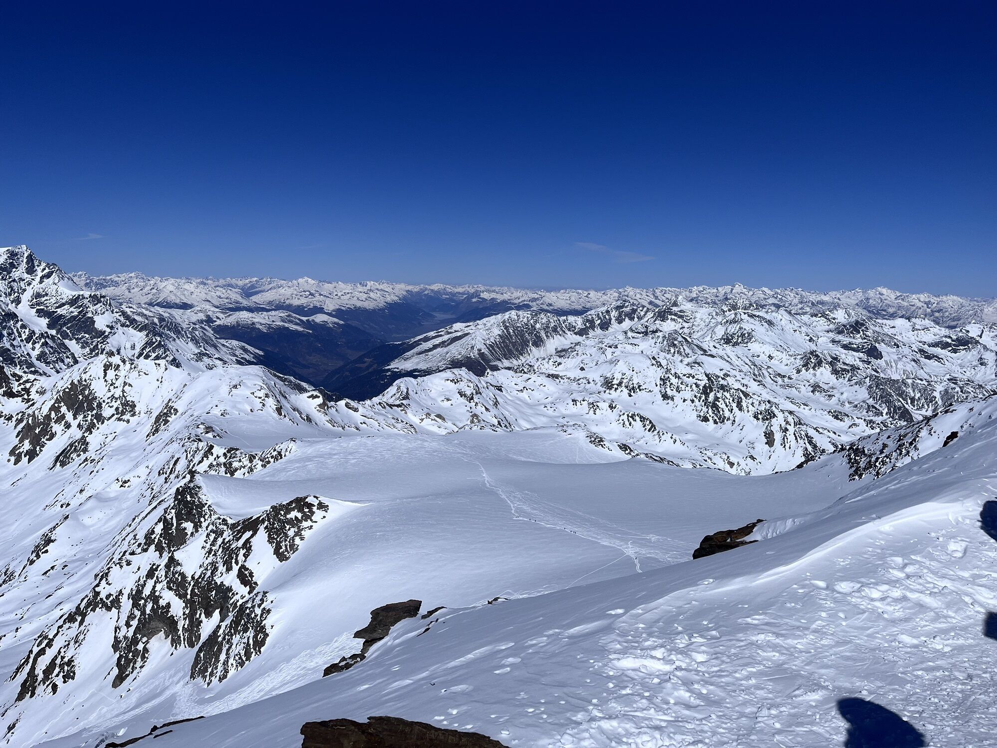
From the former Casati hut you ascend the wide vedretta on moderate slopes, generally well traced during the summer season. The route runs on glacier with progressive but never excessive inclination, crossing a grandiose environment dominated by the main peaks of the group.
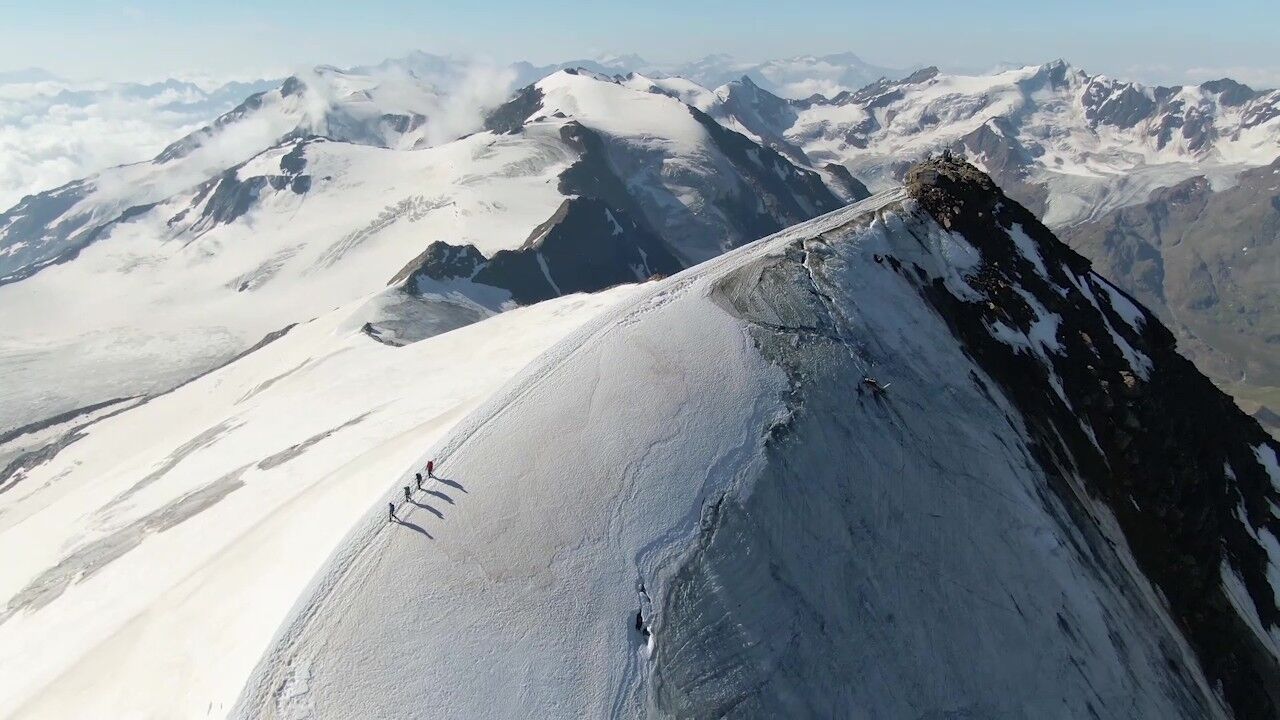
In the upper part the slope increases slightly (to about 35-40°), leading to a wide summit shoulder.
The last section is characterized by a short snowy ridge, airy but easy in places, leading to the main summit.
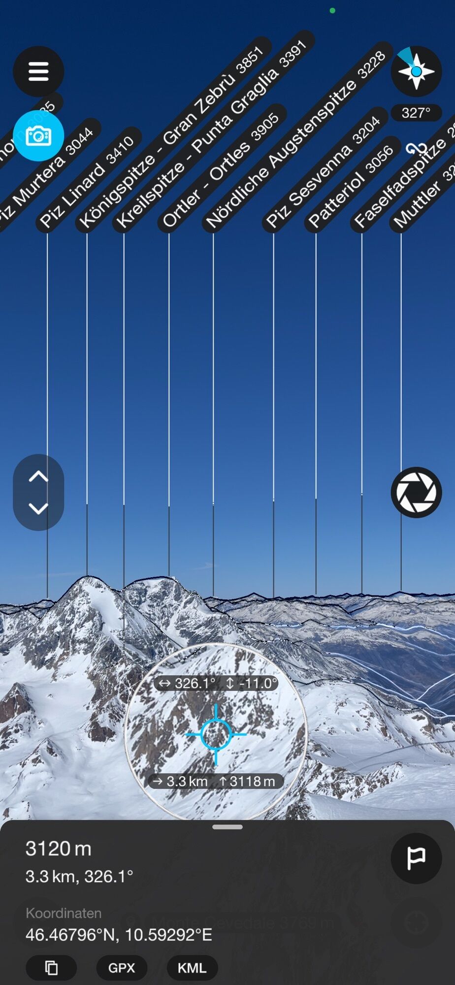
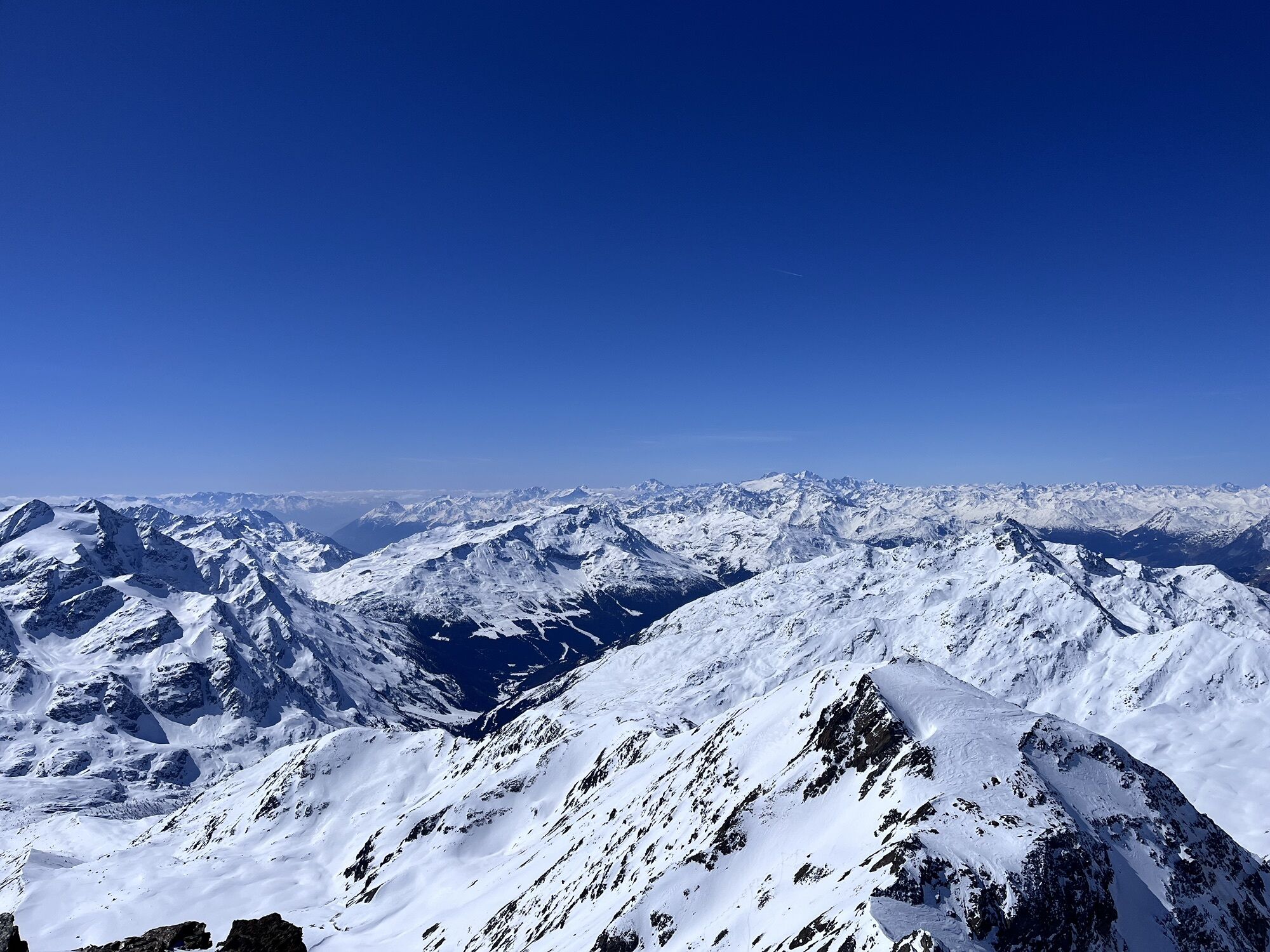
From the summit there is an exceptional panorama of Gran Zebrù, Ortles and the entire surrounding glacial system.
Descent along the same route.
From Rifugio Casati take the vedretta pointing towards the wide glacial slope in the direction of the summit.
Ascend the glacier without major technical difficulties, maintaining a direct line toward the upper part of the mountain.
Overcoming the steepest section, you reach the summit shoulder and then the short final ridge leading to the summit.
Descent along the same route.
Tak
Tak
Crampons and ice axe (required)
Harness, rope and glacier kit
Helmet
Sunglasses and UV protection
High-altitude clothing
Requires:
glacier progression skills
use of rope and mountaineering equipment
assessment of crevasses (most evident in late season)
Beware of:
hidden crevasses
hard or icy snow in the morning
possible exposure on the final ridge
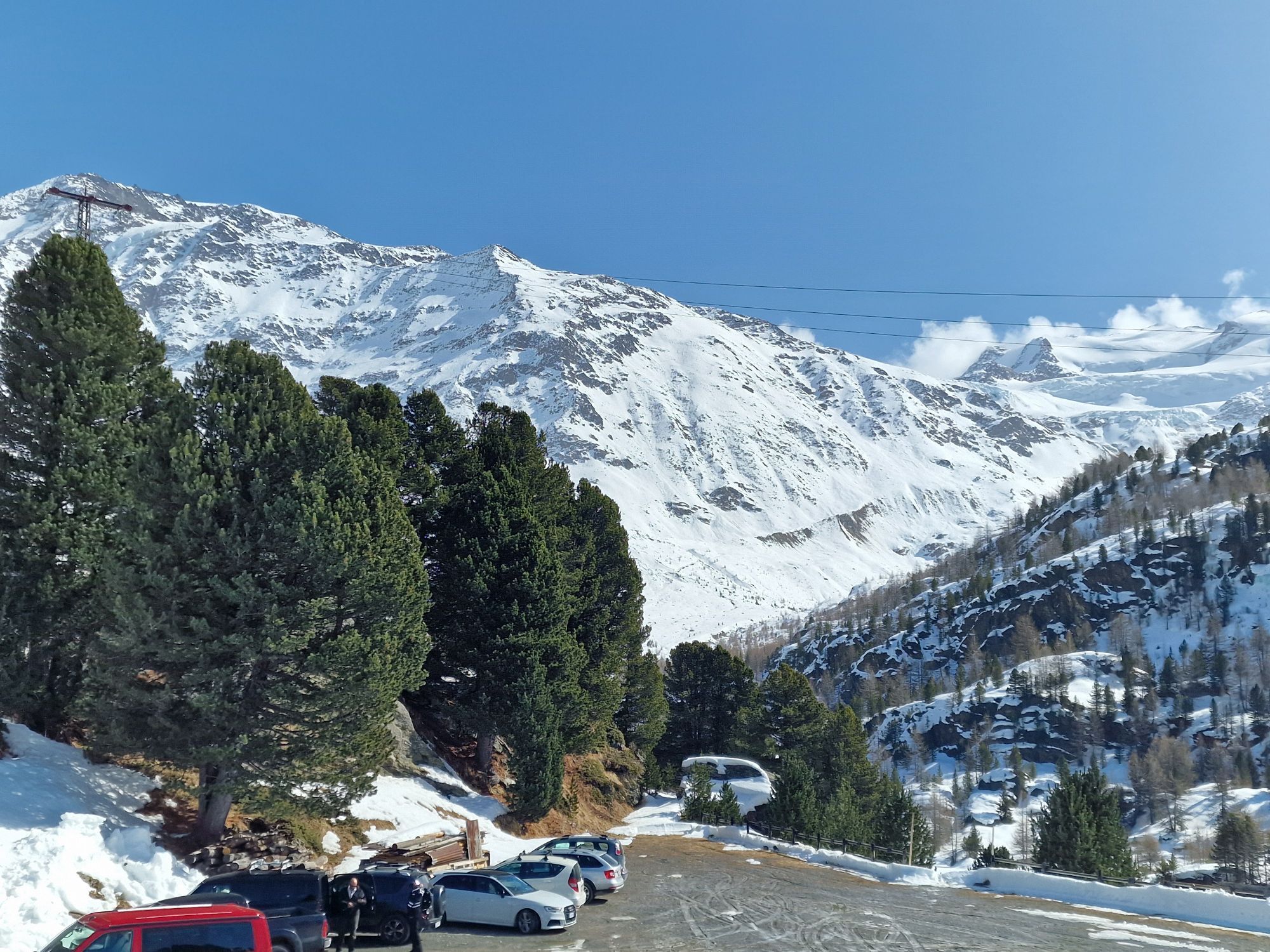
From Santa Caterina Valfurva follow the signs to Rifugio Forni along the dedicated scenic road. You must purchase a permit at the tourist office in Santa Caterina Valfurva or at the automated totems along the access road.
During the summer months the Forni Express service operates, connecting Santa Caterina Valfurva to the Forni parking lot, the starting point of the hike.
Parking available at the Forni. Permits must be purchased at the Santa Caterina Valfurva tourist office or at automated totems along the access road.
T4
Excellent acclimatization route or preparation for more challenging climbs (Gran Zebrù, Ortles)
Always check glacier conditions at the huts (Casati or Pizzini)
Possible concatenation with other peaks in the area, Cevedale being the first (or last of the 13 Peaks)
Ideal time: early summer to early fall. Check glacier conditions and refuge openings.
The climb is particularly rewarding for the open environment and views, and is often chosen as the first peak above 3500 m.
Recommended overnight stay at Rifugio Pizzini.
Popularne wycieczki w okolicy
-
4,8
Martellerhütte Höhenweg
średniWycieczka wysokogórska 8,70 km -
3,7
Von Sulden zur Hinteren Schöntaufspitze
średniWędrówka 12,7 km -
5,0
Martell-Tal Rundweg zur Marteller Hütte
światłoWędrówka 10,8 km -
Wanderung/Aufstieg zur Payerhütte
światłoWędrówka 15,9 km -
4,9
Plimaschlucht
światłoWycieczki górskie 7,23 km -
3,7
Düsseldorfer Hütte 2721m
średniWędrówka 4,14 km -
5,0
Pistenskitour zum Madritschjoch (3.123m)
światłoWycieczka narciarska 16,6 km -
5,0
Ortler über Hintergrat
ciężkiWycieczka wysokogórska 8,03 km -
4,5
Suldenspitze
światłoWycieczka wysokogórska 7,69 km -
Ortler über Meraner Weg (vom Tal/Trafoi)
ciężkiWycieczka wysokogórska 11,9 km
Wędrówki i tropienie


Nie przegap ofert i inspiracji na następne wakacje
Twój adres e-mail została dodana do listy mailingowej.