Valgerola Lakes Tour
ciężki
Nawigacja
Nawigacja
Pobierz tę trasę na swój telefon komórkowy
Valgerola Lakes Tour
ciężki
Wędrówka
14,86
km
Zeskanuj kod QR i rozpocznij nawigację w aplikacji bergfex.

Wędrówki i tropienie


Valgerola Lakes Tour
Odległość
14,86
km
Czas trwania
06:55
h
Ascent
1.038
hm
Poziom morza
1.449 -
2.435
m
Poziom trudności: T3
Ścieżka do pobrania
Valgerola Lakes Tour
ciężki
Wędrówka
14,86
km
Zdjęcia naszych użytkowników
 © Piopollo2005Utworzono dnia 19.10.2025
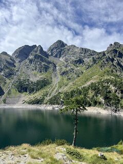
 © Valeria GrassiUtworzono dnia 27.07.2025
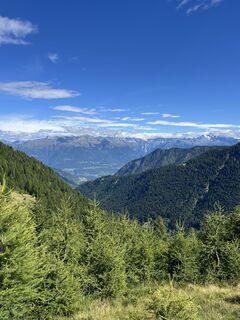 © Valeria GrassiUtworzono dnia 27.07.2025
 © Laura De CapitaniUtworzono dnia 15.06.2025
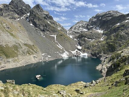 © Laura De CapitaniUtworzono dnia 15.06.2025
 © Laura De CapitaniUtworzono dnia 15.06.2025
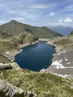 © Laura De CapitaniUtworzono dnia 15.06.2025
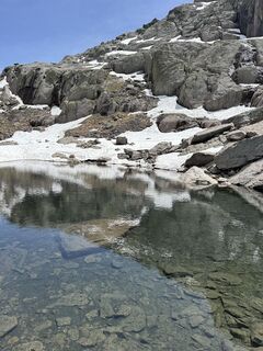 © Laura De CapitaniUtworzono dnia 15.06.2025
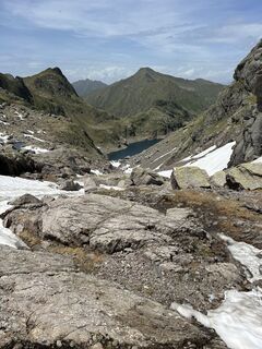 © Laura De CapitaniUtworzono dnia 15.06.2025
 © Laura De CapitaniUtworzono dnia 15.06.2025
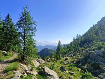
 © michael WolfgerUtworzono dnia 10.07.2024
 © michael WolfgerUtworzono dnia 10.07.2024
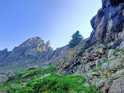 © michael WolfgerUtworzono dnia 10.07.2024
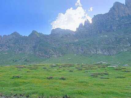 © michael WolfgerUtworzono dnia 09.07.2024
 © michael WolfgerUtworzono dnia 09.07.2024
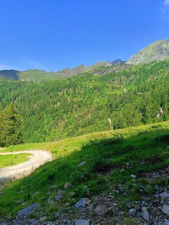 © michael WolfgerUtworzono dnia 09.07.2024
 © Daniele SpeziaUtworzono dnia 27.06.2023
 © Daniele SpeziaUtworzono dnia 27.06.2023


The tour starts in Pescegallo (M 1473) and follows the flat path - westward - to reach the trail that climbs in the woods with signs for the Lake Trona / trail N148. The route - without deviation - reaches...
Opis
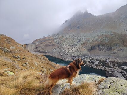
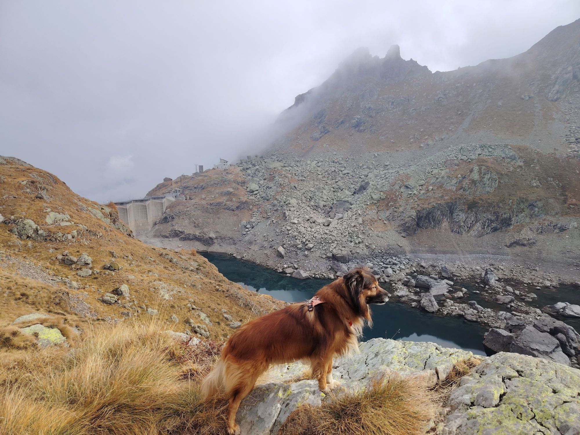
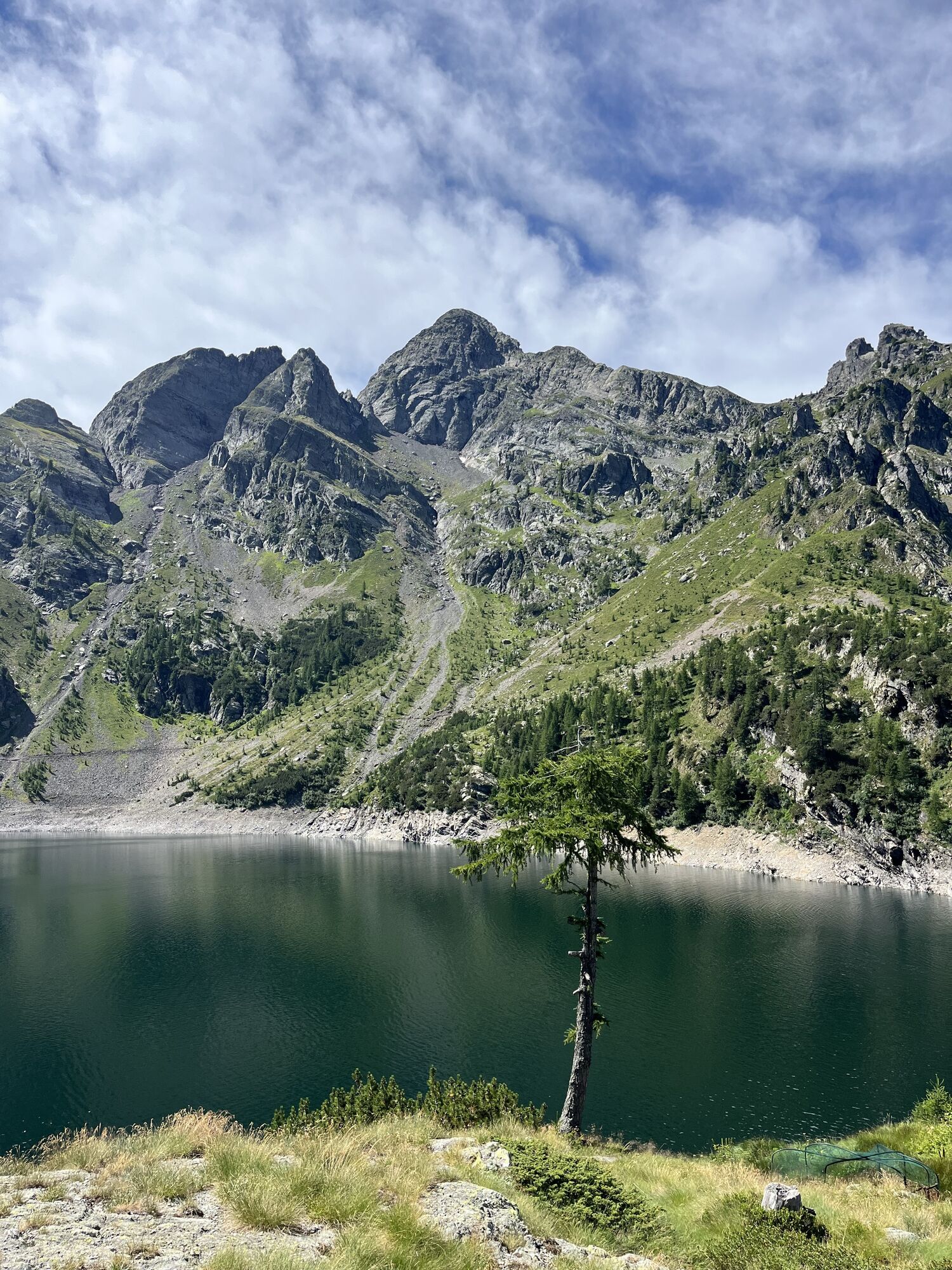
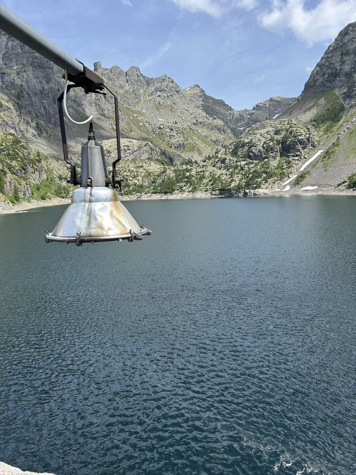
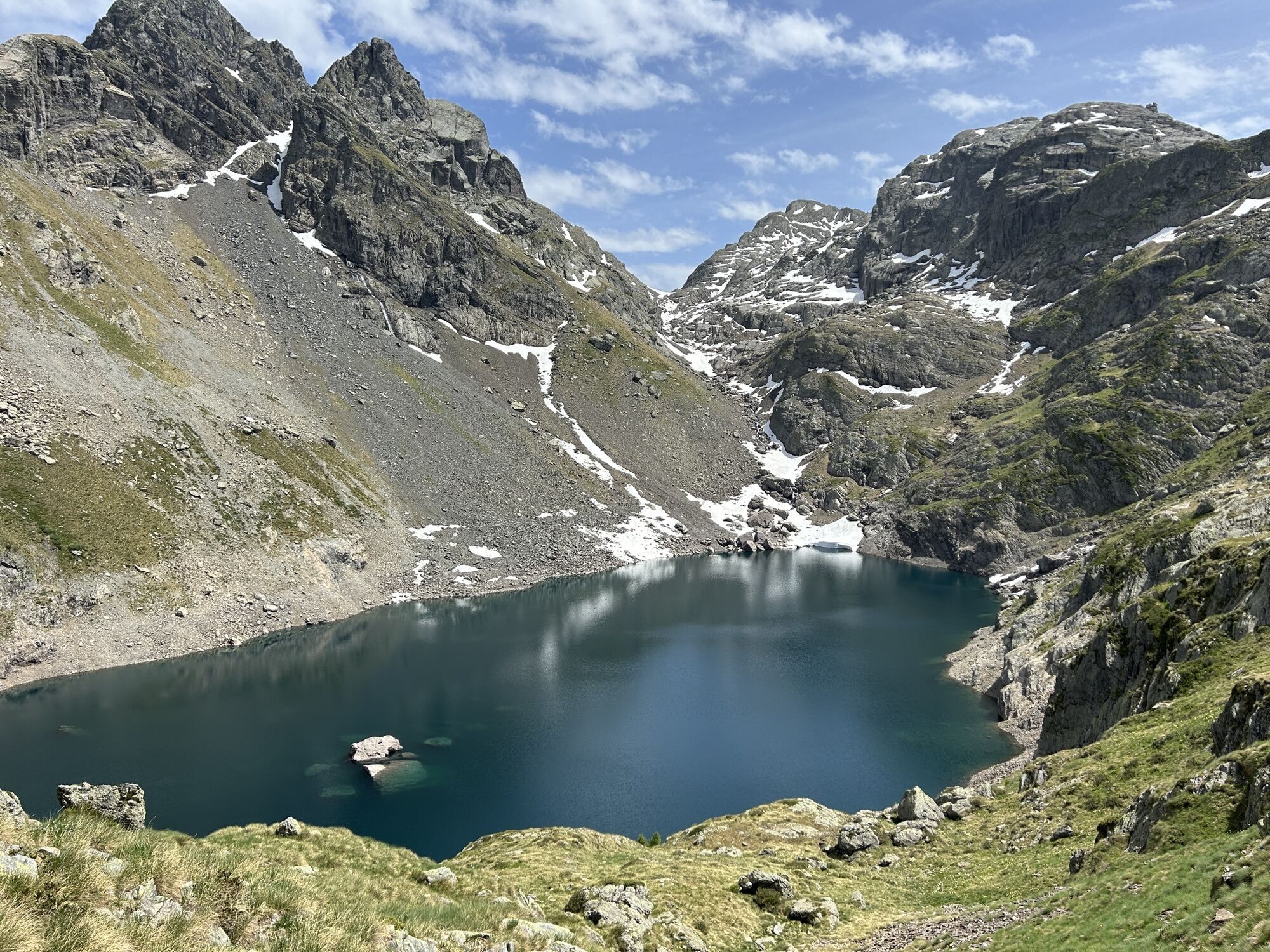
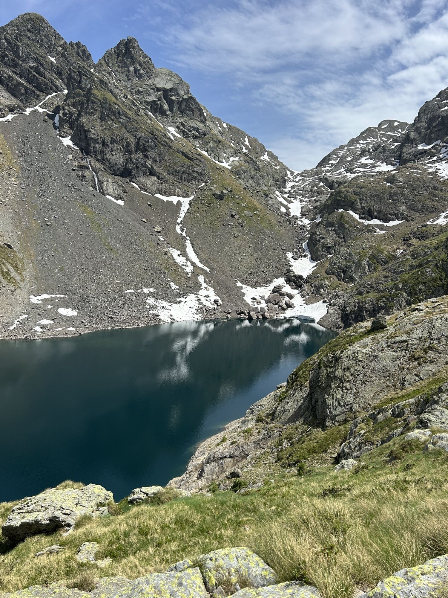
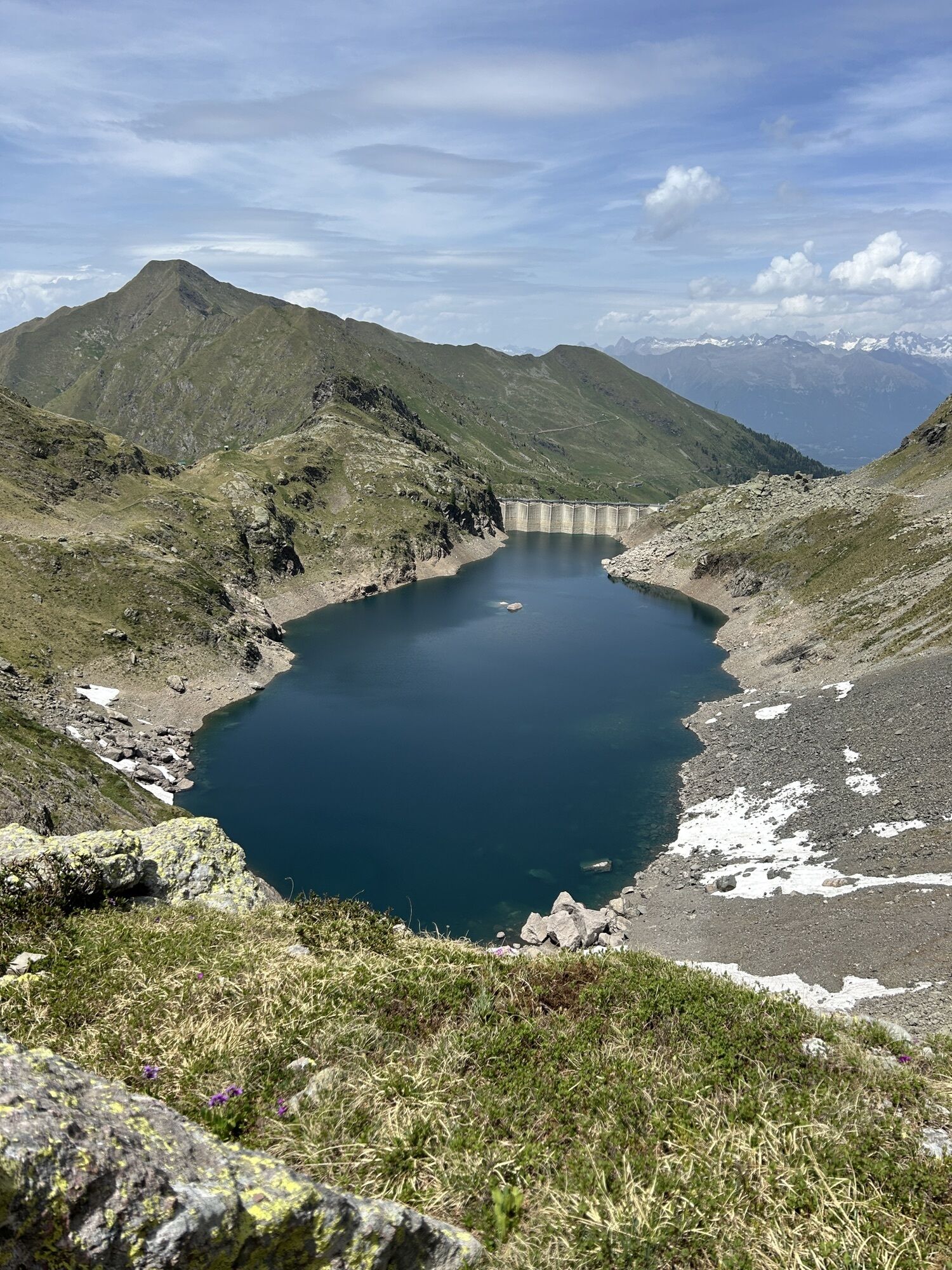
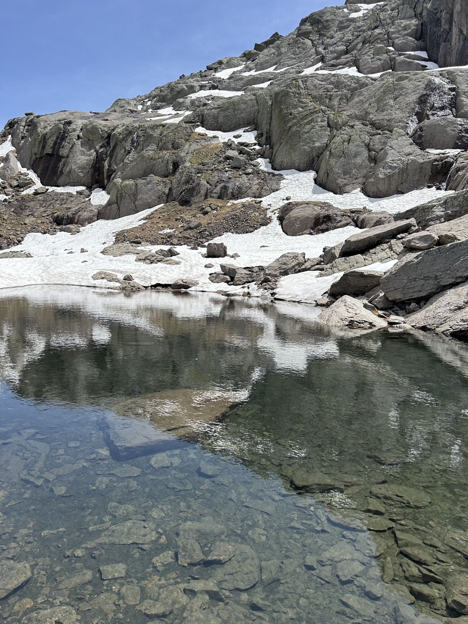
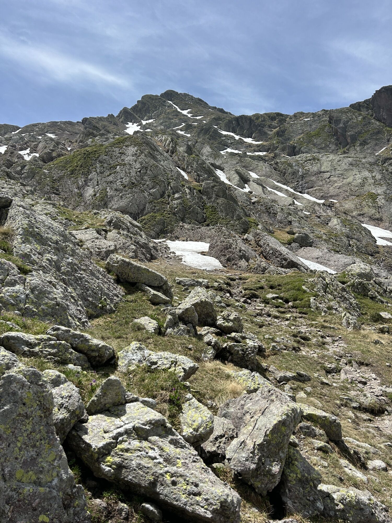
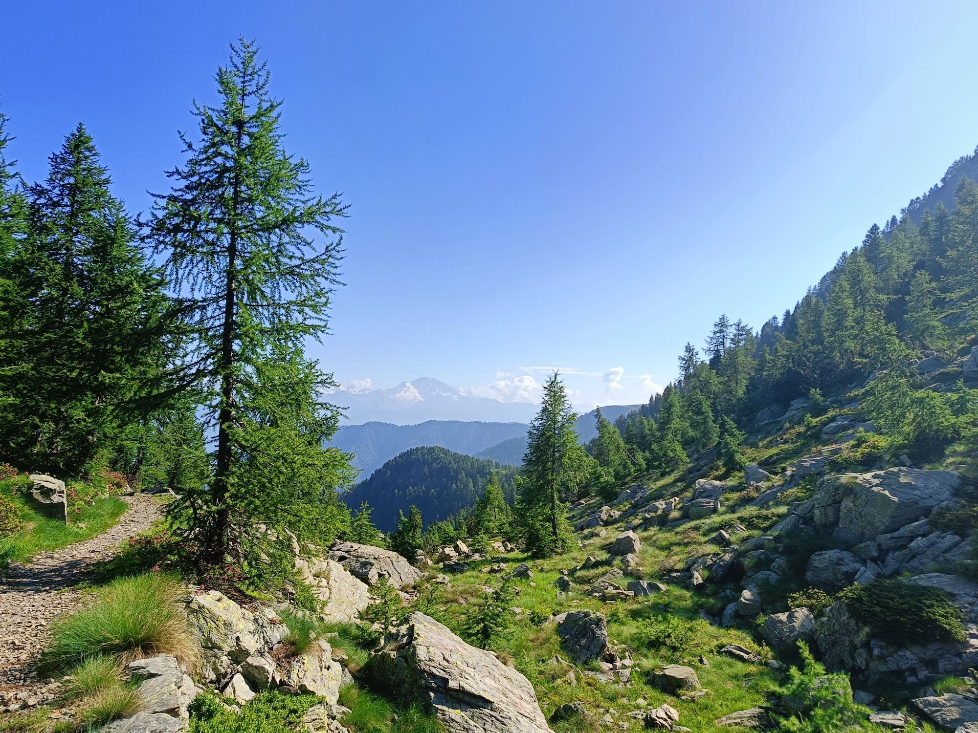
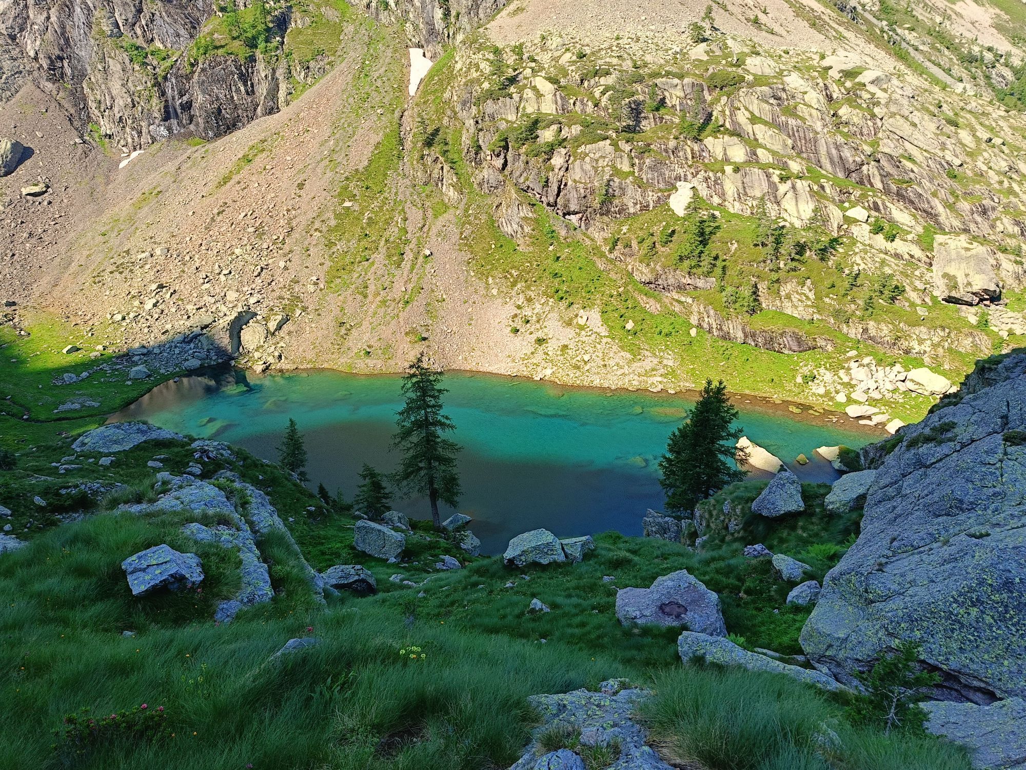
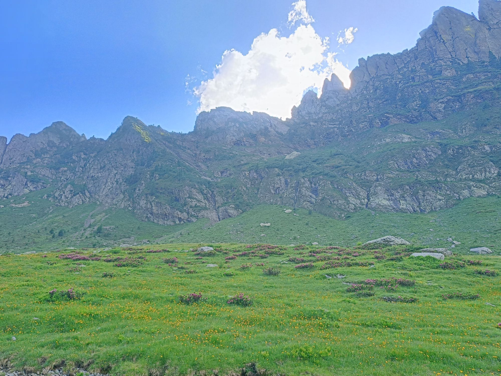
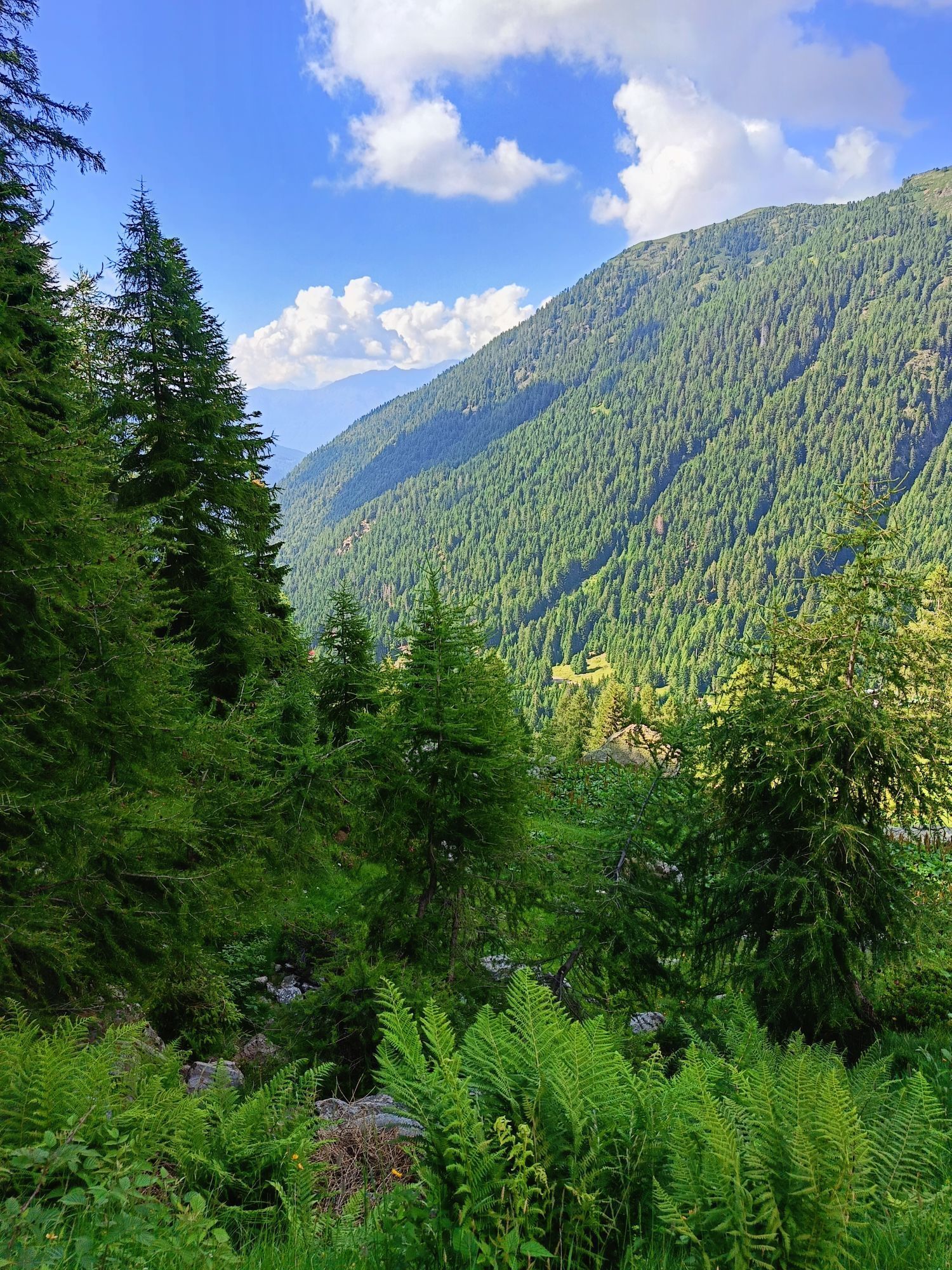
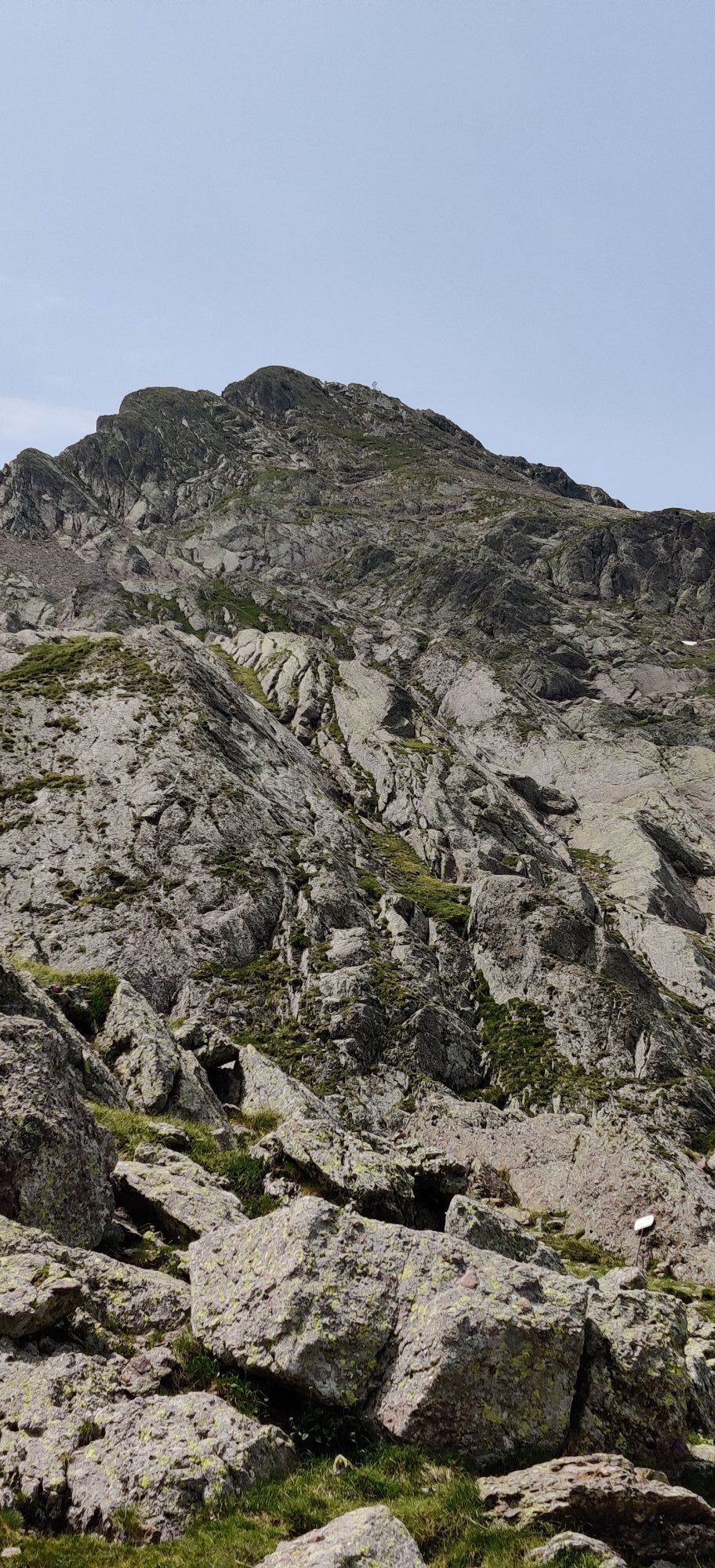
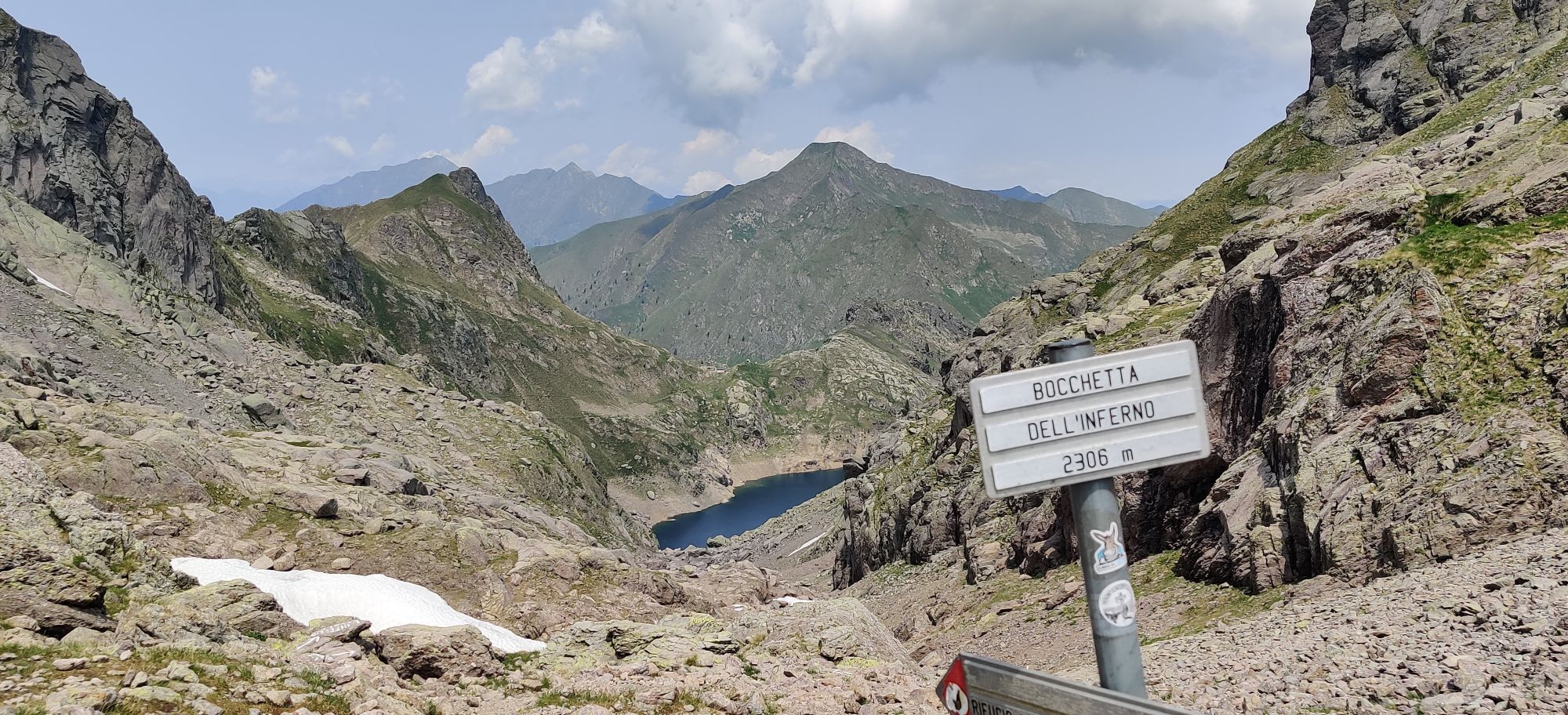
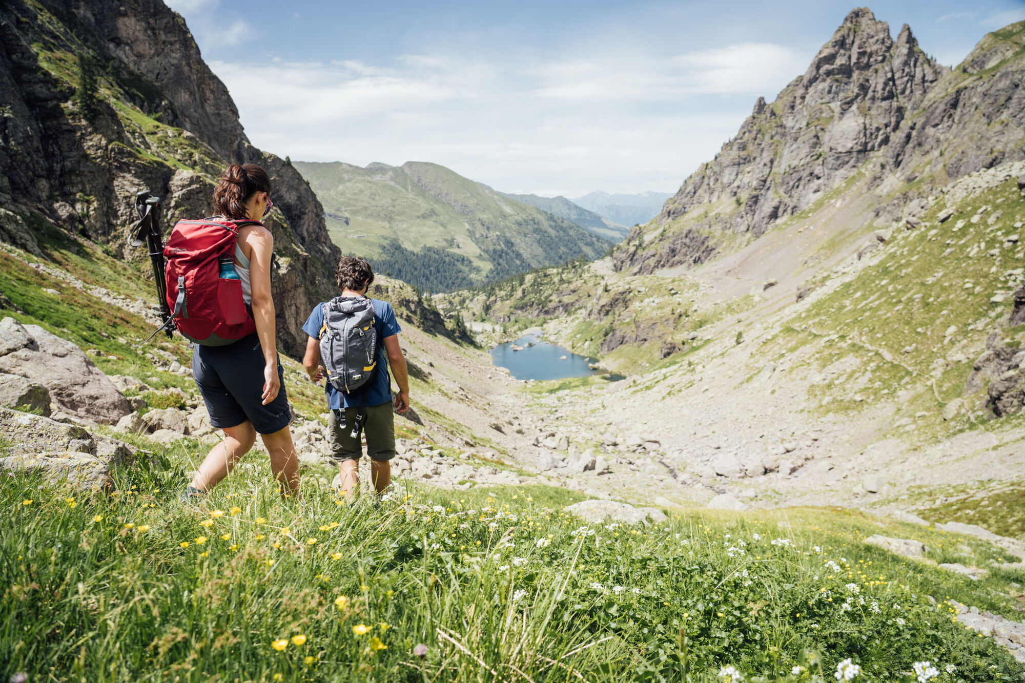
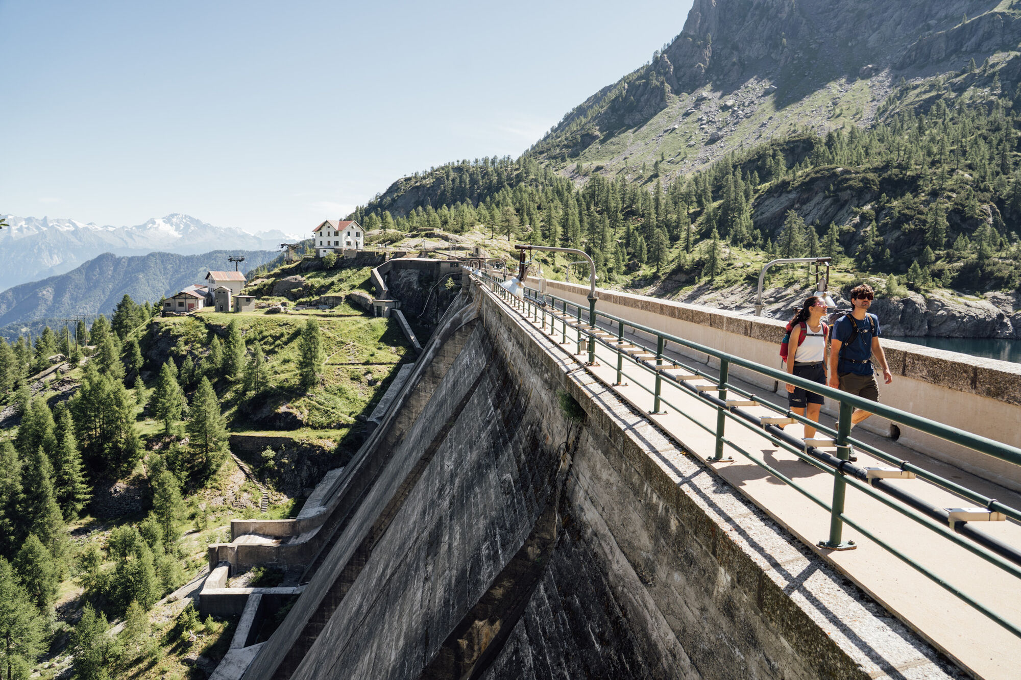
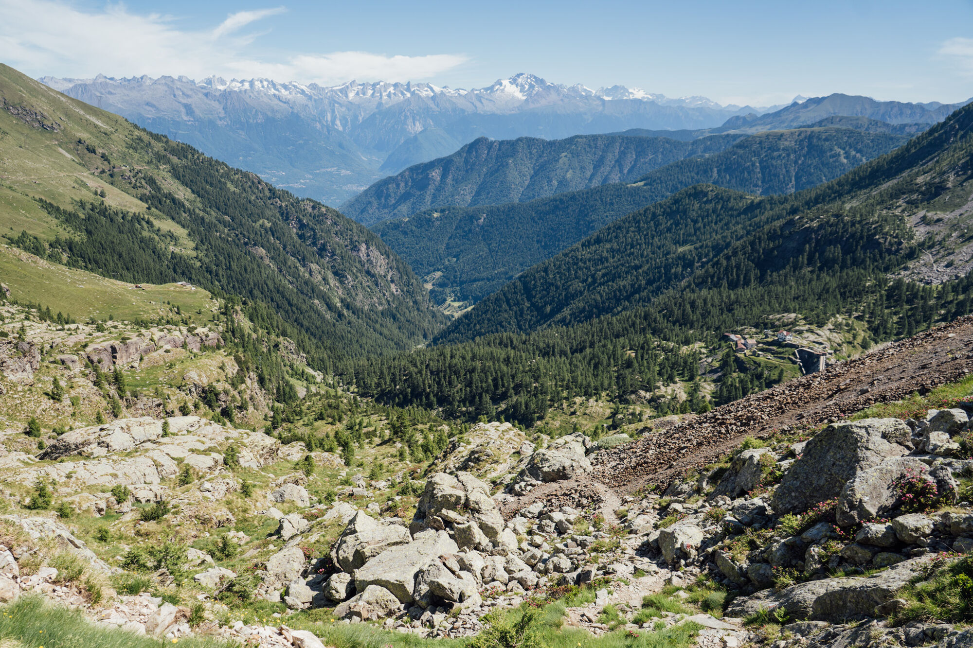
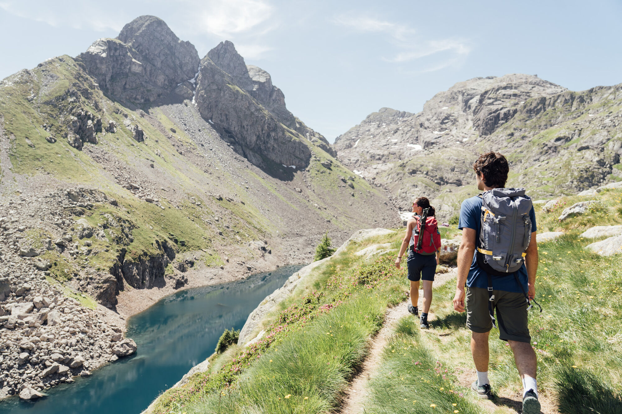
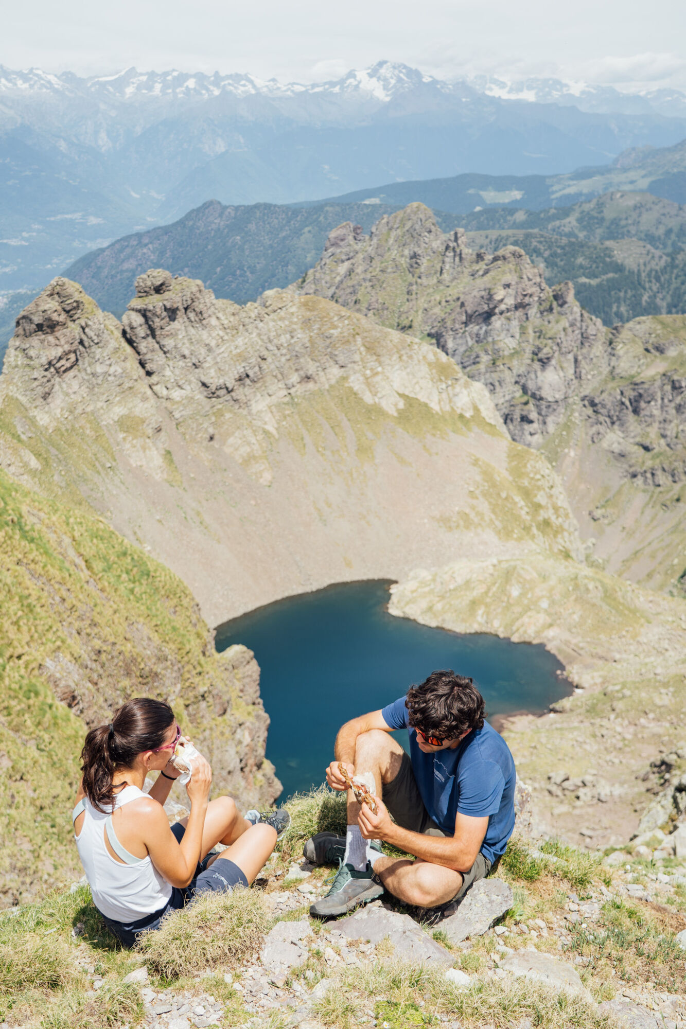
The tour starts in Pescegallo (M 1473) and follows the flat path - westward - to reach the trail that climbs in the woods with signs for the Lake Trona / trail N148. The route - without deviation - reaches the dam (M 1805) which is of glacial origin, an electric energy source from the early '40s. The dam is to be crossed along the passage on the wall, then follow the track which - near a hut - climbs the scree, with the remains of ancient mines, towards the Lake of Hell (M 2072). The basin is between Pizzo di Trona (M 2510), Pizzo dei Tre Signori (M 2554) and Pizzo Varrone (M 2325). The route continues beyond the dam to reach Bocchetta di Varrone (M 2130) and - from here - to the left along the lake shore. The track for Bocchetta d'Inferno (M 2306) is among the rocks, which are the protagonists of this landscape, and continues steeply to the saddle at 2457 m above sea level. In view is the Round Lake (M 2254). The descent is on unstable ground. The lake - in a basin - is a deep blue; around only gray rock and many ibex. The route continues along trail N14, which descends into the Trona Valley past Lake Zancone (M 1957), a greenish lake with islets. There follow the trail to Lake Trona and - then - follow N148 back to Pescegallo.

Informacje o trasie
Trasa
Pescegallo Parking - Tronella Valley - Peak - Lake Trona - Lake of Hell - Bocchetta di Varrone - Bocchetta d'Inferno - Round Lake - Lake Zancone - Peak - Tronella Valley - Pescegallo Parking
Informacje o przyjeździe
Przybycie
Follow the SP 7 of Valgerola from Morbegno to Pescegallo of Gerola Alta
Transport publiczny
STSP Line A015 Morbegno - Gerola Alta - Pescegallo SUMMER SCHEDULE ONLY
Parking
P of Pescegallo, Municipality of Gerola Alta
Dodatkowe informacje i wskazówki
Poziom trudności
T3
Dodatkowe informacje
There are no fountains/sources of drinking water along the route.
Wskazówki
Refreshment break at Rifugio Falc (M 2120) near Bocchetta di Varrone.
Nie ma jeszcze recenzji
Popularne wycieczki w okolicy
- 4,8
Monte Legnone- höchste gipfel der Comer See
średniWędrówka 11,6 km - 4,4
Colle del Balisio Vetta Grigna Settentrionale rifugio Brioschi
ciężkiWędrówka 12,6 km Tour dell’alpe Giumello
światłoWędrówka 7,52 kmCulmine San Pietro - rifugio Cazzaniga Merlin
światłoWędrówka 19,9 kmGrignone
średniWędrówka zimą 12,6 km- 5,0
Via Priula da Mezzoldo a Ca’ San Marco
światłoWędrówka 9,65 km - 5,0
Dazio's Colmen - A Mediterranean oasis in the midst of the Alps
światłoWędrówka 5,62 km - 5,0
Lago di Ponteranica inferiore
średniWędrówka 6,52 km - 5,0
Rifugio Nicola
średniWędrówka 12,8 km Alpe Piazza Rifugio
światłoWędrówka 3,06 km

Wędrówki i tropienie

Ponad 550.000 propozycji wycieczek, szczegółowe mapy i intuicyjny planer tras sprawiają, że aplikacja jest niezbędna dla wszystkich entuzjastów przyrody.

Nie przegap ofert i inspiracji na następne wakacje
Zapisz się do newslettera
Błąd
Wystąpił błąd. Spróbuj ponownie.Dziękujemy za rejestrację
Twój adres e-mail została dodana do listy mailingowej.
Wycieczki po całej Europie
Austria Szwajcaria Niemcy Włochy Słowenię Francja Holandia Belgia Polska Liechtenstein Czechy Słowacja Hiszpania Chorwacja Bośnia i Hercegowina Luksemburg Andorra Portugalia Islandia Wielka Brytania Irlandia Grecja Albania Macedonia Północna Malta Norwegia Czarnogóra Mołdawia Kosowo Węgry San Marino Rumunia Estonia Łotwa Białoruś Cypr Litwa Serbia Bułgaria Monako Dania Szwecja Finlandia