






The Ethnographic Trail
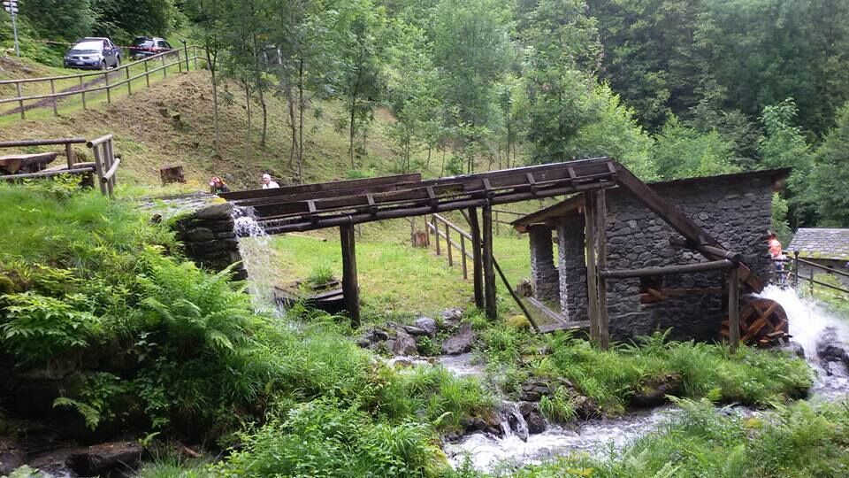
It is a unique route from an ethnographic point of view that offers the possibility to imagine what the rural subsistence economy was like until the 1950s. You can admire the numerous mills where cereals...
It is a unique route from an ethnographic point of view that offers the possibility to imagine what the rural subsistence economy was like until the 1950s. You can admire the numerous mills where cereals were ground, the Pila where chestnuts were pounded and the Grat where they were laid out to dry, the forge where metal tools were forged, the ovens for baking bread found in all hamlets, the oil mills where oil for combustion was produced. The woods were cultivated as forest for timber exploitation, for chestnut production, and to provide pasture for livestock. Until fifty years ago, the landscape was much less wooded and more open, cultivated with cereals and with many vineyards for wine production. The route starts from the path in the Cavallari district and, ascending, enters a very humid forest made up of chestnut, linden, ash, hop hornbeam, elderberry, birch, poplar, and rowan. Following the signs, you arrive at an abandoned orchard and on the left continue until you meet the Nesina district. Along the path, you can see the Church of St. Joseph, accompanied by suggestive orchards and vineyards. At the height of the fountain, the path continues to Paiosa, located in a panoramic spot. The path follows for a short stretch the mule track that enters Val Malgina and then descends to the Albert district where the Pila and the Mill are located. It descends towards Cortivo where two more mills are found, one for rye and one for buckwheat. It continues for about two hundred meters along a carriage road that leads downhill and from here a path cuts across the meadows until reaching the district of the Pile. Crossing the road again, a path descends to the valley bottom where you return to the starting point passing through the Cavallari forge.

Popularne wycieczki w okolicy
-
4,5
Rifugio Curo’ e lago del Barbellino - lago naturale del Barbellino - lago Gelt
ciężkiWędrówka 26,4 km -
4,0
Valbondione-Curò
średniWędrówka 7,02 km -
Val dal Saient - Short version
Wędrówka 11,4 km -
5,0
Brunone
średniWycieczki górskie 15,0 km -
Szlak Valtellina
średniJazda na rowerze 113,2 km -
33.10 Le Prese - Tirano, Via Albula / Bernina
średniWędrówka 14,6 km -
Schmugglerweg
Wędrówka 9,11 km -
30.07 S. Romerio - Tirano (I), ViaValtellina
ciężkiWędrówka 12,2 km -
3,0
Cima Meriggio
światłoWędrówka 11,6 km -
5,0
Pian di Gembro Nature Reserve loop (1350 m)
światłoWędrówka 4,81 km
Wędrówki i tropienie


Nie przegap ofert i inspiracji na następne wakacje
Twój adres e-mail została dodana do listy mailingowej.





