


Dosde Hut
From the Altumeira parking lot, return towards Arnoga for about 200 m and at the fork, take the road that descends to the valley towards the Baite Minestra. The route connects with trail N293, becomes...
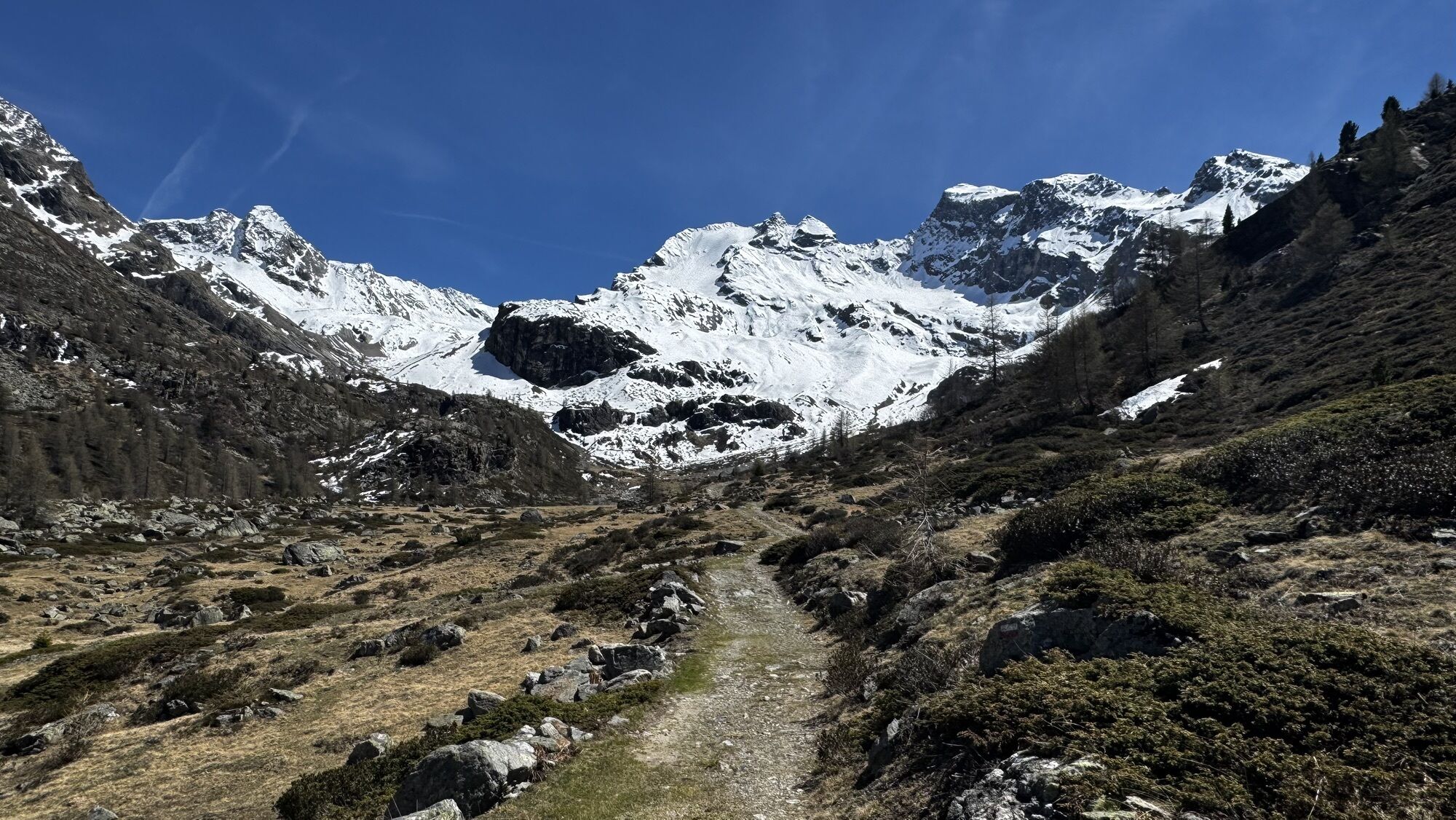
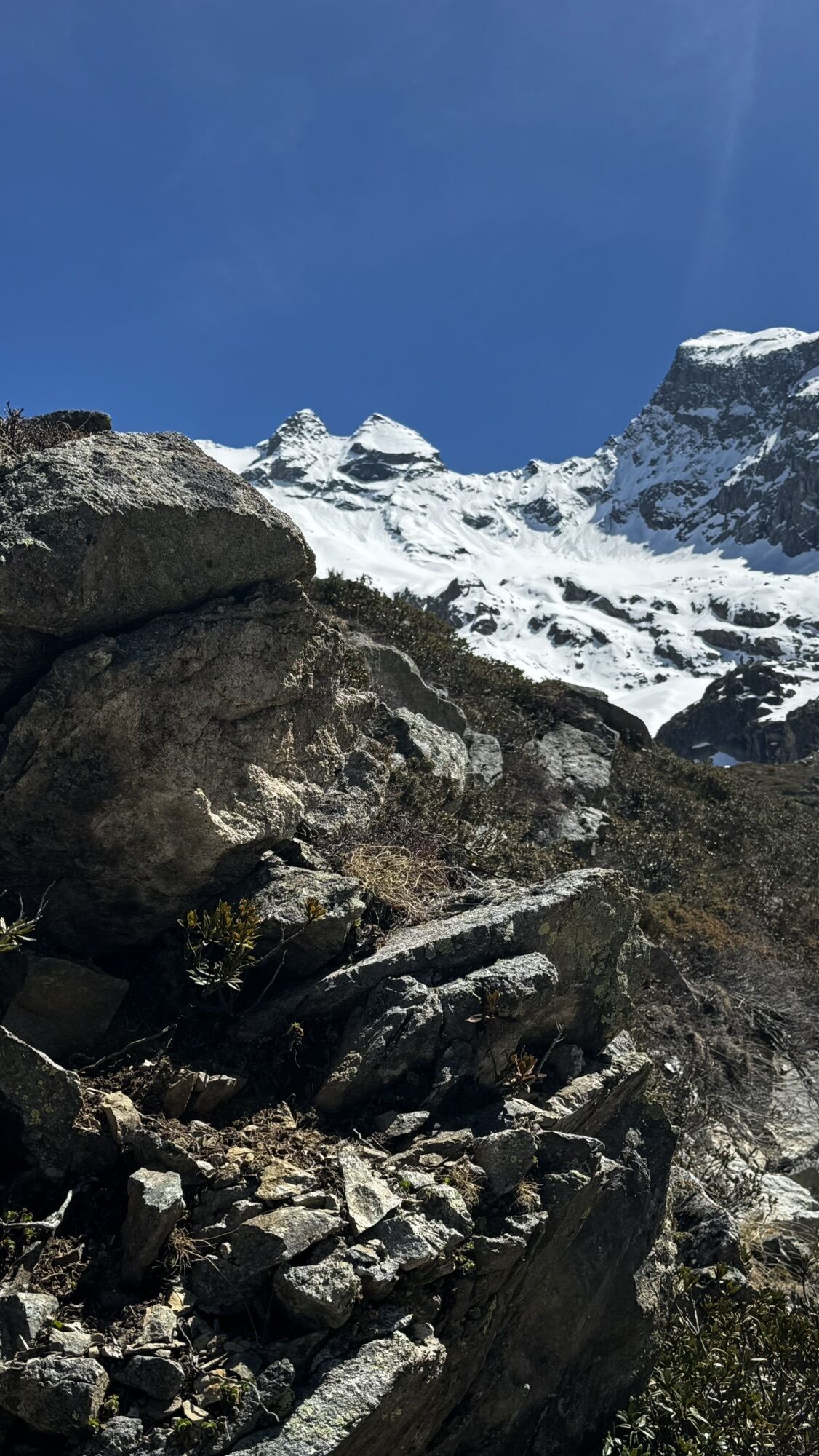
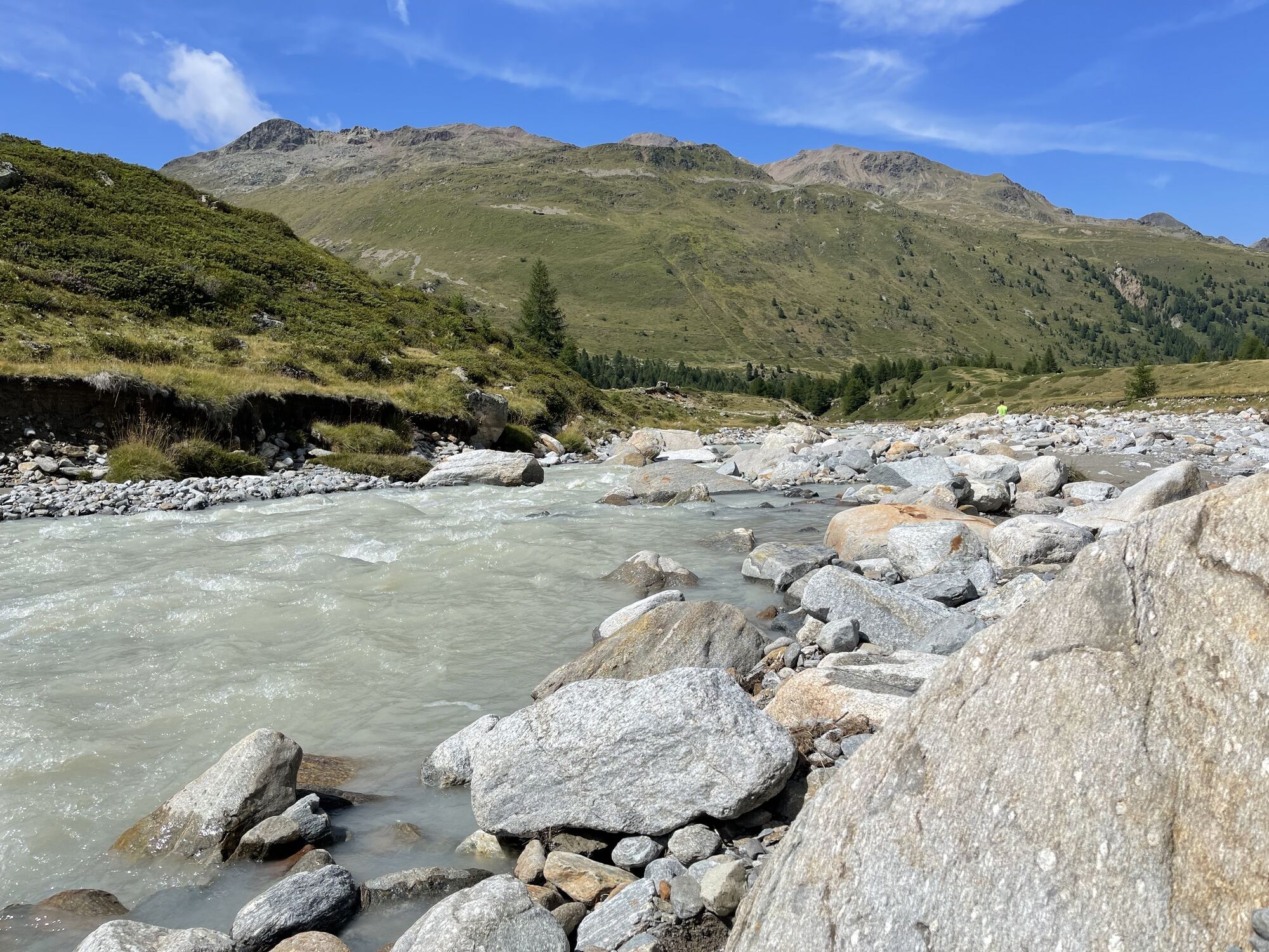
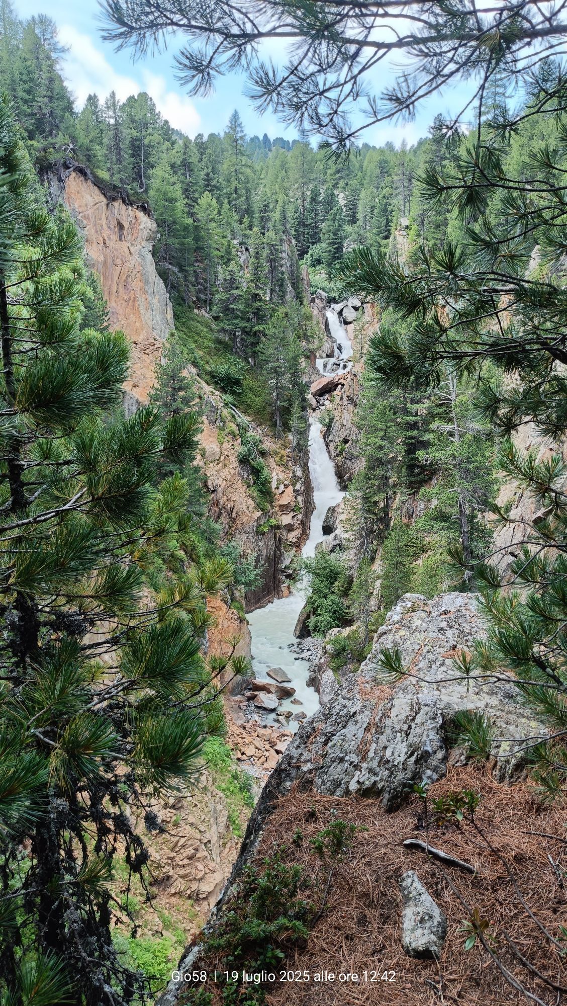
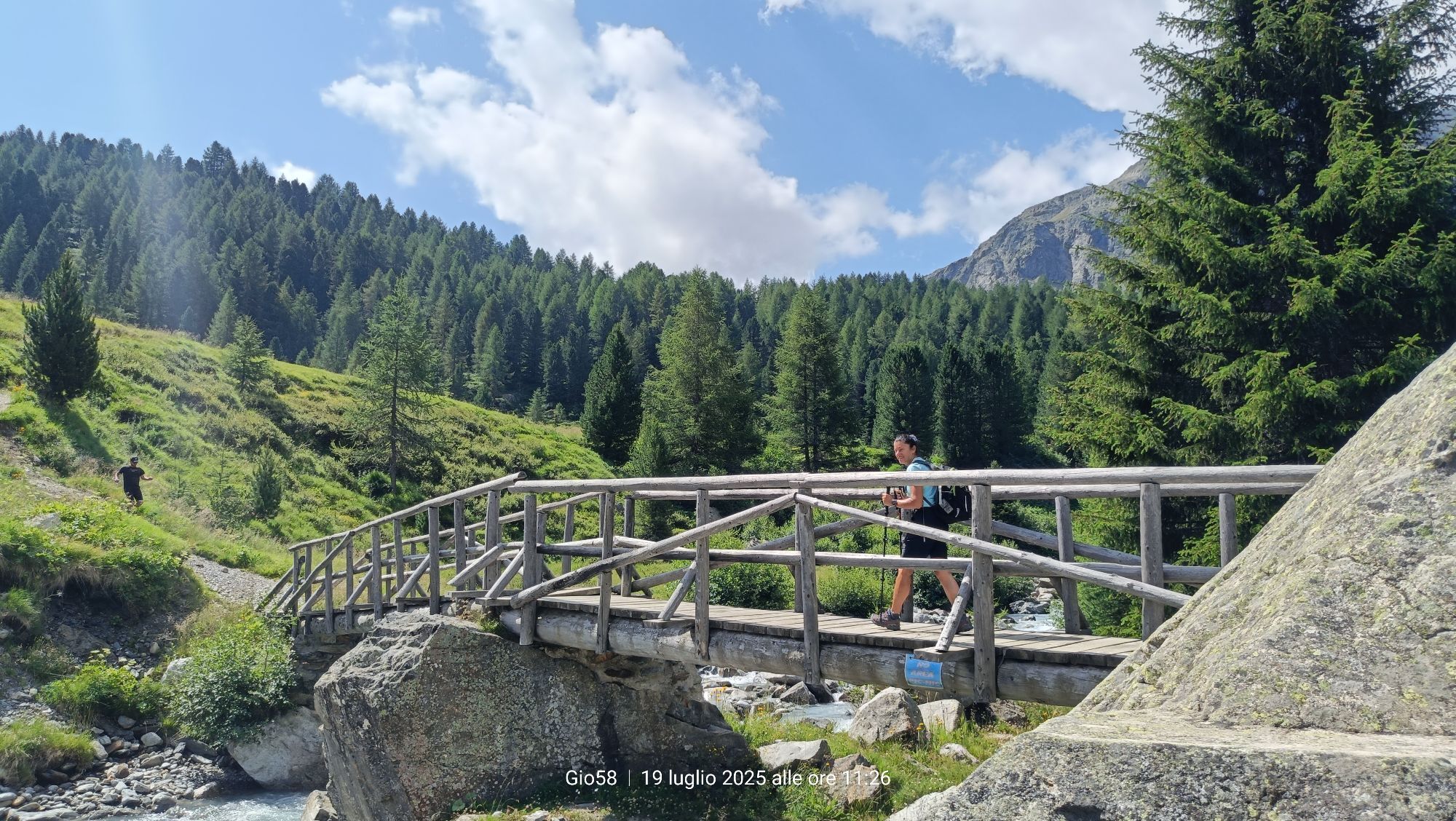
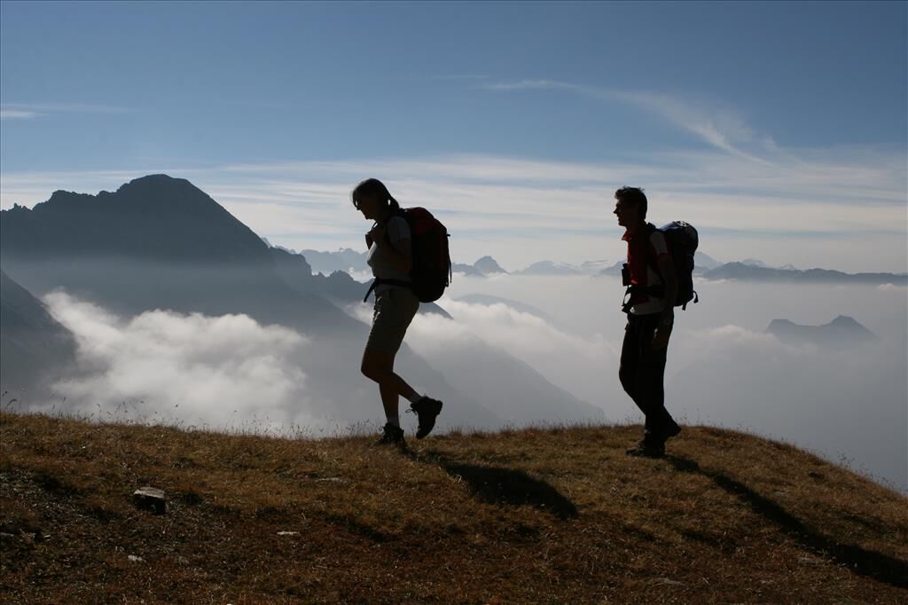
From the Altumeira parking lot, return towards Arnoga for about 200 m and at the fork, take the road that descends to the valley towards the Baite Minestra. The route connects with trail N293, becomes flat, and continues westward for a good stretch, following the Viola stream until Baita Caricci. From here, a bridge allows you to cross the watercourse. Climb to the right and ascend zigzag on a steep bushy slope, where you enjoy a dizzying view of a deep gorge carved by the Viola stream. At the top of the hill, cross a plateau until you reach the Federico Refuge in Dosde'. Continuing on a track through sparse pastures, you enter the valley. At an altitude of 2200 m, there is a fork with the left branch leading to the Caldarini Bivouac. Continue to the right along trails N208 and N292 that cross the Val Cantone di Dosde', until you reach the Pass and the Dosde' Hut. The view of the surrounding glaciers is magnificent.


Baite Minestra - Baita Caricci - Federico Refuge - Val Cantone - Canton del Dosde' - Dosde Hut
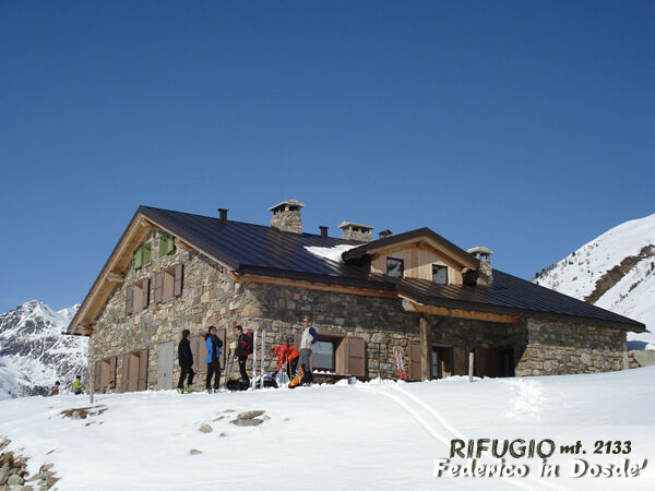
Federico Refuge in Dosde'. It is the only refuge managed by a CAI Alta Valle association. Located in Val Dosde', it was built on the site of an old ruined hut at an altitude of 2133 m a.s.l., it has a section set up as a bivouac, accessible all year round, and a refuge area open to the public from the beginning of the summer season.
Popularne wycieczki w okolicy
- 5,0
Mountain hike to Lagh da Saoseo
ciężkiWędrówka 15,0 km - 5,0
Lagalb - Val Minor - Motta Bianca - Lagalb
średniWędrówka 9,80 km - 5,0
Ospizio Bernina Station - Alp Grüm (-Cavaglia)
światłoWędrówka 4,97 km - 5,0
Val Nera Waterfalls
światłoWędrówka 5,70 km - 5,0
Lago Bianco
Wędrówka 7,91 km Alp Grüm - Cavaglia - Poschiavo
średniWędrówka 9,41 km- 4,5
Da Sfazù a lago Saoseo
światłoWędrówka 11,0 km - 5,0
53 Bernina Tour Switzerland: Stage 1 Poschiavo-Bernina Pass
średniWędrówka 14,6 km Mount of Mines
średniWycieczka narciarska 4,78 kmVal da Camp (724)
średniWędrówka 5,33 km
Wędrówki i tropienie


Nie przegap ofert i inspiracji na następne wakacje
Twój adres e-mail została dodana do listy mailingowej.