


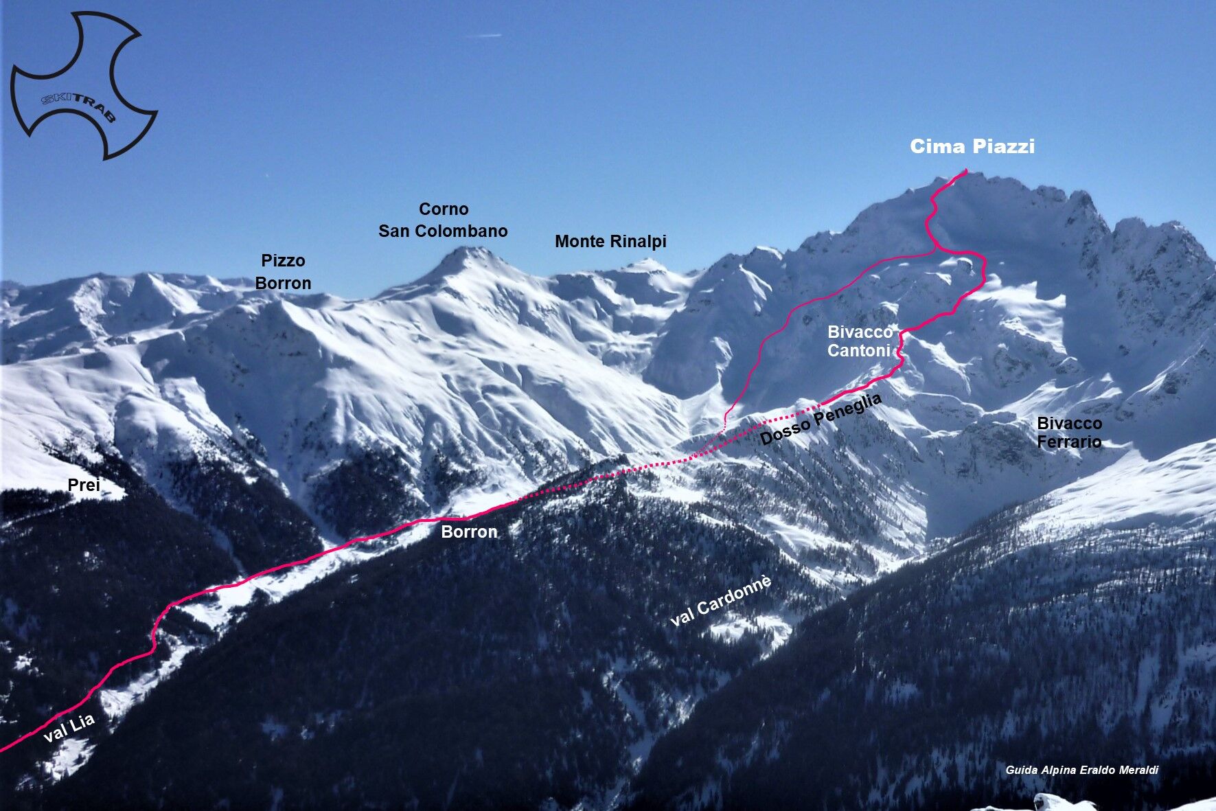
Cima Piazzi - Val Lia
From the Isolaccia parking lot, start climbing following the beautiful little road that passes by the Baite di Pezzel huts and leads to the little church of Madonna di Presedont located at 1750 m altitude....
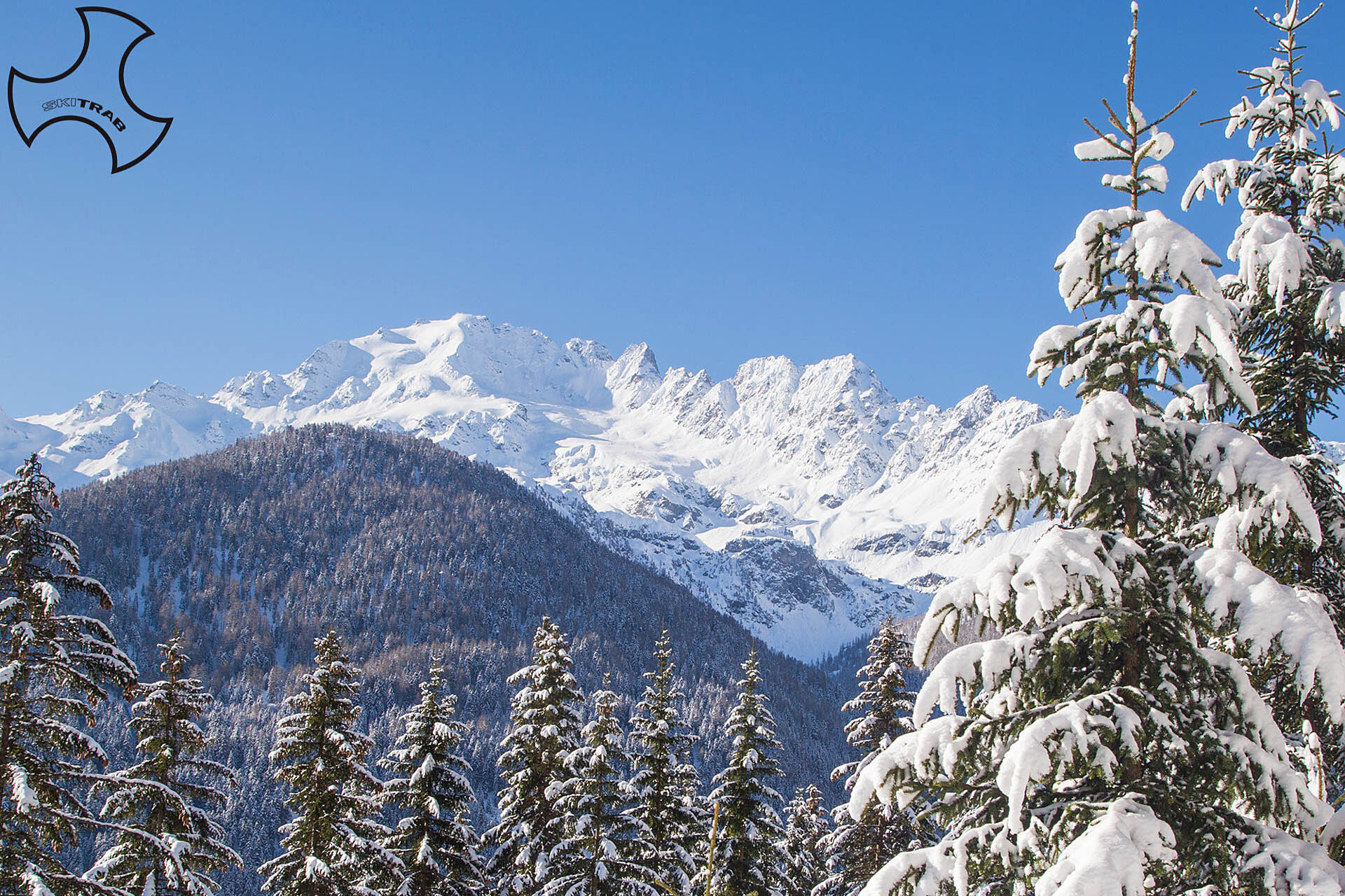
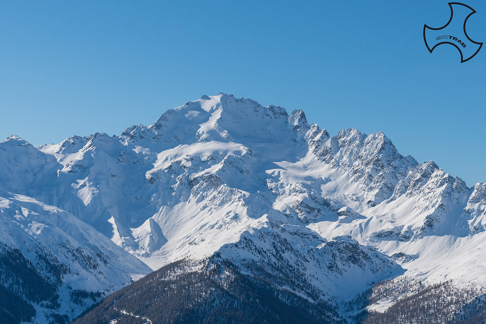
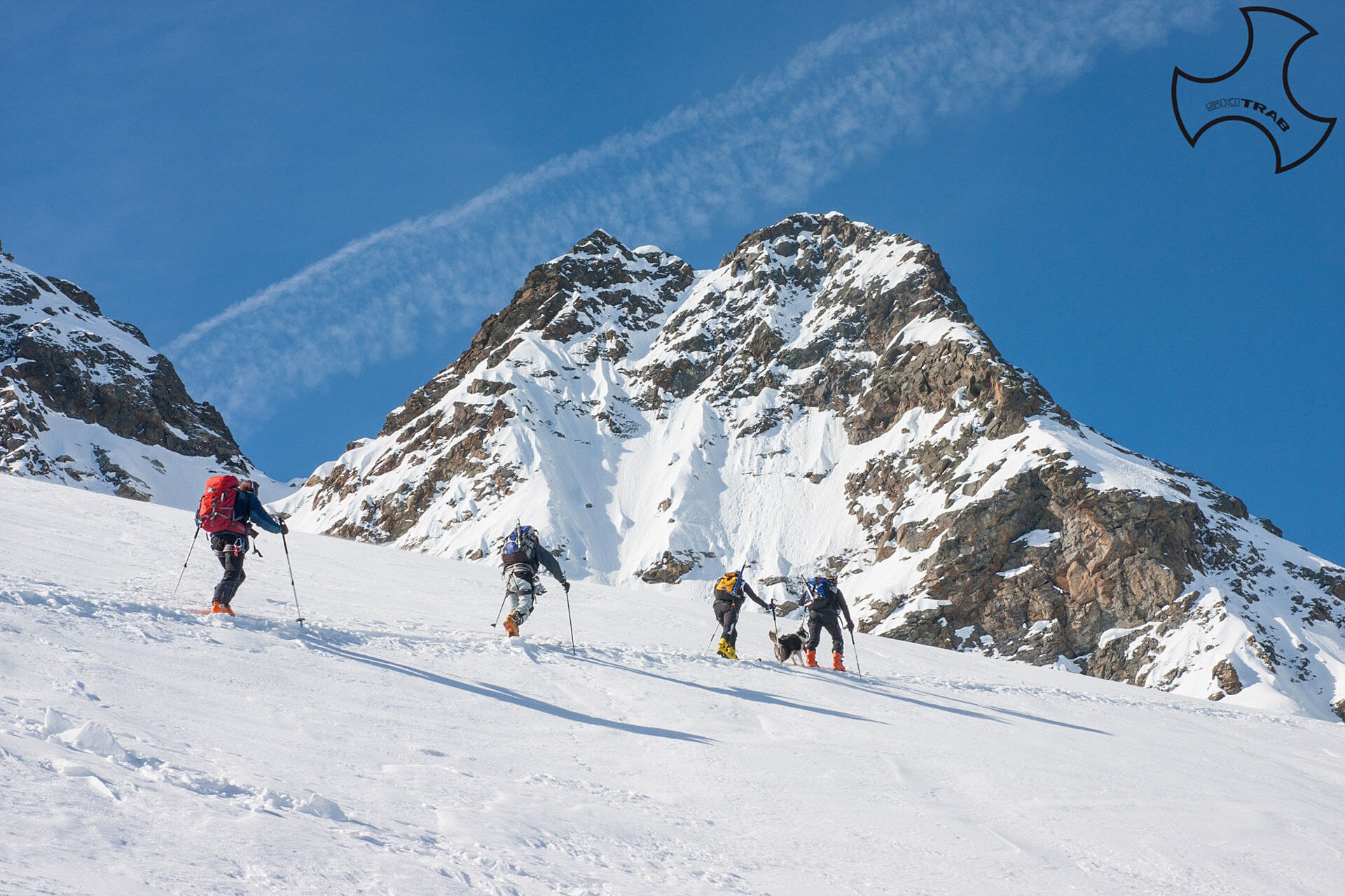
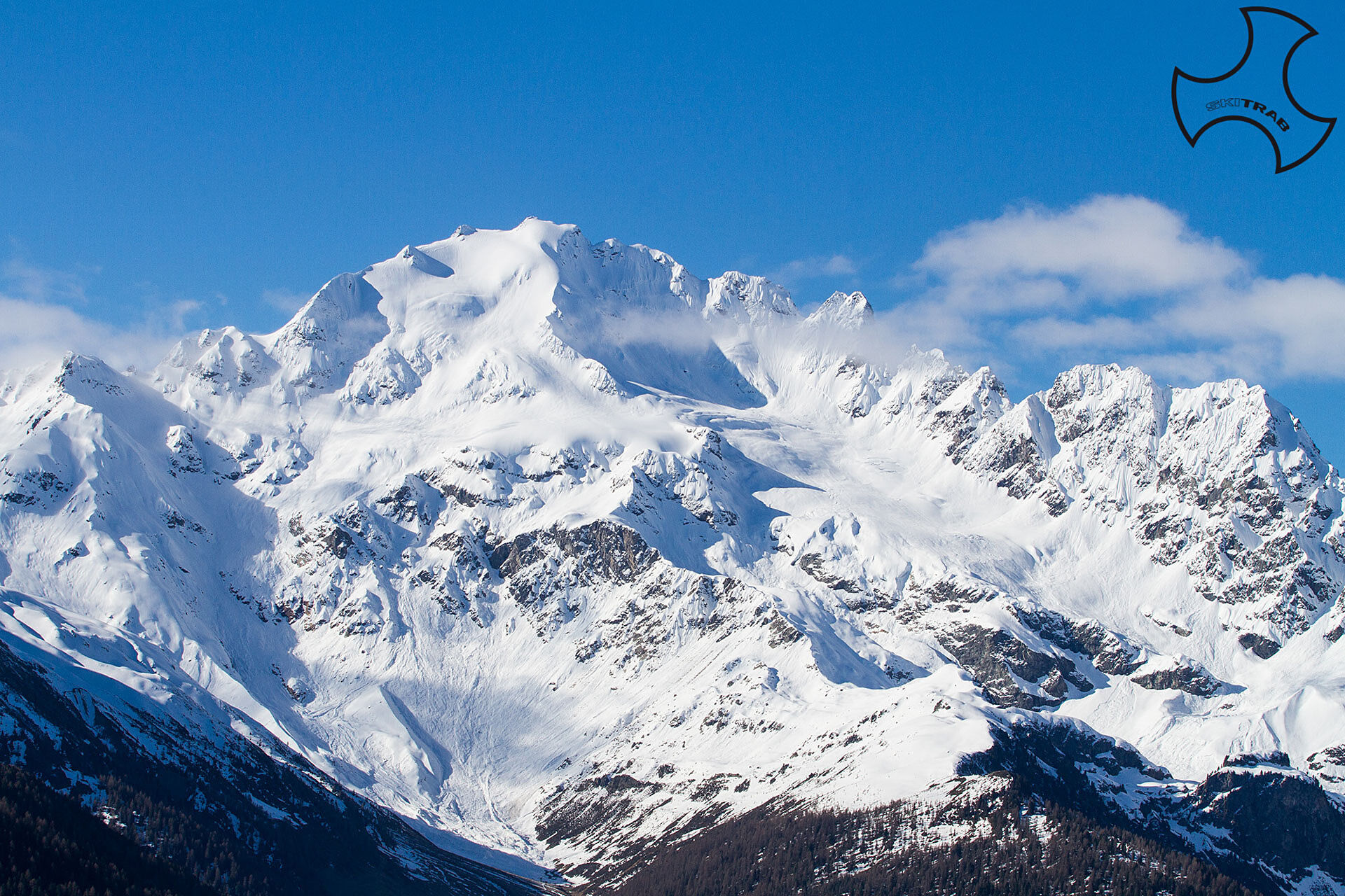
From the Isolaccia parking lot, start climbing following the beautiful little road that passes by the Baite di Pezzel huts and leads to the little church of Madonna di Presedont located at 1750 m altitude. Following the signs for the Borron hut, you enter again the beautiful forest of larch and fir trees, and shortly afterwards you begin to see the imposing northern slope of the Cima Piazzi. Past the Borron huts you continue halfway up to a vast plateau. From here you cross the stream on the right and climb the vast east-facing slope on the midslope, arriving on the final stretch on the broad ridge of Dosso Peneglia. Now bending a little to the right and re-entering just above, you arrive on the edge of the glacial moraine, near the Cantoni bivouac. You lose altitude slightly as you descend to the right to enter the amphitheater at the base of the glacier, and ascending a steep gully on the left brings you to the glacial falsopiano at the base of the central edge of the wall. We move to the left of the edge and climb up a steep slope that with some very steep sections overcomes the most impervious glacial zone, arriving in the vicinity of the antecedent. Contouring the small rocks to the right, one briefly reaches the summit. From the plateau after Borron it is possible to continue to the left going up with a more direct route the gully that leads to the left of the central edge of the wall and from here continue the ascent as for the previous route.

S. Caterina - Plaghera - arrival former double ski lift
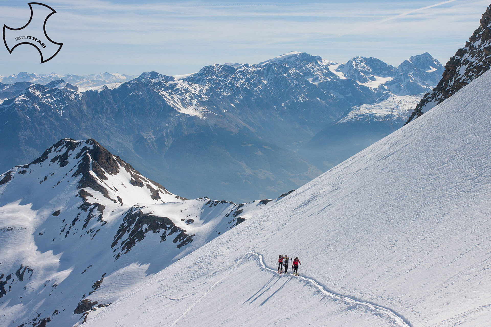
Self-rescue equipment (ARTVA, shovel and probe). Rampant, harness, ice axe and crampons; possibly a rope in case the glacier is very crevassed.
The final section, depending on snow conditions is best done with ice axe and crampons. By late season, the road to Borron may already be snow-free, shortening the approach considerably.
The route description and trail are approximate and should be checked on site depending on the state of the snowpack present during the hike.
Because this is a hike in a snowy mountain environment at high altitudes subject to continually changing snowpack conditions, it is advisable to have adequate experience in ski mountaineering, knowledge of the area, and up-to-date information on snow conditions.
Accompaniment with a professional guide is recommended.
At the start on the right.
The route description and trail are approximate and should be verified on site depending on the condition of the snowpack present during the hike.
Because this is a hike in a snowy mountain environment at high altitudes subject to continually changing snowpack conditions, it is advisable to have adequate experience in ski mountaineering, knowledge of the area, and up-to-date information on snow conditions.
Accompaniment with a professional guide is recommended.
Popularne wycieczki w okolicy
- 5,0
Mountain hike to Lagh da Saoseo
ciężkiWędrówka 15,0 km - 3,4
Sta.Maria, Prà da Vau - Lai da Rims - Alp Sot - Prà da Vau
ciężkiWędrówka 14,7 km - 5,0
Crap da la Pare' with Joëlette
światłoWędrówka 4,58 km - 4,5
Stelvio Epic Rides: Stelvio Pass
ciężkiDroga rowerowa 20,9 km - 2,0
Military Historical Hiking Trail "Scorluzzo"
średniWędrówka 9,52 km - 5,0
Cascate della val nera
światłoWędrówka 5,70 km - 5,0
444.02: Nationalpark Bike-Tour 2. Etappe
ciężkiMountainbike 39,6 km Mount of Mines
średniWycieczka narciarska 4,78 kmVal da Camp (724)
średniWędrówka 5,33 kmStelvio Epic Rides: Gavia Pass
ciężkiDroga rowerowa 25,8 km
Wędrówki i tropienie


Nie przegap ofert i inspiracji na następne wakacje
Twój adres e-mail została dodana do listy mailingowej.