


Towards the Giro Summit
Poziom trudności: 4
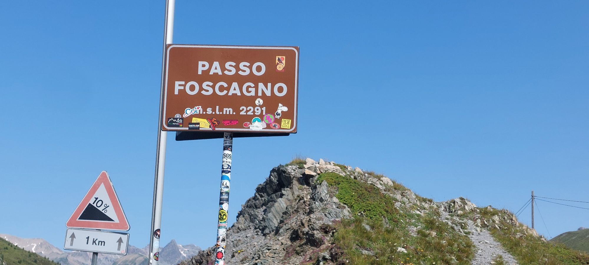
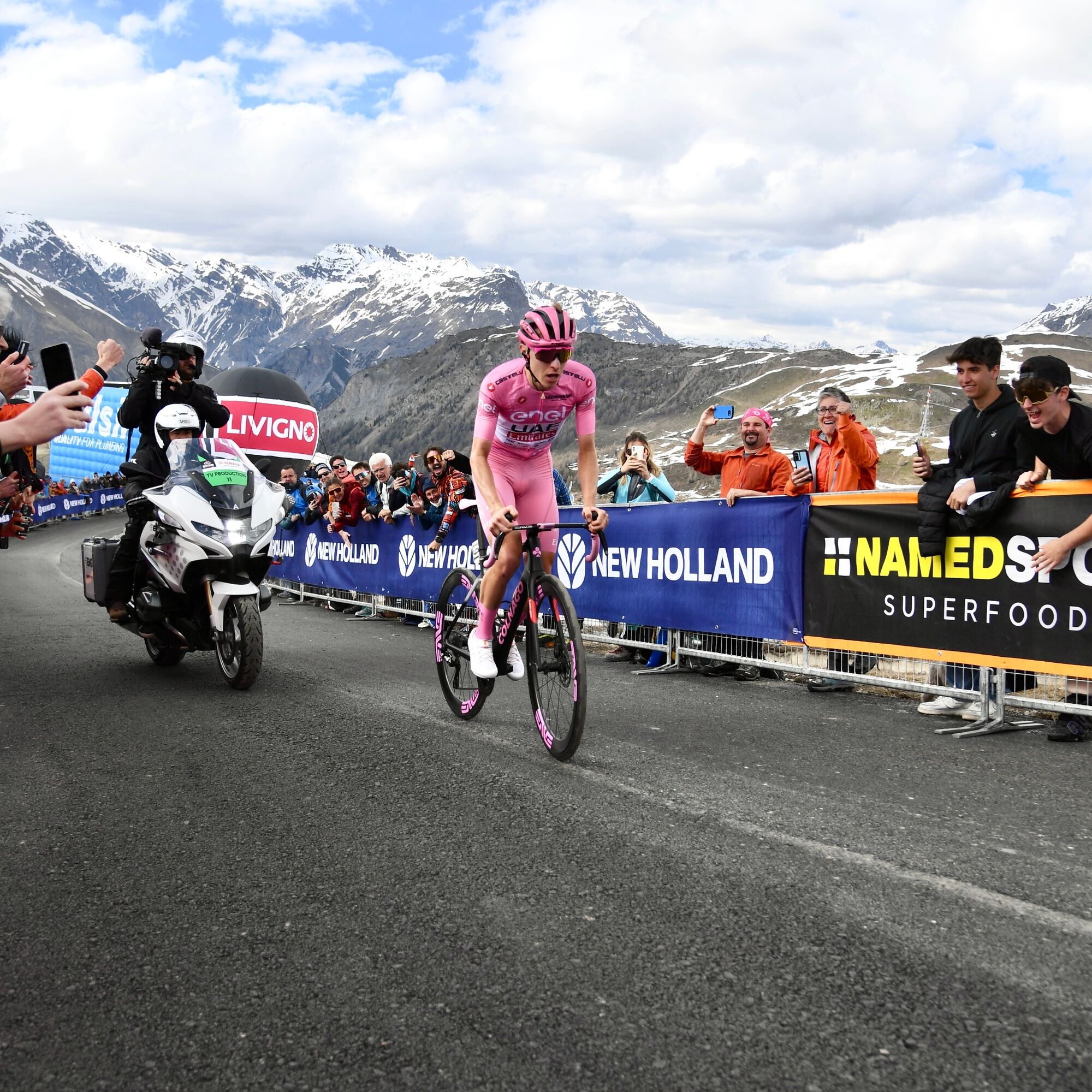
This is one of the most iconic routes in Livigno, a track that takes you to climb the same slopes tackled by the champions of the Giro d'Italia 2024, with the unforgettable finish at the top of Mottolino...
This is one of the most iconic routes in Livigno, a track that takes you to climb the same slopes tackled by the champions of the Giro d'Italia 2024, with the unforgettable finish at the top of Mottolino and the victory of Tadej PogaÄar.
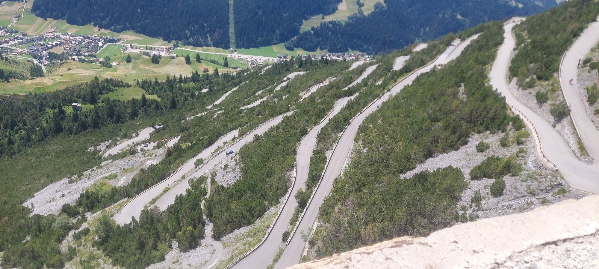
It starts with a short flat section within the village, ideal to warm up your legs. Upon reaching the Mottolino roundabout, the challenging part begins with the climb of Teola. Here the route becomes more demanding, twisting along the climb towards Passo d'Eira, characterized by a fairly constant and challenging gradient.
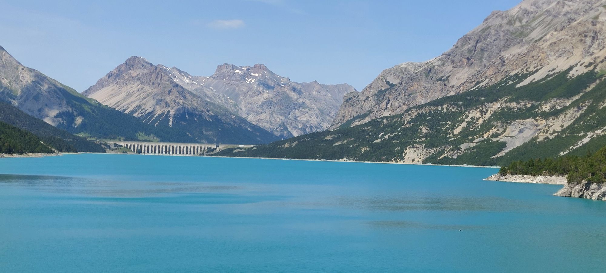
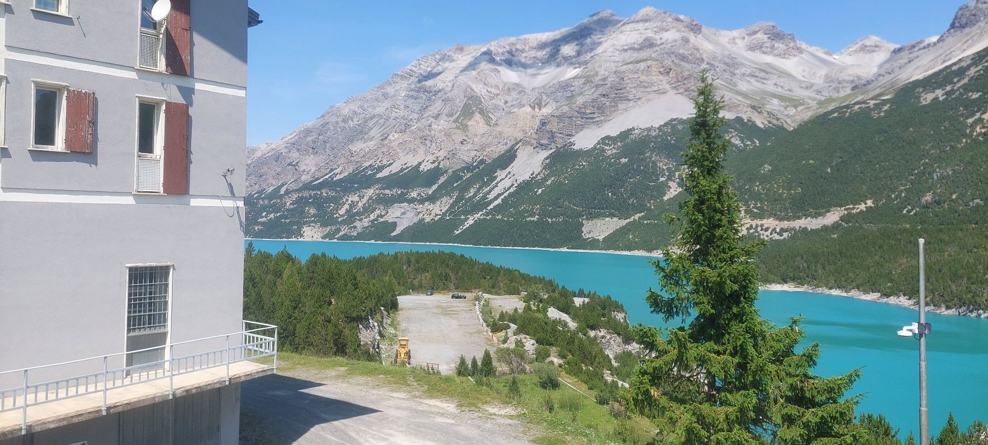
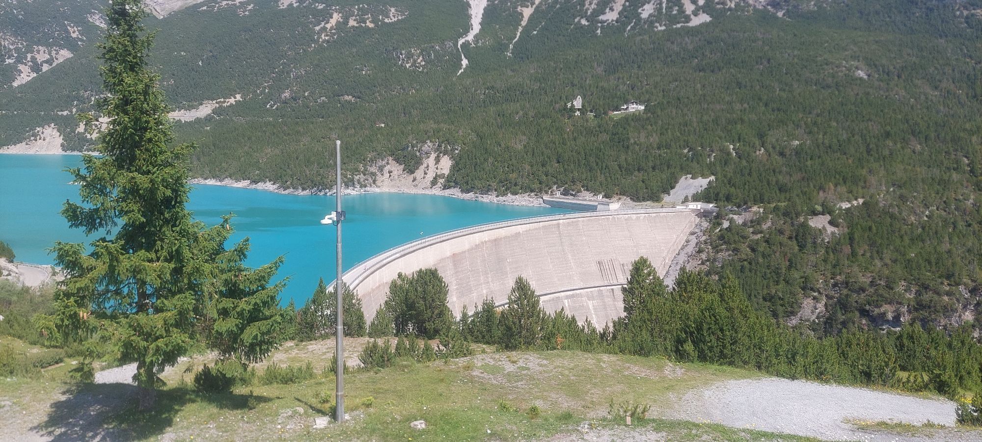
Once arrived at Passo d'Eira, the hardest but also the most symbolic section begins. The road of this last climb section, built specifically for the Giro, features very short stretches of false flat and gentle ascent, alternating with numerous steep slopes that will test your endurance.
The return retraces the same route: a sometimes steep descent to Passo d'Eira, followed by a steady descent to the village, then finishing with a short flat section to loosen your legs. This route is an unmissable experience for every cyclist wishing to live the emotions of the Giro d'Italia and test their skills on a legendary track.
Tak
4
Kamery internetowe z trasy
-
Mottolino
-
Monte Della Neve
-
Livigno - Mottolino
-
Mottolino - Bike Park
-
Livigno Ski School Area
-
Livigno
-
Livigno - Crap
-
Livigno
-
Livigno Teola
-
Livigno - Hotel Primula
-
Livigno Ortszentrum
-
Livigno
-
Livigno Centro | Livigno Town Center
-
Pista ciclabile
-
SnowFarm
-
Livigno Centro | Livigno Town Center
-
Pista ciclabile
-
SnowFarm
-
SnowFarm
-
Centro Sci Fondo | Cross Country Stadium
-
Centro Sci Fondo | Cross Country Stadium
-
Centro Sci Fondo | Cross Country Stadium
-
Centro Sci Fondo | Cross Country Stadium
-
Centro Sci Fondo | Cross Country Stadium
-
Centro Sci Fondo | Cross Country Stadium
-
Scuola Sci Centrale
-
Scuola Sci Centrale
-
Scuola Sci Centrale
-
Scuola Sci Centrale
-
Scuola Sci Centrale
-
Scuola Sci Centrale
Popularne wycieczki w okolicy
-
4,8
Circular hike Val Trupchun in the Swiss National Park
średniWędrówka 13,8 km -
5,0
Crap da la Pare' with Joëlette
światłoWędrówka 4,58 km -
4,5
Muottas Muragl - Fuorcla Muragl - Val Chamuera
średniWędrówka 17,6 km -
5,0
National Park: Spöl Valley
światłoWędrówka 7,67 km -
5,0
Val Nera Waterfalls
światłoWędrówka 5,70 km -
National Park: Murtersattel
średniWędrówka 7,66 km -
5,0
Zuoz - Munt Seja - Lej da Prastinaun - Alp Arpiglia - Zuoz
średniWędrówka 11,8 km -
4,2
Val Federia Livigno
średniE-Bike 26,5 km -
5,0
444.02: Nationalpark Bike-Tour 2. Etappe
ciężkiMountainbike 39,6 km -
Mount of Mines
średniWycieczka narciarska 4,78 km
Wędrówki i tropienie


Nie przegap ofert i inspiracji na następne wakacje
Twój adres e-mail została dodana do listy mailingowej.