Sentiero Italia D27N - Stage from Rifugio Cristina to Alpe Prabello - Rifugio Cederna Maffina
ciężki
Pobierz tę trasę na swój telefon komórkowy
Sentiero Italia D27N - Stage from Rifugio Cristina to Alpe Prabello - Rifugio Cederna Maffina
ciężki
Trasa pielgrzymki
6,18
km
Zeskanuj kod QR i rozpocznij nawigację w aplikacji bergfex.

Wędrówki i tropienie


Sentiero Italia D27N - Stage from Rifugio Cristina to Alpe Prabello - Rifugio Cederna Maffina
ciężki
Odległość
6,18
km
Czas trwania
03:25
h
Ascent
731
hm
Poziom morza
2 236 -
2 805
m
Poziom trudności: T4
Ścieżka do pobrania
Sentiero Italia D27N - Stage from Rifugio Cristina to Alpe Prabello - Rifugio Cederna Maffina
ciężki
Trasa pielgrzymki
6,18
km
With this short but steep stage, the Sentiero Italia leaves the majestic peaks of the upper Valmalenco to move among the summits overlooking directly the Valtellina, continuing the journey eastward. From...
Opis
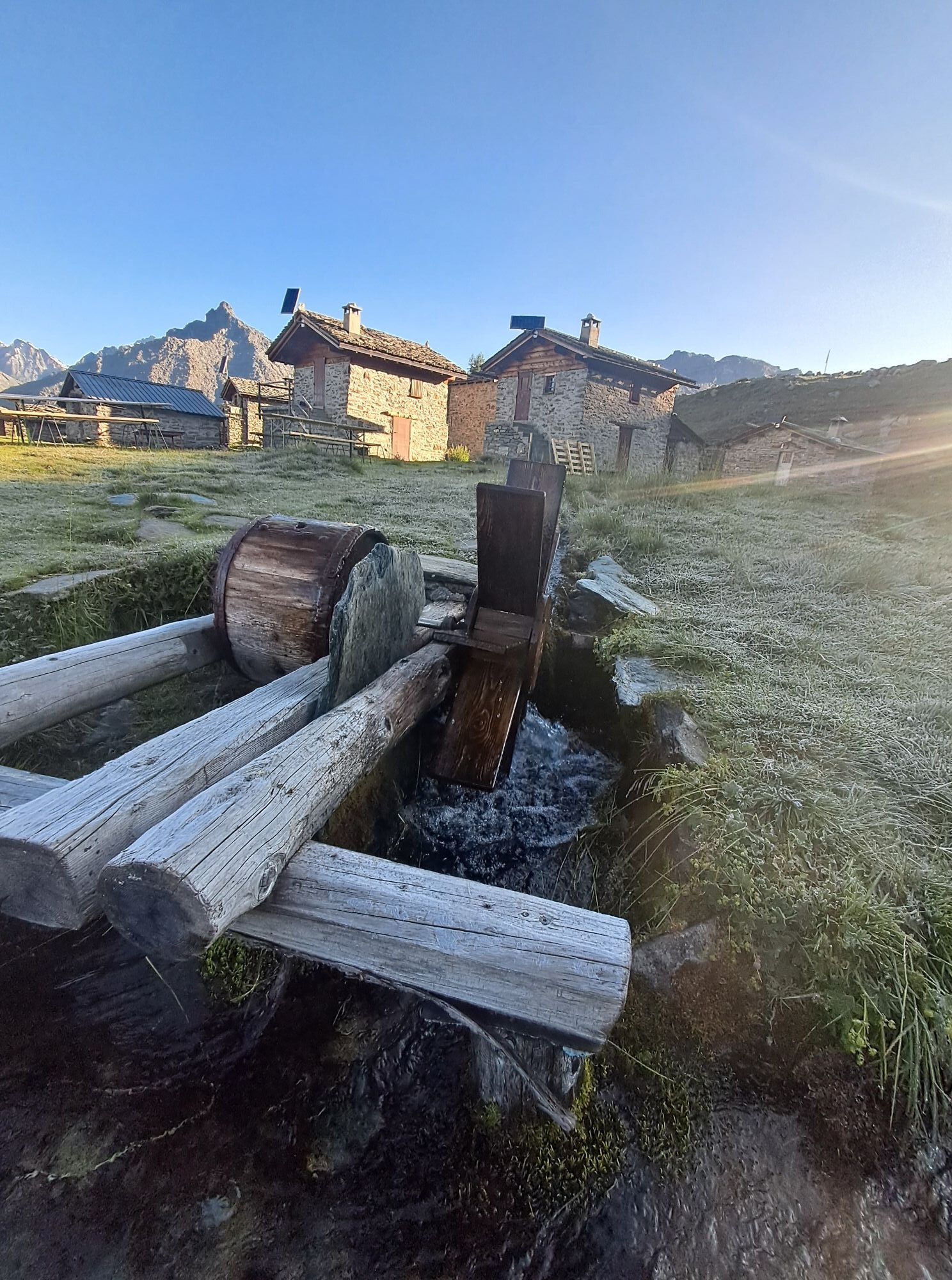
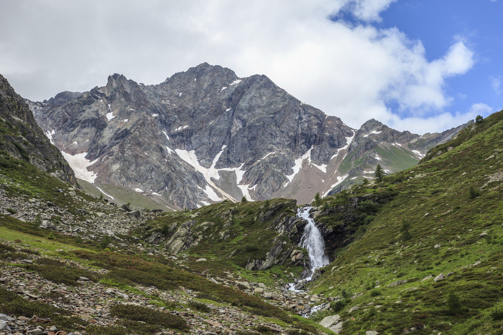
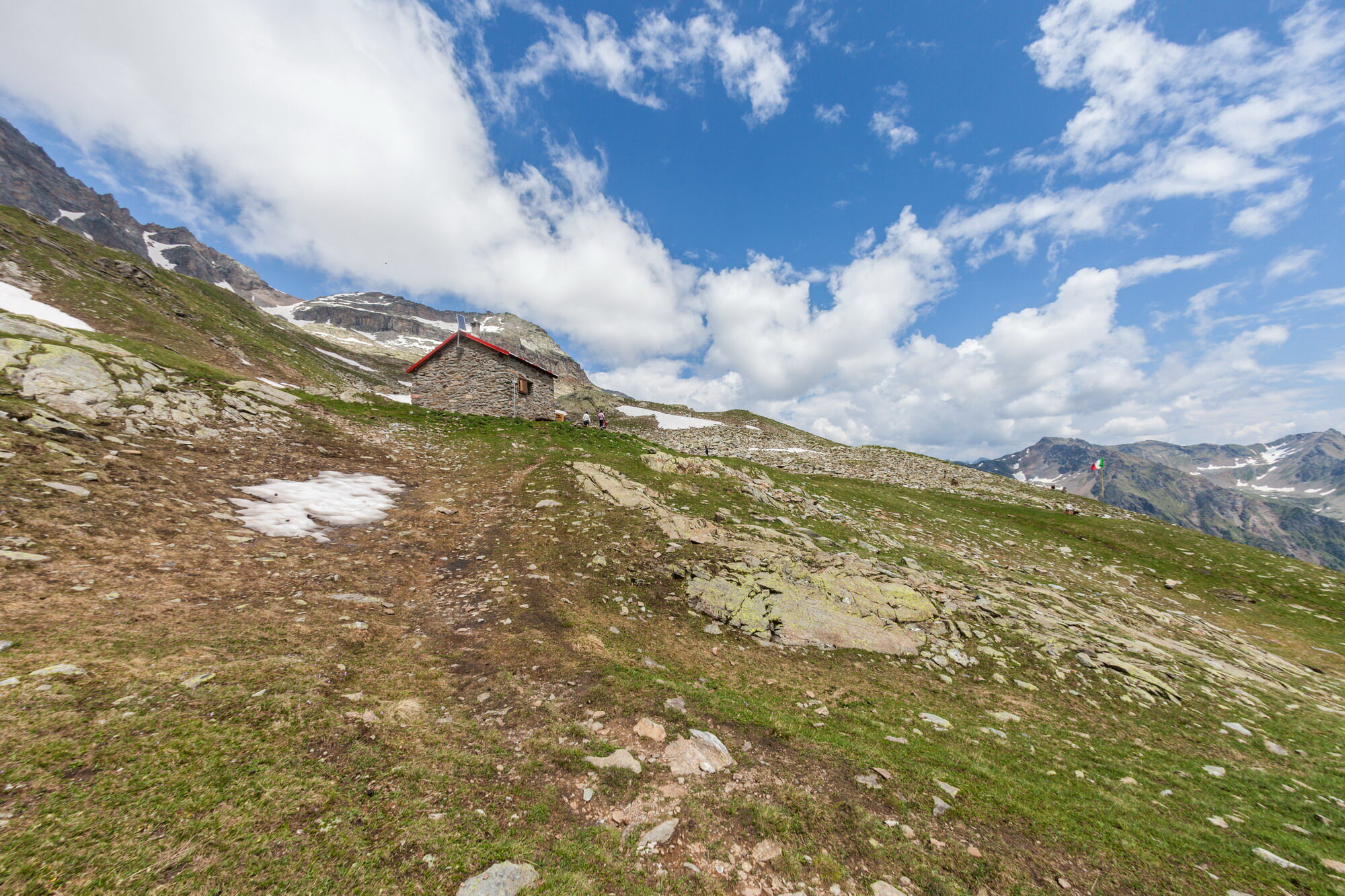
With this short but steep stage, the Sentiero Italia leaves the majestic peaks of the upper Valmalenco to move among the summits overlooking directly the Valtellina, continuing the journey eastward. From the Rifugio Cristina, you say goodbye to the last glacier in the area descending from the summit of Pizzo Scalino, from which it takes its name, which is circumnavigated throughout the day. A first climb leads to the Passo degli Ometti followed by a descent and ascent to the Passo Forame. From here, you descend to the Rifugio Cederna Maffina in the valley carved by the Fontana stream, a direct tributary of the Adda.
Trasa
Alpe Prabello
(2 230 m)
Rozliczenie
0,0 km
Capanna Cederna-Maffina
(2 582 m)
Refuge (niezarządzany)
6,1 km
Trasa
Sentiero Italia D27N - Stage from Rifugio Cristina to Alpe Prabello - Rifugio Cederna Maffina
ciężki
Trasa pielgrzymki
6,18
km
Autor
Dostarczone przez Valtellina Outdoor

Dodatkowe informacje i wskazówki
Poziom trudności
T4
Nie ma jeszcze recenzji
Popularne wycieczki w okolicy
-
4,3
Piz Palü (3.905m) – Hochtour
średniWycieczka wysokogórska 13,4 km -
5,0
Ospizio Bernina Station - Alp Grüm (-Cavaglia)
światłoWędrówka 4,97 km -
Alp Grüm - Cavaglia - Poschiavo
średniWędrówka 9,41 km -
5,0
53 Bernina Tour Switzerland: Stage 1 Poschiavo-Bernina Pass
średniWędrówka 14,6 km -
4,0
Giro del Lago - Le prese - Miralago
światłoWędrówka 7,43 km -
5,0
Palu' Lake, a blue pearl in the center of Valmalenco.
średniWędrówka 8,41 km -
4,5
Ghiacciaio Fellaria
światłoWędrówka 5,23 km -
33.08 Ospizio Bernina - Cavaglia, Via Albula / Bernina
średniWędrówka 9,39 km -
4,0
Capanna Marinelli
światłoWędrówka 8,39 km -
Alp Grüm - Cavaglia (Via Stablini)
Wędrówka 3,02 km
Wędrówki i tropienie

Ponad 550.000 propozycji wycieczek, szczegółowe mapy i intuicyjny planer tras sprawiają, że aplikacja jest niezbędna dla wszystkich entuzjastów przyrody.

Nie przegap ofert i inspiracji na następne wakacje
Zapisz się do newslettera
Błąd
Wystąpił błąd. Spróbuj ponownie.
Dziękujemy za rejestrację
Twój adres e-mail została dodana do listy mailingowej.
Wycieczki po całej Europie
Austria
Szwajcaria
Niemcy
Włochy
Słowenię
Francja
Holandia
Belgia
Polska
Liechtenstein
Czechy
Słowacja
Hiszpania
Chorwacja
Bośnia i Hercegowina
Luksemburg
Andorra
Portugalia
Islandia
Wielka Brytania
Irlandia
Grecja
Albania
Macedonia Północna
Malta
Norwegia
Czarnogóra
Mołdawia
Kosowo
Węgry
San Marino
Rumunia
Estonia
Łotwa
Białoruś
Cypr
Litwa
Serbia
Bułgaria
Monako
Dania
Szwecja
Finlandia