






Albosaggia, S.Giacomo, S.Bernardo di Faedo, Albosaggia (MTB-EMTB)
This route allows you to pass through many hamlets located in the lower band of Albosaggia. The ascent is entirely on asphalt with a fairly steep average gradient and some stretches exceeding 15%. The...
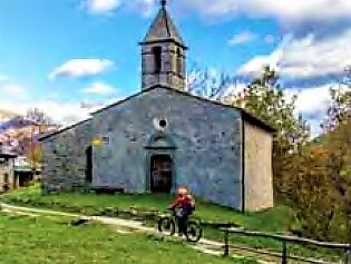
This route allows you to pass through many hamlets located in the lower band of Albosaggia. The ascent is entirely on asphalt with a fairly steep average gradient and some stretches exceeding 15%. The descent, on the other hand, is on a dirt road with a fairly rocky surface. The start is from the parking lot near the white bridge over the Adda of the Sentiero Valtellina and climbs towards Albosaggia Center; from here you continue in the direction of Campelli. In the first section up to the junction for San Giacomo, we have the steepest gradients. The itinerary passes above the Paganoni nucleus and below the houses of Mantegone and San Giacomo, all reachable by short detours. Then you reach San Bernardo with its small church. From here begins the descent on a dirt road that turns left and returns east, touching other scattered Albosaggia hamlets in the woods. Two steep hairpin bends with uneven ground and a long paved traverse bring you back to the Center and the starting point.


CASTIONE-BALZARRO-VENDOLO-SAN ROCCO-CA' BIANCA-TRIASSO-MAIONI-SONDRIO
Uzyskaj wgląd Zawsze na żywo z ponad 9 500 kamer internetowych. bergfex Jako użytkownik Pro, możesz teraz zobaczyć odpowiednie kamery internetowe dla wielu wycieczek w aplikacji wycieczki od. Pozwala to na bezpośredni podgląd aktualnych warunków. Popularne wycieczki w okolicy
- 5,0
Brunone
średniWycieczki górskie 15,0 km - 5,0
Carona - Rifugio Fratelli Calvi - Portulino - Monte Madonnino
ciężkiWędrówka 25,6 km Szlak Valtellina
średniJazda na rowerze 113,2 kmRifugio Bosio-Galli (from Primolo)
średniWędrówka 8,35 km- 5,0
Fusine-Dordona Pass (MTB-EMTB)
światłoMountainbike 20,4 km - 5,0
Bosio-Galli Refuge (from Piasci)
światłoWędrówka 4,58 km - 3,0
Cima Meriggio
światłoWędrówka 11,6 km - 4,2
Il Bivacco - Bivacco Pedrinelli - Passo di Publino - Pizzo Zerna
ciężkiWędrówka 15,9 km Via Dei Terrazzamenti
średnidługodystansowy szlak pieszy 74,1 km- 4,0
Poggi-Montagna Itinerary (GAL VALTELLINA call)
średniWędrówka 9,66 km
Wędrówki i tropienie


Nie przegap ofert i inspiracji na następne wakacje
Twój adres e-mail została dodana do listy mailingowej.





