Nawigacja
Pobierz tę trasę na swój telefon komórkowy
Mapa
Oenovélo: abbey and castles loop

średni
Kolarstwo długodystansowe
79,66 km
Zeskanuj kod QR i rozpocznij nawigację w aplikacji bergfex.
QR Code
Wędrówki i tropienie

Oenovélo: abbey and castles loop

średni
Kolarstwo długodystansowe
Odległość
79,7 km
Czas trwania
19:22 h
Ascent
444 hm
Poziom morza
25 - 117 m

Poziom trudności: 2

Ścieżka do pobrania
Mapa
Oenovélo: abbey and castles loop
średni
Kolarstwo długodystansowe
79,66 km

Practical information:

Distance and signage: 80 km, fully signposted, with no major technical difficulties. Some sections on shared roads require vigilance. Suggested breakdown: Saumur > Montsoreau > Fontevraud...

Opis

Practical information:

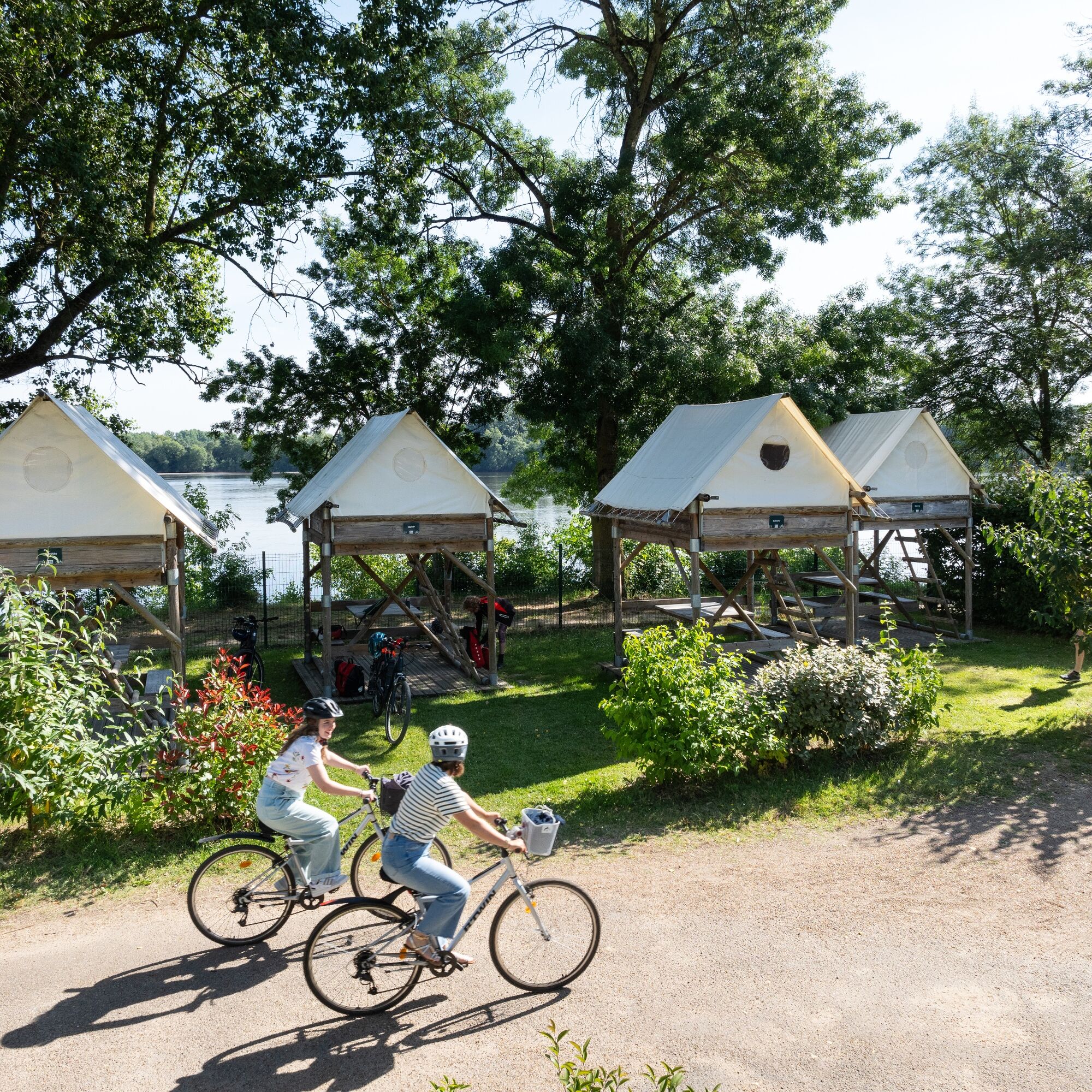
Distance and signage: 80 km, fully signposted, with no major technical difficulties. Some sections on shared roads require vigilance. Suggested breakdown: Saumur > Montsoreau > Fontevraud Abbey (19.5 km) Fontevraud Abbey > Roiffé > Brézé (28.5 km) Brézé > Montreuil-Bellay (11 km) Montreuil-Bellay > Saumur (21 km) Access: Recommended starting point: Saumur (accessible by train, car, or bike). Accommodations: Many establishments labeled "Accueil Vélo" along the route. Bike services: Rentals, repairs, and free service areas available. Must see:

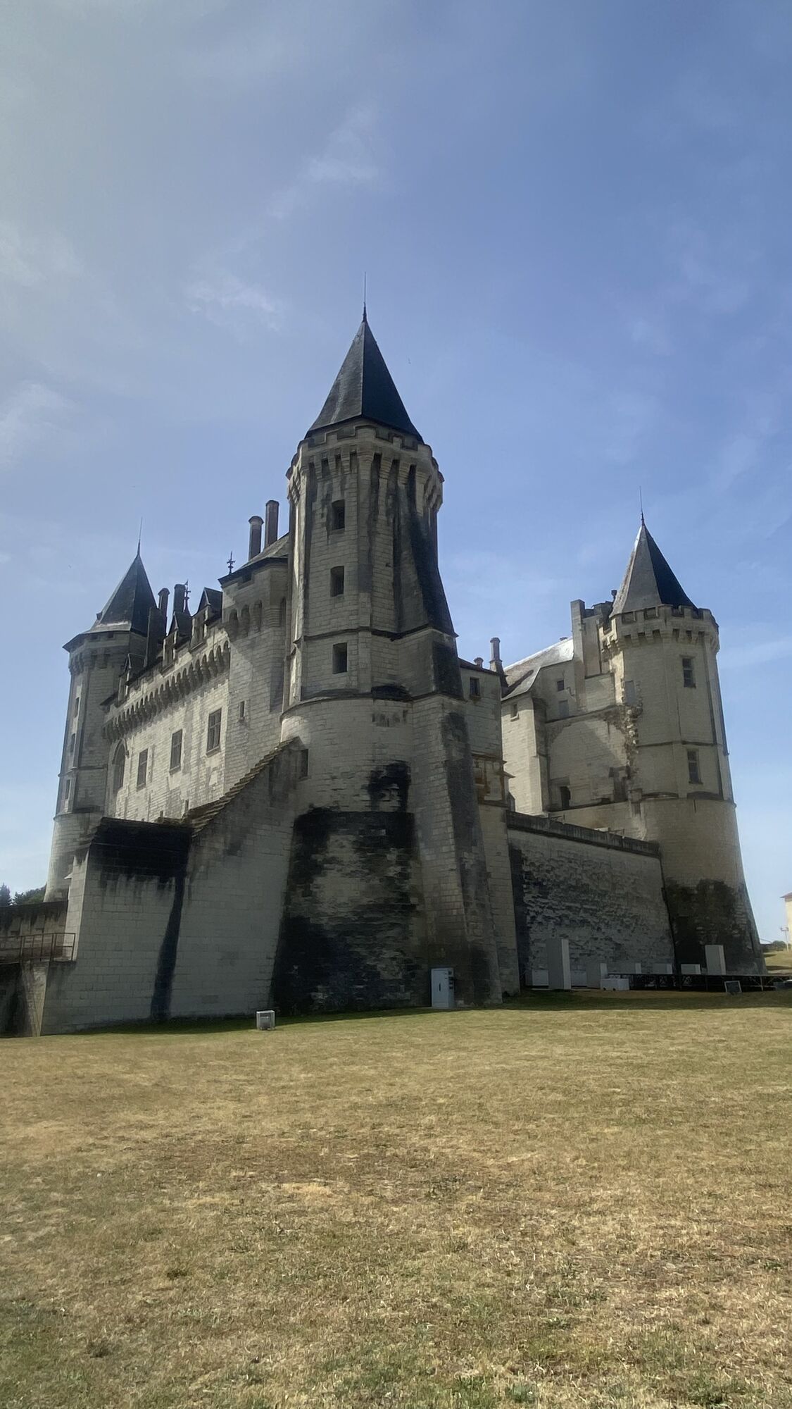
The troglodytes and the Saumurois vineyards. The emblematic castles: Saumur, Montsoreau, Brézé, Montreuil-Bellay. Charming villages: Montsoreau, Fontevraud Abbey. The wines with Saumur-Champigny appellation.

Trasa
Église Notre-Dame des Ardilliers
(31 m)
Miejsce kultu
0,3 km
Église Saint-Pierre
(33 m)
Miejsce kultu
15,1 km
Chapelle Notre-Dame de Pitié
(81 m)
Miejsce kultu
21,1 km
Chapelle Sainte-Radegonde
(51 m)
Miejsce kultu
36,3 km
Saix
(51 m)
Wioska
37,1 km
Chapelle de l'hôpital Saint-Jean
(62 m)
Miejsce kultu
57,1 km
Chapelle Saint-Jean
(30 m)
Miejsce kultu
79,1 km
Trasa
Mapa
Oenovélo: abbey and castles loop
średni
Kolarstwo długodystansowe
79,66 km
Saumur
(30 m)
Miasto
0,0 km
Église Notre-Dame des Ardilliers
(31 m)
Miejsce kultu
0,3 km
Le Gaillardin
(44 m)
Rozliczenie
3,1 km
Dampierre-sur-Loire
(32 m)
Wioska
3,7 km
Brasserie Tina
(30 m)
Restauracja
4,6 km
L'Amuse Bouche
(31 m)
Restauracja
4,7 km
Souzay-Champigny
(32 m)
Wioska
6,1 km
Église Saint-Maurice
(44 m)
Miejsce kultu
6,5 km
Le Bourg Neuf
(33 m)
Rozliczenie
7,9 km
La Basse Rue
(47 m)
Rozliczenie
7,9 km
Parnay
(30 m)
Wioska
8,5 km
Église Saint-Fiacre
(63 m)
Miejsce kultu
8,6 km
Le Bourg Joli
(34 m)
Rozliczenie
8,9 km
Clos de la Pouge
(65 m)
Rozliczenie
9,9 km
Bistroglo
(38 m)
Restauracja
11,2 km
L'Helianthe
(40 m)
Restauracja
11,6 km
Église Saint-Aubin
(32 m)
Miejsce kultu
11,6 km
Turquant
(36 m)
Wioska
11,8 km
La Maumenière
(70 m)
Rozliczenie
14,6 km
Montsoreau
(40 m)
Wioska
15,1 km
Église Saint-Pierre
(33 m)
Miejsce kultu
15,1 km
Les Marais
(32 m)
Rozliczenie
15,6 km
La Table de Mestré
(53 m)
Restauracja
16,8 km
Mestre
(51 m)
Rozliczenie
16,8 km
Les Ecoteries
(56 m)
Rozliczenie
19,1 km
Les Roches
(78 m)
Rozliczenie
19,6 km
Le Clos Retiveau
(60 m)
Rozliczenie
19,9 km
Le Délice
(57 m)
Restauracja
20,0 km
Église Saint-Michel
(81 m)
Miejsce kultu
20,3 km
Fontevraud-l’Abbaye
(80 m)
Wioska
20,5 km
Chapelle Notre-Dame de Pitié
(81 m)
Miejsce kultu
21,1 km
Les Blanchardières
(102 m)
Korytarz/teren
22,9 km
Couziers
(71 m)
Wioska
24,2 km
L'Échaufaud
(71 m)
Rozliczenie
24,5 km
L'Échafaud
(74 m)
Rozliczenie
24,5 km
La Goujonnière
(74 m)
Rozliczenie
24,9 km
Cuzay
(92 m)
Rozliczenie
28,4 km
Le Chat Pendu
(66 m)
Rozliczenie
29,7 km
Les Varennes
(68 m)
Sąsiedztwo
29,9 km
Les Portes Neuves
(64 m)
Sąsiedztwo
30,0 km
Roiffé
(66 m)
Wioska
30,1 km
Église Saint-Martin
(64 m)
Miejsce kultu
30,1 km
Le Ruisseau
(61 m)
Sąsiedztwo
30,1 km
Les Vignes du Bourg
(63 m)
Sąsiedztwo
30,6 km
Les Énauderies
(67 m)
Sąsiedztwo
31,2 km
Les Houches
(52 m)
Rozliczenie
32,7 km
La Croix de Chaume
(54 m)
Rozliczenie
32,8 km
Le Carrefour
(52 m)
Rozliczenie
32,9 km
Le Pontignou
(46 m)
Rozliczenie
33,7 km
Chapelle Sainte-Radegonde
(51 m)
Miejsce kultu
36,3 km
Église Sainte-Radegonde
(50 m)
Miejsce kultu
36,8 km
Les Entrées
(51 m)
Rozliczenie
36,9 km
Saix
(51 m)
Wioska
37,1 km
La Croix Verte
(80 m)
Rozliczenie
38,1 km
La Tourette
(70 m)
Rozliczenie
38,5 km
La Belle Cave
(62 m)
Rozliczenie
38,9 km
La Croix de Pas de Loup
(58 m)
Rozliczenie
39,2 km
La Marsaudière Nord
(75 m)
Korytarz/teren
39,7 km
La Marsaudière
(74 m)
Rozliczenie
39,7 km
La Chauvière
(65 m)
Rozliczenie
39,9 km
Bizay
(71 m)
Rozliczenie
40,5 km
L'Echaillier
(64 m)
Korytarz/teren
40,9 km
Le Grand Fond
(56 m)
Korytarz/teren
42,2 km
Grand Fond
(51 m)
Rozliczenie
42,4 km
Le Moulin Carré
(66 m)
Korytarz/teren
43,6 km
Saint-Vincent
(40 m)
Rozliczenie
44,1 km
Pizza Tony
(60 m)
Restauracja
44,7 km
Église Saint-Vincent de Brézé
(60 m)
Miejsce kultu
44,7 km
Brézé
(58 m)
Wioska
44,9 km
Le Bois de Méron
(36 m)
Korytarz/teren
48,4 km
Le Pré Gaudin
(40 m)
Korytarz/teren
52,1 km
Chaumont
(40 m)
Rozliczenie
52,7 km
Sur les Pouches
(46 m)
Korytarz/teren
54,2 km
Le Bourg Est
(59 m)
Korytarz/teren
55,9 km
Montreuil-Bellay
(60 m)
Wioska
56,3 km
Chapelle de l'hôpital Saint-Jean
(62 m)
Miejsce kultu
57,1 km
Le Clos Saint-Jean
(62 m)
Korytarz/teren
57,1 km
Port Sainte-Catherine
(33 m)
Korytarz/teren
59,1 km
La Houdinière
(33 m)
Sąsiedztwo
59,3 km
Les Plantis
(47 m)
Sąsiedztwo
59,4 km
L'Enfer
(33 m)
Korytarz/teren
59,5 km
Le Clos du Bourg
(38 m)
Sąsiedztwo
59,7 km
Le Clos du Presbytère
(48 m)
Sąsiedztwo
60,0 km
Le Ruau
(33 m)
Rozliczenie
62,6 km
Bron
(47 m)
Rozliczenie
64,0 km
La Motte
(39 m)
Rozliczenie
66,7 km
Artannes-sur-Thouet
(40 m)
Wioska
68,2 km
Les Ouches
(33 m)
Rozliczenie
71,4 km
Saumur
(30 m)
Miasto
78,8 km
Chapelle Saint-Jean
(30 m)
Miejsce kultu
79,1 km
Église Saint-Pierre
(32 m)
Miejsce kultu
79,1 km
Informacje o wycieczce

An 80 km loop in 2 to 3 days

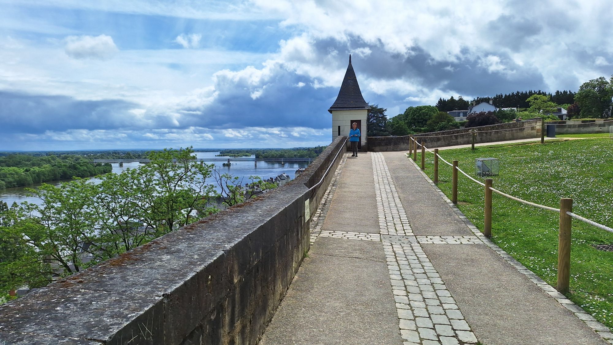
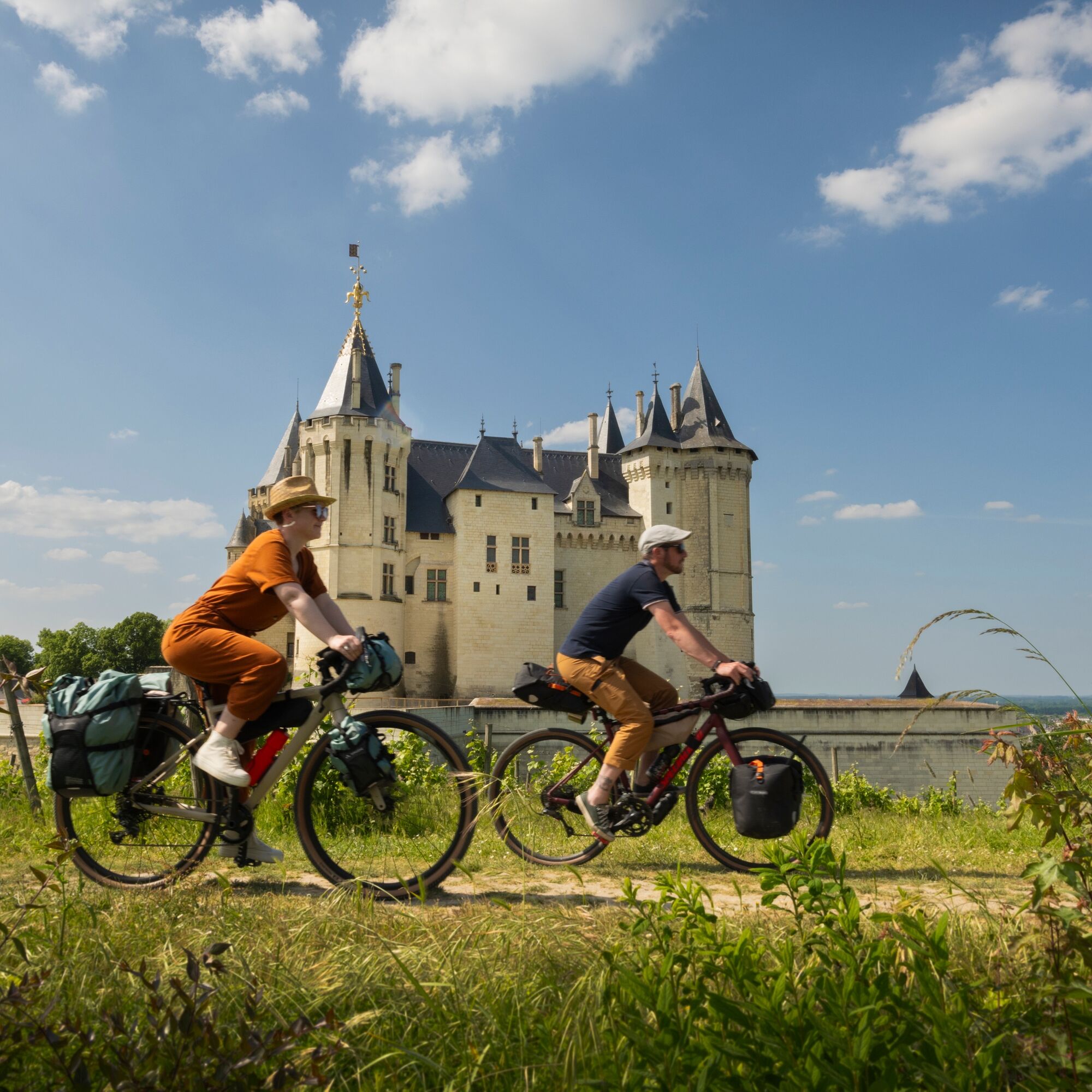
This cycling route, designed for heritage and nature enthusiasts, connects must-see sites such as Saumur, Montsoreau, and the Royal Abbey of Fontevraud, while exploring the villages of Brézé and Montreuil-Bellay. A perfect itinerary to enjoy the Loire castles and the enchanting landscapes of Anjou.

Technologia
2 / 6
Stan
3 / 6
Krajobraz
5 / 6
Doświadczenie
5 / 6
Najlepsza pora roku
Sty
Lut
Mar
Kwi
Maj
Cze
Lip
Sie
Wrz
Paź
Lis
Gru
Autor
Dostarczone przez Loiretal Atlantik
Logo
Udostępnij trasę
Mapa
Oenovélo: abbey and castles loop
średni
Kolarstwo długodystansowe
79,66 km
Błąd
Wystąpił błąd. Spróbuj ponownie.
Informacje o trasie
Trasa

Fully signposted route.

Najważniejsze informacje geologiczne

Tak

Odpowiedni dla rodzin

Tak

Sprzęt

Wearing a helmet, although not mandatory for adults, is strongly recommended. It is mandatory for children up to 12 years old.

Instrukcje bezpieczeństwa

In case of emergency, dial 112

Informacje o przyjeździe
Przybycie

Consider carpooling

Transport publiczny

Prefer using public transport for your travel

Parking

Parking near the starting point

Dodatkowe informacje i wskazówki
Poziom trudności

2

Wskazówki

We recommend starting this loop from Saumur, accessible by train, car, or bike, in a clockwise direction.

Wędrówki i tropienie

Wędrówki i tropienie

Wędrówki i tropienie
Ponad 550.000 propozycji wycieczek, szczegółowe mapy i intuicyjny planer tras sprawiają, że aplikacja jest niezbędna dla wszystkich entuzjastów przyrody.
bergfex