


Sent – Chauennas – Scuol
Poziom trudności: 2
After leaving the village heading west, the wide road ascends slightly. At the next signpost, the path turns left and mostly runs flat in the sun along the snowy south-facing slope before it becomes steep...
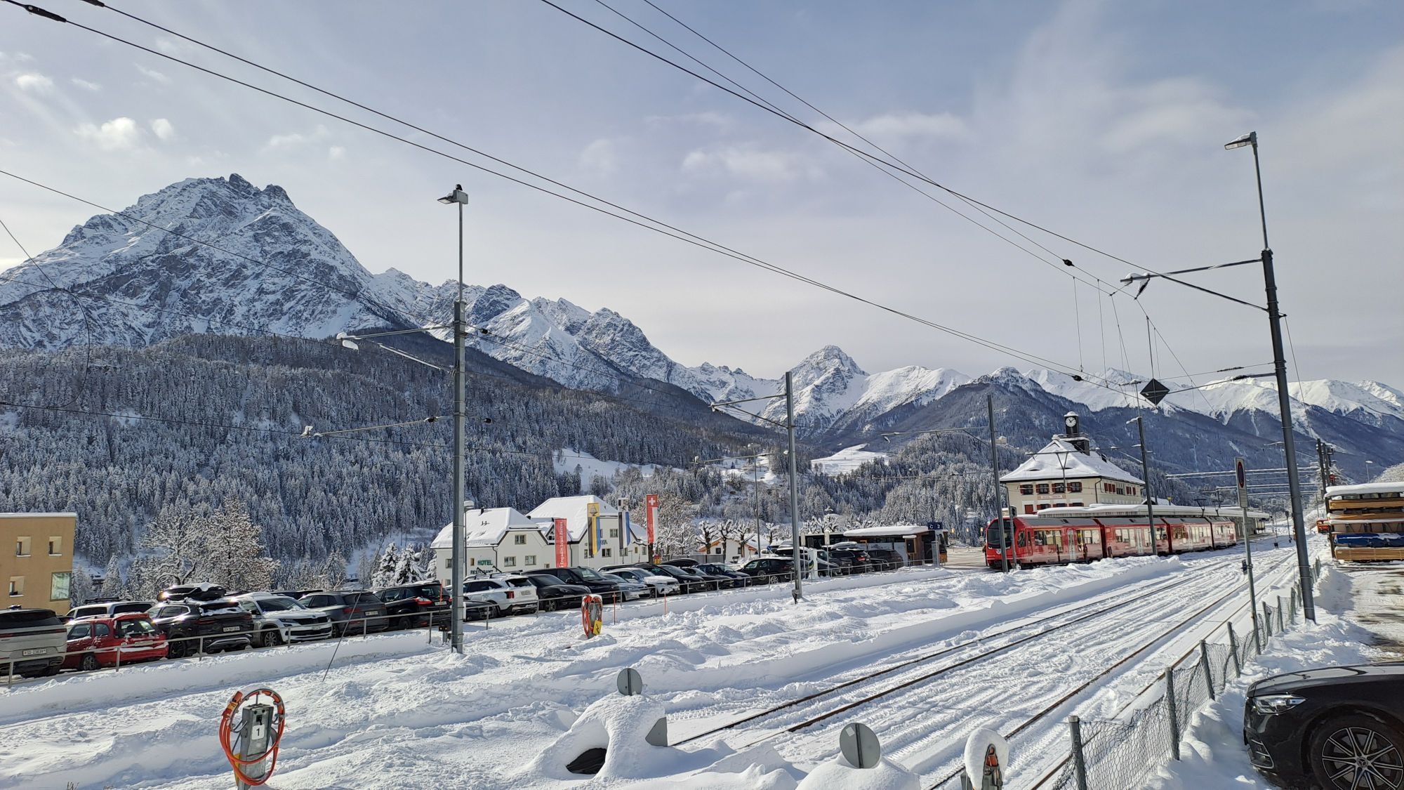
After leaving the village heading west, the wide road ascends slightly. At the next signpost, the path turns left and mostly runs flat in the sun along the snowy south-facing slope before it becomes steep shortly before the Chauennas farm. Benches along the path offer resting places and views of the snowy Lower Engadine Dolomites and the Inn in the valley floor. At the Chauennas farm, where you can buy farm honey, cheese, meat, and sheepskins, trees and bushes line the path. It then continues slightly downhill to Scuol, where at the hospital at the PostAuto stop a free sport bus takes guests back to the village of Scuol or to the station.
In places, the hike is steep and includes downhill sections. Those who want to shorten the hike can take the left path junction after the Chauennas farm and take the PostAuto on the main road towards Scuol (half-hourly connection).

Leave the village from the PostAuto stop heading west
Along the road
At the fork, turn left towards Scuol
At Chauennas, continue following the path towards Scuol
Option: At Chauennas, turn left and go to the PostAuto stop on the road
Tak
High and sturdy hiking boots or winter boots, warm clothing, sunscreen, sunglasses, sun protection, hiking poles.
Spikes are recommended. If there is little snow, the path soon becomes icy.
The path is prepared after every snowfall. Please observe condition reports in the winter sports report. The route was rated under favorable weather conditions; current snow and weather conditions must be considered before starting.
Note: The path partly runs on the sledding trail - please walk at the edge of the trail.
Emergency numbers:
144 Emergency, First Aid
1414 Mountain rescue REGA
112 International emergency number
From the north: via Landquart – Klosters by car shuttle through the Vereina tunnel (Selfranga - Sagliains) or via the Flüelapass into the Lower Engadin on H27
From the east: via Landeck / Austria towards St. Moritz on H27
From the south: via Reschen Pass (Nauders-Martina) or Ofen Pass (Val Müstair-Zernez) on H27
Sent can be reached from the Engadin road H27 at Scuol as well as Sur En in 5 minutes by car (25 minutes driving time from Veraina south portal)
Hourly service with the Rhaetian Railway (from Chur, Landquart/Prättigau or Upper Engadin) to Scuol-Tarasp station
Hourly PostAuto service (from Martina, Ftan or Tarasp) to Scuol-Tarasp station
Direct half-hourly PostAuto connection from Scuol to the PostAuto stop Sent, Sala
Parking spaces with fees at the western (parking garage) and eastern village entrance (below the cemetery)
2
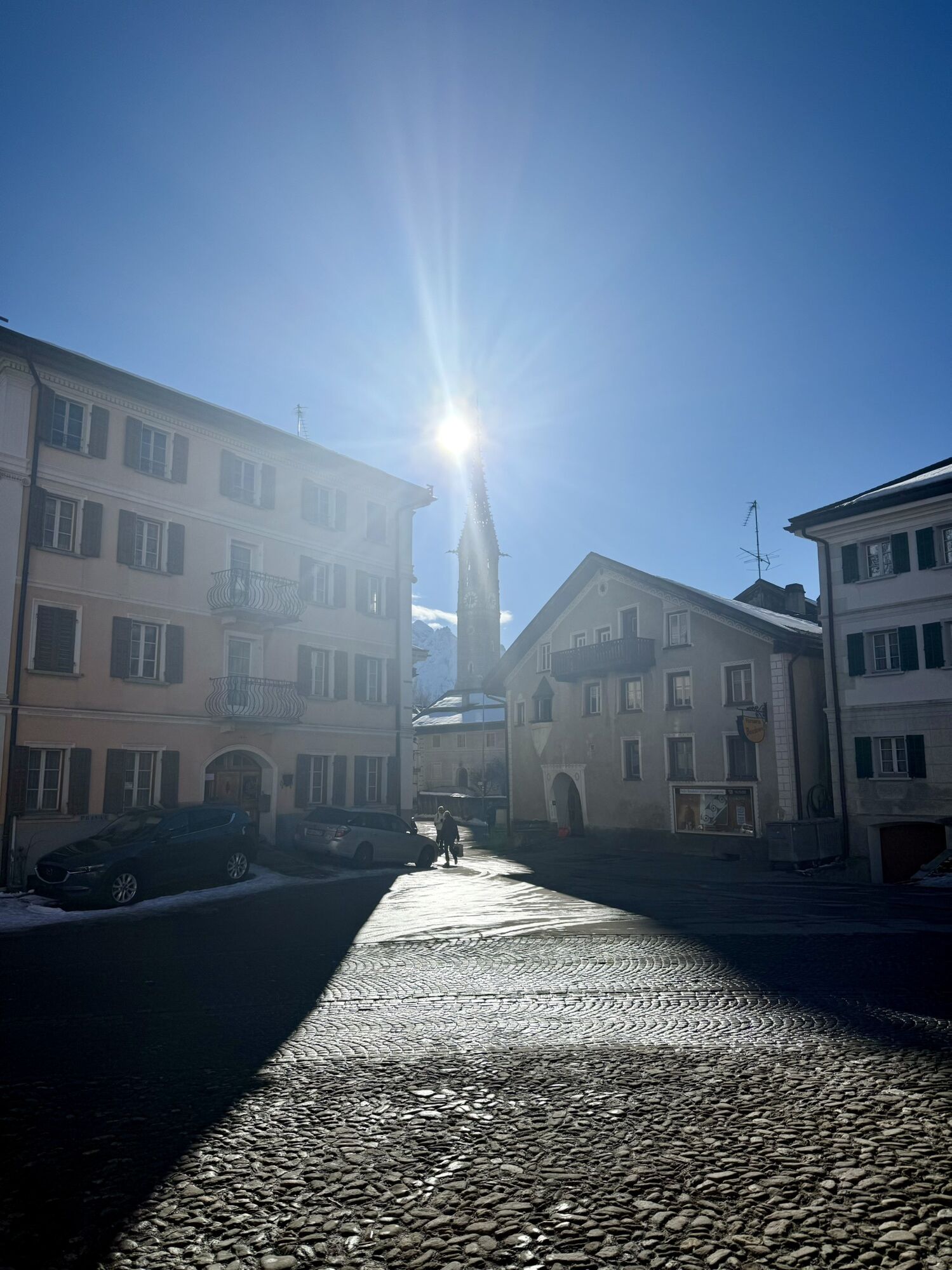
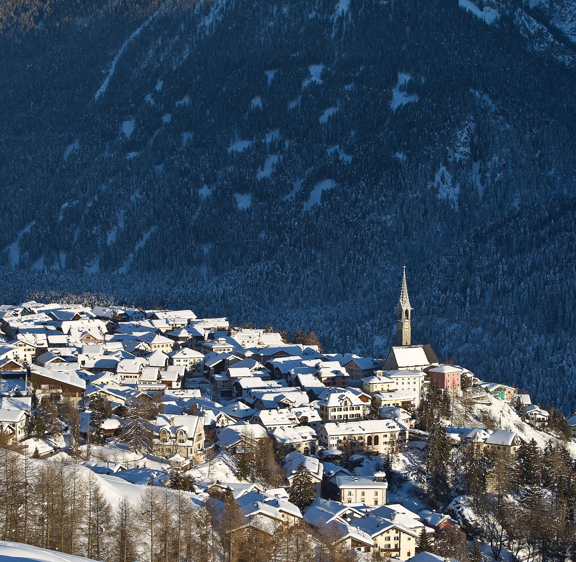
It is recommended to take a few minutes in Sent and stroll through the village with its spacious squares.
Popularne wycieczki w okolicy
- 4,1
Panoramaweg Schöneben Haider Alm
światłoWędrówka 5,78 km - 5,0
Samnaun Dorf – Muttler
ciężkiWędrówka 14,8 km - 4,5
Tarasp Fontana – Sparsels – Lai Nair (circular route)
światłoWędrówka 7,67 km - 4,7
Bergwanderung Schlinig -Seswenahütte
średniWędrówka 13,6 km - 5,0
San Jon – Chamonna Lischana (return)
średniWędrówka 12,0 km Nauders: Schweiz-Runde
Mountainbike 32,6 km- 5,0
3 Länder Tour Uinaschlucht MTB
ciężkiMountainbike 74,6 km - 4,0
Prui – Piz Clünas – Alp Laret – Ftan
średniWędrówka 13,6 km - 5,0
Piz Lad
średniWycieczka wysokogórska 6,67 km - 5,0
National Park: Mot Tavrü
średniWędrówka 12,0 km
Wędrówki i tropienie


Nie przegap ofert i inspiracji na następne wakacje
Twój adres e-mail została dodana do listy mailingowej.