


National park: Fuorcla Murter
This hike can extend the route from Zernez to Chamanna Cluozza into an attractive circular route. Leisurely hikers will of course spend the night. Along the way, the Murtersattel offers not only one of...
This hike can extend the route from Zernez to Chamanna Cluozza into an attractive circular route. Leisurely hikers will of course spend the night. Along the way, the Murtersattel offers not only one of the best points for animal observation in the national park but also an excellent panorama, as well as a view of the Platte with dinosaur tracks on Piz dal Diavel. The route is interesting, especially demanding on the knees during the descent, and requires surefooted and concentrated walking in some exposed sections.
Note: Dogs are not allowed in the Swiss National Park, not even on a leash. For more information and all protection regulations, see nationalpark.ch/schutzbestimmungen.

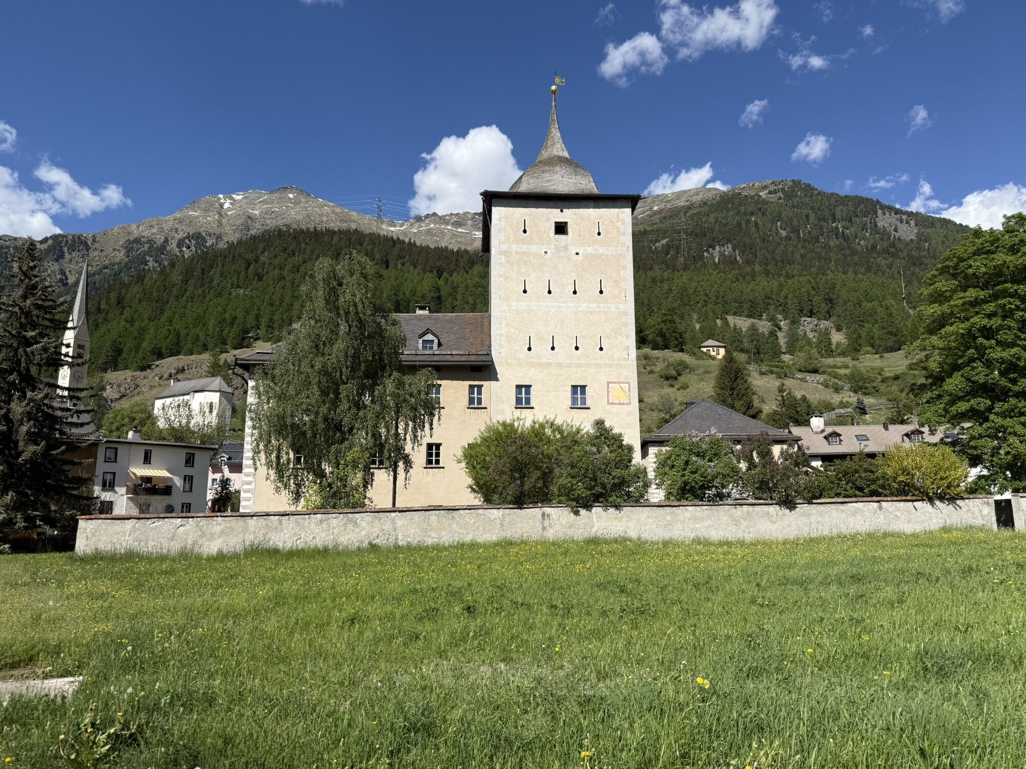
From Zernez station (1474 m a.s.l.) through the Val Cluozza to the Chamanna Cluozza (see route «Chamanna Cluozza»). There is the possibility to stay overnight. Be sure to book early (nationalpark.ch/de/besuchen/unterkunft/cluozza)!
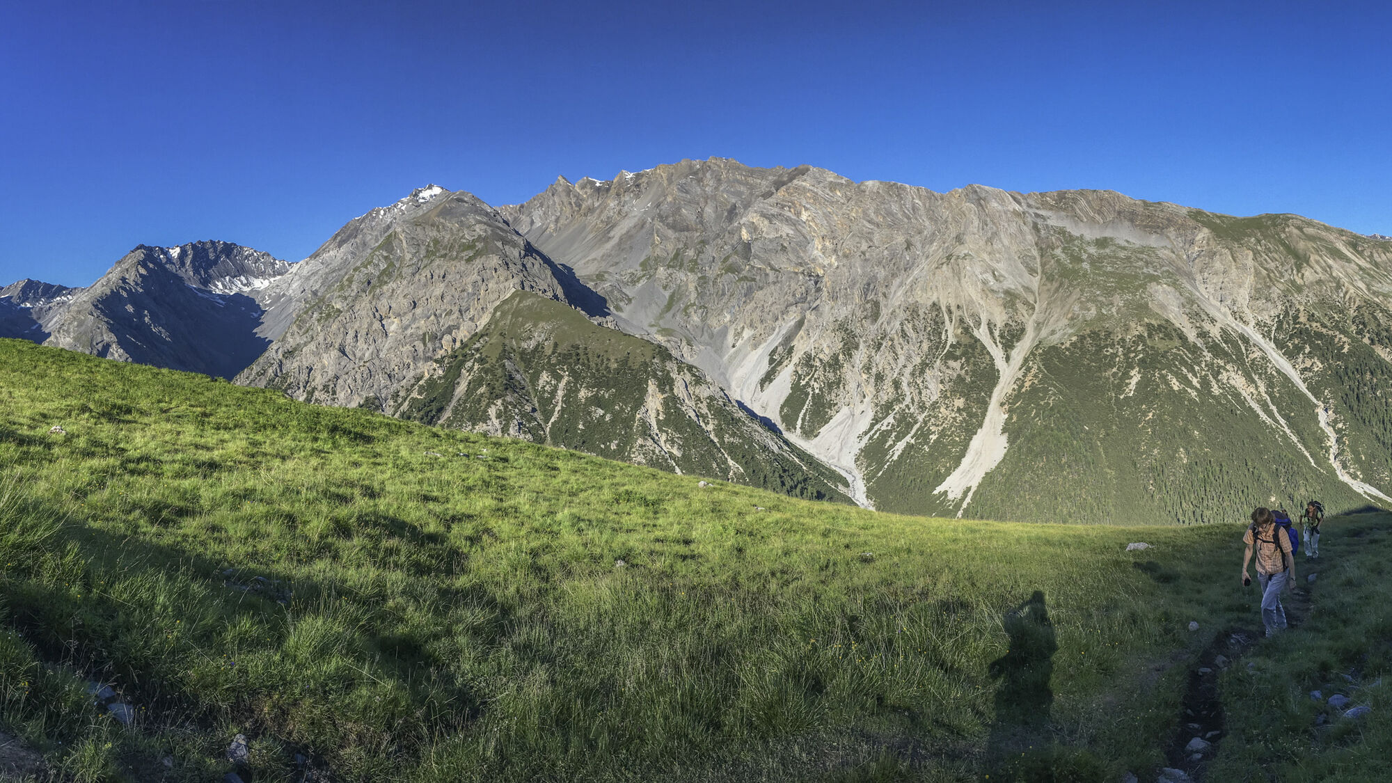
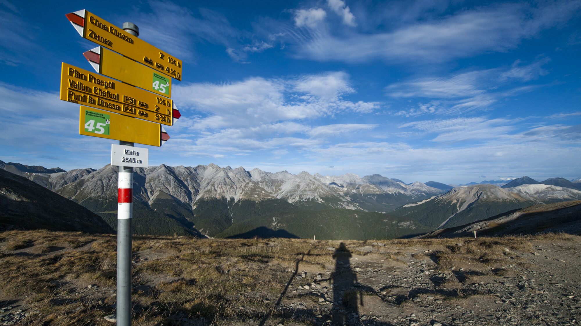
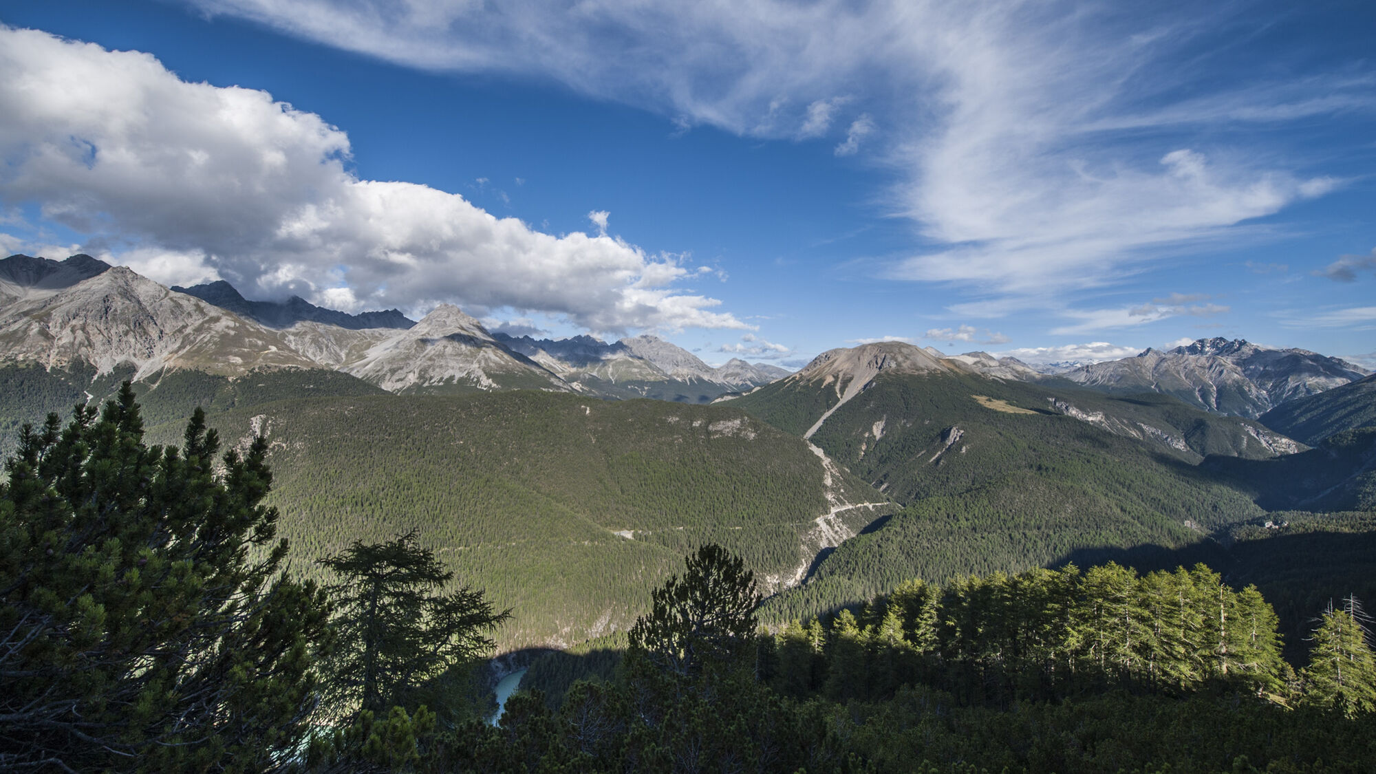
In the morning from the Chamanna Cluozza (1882 m a.s.l.) through pine-larch forest and later through dwarf pine fields uphill. At 2200 m a.s.l. through a steep scree chute – a fixed rope provides support here – and then over the Murter alpine pastures. Cattle used to graze here. Today numerous marmots inhabit the area near the path, which are ideal for observation. At the height of the ruins of the old alpine building, dinosaur tracks on Piz dal Diavel can be spotted with a good pair of binoculars. Shortly afterwards, the path reaches the Murtersattel (2545 m a.s.l.), where a brisk wind often blows. Now the view opens to the Spöl valley and the Engadine Dolomites. The descent begins steeply and leads past ruins of former alpine buildings once again at Plan dals Poms. After this terrace begins the seemingly endless zigzag path through dwarf pine stands and later through a magnificent larch, Swiss stone pine, spruce, and pine forest. At the clearing of Plan Praspöl (1690 m a.s.l.) the valley floor is almost reached. Only 10 minutes to the bridge over the Spöl, where the final ascent to the PostAuto stop «Vallun Chafuol/P3» begins.
Tak
Hiking shoes or mountain boots, warm clothing, sun and rain protection, hiking poles and binoculars recommended as needed.
Mountain hike (white-red-white). Long and partly steep descent. Surefootedness is required. It is usually windy at the saddle.
Emergency Numbers:
144 Emergency, first aid
1414 Mountain rescue REGA
112 International emergency number
Zernez is located directly on the Engadine road H27.
Hourly by the Rhaetian Railway (from Chur, Prättigau, Upper and Lower Engadine) to Zernez
Free parking at the station, in the village, and at the visitor center of the National Park in Zernez.
Those who have problems with long descents should do the route better in the opposite direction and stay overnight at the Chamanna Cluozza.
Kamery internetowe z trasy

Popularne wycieczki w okolicy
-
4,8
Circular hike Val Trupchun in the Swiss National Park
średniWędrówka 13,8 km -
4,8
National park: Zernez – Munt Baselgia – Macun lakes – Alp Zeznina – Lavin
ciężkiWędrówka 22,9 km -
4,0
National Park: Margunet
światłoWędrówka 7,76 km -
4,8
National Park: Grimmels (circular hike)
światłoWędrówka 6 km -
Flüelapass – Schwarzhorn (return)
średniWędrówka 7,92 km -
5,0
Crap da la Pare' with Joëlette
światłoWędrówka 4,58 km -
5,0
Fluela Schwarzhorn 3147 m
światłoWycieczka wysokogórska 7,34 km -
5,0
National Park: Murtaröl
ciężkiWędrówka 15,6 km -
5,0
National Park: Spöl Valley
światłoWędrówka 7,67 km -
National Park: Chamanna Cluozza
średniWędrówka 8,37 km
Wędrówki i tropienie


Nie przegap ofert i inspiracji na następne wakacje
Twój adres e-mail została dodana do listy mailingowej.