


Glacier path Länta
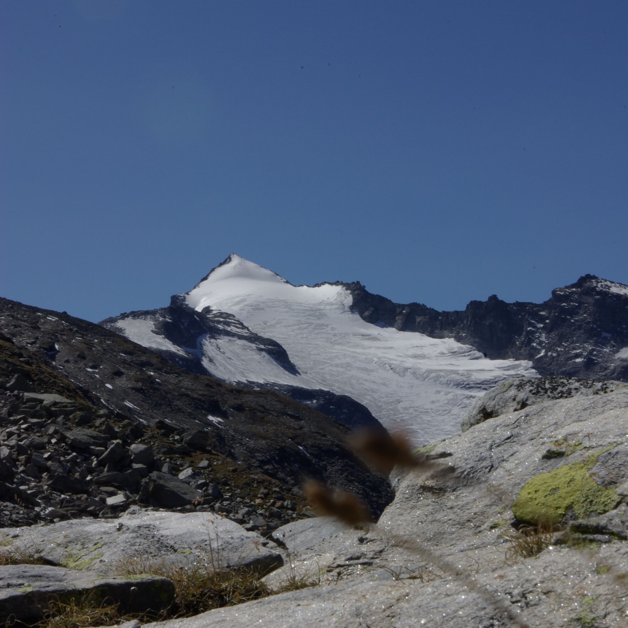
The Länta Glacier, as the fourth largest glacier of the Adula Alps, shows itself in its entire alpine diversity. Finger-wide crevices, glacier tables, meandering meltwater channels, and a steep ice front...
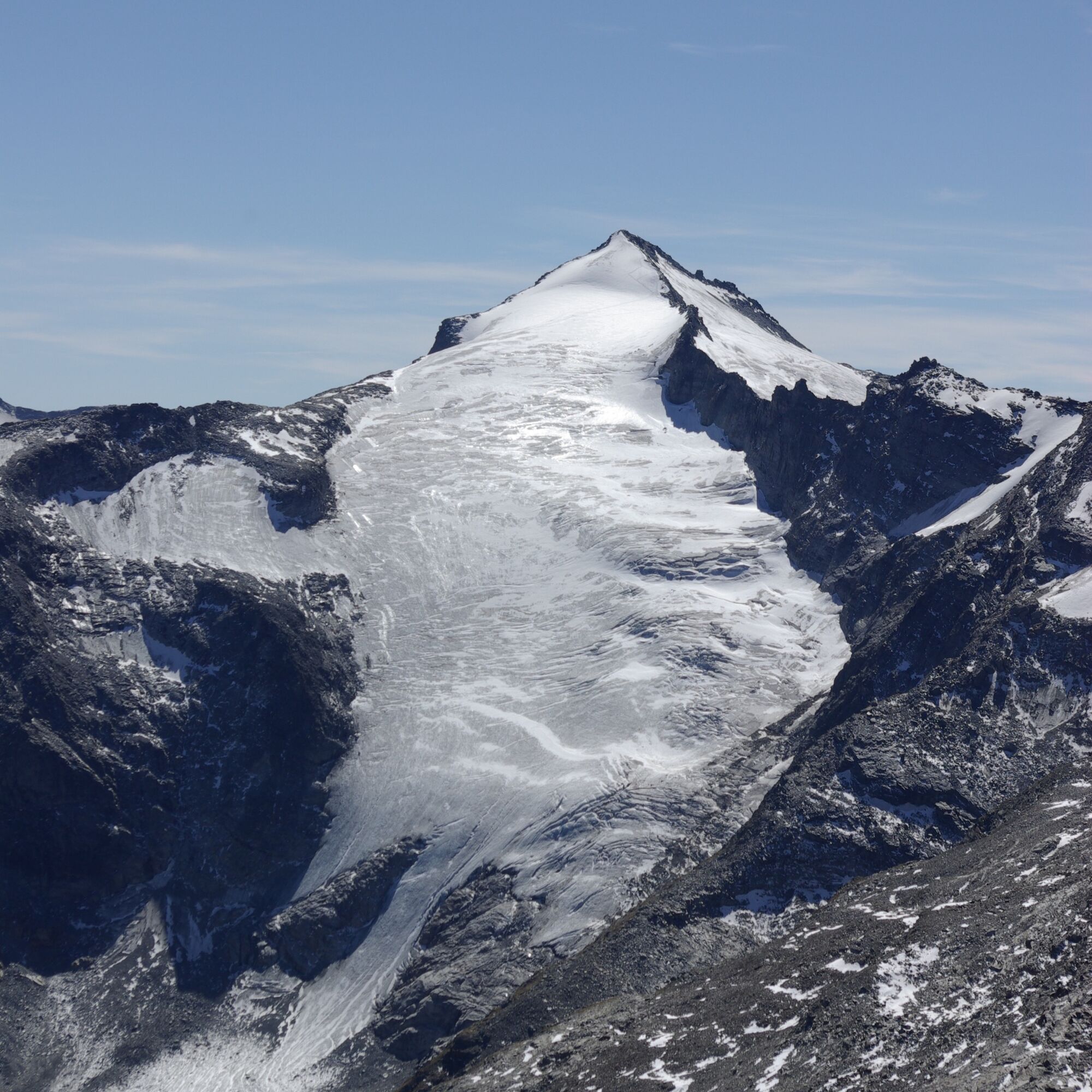
The Länta Glacier, as the fourth largest glacier of the Adula Alps, shows itself in its entire alpine diversity. Finger-wide crevices, glacier tables, meandering meltwater channels, and a steep ice front in the upper glacier section.

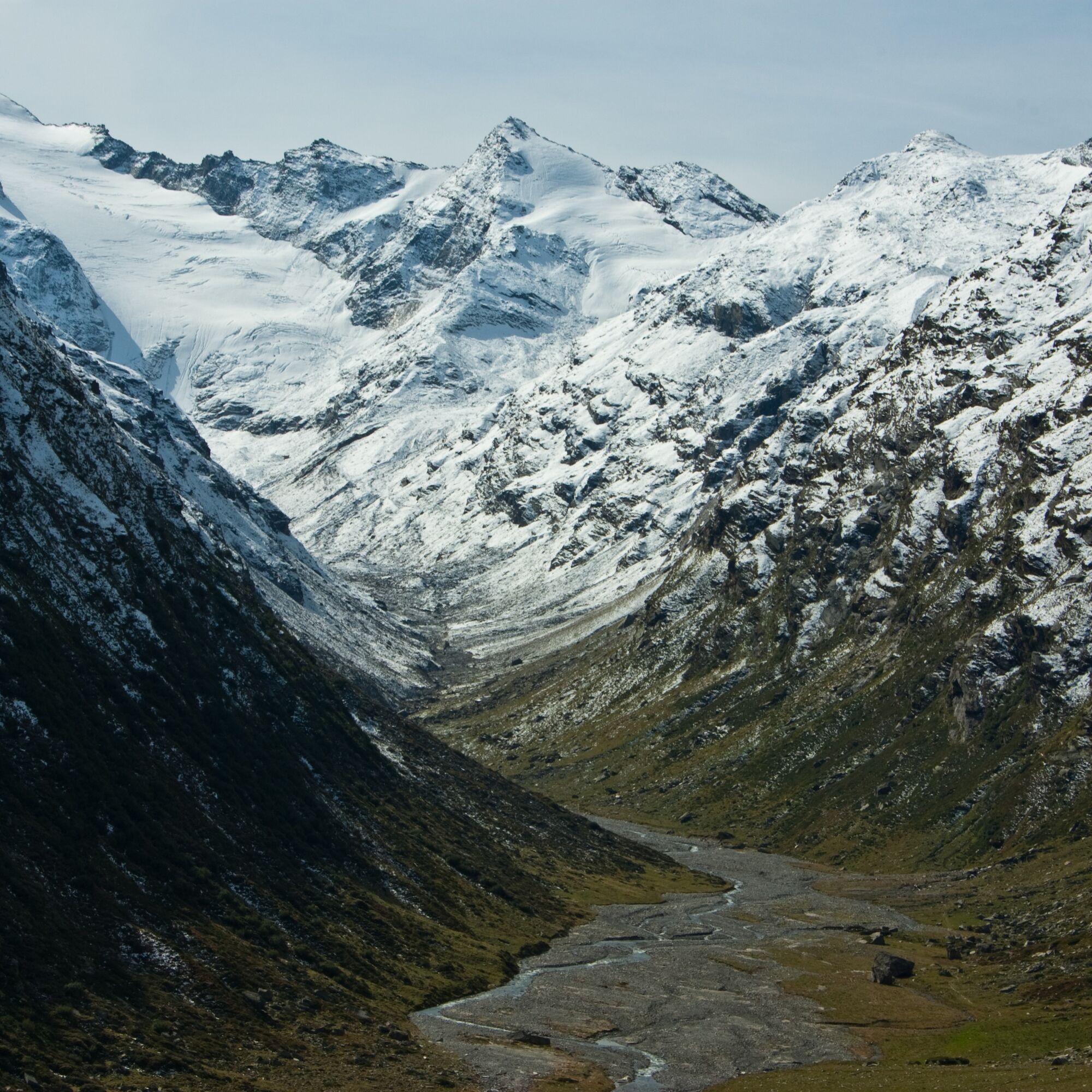
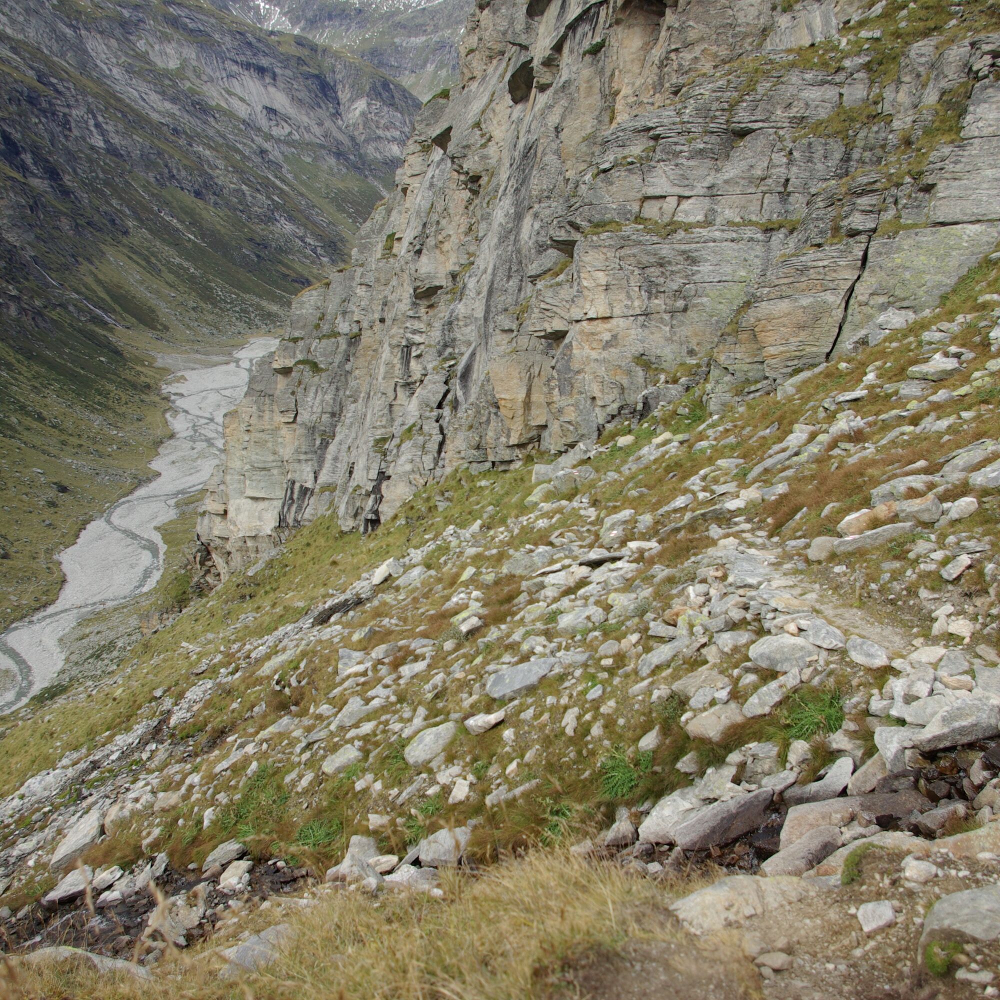
Attention: The glacier path starts at the Länta Hut SAC. It takes about 3 hours on foot from Zerfreila to the Länta Hut. Circular route starting at the Länta Hut SAC. The path runs as a circular route on both sides of the Valser Rhine up to the immediate ice edge. The path leads from initially alpine meadow terrain through stony moraines up to the ice edge of the Länta Glacier. On the other side of the stream, it goes back to the Länta Hut SAC.
Tak
Solid, rainproof, warm clothing. Robust mountain or trekking shoes. Gloves, hat, sun protection. Hiking poles, food and drinks from the backpack, emergency first aid kit, topographic map, altimeter, compass, mobile phone, flashlight.
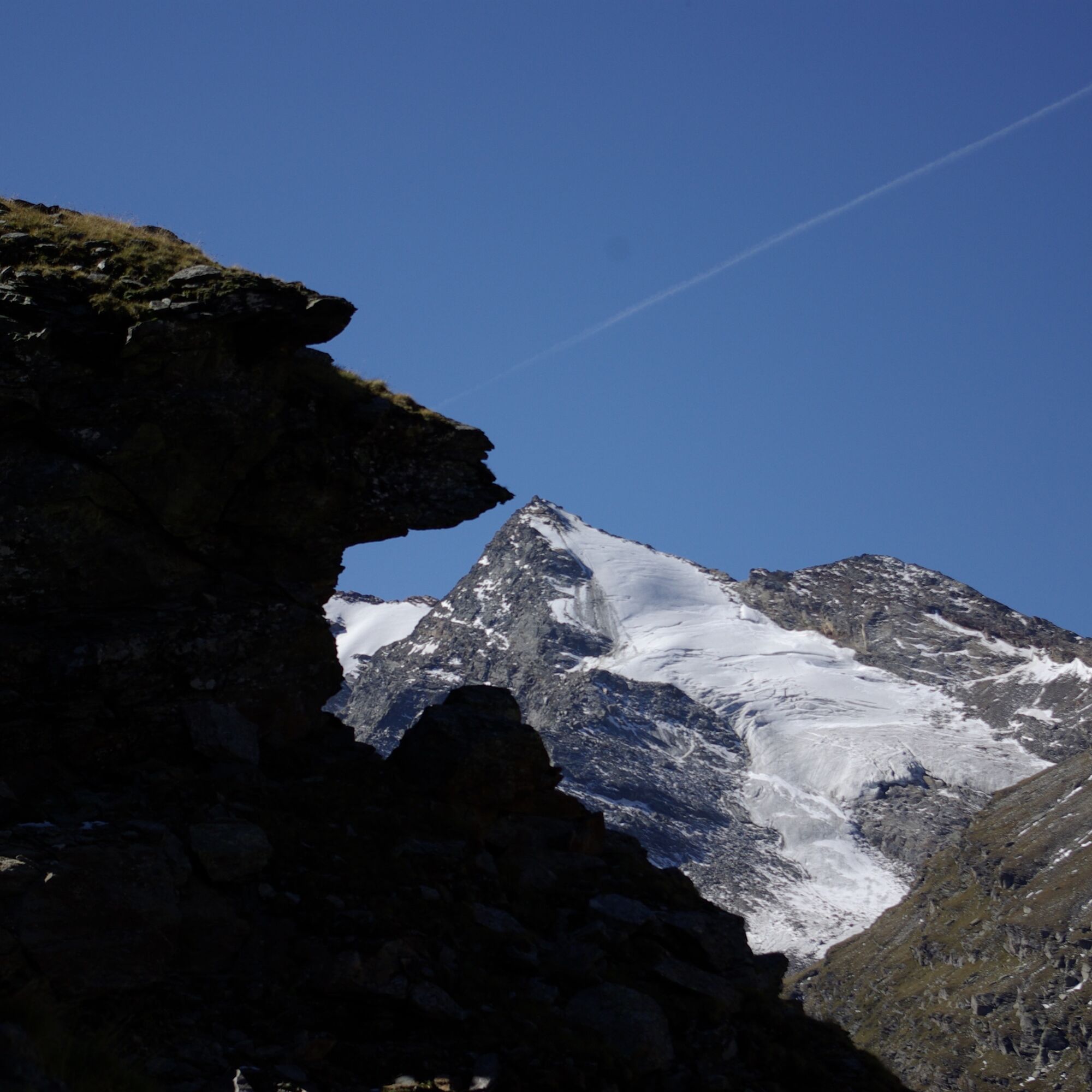
Difficulty T4, marked white-blue-white. Caution: Walking on the ice is not recommended, as there may be cavities, crevices, and meltwater channels beneath the ice. For safety reasons, keep away from the steep lateral moraines and the rock outcrop to the upper glacier section. Danger from falling stones and ice!
From Chur via Ilanz to Vals. By post bus or private car. From Vals onward to Zerfreila, also by post bus or private car. Attention: The glacier path starts at the Länta Hut SAC. It takes about 3 hours on foot from Zerfreila to the Länta Hut.
Attention: The glacier path starts at the Länta Hut SAC. It takes about 3 hours on foot from Zerfreila to the Länta Hut.
Parking lot in front of the Zerfreila restaurant. Or parking lot at the Zerfreila chapel (limited number of parking spaces).
Overnight stay at the Länta Hut SAC, and then enjoy the excellent dinner completely relaxed. The next morning, set out early on the glacier path. Registration at the Länta Hut SAC is required.
Popularne wycieczki w okolicy
- 5,0
Panorama route
światłoWędrówka 5,39 km Giro della Greina
Wędrówka 50,6 km- 3,3
3-lake hike
średniWędrówka 12,8 km - 5,0
Winter hike Gadastatt - Frunt - Zerfreila (Panorama trail)
światłoWędrówka zimą 5,36 km - 5,0
2-day hike Greina high plateau
średniWędrówka 14,9 km - 5,0
Southeast Switzerland Hiking Day Vals 2017
światłoWędrówka 11,8 km Piz Terri, 3.149 m
średniWycieczka wysokogórska 6,92 kmFurggelti 2712m
ciężkiWędrówka 18,7 kmFanellhorn 3124 m
ciężkiWycieczka wysokogórska 6,86 km- 4,7
Tibet Suspension Bridge Route Riasc
światłoWędrówka 6,12 km
Wędrówki i tropienie


Nie przegap ofert i inspiracji na następne wakacje
Twój adres e-mail została dodana do listy mailingowej.