


Prui – Ftan
Poziom trudności: 2
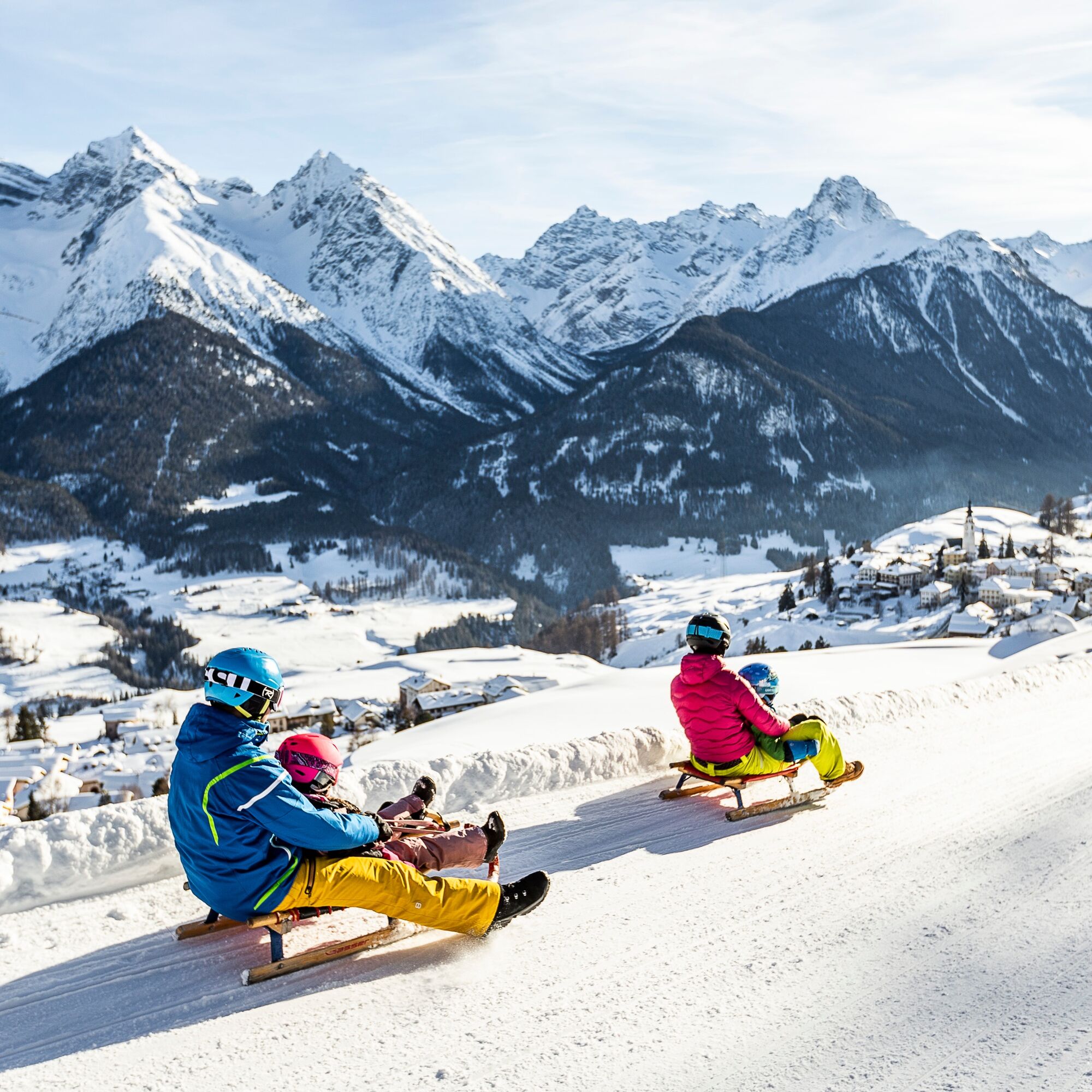
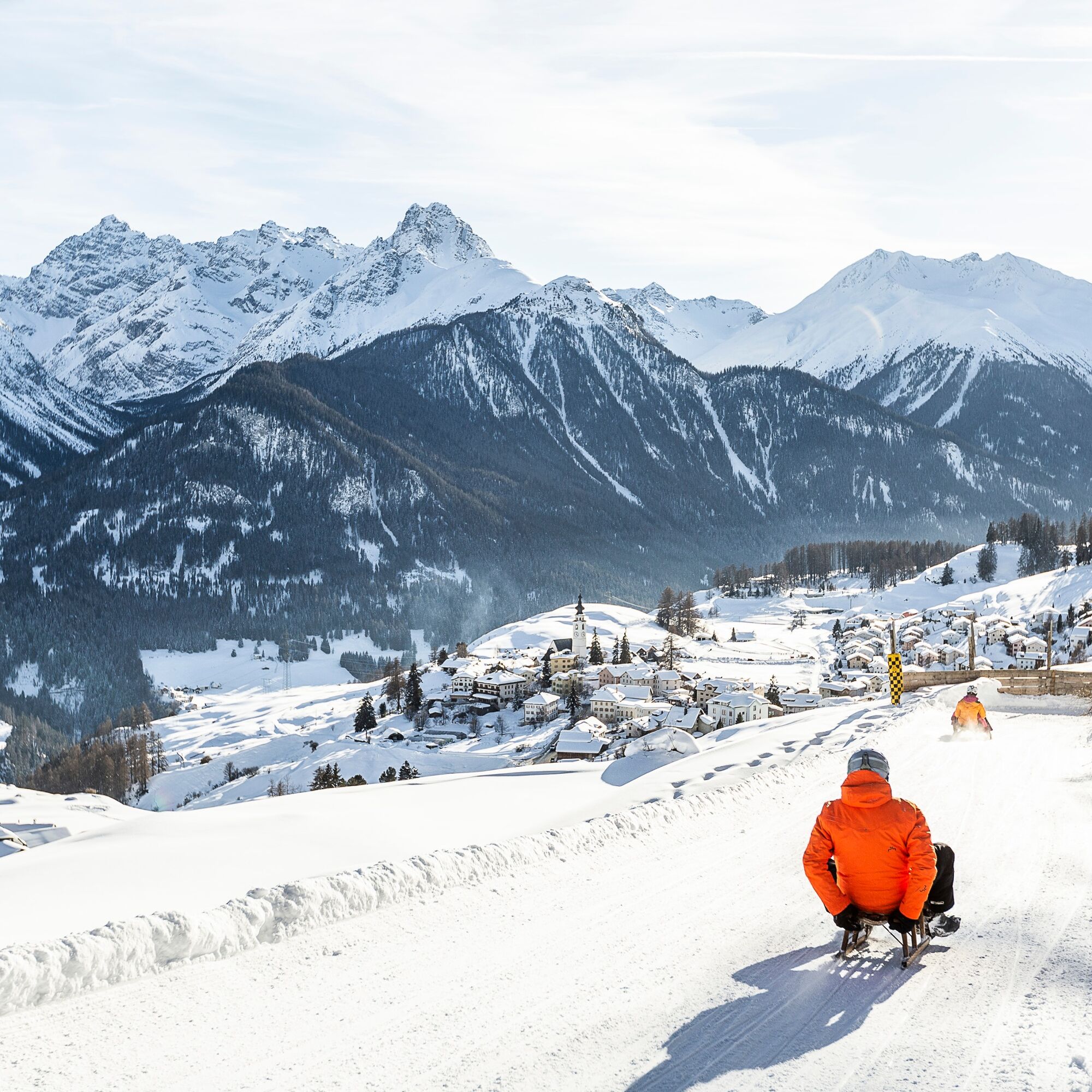
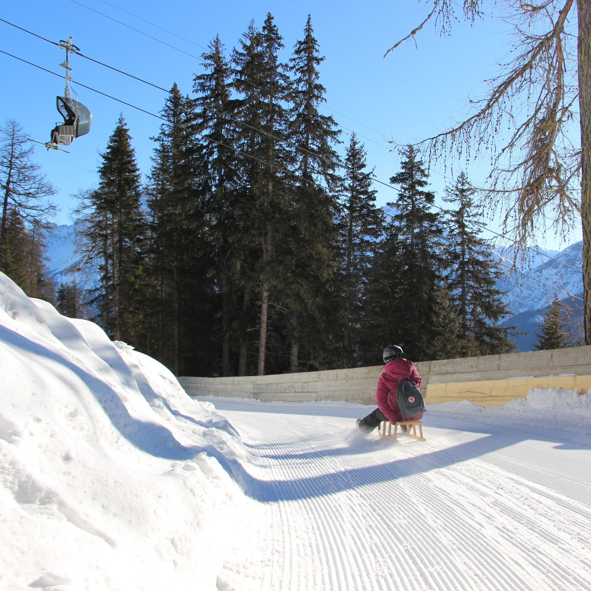
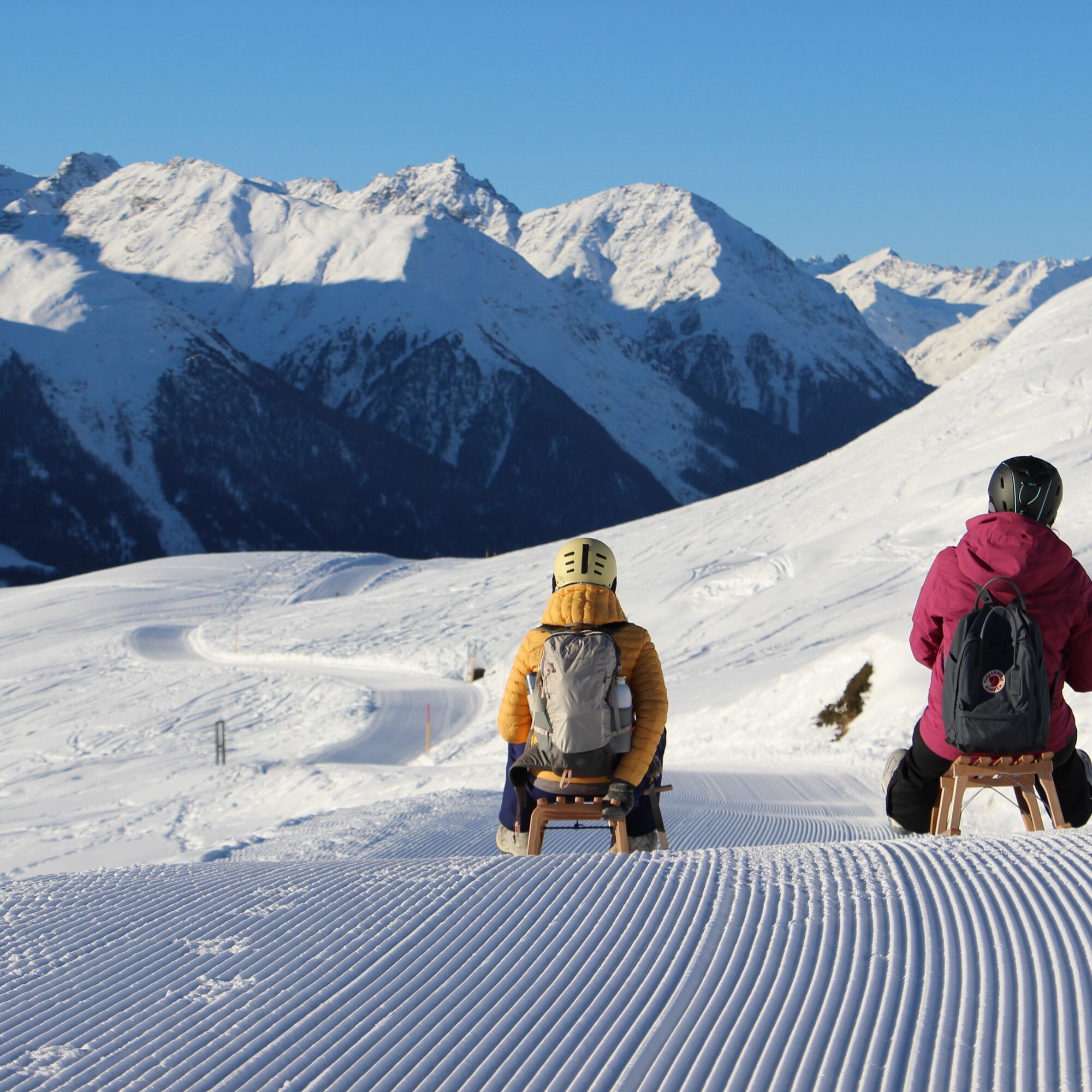
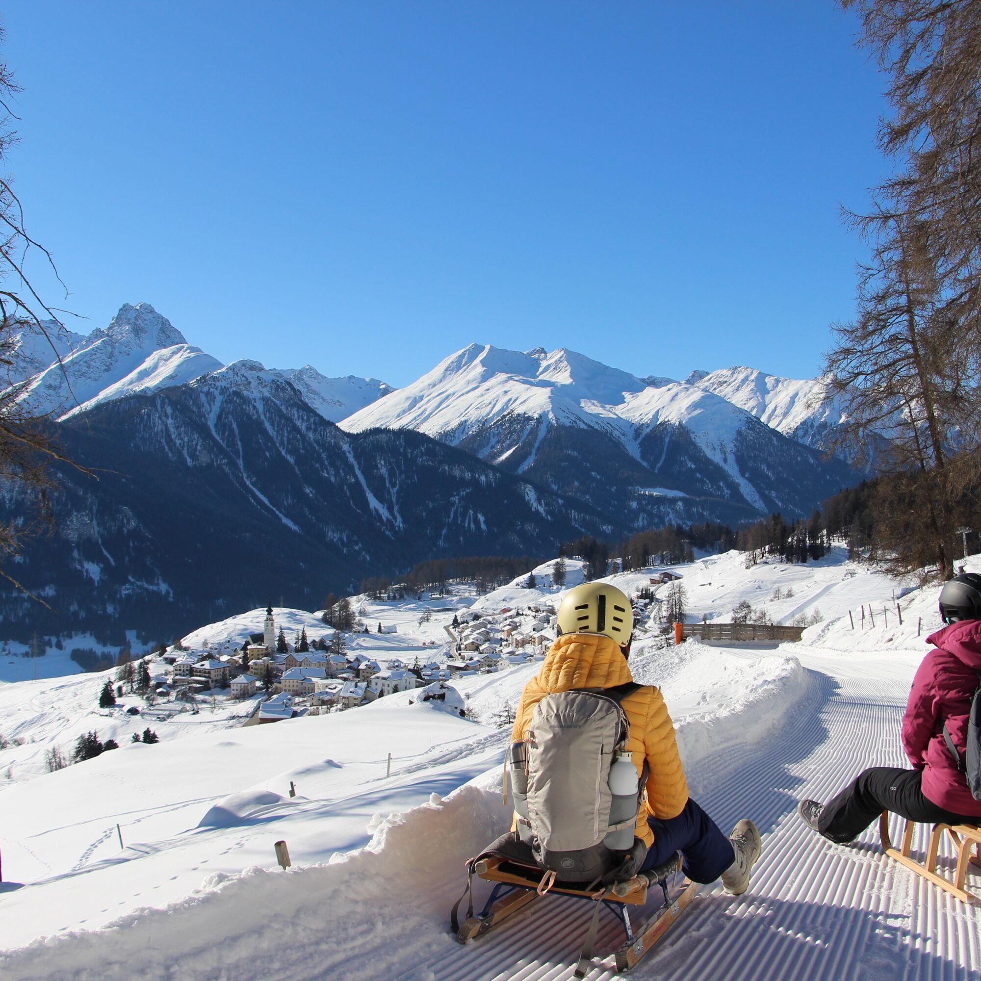
The entry to the toboggan run is located at over 2000 meters, west of the mountain restaurant Prümaran Prui. Almost a must: enjoy the view over the Lower Engadin before the descent. The shared piste for...
The entry to the toboggan run is located at over 2000 meters, west of the mountain restaurant Prümaran Prui. Almost a must: enjoy the view over the Lower Engadin before the descent. The shared piste for tobogganers and winter hikers then leads to the entry of the toboggan run.
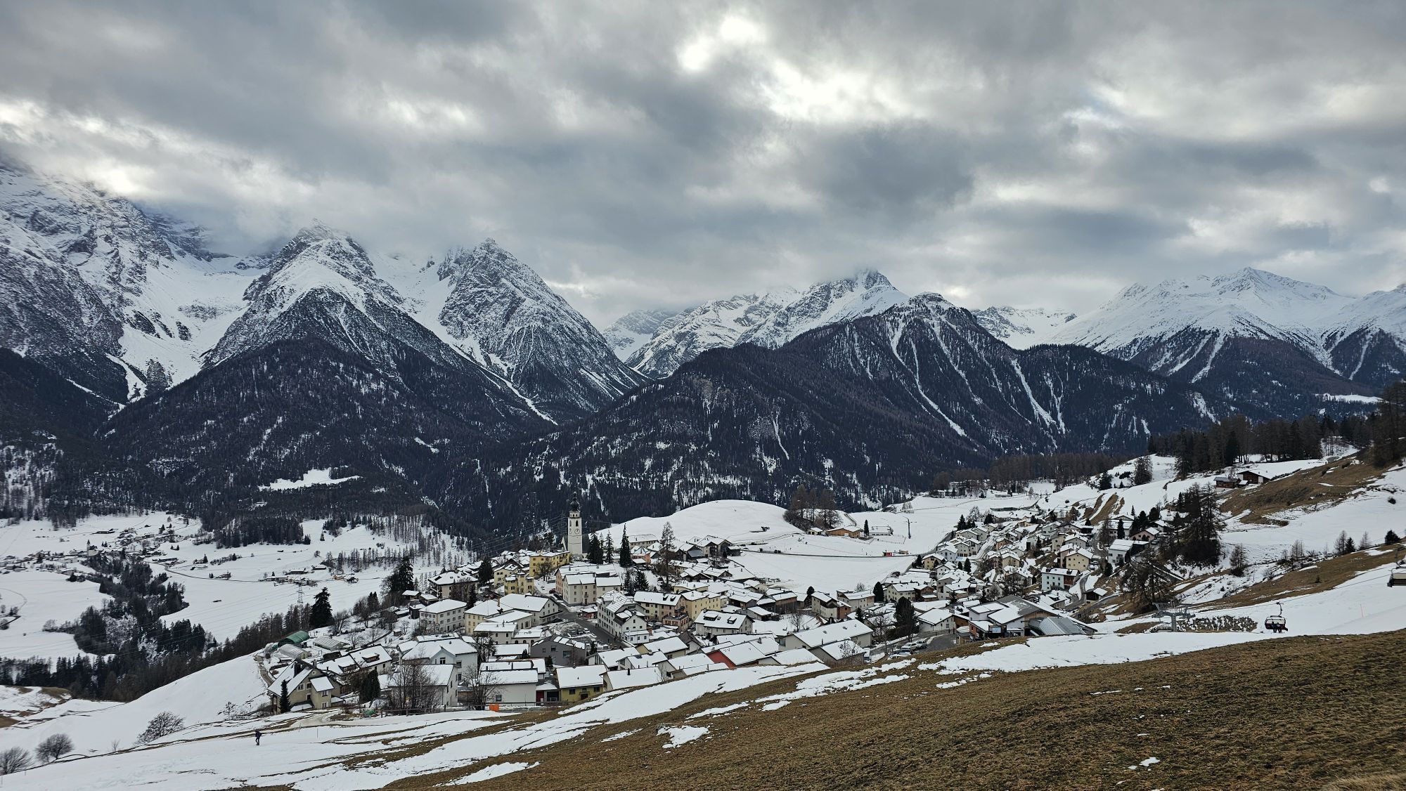
The first section of the toboggan run, facing southeast, is quite straight before the piste leads into the forest "God S-chür", where many small curves challenge technical skills. After a little more than one kilometer, a sharp right curve follows. This maneuver is rewarded with the wonderful view over Ftan Pitschen, a typical Engadin village. The last section to the valley station of the Ftan-Prui cable car is clear and suitable for a fast descent. Overall, about two of the three kilometers run through the forest.

From the mountain station of the Ftan Prui chairlift about 400 m westwards
Entry to the toboggan run
Follow the path to the valley station of the chairlift
Tak
Tak
Toboggan (toboggan can also be rented at the valley station of the Ftan-Prui cable car), high and sturdy hiking boots or winter boots, warm clothing, sun protection, gloves and helmet recommended.
The path is prepared after every snowfall. Please observe the condition reports in the winter sports report. The route was rated under favorable weather conditions; current snow and weather conditions must be checked before starting.
Emergency numbers:
144 emergency call, first aid
1414 mountain rescue REGA
112 international emergency call
From the north: via Landquart – Klosters by car shuttle through the Vereina tunnel (Selfranga - Sagliains) or via the Flüela Pass into the Lower Engadin on H27
From the east: via Landeck / Austria towards St. Moritz on H27
From the south: via Reschen Pass (Nauders-Martina) or Ofen Pass (Val Müstair-Zernez) on H27
Ftan can be reached from the Engadin road H27 from Ardez or from the western edge of the village of Scuol in 10 minutes by car (25 minutes driving time from Veraina south portal)
By the Rhaetian Railway (from Chur, Prättigau or Upper Engadin) or by PostBus (from Martina, Sent or Tarasp) hourly to Scuol-Tarasp station.
Direct hourly PostBus connection from Scuol-Tarasp to the PostBus stop Ftan, cumün
Paid parking spaces in Ftan at the valley station of the Ftan-Prui chairlift
2
The condition of the piste can be found in the winter sports report.
The toboggan run is also a night toboggan run. For more information, please see here.
Popularne wycieczki w okolicy
-
4,9
Hiking trail Piz Buin - view
średniWędrówka 14,4 km -
5,0
Großer Piz Buin (3.312m), Normalweg 2019 über Ochsentaler Gletscher
ciężkiWycieczka wysokogórska 24,1 km -
4,8
National park: Zernez – Munt Baselgia – Macun lakes – Alp Zeznina – Lavin
ciężkiWędrówka 22,9 km -
2,0
Bielerhöhe - Vermuntkopf - Bielerhöhe
średniWędrówka 17 km -
4,0
National Park: Margunet
światłoWędrówka 7,76 km -
4,5
Tarasp Fontana – Sparsels – Lai Nair (circular route)
światłoWędrówka 7,67 km -
5,0
San Jon – Chamonna Lischana (return)
średniWędrówka 12,0 km -
4,0
Prui – Piz Clünas – Alp Laret – Ftan
średniWędrówka 13,6 km -
5,0
National Park: Mot Tavrü
średniWędrówka 12,0 km -
Suspension Bridge Trail Val Sinestra – Zuort – Griosch – Vnà
średniWędrówka 11,0 km

Wędrówki i tropienie


Nie przegap ofert i inspiracji na następne wakacje
Twój adres e-mail została dodana do listy mailingowej.