


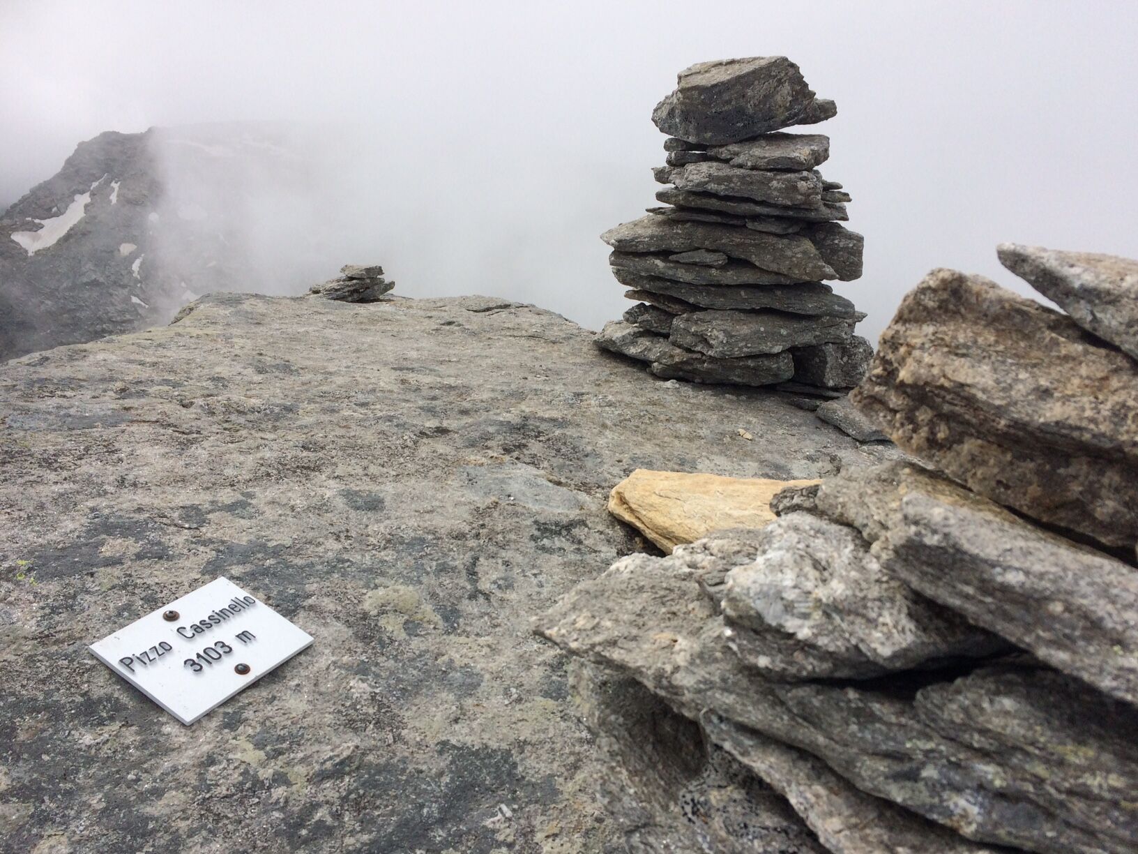
Pizzo Cassinello 3103 m
Thanks to the proximity to the Länta Hütte SAC and Passo Soreda, Pizzo Cassinello is one of the most climbed mountains in the Valser valley. Rightly so, because the surrounding glacier world and the view...
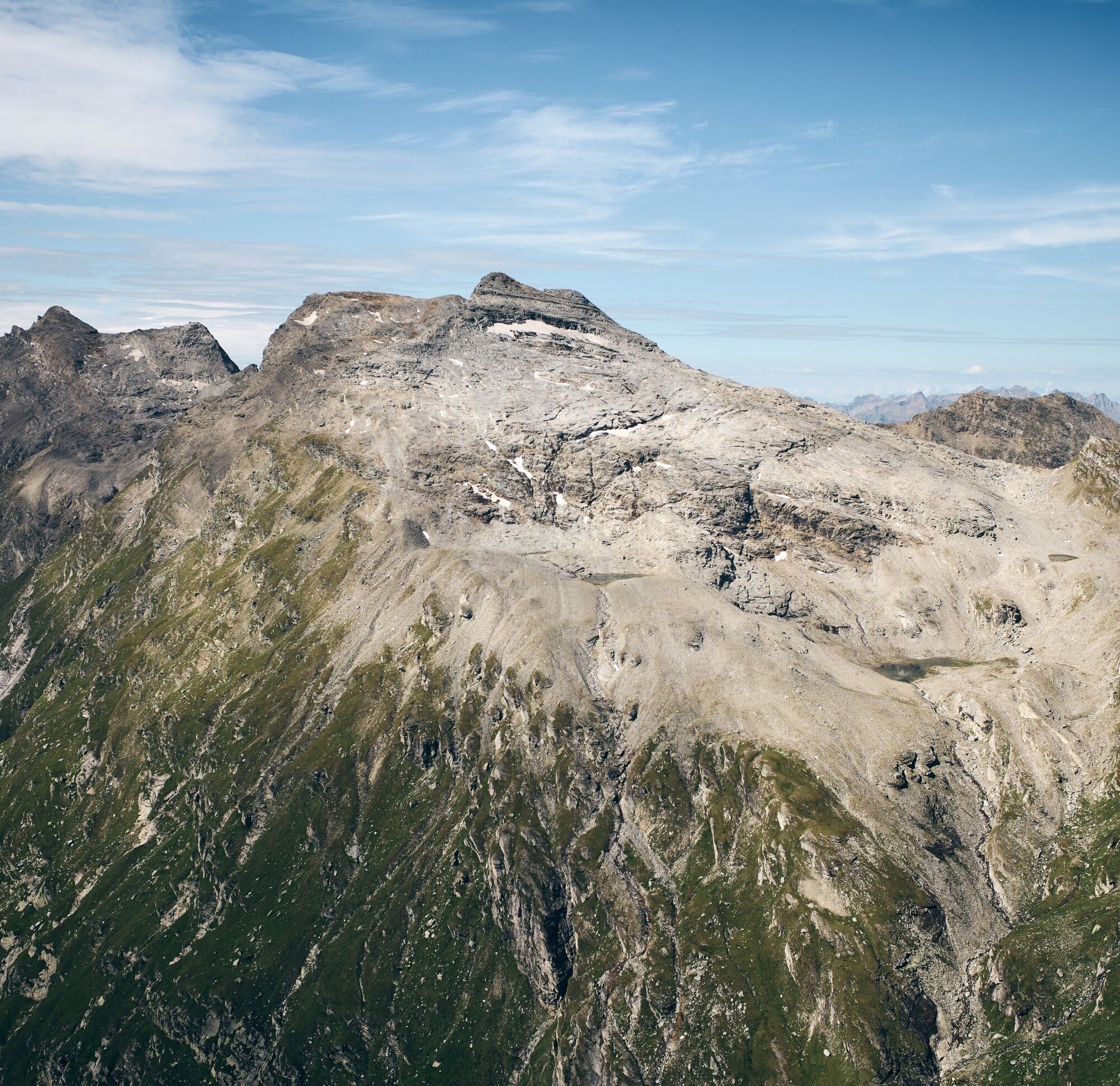
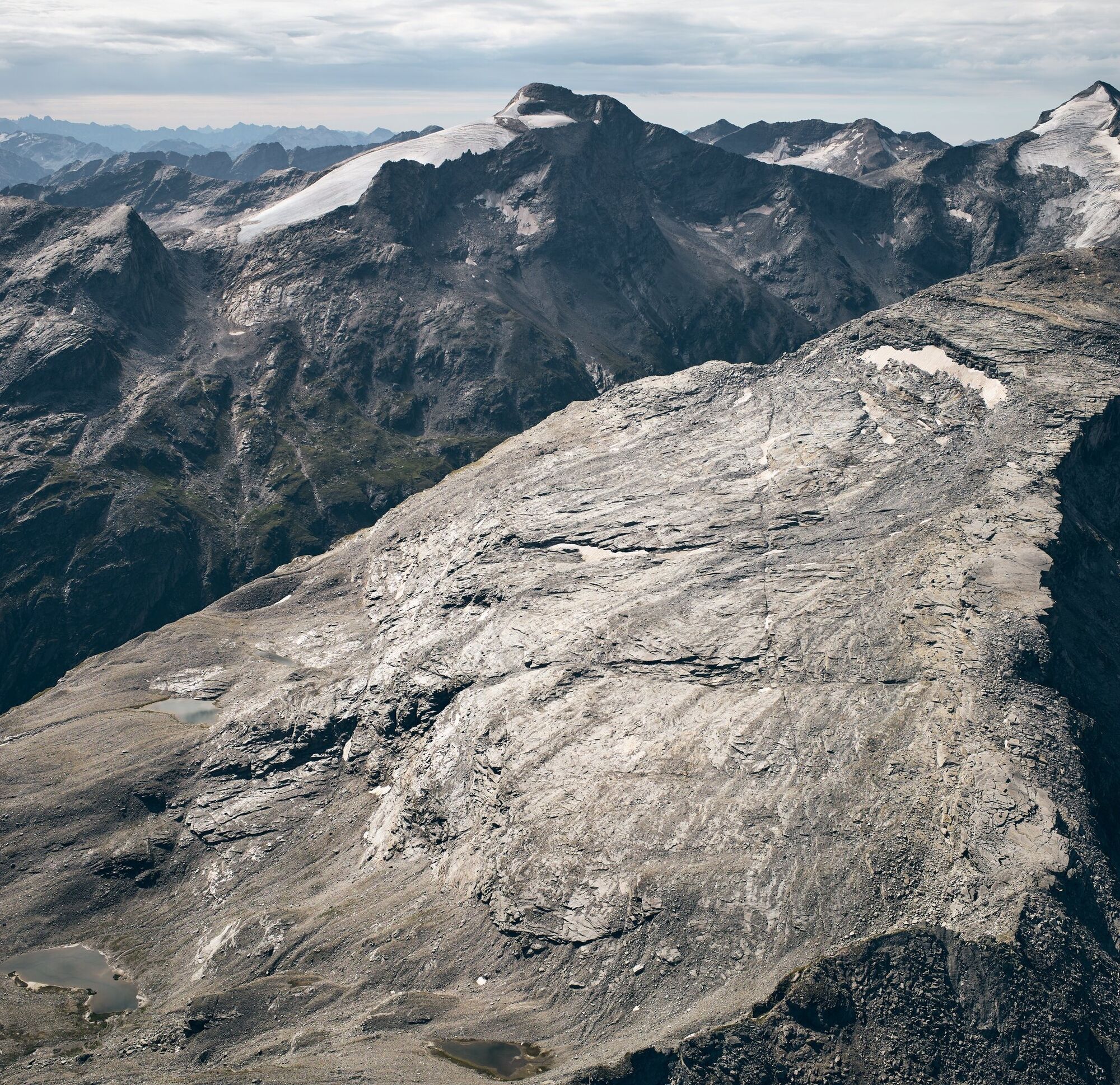
Thanks to the proximity to the Länta Hütte SAC and Passo Soreda, Pizzo Cassinello is one of the most climbed mountains in the Valser valley. Rightly so, because the surrounding glacier world and the view over the Ticino mountain scenery into Valais and towards the Bernese and Glarus Alps is spectacular.
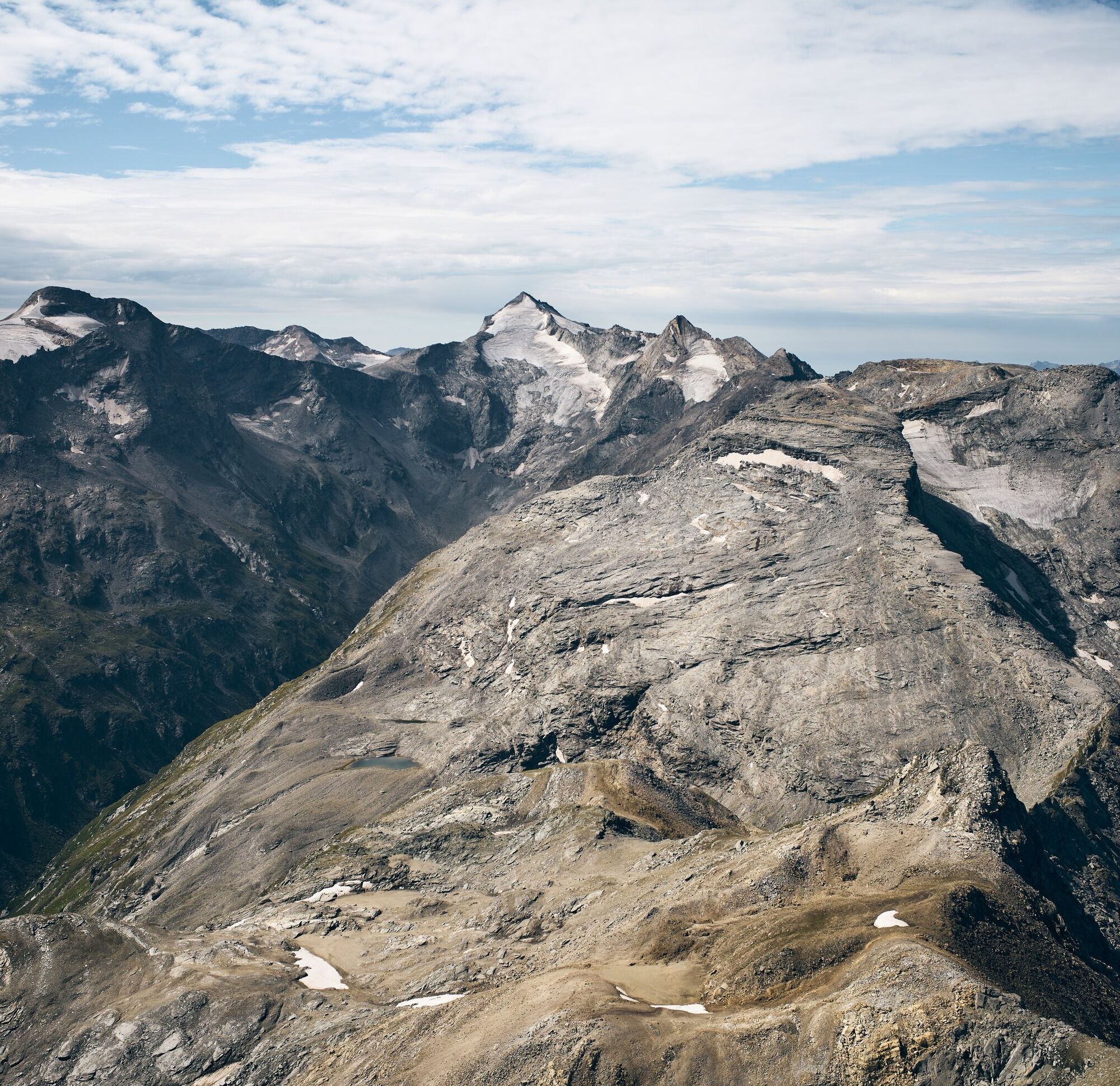
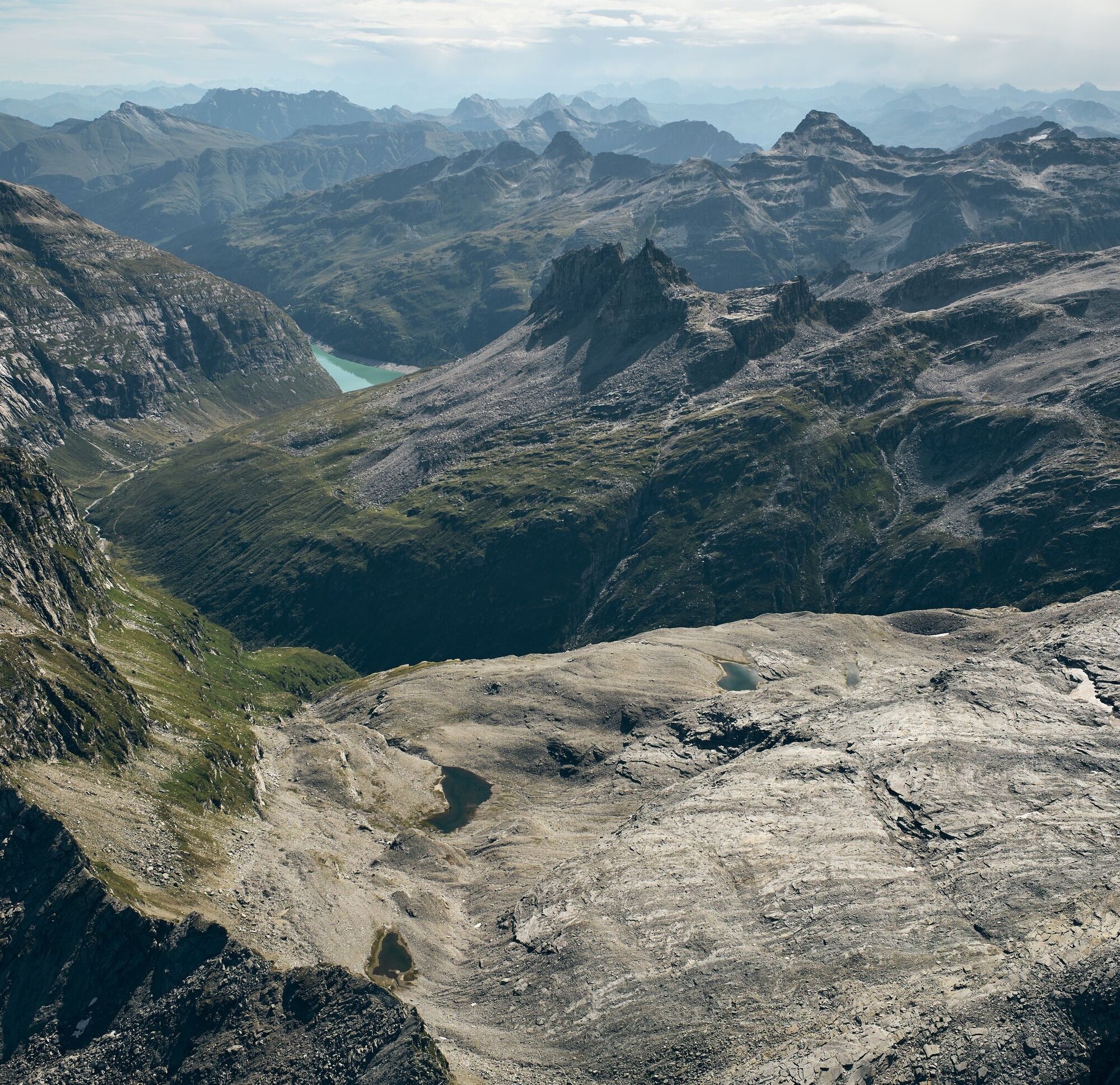
The ascent from Passo Soreda to the summit leads over impressive gneiss plates and light scree. Snow can lie far into the summer, covering the markings. With good visibility, however, the mountain poses no orientation problems, and for particularly brave alpine hikers, the small lakes by the wayside invite a refreshing swim on the descent.

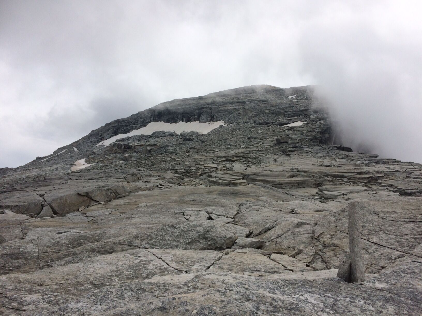
From the Länta Hütte SAC in 35 min. or from Zerfreila in 2 hrs 30 min. to the junction to Passo Soreda south of the Lampertschalp. From there, in 2 hrs moderately steep on a marked mountain path up to Passo Soreda (2759 m). From the pass, only slightly ascending over the broad rock ridge to the south towards the summit. At 2950 meters, over a short and well-stepped rock ledge to the summit area above it, which is crossed in a southeast direction to the flat northeast ridge. Over this ridge in a few minutes to the 3103 m high summit (1 hr 15 min from Passo Soreda). Descent by the same route.
Ascent time: 3 hrs 45 min from the Länta Hütte SAC, 5 hrs 45 min from Zerfreila
Descent time: 2 hrs 30 min to the Länta Hütte SAC, 3 hrs 45 min to Zerfreila
Total walking time: 6 hrs 15 min (Länta Hütte SAC), 9 hrs 30 min (Zerfreila)
Tak
Tak
Tak
Solid, rainproof, warm clothing. Robust mountaineering or trekking shoes. Gloves, hat, sun protection. Walking sticks, provisions and drinks from the backpack, emergency first aid kit, topographic map, altimeter, compass, mobile phone, flashlight.
Requirements: For good alpine hikers, a technically easy route (T4), which requires caution at the summit in wet, cold, snowy or foggy conditions.
On this hike, you must expect mother cows.
Exact information on behavior: https://www.wandern.ch/de/wandern/sicher-unterwegs/mutterkuhherden
Via Chur-Ilanz-Vals to Zerfreila.
By PostAuto from Vals to Zerfreila (only in summer).
Parking lot at the Zerfreila chapel
Pizzo Cassinello 3102m – route reports and photos [hikr.org]
Food and drink: In the restaurant Zervreila, on the Lampertschalp, or in the Länta Hütte SAC.
From Passo Soreda, it is also possible as an option to descend into Ticino.
With an overnight stay in the Länta Hütte SAC, the relatively long route from Vals can be taken quite comfortably. Information by phone 081 935 17 13
Popularne wycieczki w okolicy
-
5,0
Panorama route
światłoWędrówka 5,39 km -
Giro della Greina
Wędrówka 50,6 km -
3,3
3-lake hike
średniWędrówka 12,8 km -
5,0
Winter hike Gadastatt - Frunt - Zerfreila (Panorama trail)
światłoWędrówka zimą 5,36 km -
5,0
Southeast Switzerland Hiking Day Vals 2017
światłoWędrówka 11,8 km -
Piz Terri, 3.149 m
średniWycieczka wysokogórska 6,92 km -
5,0
Hike Vrin - Uors over the suspension bridge Val da Silgin
średniWędrówka 12,3 km -
3,5
Places of Magic - Lumbrein
średniWędrówka 8,74 km -
Furggelti 2712m
ciężkiWędrówka 18,7 km -
4,7
Tibet Suspension Bridge Route Riasc
światłoWędrówka 6,12 km

Wędrówki i tropienie


Nie przegap ofert i inspiracji na następne wakacje
Twój adres e-mail została dodana do listy mailingowej.