


Mount Ermada Open-Air Museum from Ceroglie
Poziom trudności: T1
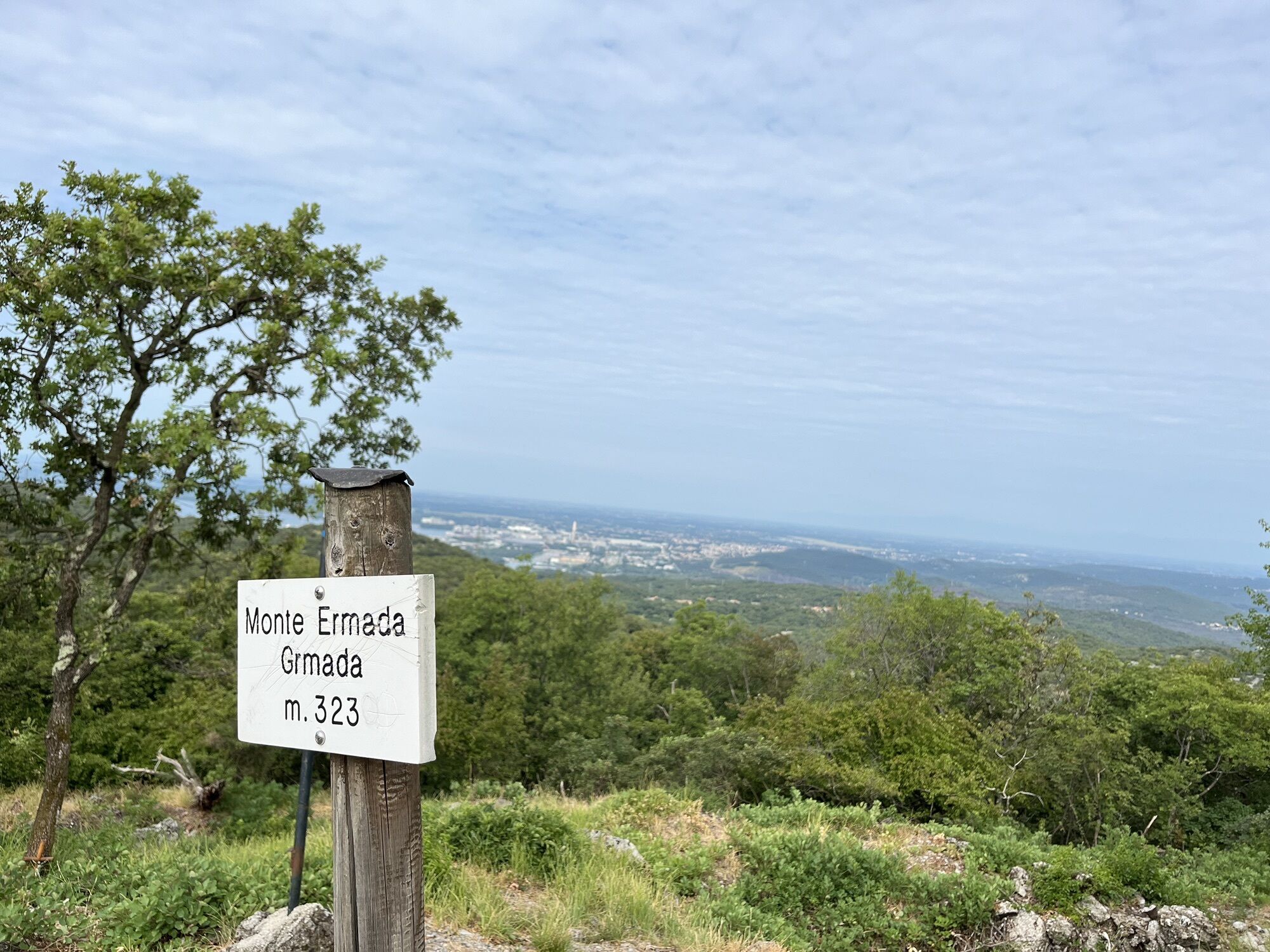
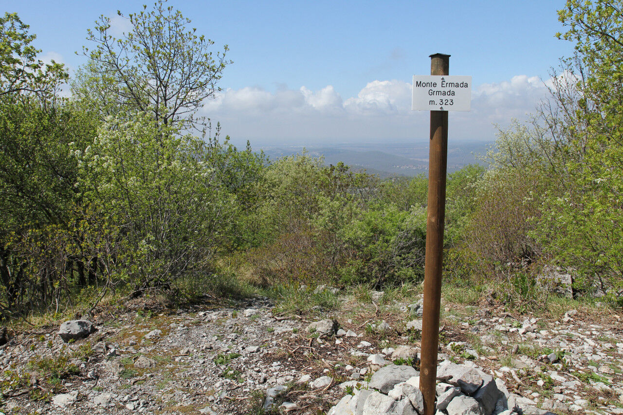
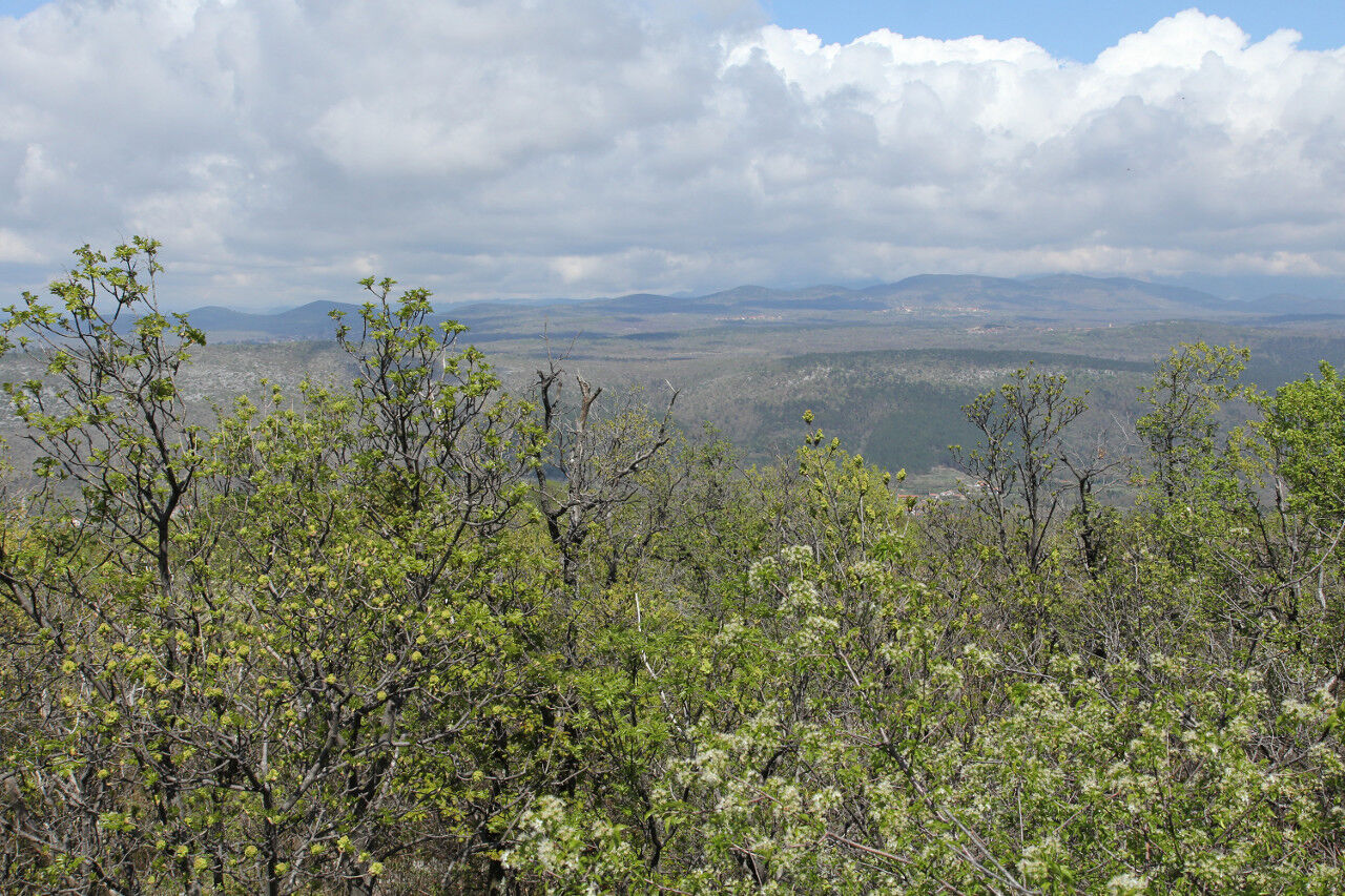
Starting from the village of Ceroglie, visitors can explore the entire cross-border open-air museum or enjoy a circular walk around its highest summit, at 323 metres above sea level. Along the way, well-marked...
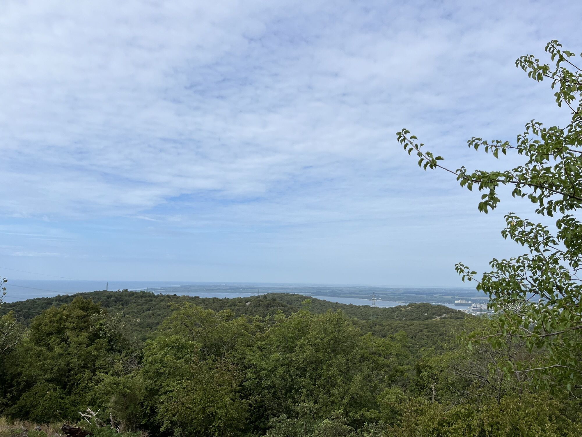
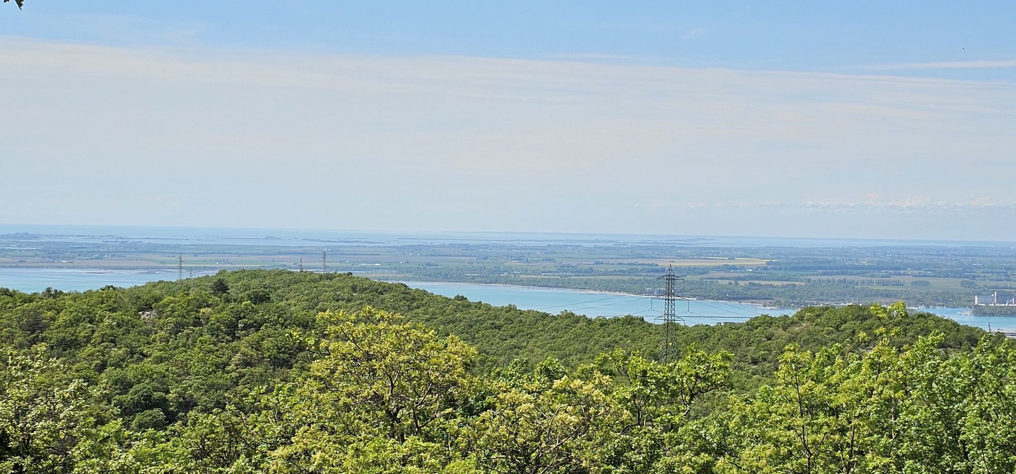
Before reaching the summit, the route passes the 30.5 cm Mortar Dolina, the Dörfler Cave and the Monte Querceto Cave, which once housed an electrical transformer station. On the mountain's forepeak stands a combat position used as a battalion command post, where the remains of a periscope emplacement, once used to observe the terrain ahead, are still visible. The summit is surrounded by the remains of trenches, small military caves and reinforced fortifications, and offers sweeping views over the former battlefields, stretching from the Adriatic Sea to the Julian Alps.

Tak
Suitable sportswear, footwear appropriate for uneven ground and trekking poles are recommended. Visitors are also advised to bring an adequate supply of water.
This itinerary can be followed all year round; always check the weather forecast. In summer, pay attention to the vegetation.
Take the Sistiana exit from the A4 motorway and join Provincial Road SP1, continuing as far as the centre of Sistiana. At the junction, turn right towards Visogliano and, after one hundred metres, turn left onto Provincial Road SP4, following the signs for Trieste Adventure Park and Ceroglie.
T1
Visitors wishing to extend the circular route and explore other sections of the cross-border open-air museum can continue either towards Medeazza, to discover the Mount Cocco area, or towards Brestovica, to explore the area around Grofova Jama (Fire Cave). In both cases, using two cars is recommended in order to return to Ceroglie.
Popularne wycieczki w okolicy
-
4,7
Rilkeweg
światłoWędrówka 6,19 km -
2,7
Grado - Triest (C204)
średniKolarstwo długodystansowe 68,2 km -
5,0
Etappe 34 Alpe-Adria-Trail: Duino - Prosecco
średnidługodystansowy szlak pieszy 24,3 km -
3,0
Die Isola della cona
światłoWędrówka 12,7 km -
5,0
Sage Trail or Tiziana Weiss
światłoWędrówka 2,41 km -
FVG 2/b Wariant krasowy (C2V2)
ciężkiKolarstwo długodystansowe 105,1 km -
4,0
Etappe 33 Alpe-Adria-Trail: Gradisca d'Isonzo - Duino
średnidługodystansowy szlak pieszy 27,8 km -
Carsus Trail - a long-distance trail through the Karst region of Slovenia and Italy
średnidługodystansowy szlak pieszy 102,2 km -
Dall’obelisco di Opicina ad Aurisina, lungo il ciglione carsico
długodystansowy szlak pieszy 16,8 km -
5.Etappe: Gradisca-Triest 40km, 150Hm
światłoJazda na rowerze 40,0 km
Wędrówki i tropienie


Nie przegap ofert i inspiracji na następne wakacje
Twój adres e-mail została dodana do listy mailingowej.