
Presqu’Île du Châtelier - Église Saint-Étienne - Le Rustic - Église Paroissiale Saint-Florentin
średni
Pobierz tę trasę na swój telefon komórkowy
Presqu’Île du Châtelier - Église Saint-Étienne - Le Rustic - Église Paroissiale Saint-Florentin
średni
Jazda na rowerze
41,69
km
Zeskanuj kod QR i rozpocznij nawigację w aplikacji bergfex.

Wędrówki i tropienie


Presqu’Île du Châtelier - Église Saint-Étienne - Le Rustic - Église Paroissiale Saint-Florentin
średni
Odległość
41,69
km
Czas trwania
02:53
h
Ascent
225
hm
Poziom morza
52 -
121
m
Ścieżka do pobrania
Presqu’Île du Châtelier - Église Saint-Étienne - Le Rustic - Église Paroissiale Saint-Florentin
średni
Jazda na rowerze
41,69
km
Trasa
Église Saint-Étienne
(58 m)
Miejsce kultu
1,5 km
Le Bourg
(58 m)
Sąsiedztwo
7,0 km
Fontenay
(76 m)
Rozliczenie
12,8 km
La Grange
(60 m)
Rozliczenie
16,5 km
Le Bourg
(67 m)
Sąsiedztwo
24,2 km
La Grange Tiphaine
(118 m)
Sąsiedztwo
34,0 km
Église Paroissiale Saint-Florentin
(59 m)
Miejsce kultu
37,4 km
Trasa
Presqu’Île du Châtelier - Église Saint-Étienne - Le Rustic - Église Paroissiale Saint-Florentin
średni
Jazda na rowerze
41,69
km
Presqu’Île du Châtelier
(51 m)
Sąsiedztwo
0,0 km
Le Bourg
(64 m)
Korytarz/teren
1,4 km
Église Saint-Étienne
(58 m)
Miejsce kultu
1,5 km
Le Rustic
(57 m)
Restauracja
1,6 km
Lussault-sur-Loire
(80 m)
Wioska
1,9 km
Le Village
(66 m)
Korytarz/teren
1,9 km
Le Clos du Chêne
(85 m)
Sąsiedztwo
2,3 km
La Vallée Saint-Martin
(73 m)
Korytarz/teren
2,4 km
Le Pommier
(89 m)
Rozliczenie
3,3 km
Le Boulay
(104 m)
Rozliczenie
5,1 km
Les Chaumodières
(89 m)
Rozliczenie
6,1 km
Fond de Vauganne
(76 m)
Korytarz/teren
6,3 km
Vauganne
(76 m)
Korytarz/teren
6,4 km
Le Bourg
(58 m)
Sąsiedztwo
7,0 km
Saint-Martin-le-Beau
(65 m)
Wioska
7,0 km
Auberge de la Treille
(59 m)
Restauracja
7,1 km
Les Courtils Martin
(55 m)
Korytarz/teren
7,3 km
La Plaine
(53 m)
Rozliczenie
7,8 km
Chandon
(69 m)
Rozliczenie
9,0 km
La Boulaye
(61 m)
Restauracja
10,0 km
La Giletterie
(82 m)
Rozliczenie
10,8 km
Vallet
(54 m)
Korytarz/teren
11,2 km
La Colinerie
(66 m)
Korytarz/teren
11,9 km
Vallet
(55 m)
Rozliczenie
12,0 km
Fontenay
(76 m)
Rozliczenie
12,8 km
La Choltrie
(68 m)
Rozliczenie
13,5 km
Lieu Dit la Cholterie
(58 m)
Rozliczenie
13,6 km
Les Regains
(55 m)
Rozliczenie
14,0 km
La Tuilerie
(56 m)
Rozliczenie
15,1 km
Bel-Air
(57 m)
Sąsiedztwo
15,2 km
Pré Saint-Louis
(55 m)
Sąsiedztwo
15,3 km
Bléré
(58 m)
Wioska
15,4 km
Les Crespières
(56 m)
Rozliczenie
15,5 km
L'Écluse
(56 m)
Rozliczenie
15,7 km
La Plage
(55 m)
Sąsiedztwo
15,8 km
La Gatine
(56 m)
Sąsiedztwo
15,9 km
La Grange
(60 m)
Rozliczenie
16,5 km
La Taille Saint-Julien
(58 m)
Rozliczenie
17,1 km
Prés des Renards
(56 m)
Rozliczenie
17,4 km
La Canardière
(56 m)
Rozliczenie
19,4 km
Prairie de Coulommiers
(57 m)
Rozliczenie
20,3 km
Les Sables de Coulommiers
(58 m)
Rozliczenie
20,5 km
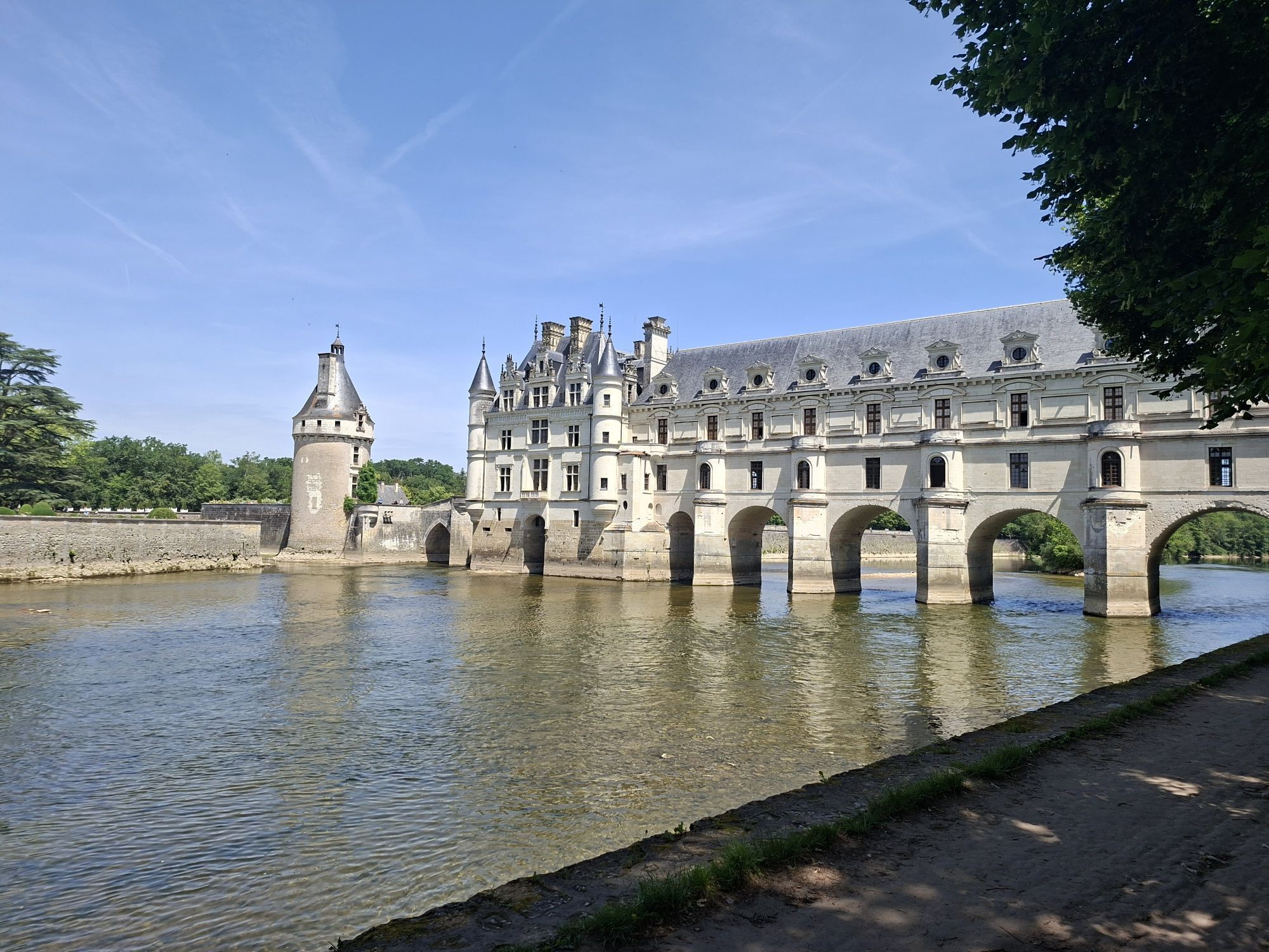
Chenonceaux
(57 m)
Punkt widzenia
21,4 km
Parc de Chenonceau
(57 m)
Rozliczenie
21,6 km
La Gare
(60 m)
Sąsiedztwo
23,4 km
L'Arabe
(63 m)
Sąsiedztwo
23,9 km
Le Regain
(58 m)
Sąsiedztwo
24,2 km
Chenonceaux
(71 m)
Wioska
24,2 km
Le Bourg
(67 m)
Sąsiedztwo
24,2 km
Chenonceaux
(62 m)
Stacja kolejowa
24,4 km
Les Pichards
(64 m)
Sąsiedztwo
25,7 km
Le Bourg
(63 m)
Sąsiedztwo
26,0 km
Civray-de-Touraine
(64 m)
Wioska
26,0 km
Caves du Père Auguste
(71 m)
Stół piknikowy
26,3 km
Fontaine Besnard
(79 m)
Źródło
26,7 km
La Fontaine Besnard
(84 m)
Rozliczenie
26,7 km
La Pichellerie
(90 m)
Rozliczenie
26,9 km
Moque Baril
(90 m)
Korytarz/teren
27,1 km
Les Touches
(111 m)
Rozliczenie
29,5 km
La Grange Tiphaine
(118 m)
Sąsiedztwo
34,0 km
La Poterie
(118 m)
Sąsiedztwo
34,2 km
La Poupardière
(112 m)
Sąsiedztwo
34,5 km
Clos Chauffour
(91 m)
Korytarz/teren
34,9 km
Beau Clos
(80 m)
Sąsiedztwo
35,1 km
La Bondonnière-Est
(79 m)
Sąsiedztwo
35,5 km
La Bondonnière
(79 m)
Sąsiedztwo
35,6 km
La Commanderie
(66 m)
Sąsiedztwo
35,6 km
Le Pied Courtault
(60 m)
Sąsiedztwo
35,7 km
Château-Gaillard-Sud
(59 m)
Sąsiedztwo
35,9 km
La Malonnière
(80 m)
Sąsiedztwo
36,0 km
La Malonnière-Nord
(99 m)
Sąsiedztwo
36,2 km
Amboise
(58 m)
Miasto
37,2 km
Église Paroissiale Saint-Florentin
(59 m)
Miejsce kultu
37,4 km
La Noiraye
(60 m)
Sąsiedztwo
38,4 km
Les Varennes-Est
(52 m)
Sąsiedztwo
38,6 km
La Demi-Lune
(59 m)
Sąsiedztwo
38,7 km
Les Varennes-Ouest
(57 m)
Sąsiedztwo
39,2 km
La Varenne du Four à Chaux
(56 m)
Sąsiedztwo
39,9 km
La Fontaine Chandon
(63 m)
Sąsiedztwo
40,4 km
Le Haut Chandon
(81 m)
Sąsiedztwo
40,8 km
Presqu’Île du Châtelier
(51 m)
Sąsiedztwo
41,6 km
Nie ma jeszcze recenzji
Popularne wycieczki w okolicy
-
5,0
Tours - Église Saint-Laurent - Église Paroissiale Saint-Florentin - Parc de Chenonceau
światłoJazda na rowerze 56,2 km -
Amboise - Église de la Sainte-Famille - Tours
Jazda na rowerze 62,7 km -
4,0
Le Bourg - Église Paroissiale Saint-Florentin - Église Saint-Paul - Chenonceaux
średniDroga rowerowa 42,5 km -
Le Puits Pabot - La Bergerie - Église Saint-Symphorien - Larçay
światłoRower szutrowy 30,7 km -
Amboise - Église Paroissiale Saint-Florentin - Église Saint-Pierre - La Gare
średniJazda na rowerze 40,5 km -
Loches - Collégiale Saint-Ours - Église Sainte-Luce
średniJazda na rowerze 64,1 km -
Noizay - Église Paroissiale Saint-Florentin - Église Paroissiale Saint-Thibault - Église Paroissiale Saint-Médard
średniJazda na rowerze 62,2 km -
Cormery - La Montée de la Route - Faubourg Saint-Pierre - Église Saint-Martin
średniJazda na rowerze 55,0 km -
Pontlevoy - Église Saint-Germain - Église Saint-Pierre - Église Saint-Aubin
średniJazda na rowerze 48,6 km -
Le Bourg - Église Saint-Martin - Église Saint-Saturnin - Église Sainte-Eugénie
średniJazda na rowerze 55,9 km
Wędrówki i tropienie

Ponad 550.000 propozycji wycieczek, szczegółowe mapy i intuicyjny planer tras sprawiają, że aplikacja jest niezbędna dla wszystkich entuzjastów przyrody.

Nie przegap ofert i inspiracji na następne wakacje
Zapisz się do newslettera
Błąd
Wystąpił błąd. Spróbuj ponownie.
Dziękujemy za rejestrację
Twój adres e-mail została dodana do listy mailingowej.
Wycieczki po całej Europie
Austria
Szwajcaria
Niemcy
Włochy
Słowenię
Francja
Holandia
Belgia
Polska
Liechtenstein
Czechy
Słowacja
Hiszpania
Chorwacja
Bośnia i Hercegowina
Luksemburg
Andorra
Portugalia
Islandia
Wielka Brytania
Irlandia
Grecja
Albania
Macedonia Północna
Malta
Norwegia
Czarnogóra
Mołdawia
Kosowo
Węgry
San Marino
Rumunia
Estonia
Łotwa
Białoruś
Cypr
Litwa
Serbia
Bułgaria
Monako
Dania
Szwecja
Finlandia