


Yellow Wall Trail, Tegelberg (A)
Poziom trudności: A
Zdjęcia naszych użytkowników
 © Ralf TheuneUtworzono dnia 09.05.2026
 © Marly WoutersUtworzono dnia 07.11.2025
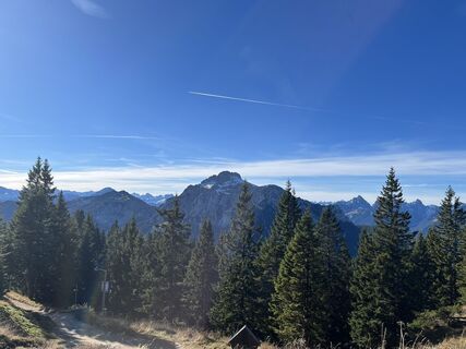 © Marly WoutersUtworzono dnia 07.11.2025
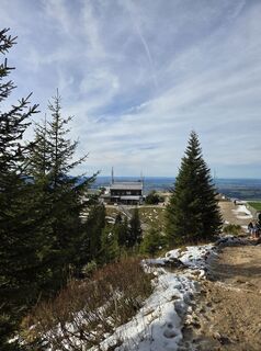
 © Michael HohlfeldUtworzono dnia 29.10.2025
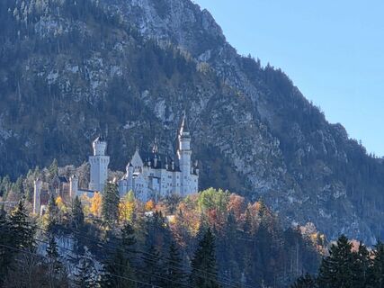 © Michael HohlfeldUtworzono dnia 29.10.2025
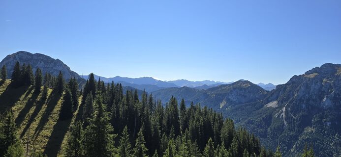
 © Steph BrotkrumenUtworzono dnia 18.09.2025
 © Rainer KieningUtworzono dnia 04.09.2025
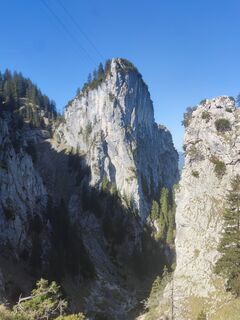 © Peter BartenschlagerUtworzono dnia 01.05.2025
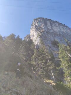 © Peter BartenschlagerUtworzono dnia 01.05.2025
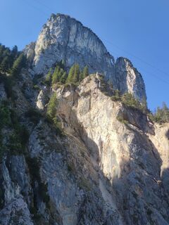 © Peter BartenschlagerUtworzono dnia 01.05.2025
 © Peter BartenschlagerUtworzono dnia 01.05.2025
 © Peter BartenschlagerUtworzono dnia 01.05.2025
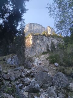 © Peter BartenschlagerUtworzono dnia 01.05.2025
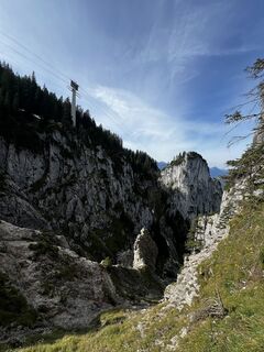
 © Leon PrinzUtworzono dnia 22.09.2024
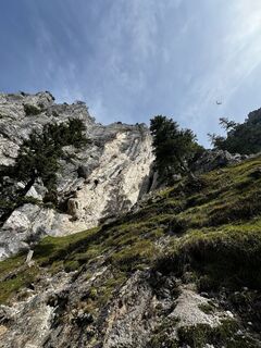 © Leon PrinzUtworzono dnia 22.09.2024
 © Leon PrinzUtworzono dnia 22.09.2024
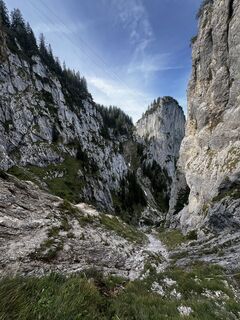 © Leon PrinzUtworzono dnia 22.09.2024
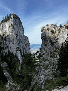 © Leon PrinzUtworzono dnia 22.09.2024
 © Leon PrinzUtworzono dnia 22.09.2024
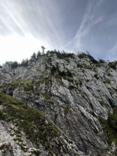 © Leon PrinzUtworzono dnia 22.09.2024
 © Leon PrinzUtworzono dnia 22.09.2024
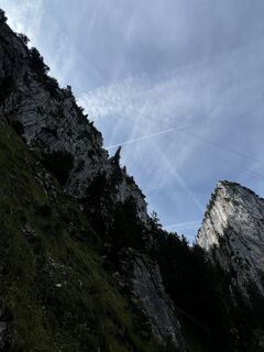 © Leon PrinzUtworzono dnia 22.09.2024
 © Leon PrinzUtworzono dnia 22.09.2024
 © Leon PrinzUtworzono dnia 22.09.2024
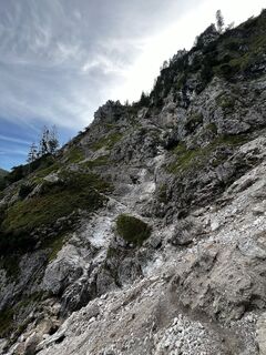 © Leon PrinzUtworzono dnia 22.09.2024
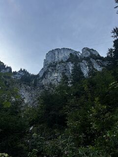 © Leon PrinzUtworzono dnia 22.09.2024
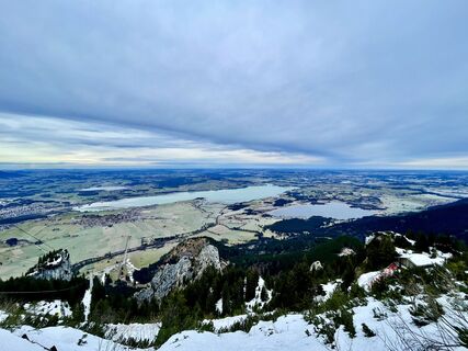
 © Les aventures de GhislainUtworzono dnia 31.12.2023
 © MattiUtworzono dnia 18.10.2023
 © PerryBUtworzono dnia 06.07.2021


The easy via ferrata with an A rating is ideal for beginners and is particularly suitable for beginners who want to gain their first experience of climbing. The route runs through easy terrain without...
The easy via ferrata with an A rating is ideal for beginners and is particularly suitable for beginners who want to gain their first experience of climbing. The route runs through easy terrain without any excessively steep or difficult passages and therefore offers a safe and enjoyable way to get to know the basics of via ferrata climbing. Inexperienced climbers can get their first taste of high altitude under supervision and enjoy climbing in an easy environment. Thanks to the well-secured sections and the manageable level of difficulty, nothing stands in the way of a shared adventure.

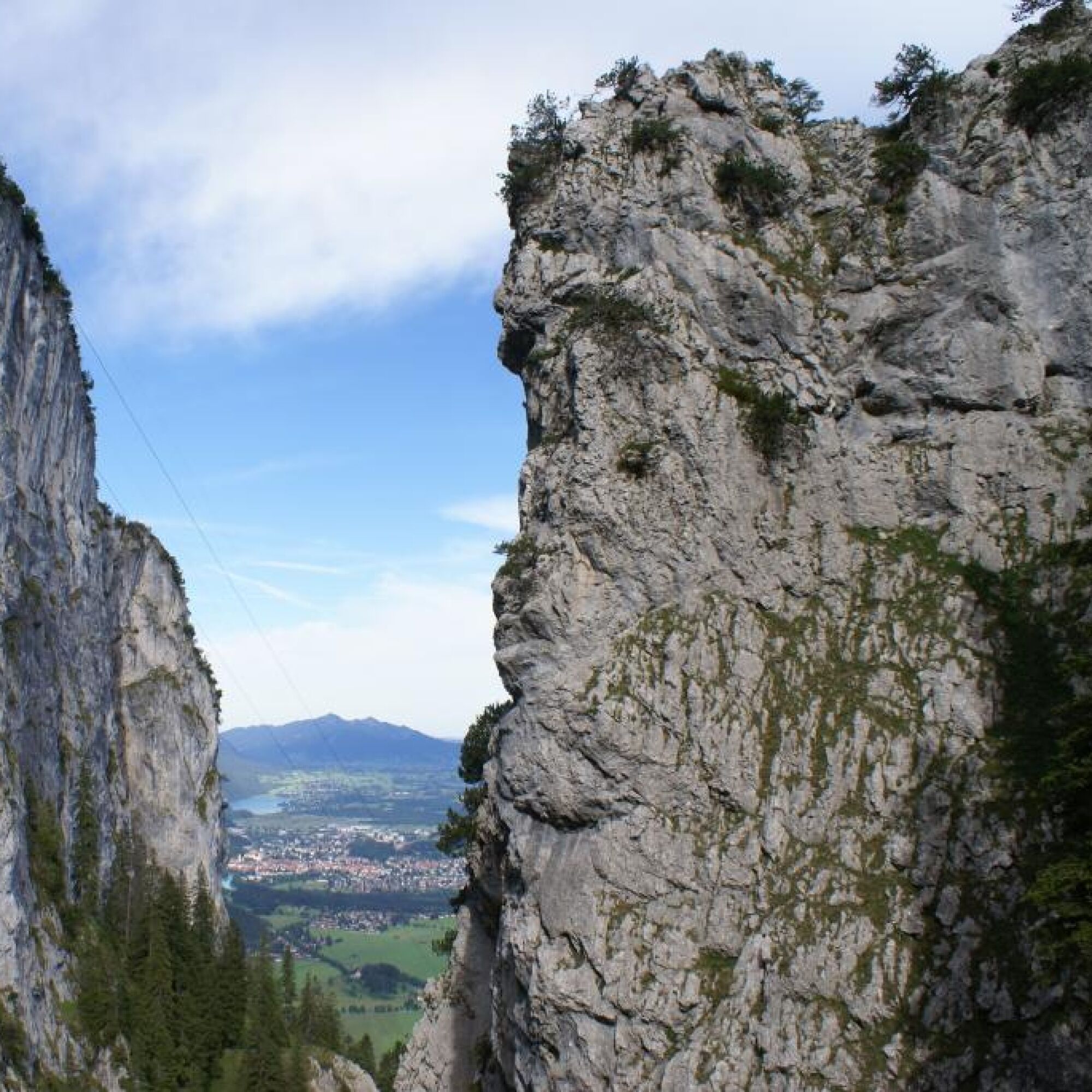


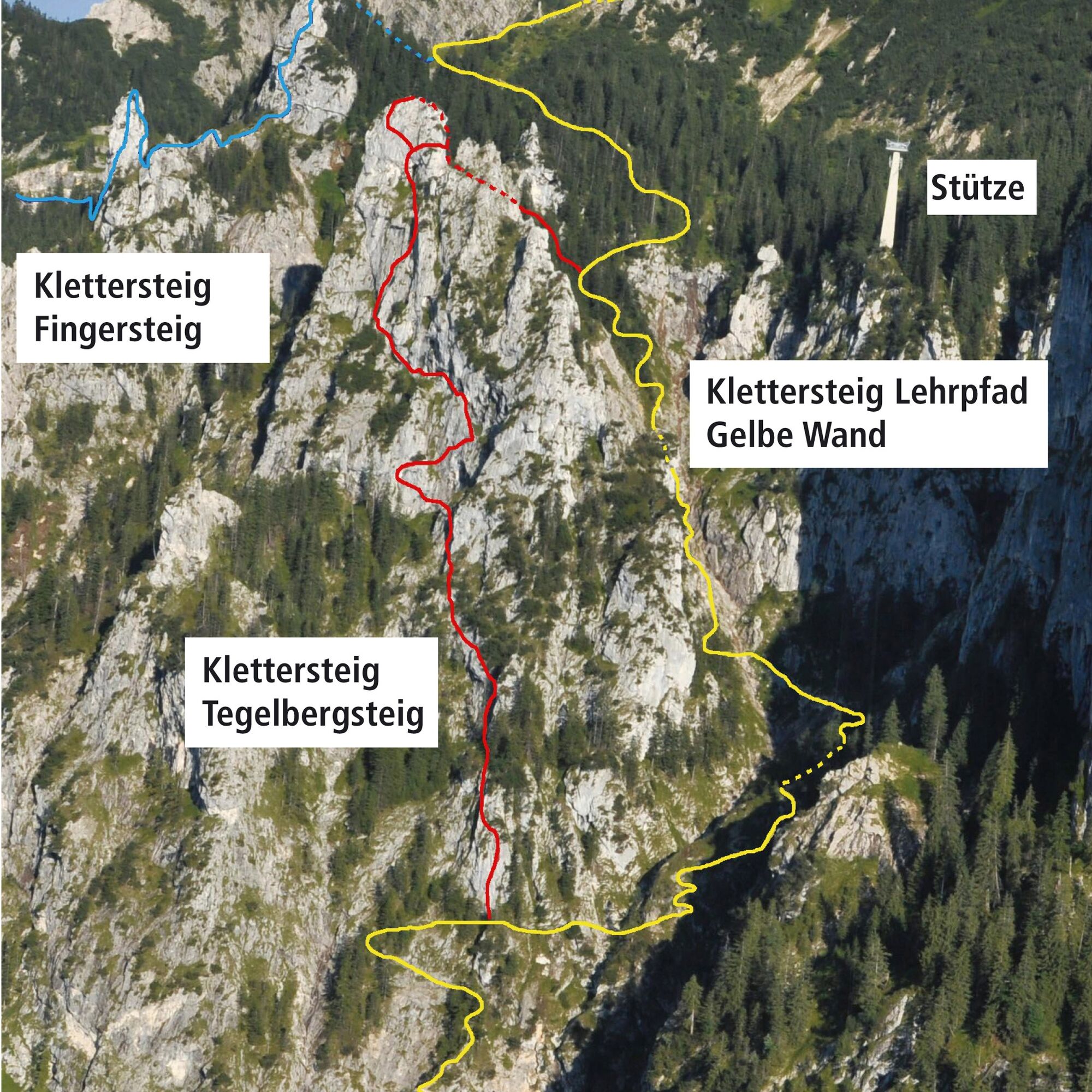
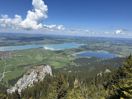
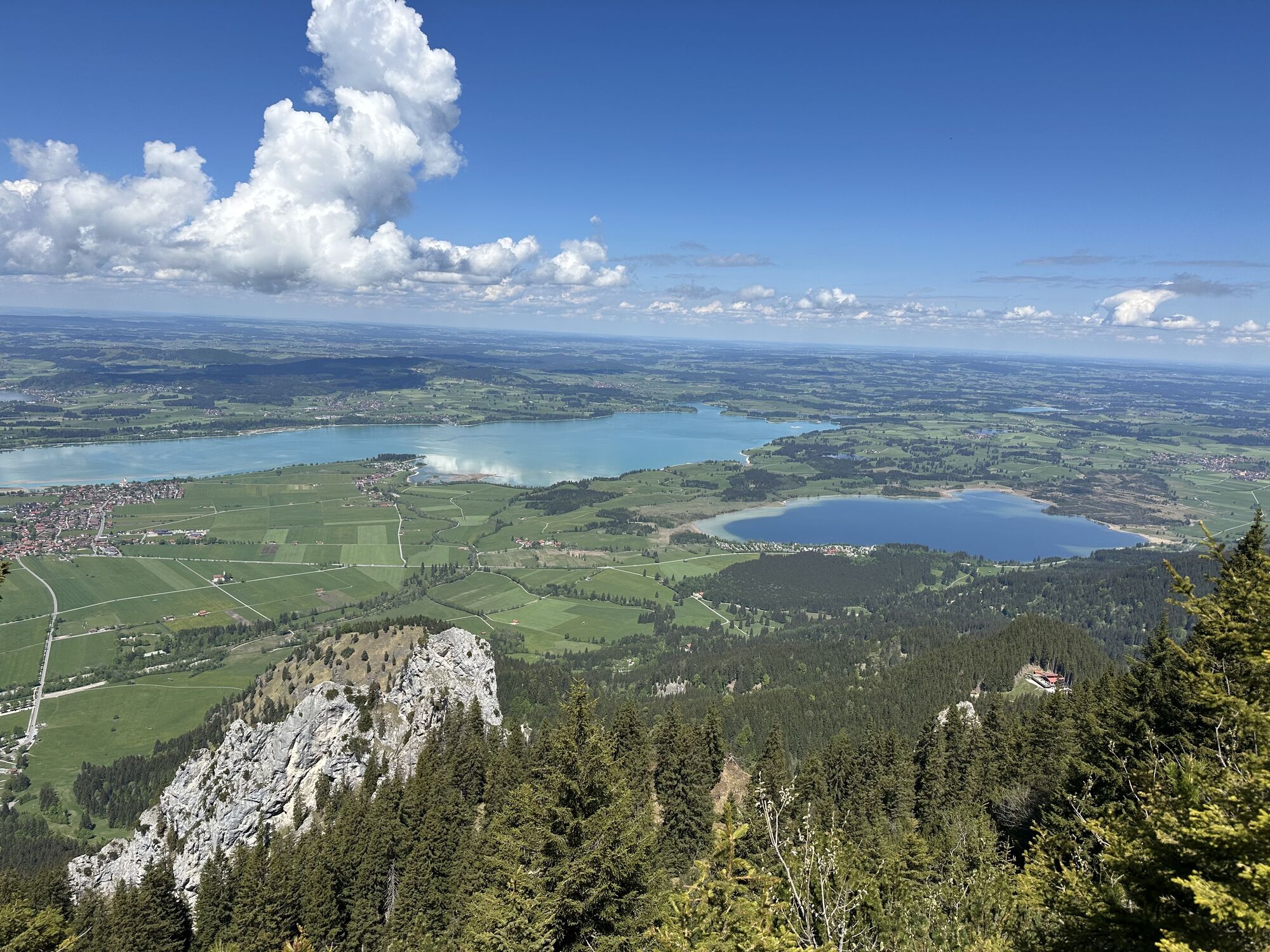
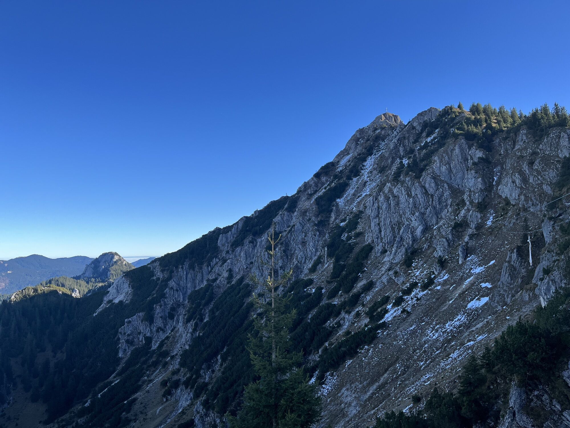
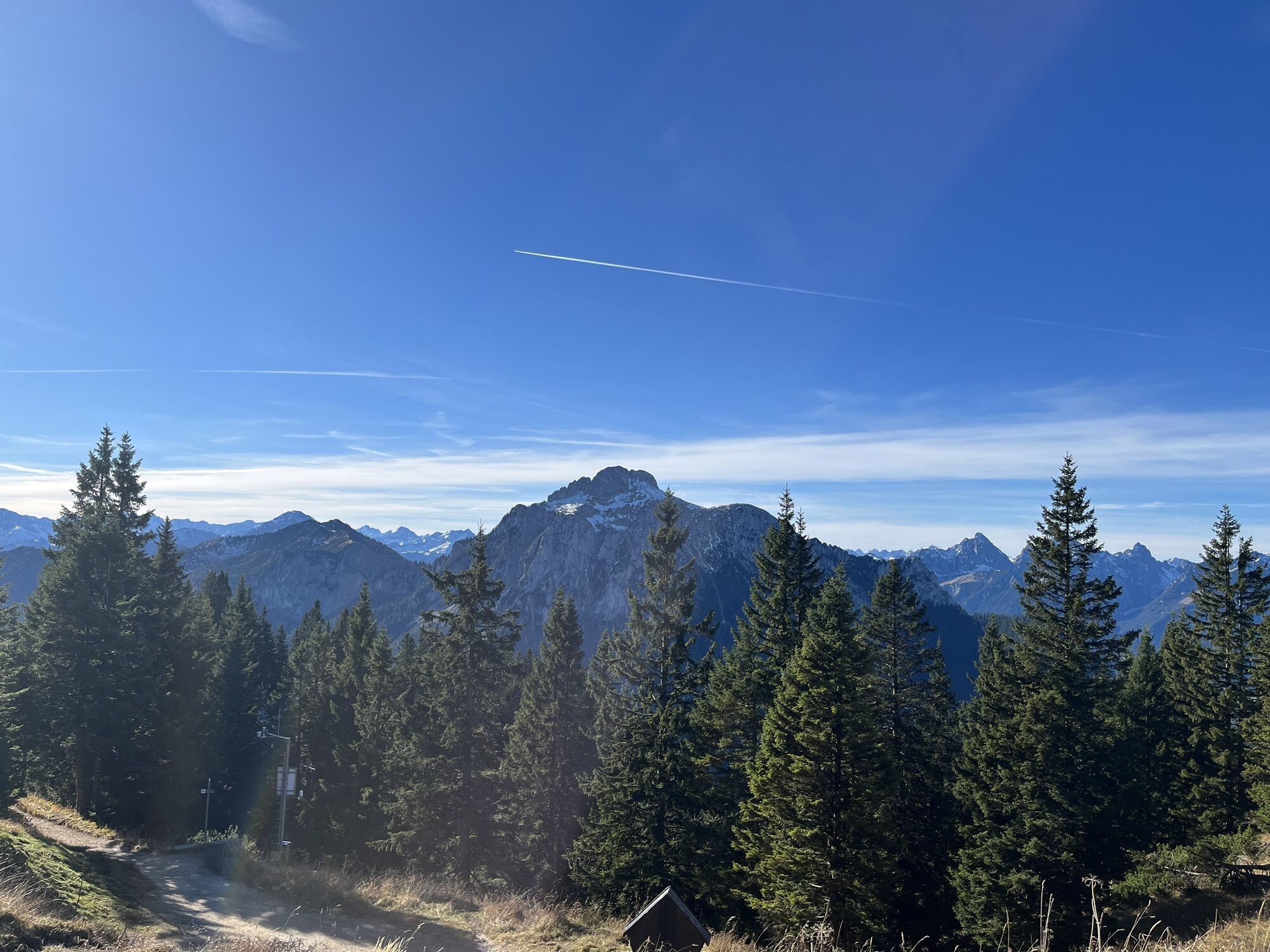
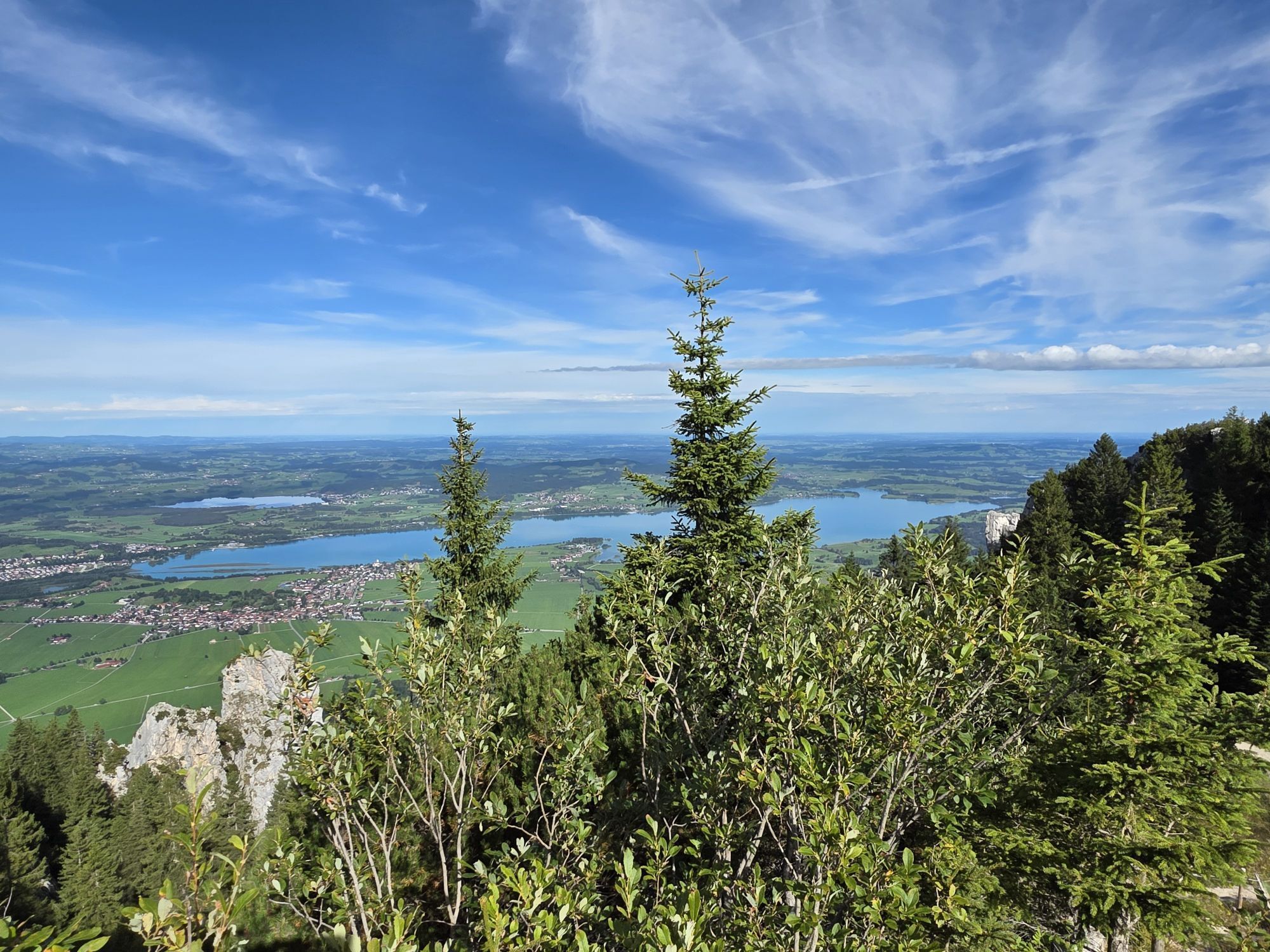
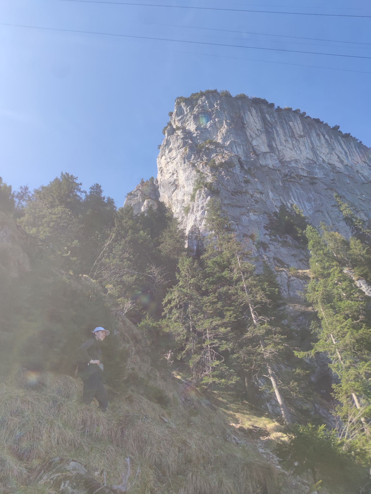
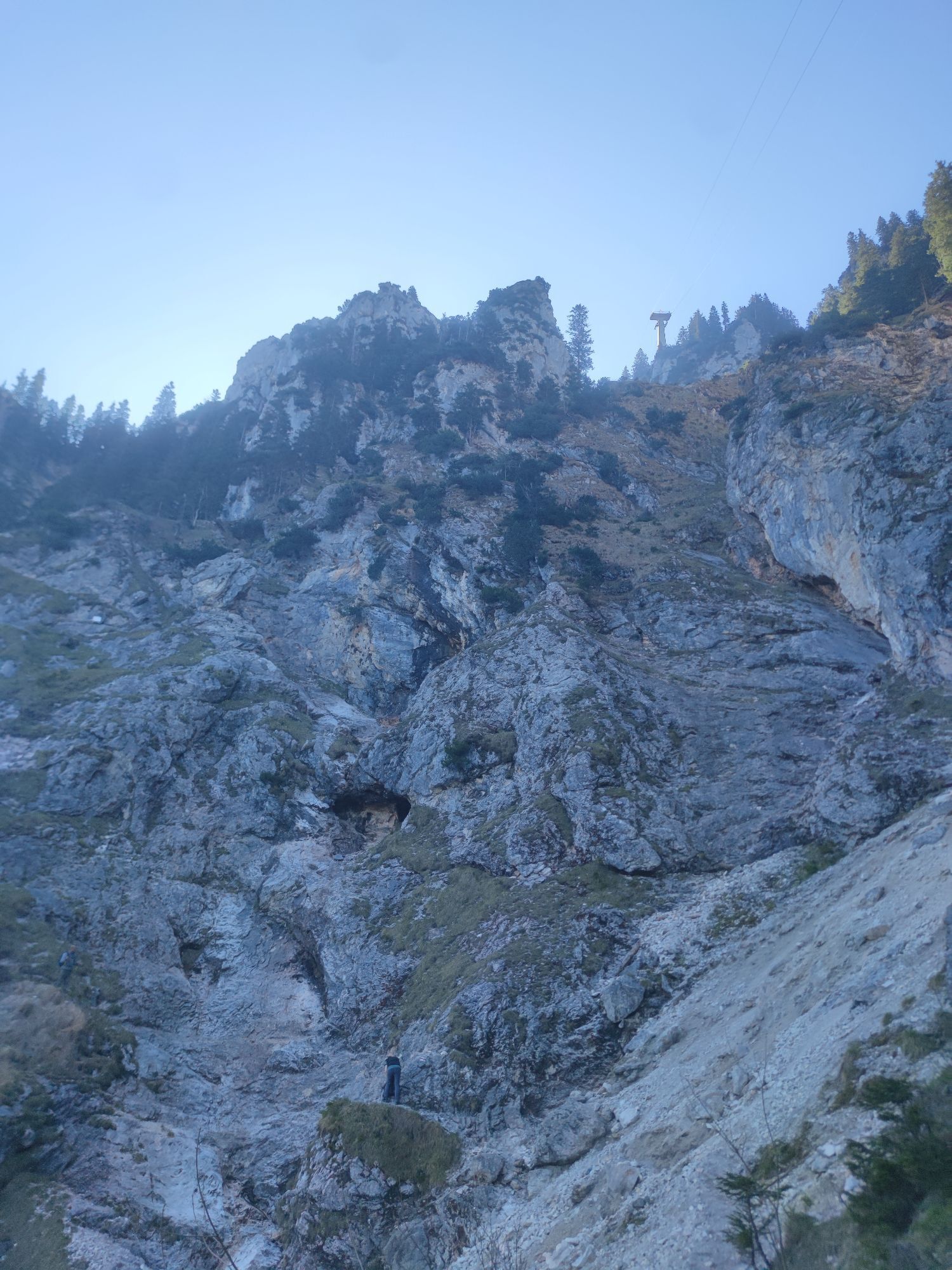
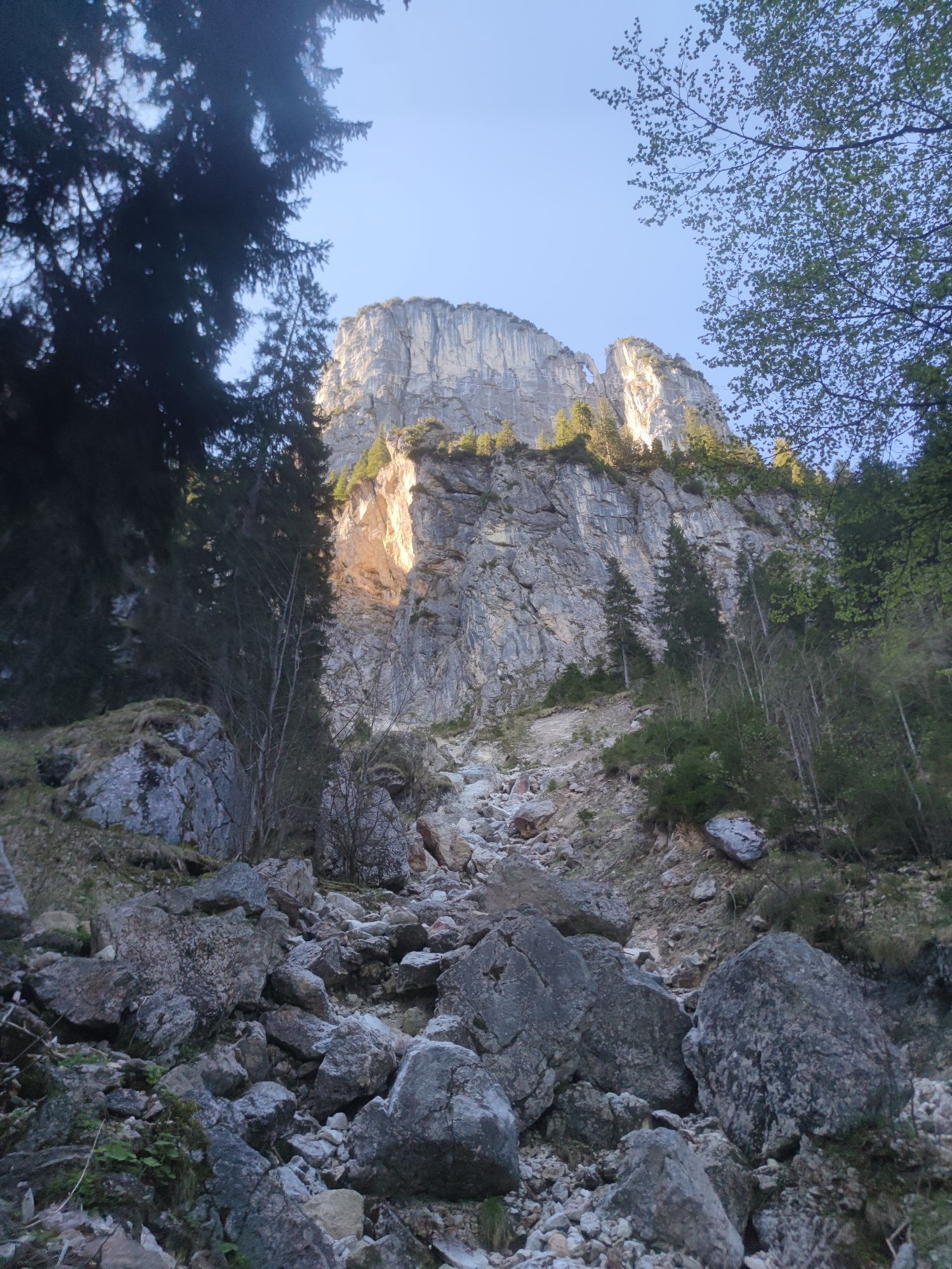
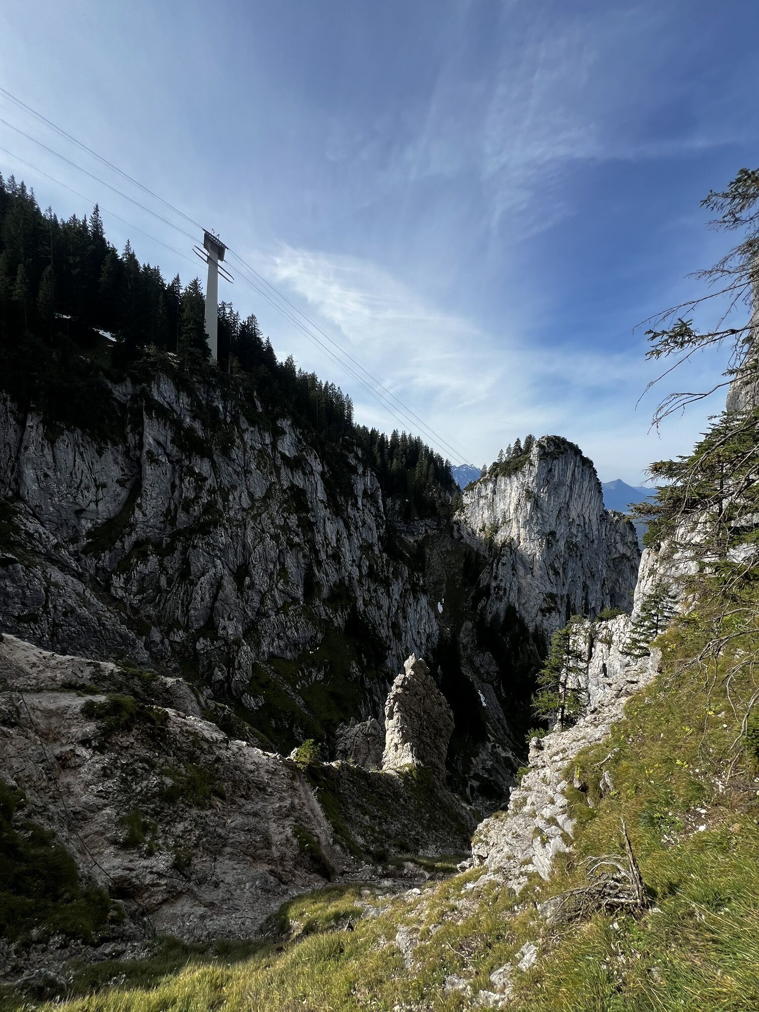
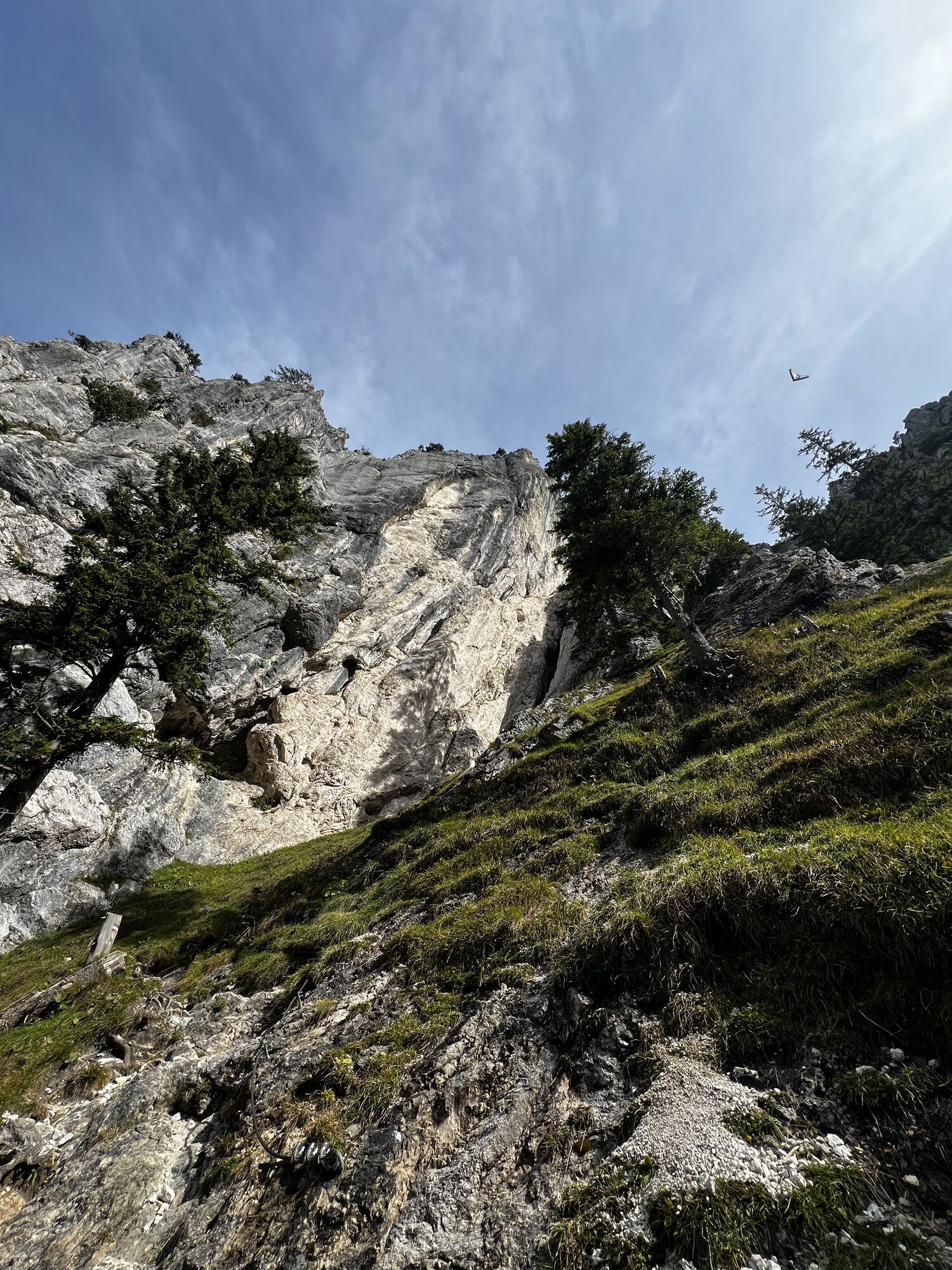
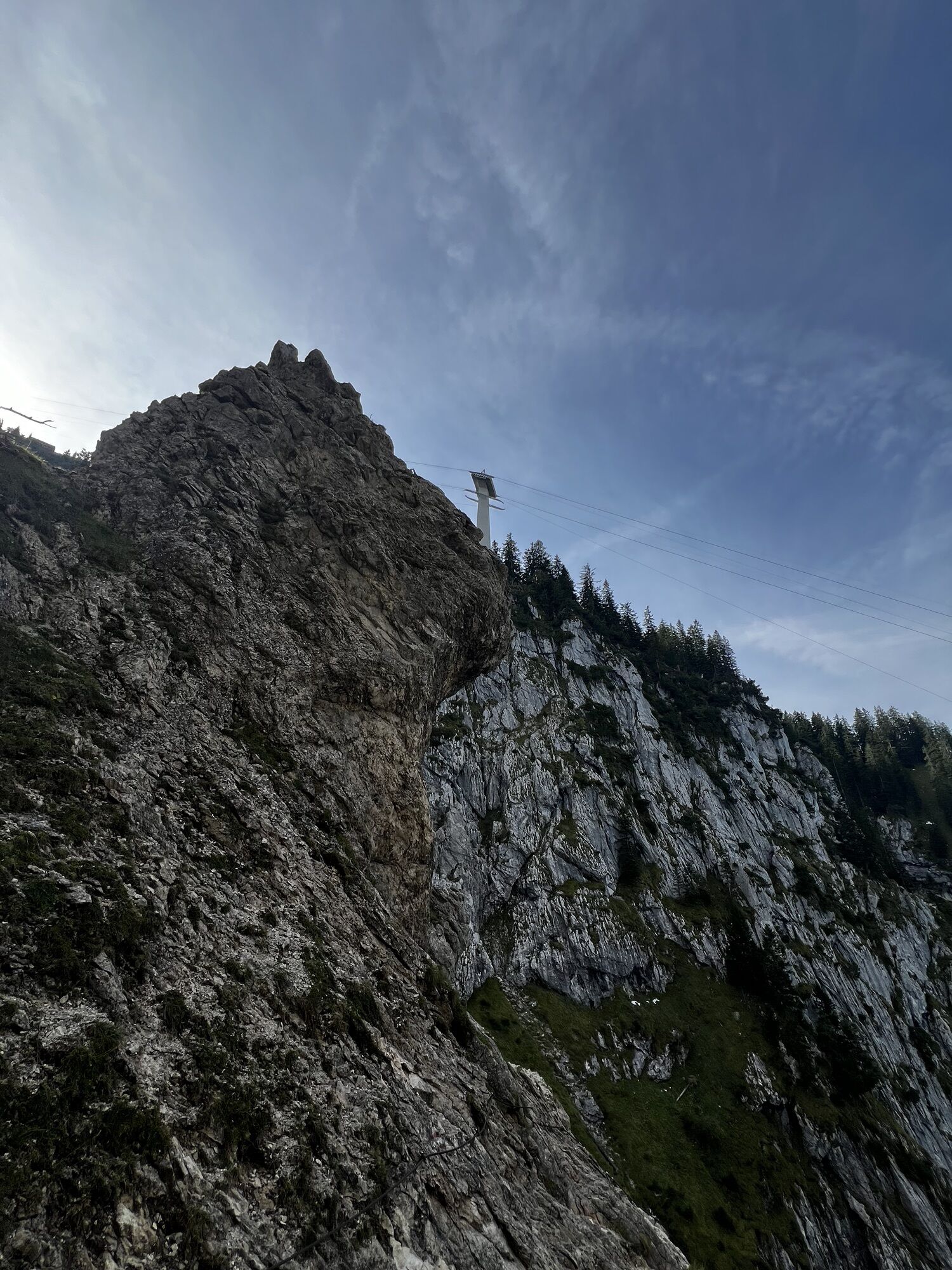
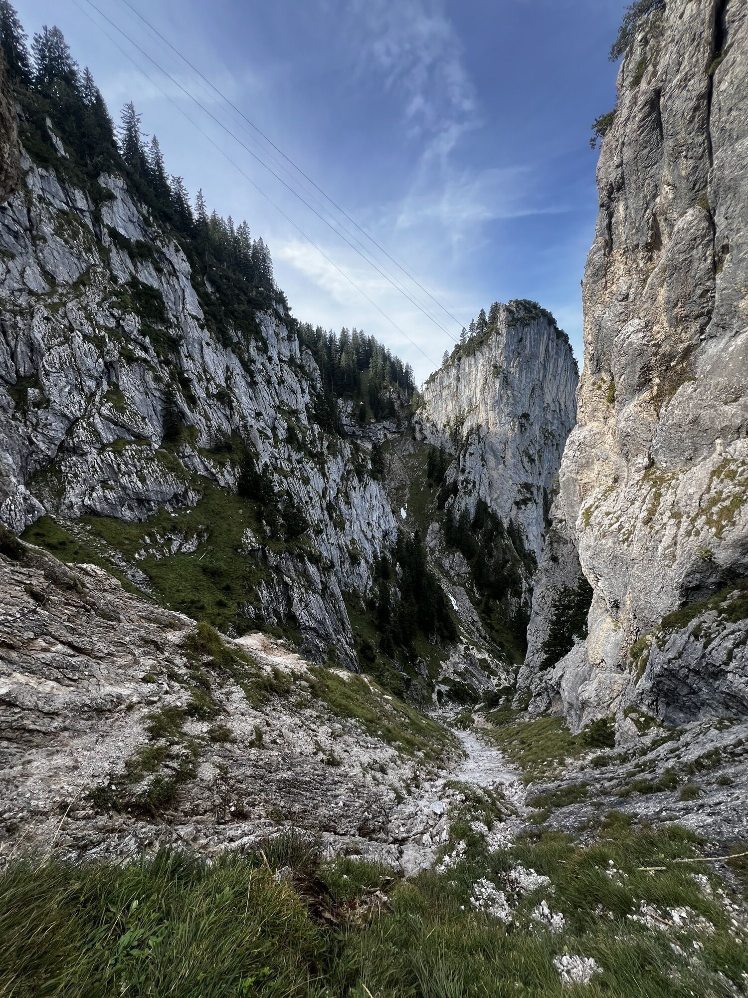
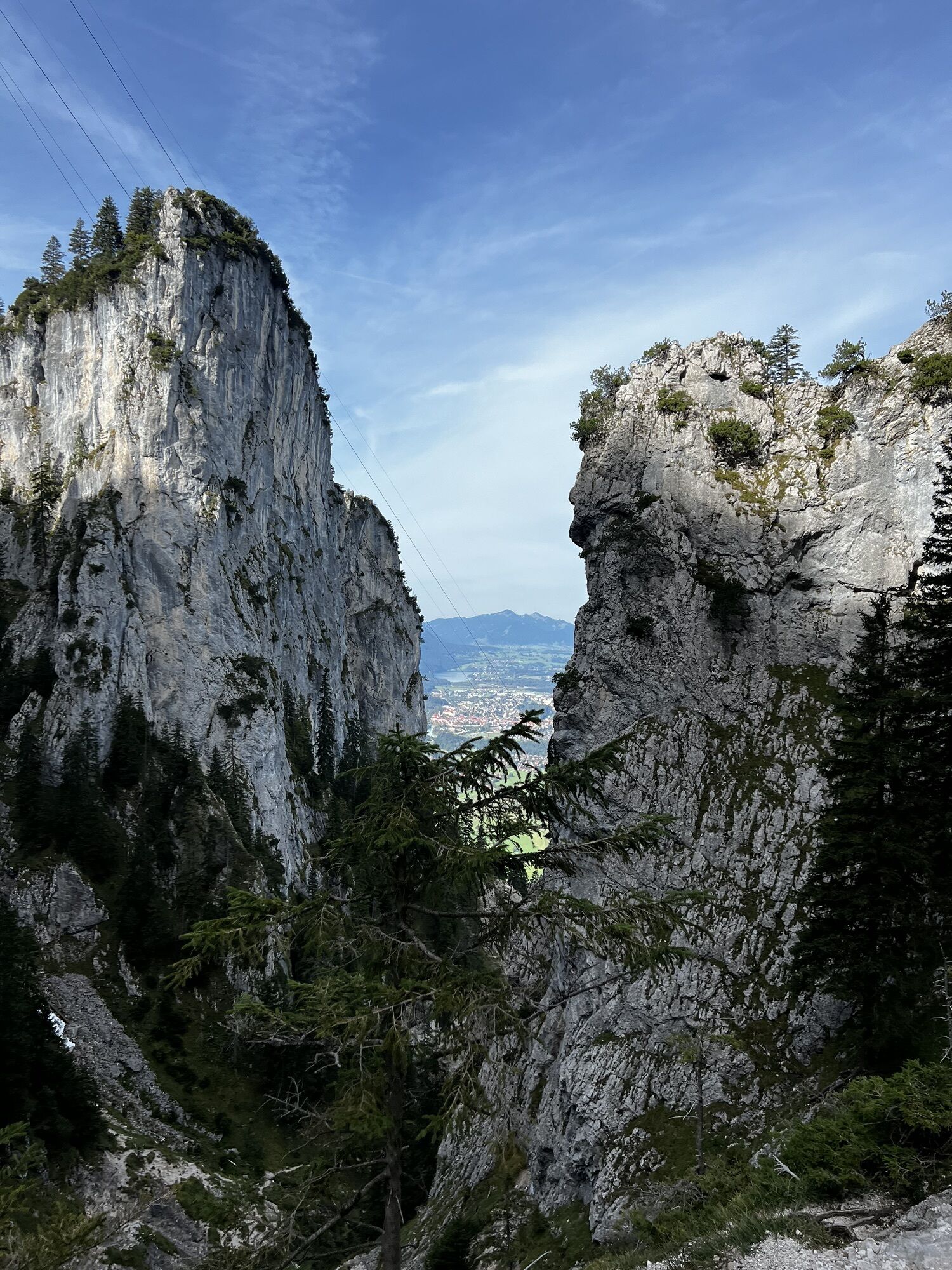
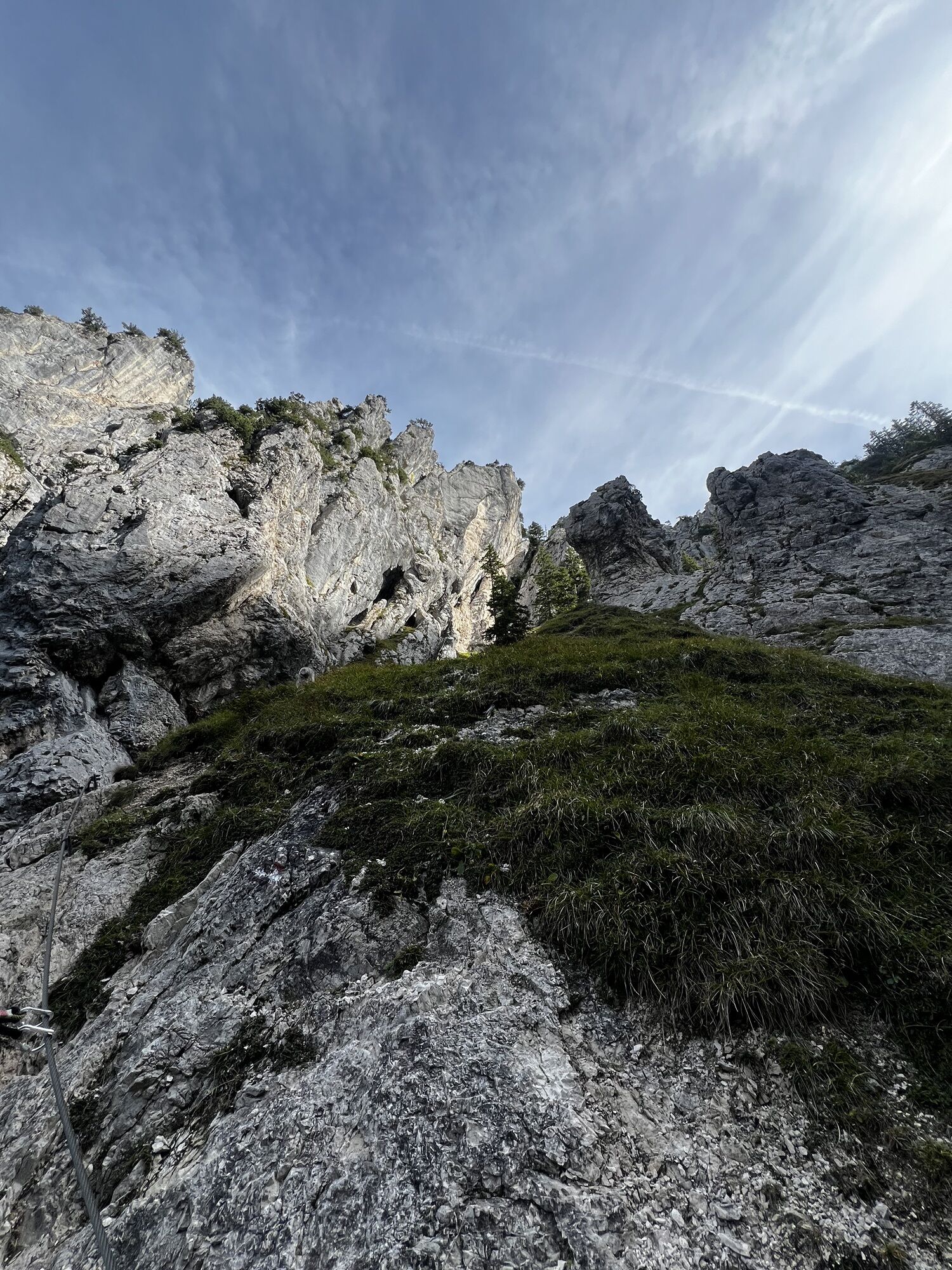
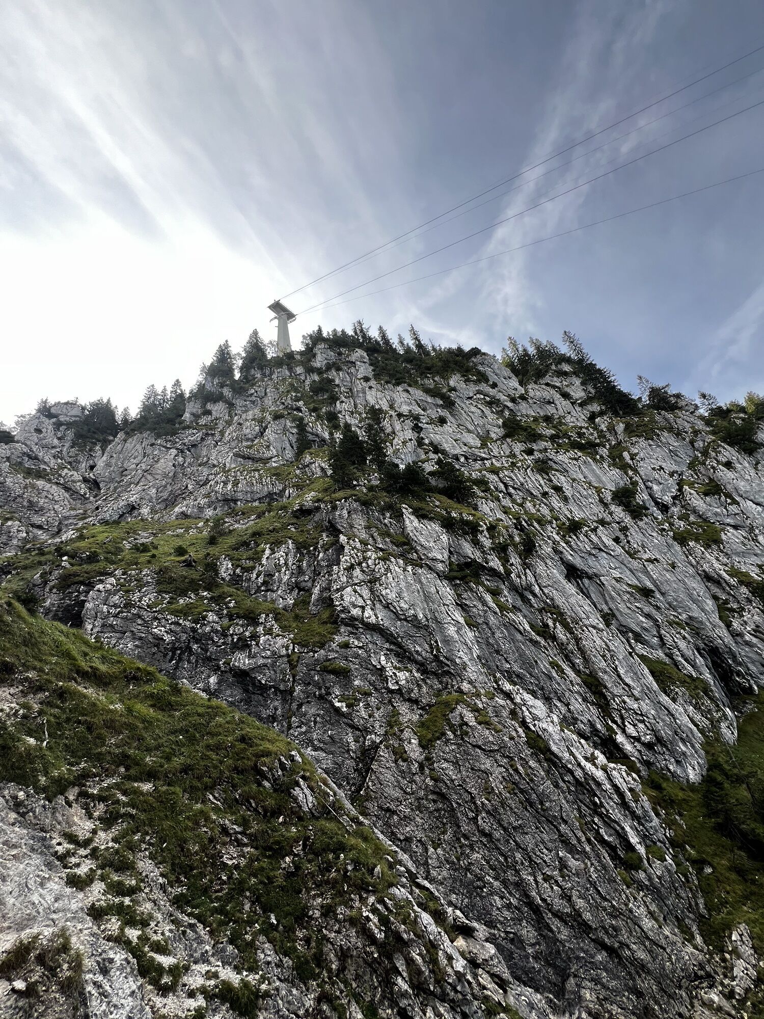
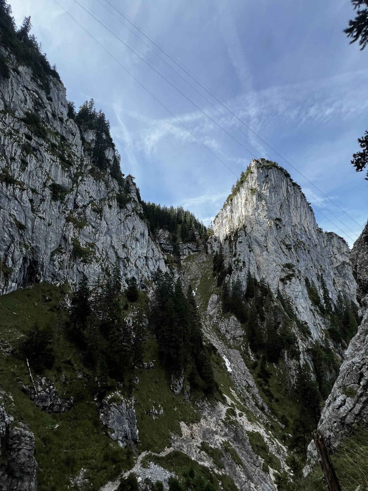
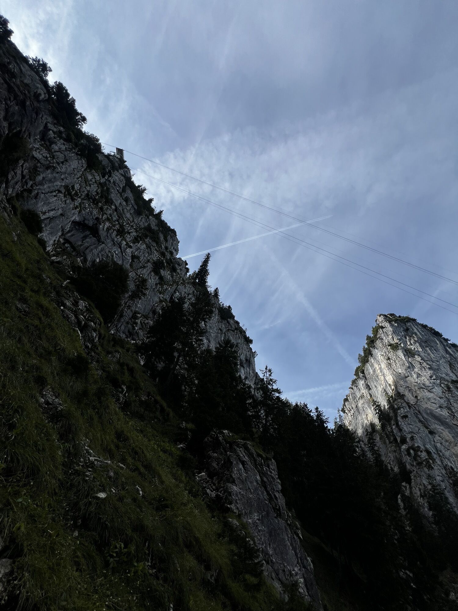
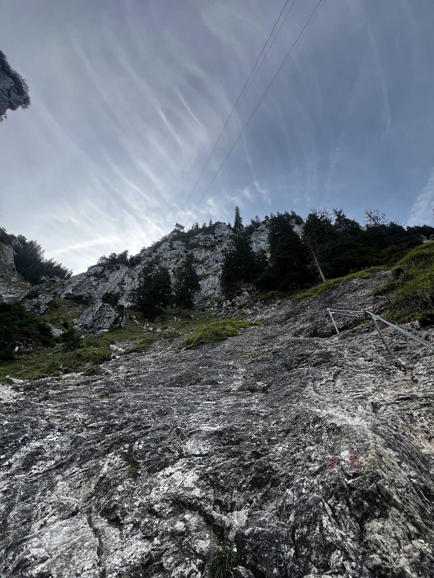
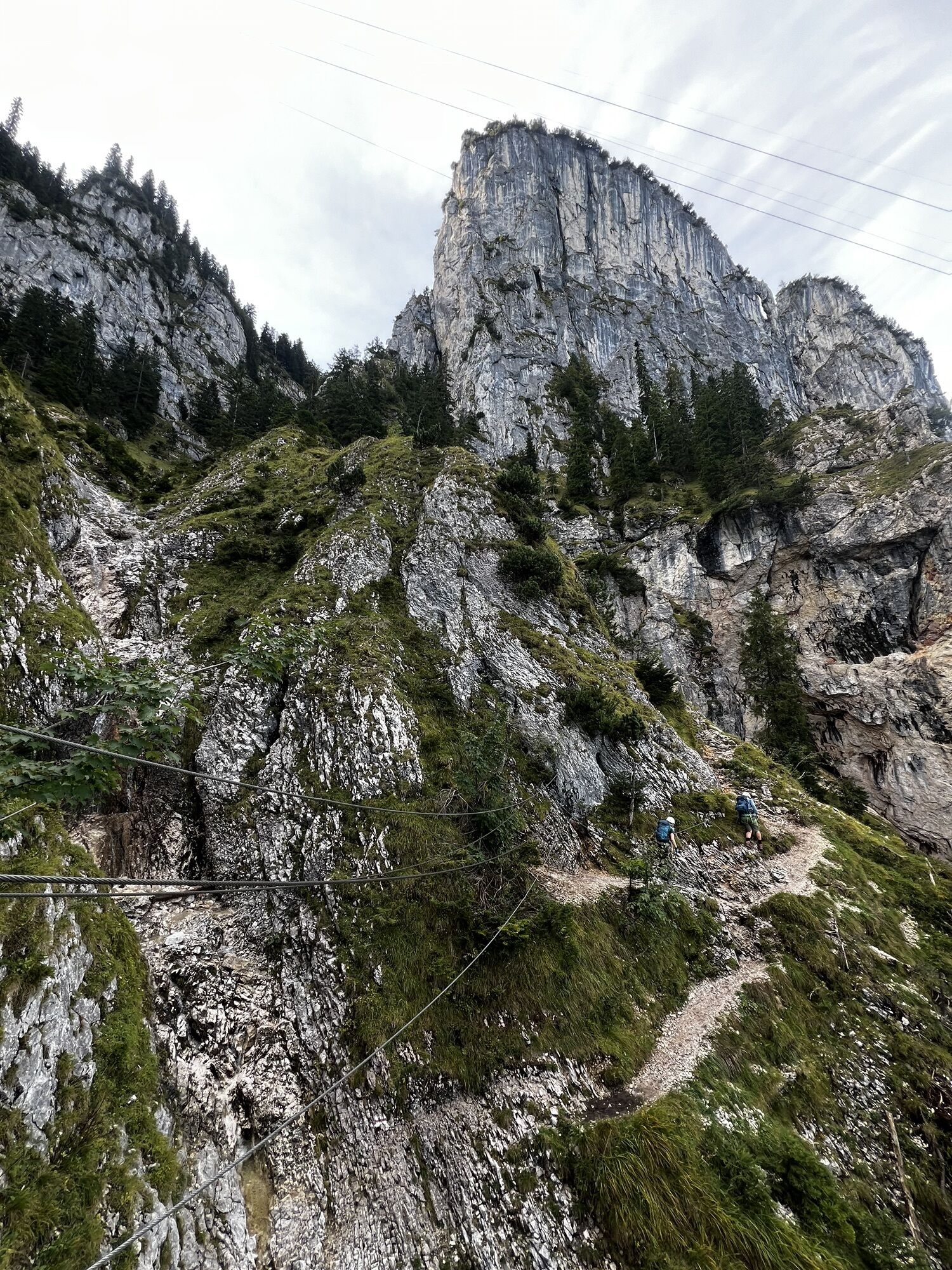
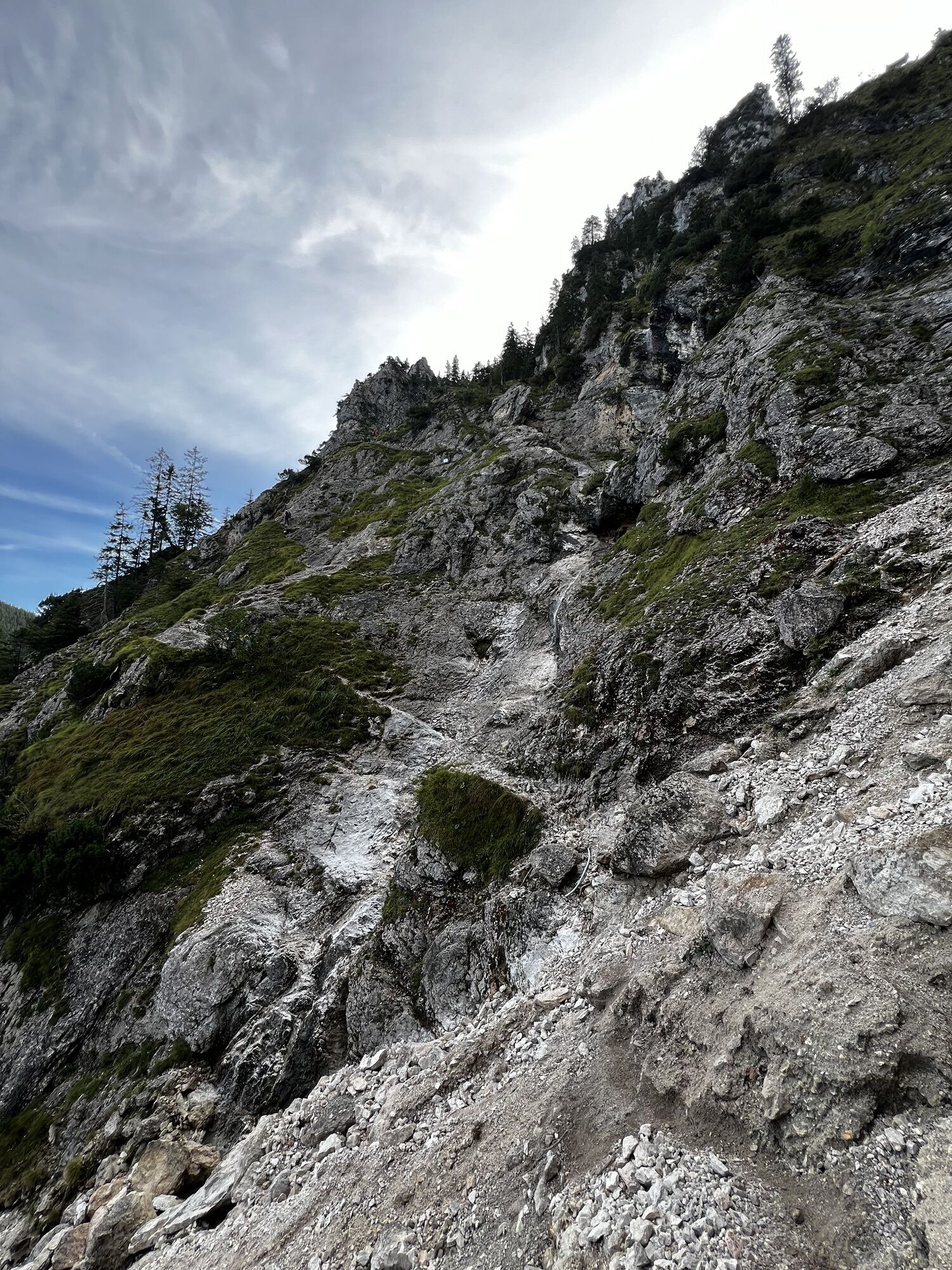
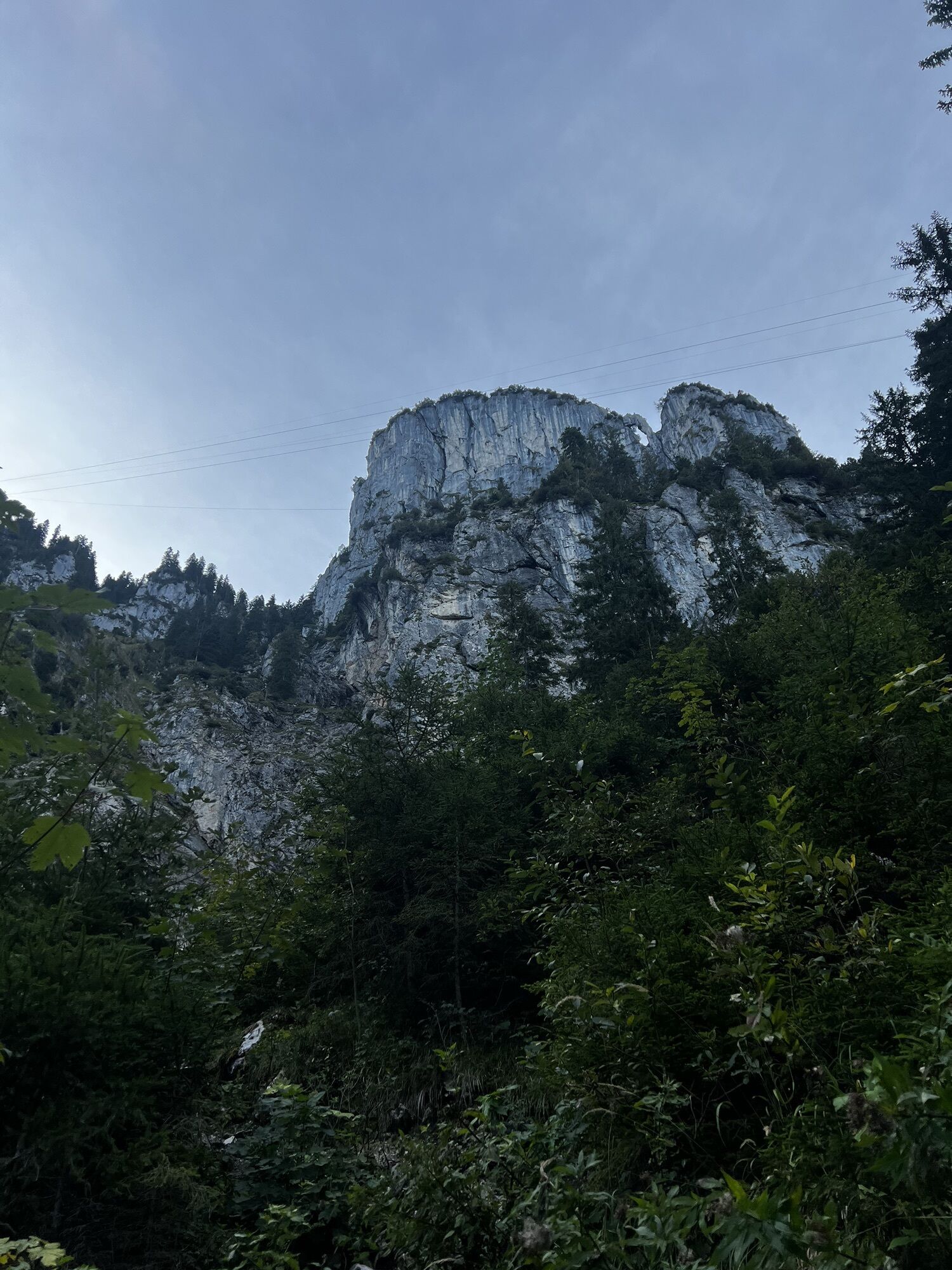
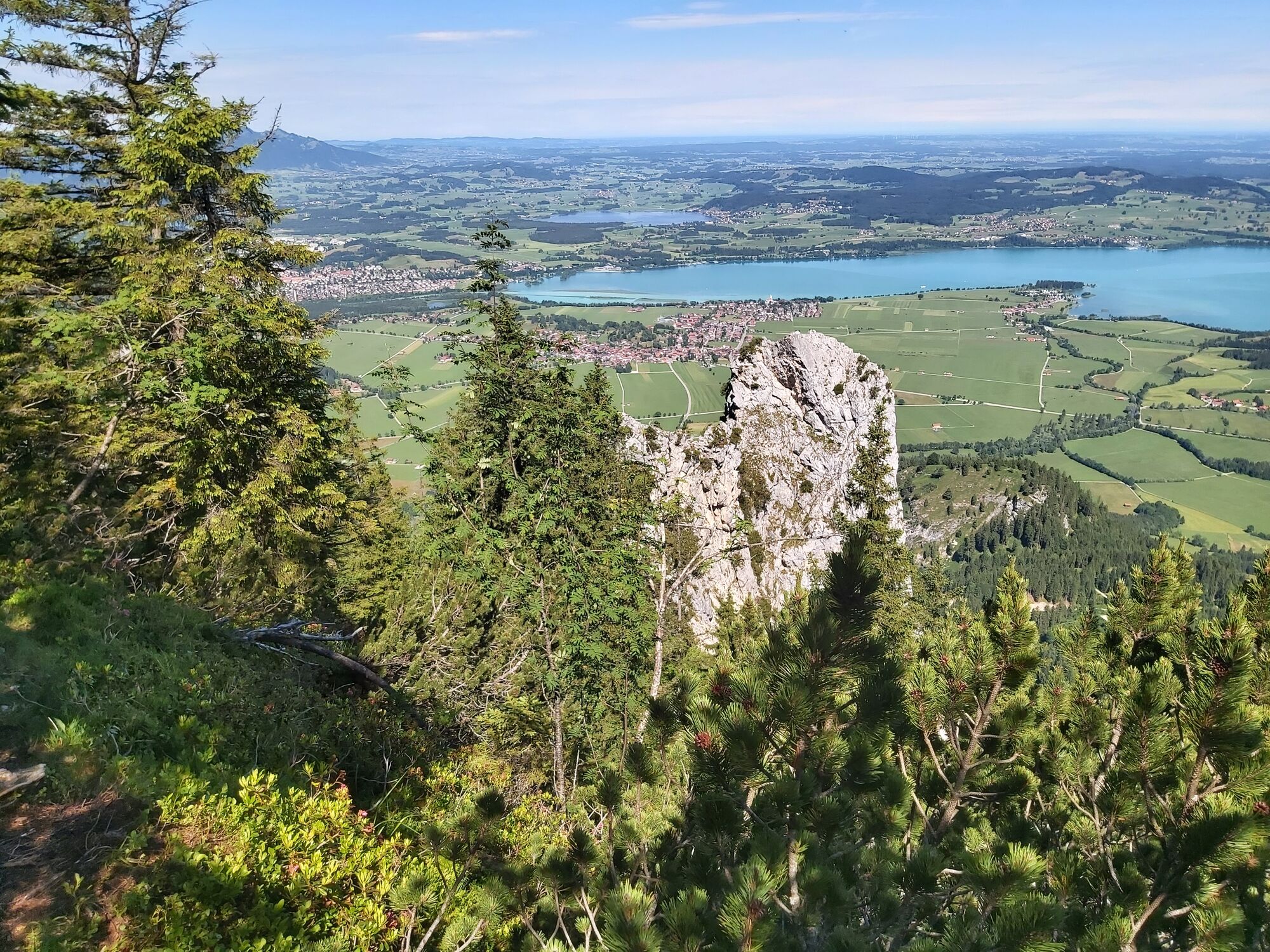
From the Tegelbergbahn valley station along the tarred road, then over the Rautbach stream up the steep forest path. Cross the stream again and continue in the forest on a rooty path. You soon come to the sign: "Fasten your harness here". Information boards point out the correct way to climb a via ferrata and the necessary equipment. The Gelbe-Wand-Steig winds its way through a striking gorge between Torschrofen and Gelbe-Wand-Schrofen with magnificent views of the Alpine foothills and its lakes. On steel cables, you pass the entrance to the Tegelbergsteig and up to the Täfelesattel. Now the last few steps to the Tegelberghaus and the Tegelbergbahn mountain station is reached.
Tak
Tak
Via ferrata set, helmet, sturdy shoes, first aid kit, cell phone, rainwear, possibly snacks and drinks. For smaller children it is advisable to bring a short safety rope.
Attention, winter closure!
Via Schwangau to the Tegelberg valley station.
Bus (RVA) No. 78
Tegelberg valley station (subject to charge)
A
Interested alpine sports enthusiasts can get a taste of via ferrata climbing at the Mountain Lodge information building in the valley area of the Tegelbergbahn. Via ferrata sets are available to hire from Armins Sporthäusle in Schwangau (Tel. +49 8362 81198, info@sporthaeusle.de) The small training facility at the mountain sports center enables first attempts at via ferrata climbing and offers ideal training conditions. The climbing rocks with suspension bridge for children and the slackline park round off the introductory offer. The information building is also the starting point for guided tours by regional mountain guides.
The Tegelberg mountain sports center in Schwangau offers a wide range of activities for all mountain sports enthusiasts, including equipment hire. You can make your first attempts at climbing in the information building, climbing rocks and a suspension bridge for children are available. Guided tours by regional mountain guides also start here.
Kamery internetowe z trasy
Talstation
Tegelbergbahn Bergstation
Tegelberghaus
Füssen - Wellness Hotel Sommer
Segelclub Füssen
Tegelbergbahn Bergstation
Tegelbergbahn Bergstation
Tegelbergbahn Bergstation
Tegelbergbahn Bergstation
Tegelbergbahn Bergstation
Schloss Hohenschwangau
Schloss Hohenschwangau
Schloss Hohenschwangau
Schloss Hohenschwangau
Schloss Hohenschwangau
Schloss Hohenschwangau
Schloss Hohenschwangau
Ludwigs Festspielhaus Füssen
Ludwigs Festspielhaus Füssen
Ludwigs Festspielhaus Füssen
Ludwigs Festspielhaus Füssen
Ludwigs Festspielhaus Füssen
Ludwigs Festspielhaus Füssen
Forggensee
Tegelbergbahn Bergstation
Schwangau - Blick auf den Tegelberg
Hotel Hirsch
Hotel Hirsch
Hotel Hirsch
Hotel Hirsch
Hotel Hirsch
Hotel Hirsch
Hotel Hirsch
Schwangau - Schlossbrauhaus
Tegelberg Landeplatz
Popularne wycieczki w okolicy
- 4,8
Around Weißensee
światłoWędrówka 6,12 km - 4,1
Drehhütte
światłoWędrówka 3,34 km - 4,5
Circular hike Dreh- and Rohrkopfhütte
światłoWędrówka 8,76 km - 4,2
Cultural trail Schutzengelweg
średniWędrówka 5,13 km - 3,6
Rundwanderung Plansee
średniWędrówka 9,80 km - 4,5
Schönjöchl am Plansee
średniWędrówka 7,21 km - 4,9
Tegelberg | Branderschrofen | Neuschwanstein
średniWędrówka 14,8 km - 4,4
Schloß Neuschwanstein und Schwanensee Schwangau, Bayern
średniWędrówka 9 km - 4,4
Rundwanderung Stuibenfälle
średniWędrówka 3,92 km - 4,6
Hochplatte
średniWędrówka 10,4 km
Wędrówki i tropienie


Nie przegap ofert i inspiracji na następne wakacje
Twój adres e-mail została dodana do listy mailingowej.