






Panoramic hike around the Rinkenberg
Poziom trudności: T1
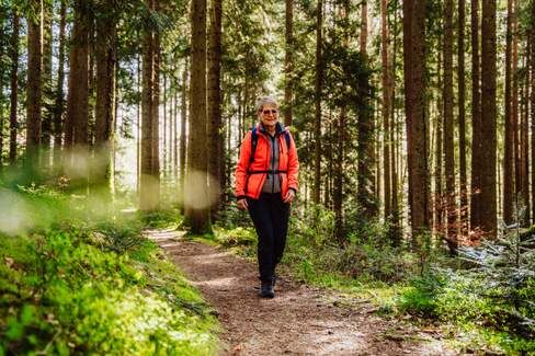
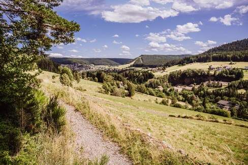
The hike starts at the Sommerseite parking lot and initially follows the Baiersbronn Genussweg Satteleisteig on mostly soft and natural paths. Along the way, you pass the locations Rechen, Rinkenkopfwegle,...
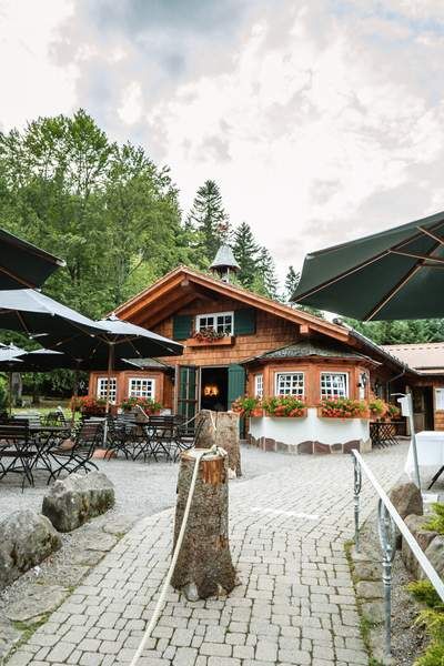
The hike starts at the Sommerseite parking lot and initially follows the Baiersbronn Genussweg Satteleisteig on mostly soft and natural paths. Along the way, you pass the locations Rechen, Rinkenkopfwegle, Häslen, Am Waldacker, Heideweg, and Rinkenteichwegle. Upon arrival here, you leave the Genussweg, turn left onto the wide path, and soon reach the Sattelei hiking hut - a wonderful place for a cozy rest. Refreshed, you continue over a narrow path to the Wasserstube and Satteleiwegle locations, then head toward Labbronnen parking lot and from there along a scenic path back to the starting point.


From the direction of Freudenstadt, in Baiersbronn, turn right at the roundabout and take the next street to the right (Häslergasse), drive uphill until Sommerseitenweg joins on the left, follow it for about 700 m to the Sommerseite hiking parking lot.
Coming from the lower Murgtal, after the outlet center (Trigema), turn right into Häslergasse and continue as previously described.
Coming from Ruhestein, go straight through the roundabout, turn left into Häslergasse and continue as previously described.
S-Bahn station Baiersbronn station (S8, RB 40, RB41)
Bus stop Baiersbronn station (21, F11, 200)
From here, follow the "Zuweg Murgleiter" signage to the Sommerseitenweg location and continue straight to the starting point of the route (Sommerseite parking lot).
Note: From the Sommerseitenweg location up to the Murgleiter portal, you can enter the route directly here.
Route length: 1.7 km, approx. 80 meters elevation gain
Duration: approx. 30 minutes
Sommerseite parking lot
T1
Uzyskaj wgląd
Zawsze na żywo z ponad 9 500 kamer internetowych. bergfex Jako użytkownik Pro, możesz teraz zobaczyć odpowiednie kamery internetowe dla wielu wycieczek w aplikacji wycieczki od. Pozwala to na bezpośredni podgląd aktualnych warunków.
Popularne wycieczki w okolicy
-
4,9
Ottenhöfen - Eichkopf - Karlsruher Grat
średniWędrówka 13,7 km -
4,7
Kniebiser Heimatpfad - Wandern mit Genuss
światłoWędrówka 9,07 km -
4,2
Sankenbachwasserfälle und Glasmännlehütte am Stöckerkopf
średniWędrówka 12,8 km -
4,5
Naturgewalten-Tour
Wędrówka 15,6 km -
5,0
Bannwald-Tour
Wędrówka 13,3 km -
4,8
Bad Peterstal-Griesbach - Himmelssteig für "Höhenverliebte"
ciężkiWędrówka 10,3 km -
4,6
Bad Rippoldsau - Cafe & Restaurant Zum Schlüssel - Klösterle - Burgbachwasserfall
średniWędrówka 11,2 km -
5,0
Kniebis-Sankenbachwasserfälle-Sankenbachsee
średniWędrówka 7,98 km -
4,0
Eiszeit-Tour
Wędrówka 11,7 km -
2,6
Genießerpfad zum Panoramastüble
Wędrówka 10,6 km
Wędrówki i tropienie


Nie przegap ofert i inspiracji na następne wakacje
Twój adres e-mail została dodana do listy mailingowej.





