


7 - To the Hanner rocks
The former residential town of Bad Urach lies in the middle of the UNESCO Swabian Alb Biosphere Reserve. Wonderful nature, fresh air, and the picturesque half-timbered town provide a relaxed, deep breath...
The former residential town of Bad Urach lies in the middle of the UNESCO Swabian Alb Biosphere Reserve. Wonderful nature, fresh air, and the picturesque half-timbered town provide a relaxed, deep breath and restful vacation days.

The overview boards at the railway crossing form the starting point for this route.
Behind the boards, our path begins: It first zigzags partly over stone steps uphill to the lower Tiergartenberg trail.
We continue uphill through the forest to a wide forest road, into which we turn left. We
remain on the wide path and reach the Tiergartenberg forest park. At the edge of the forest park, we recognize the remains of the old stone enclosure wall of the ducal hunt.
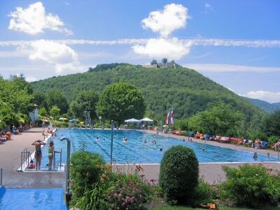
We leave the forest park at its western edge and come via a short access road to Parkstraße by the municipal outdoor pool Tiergartenberg, which we follow uphill to the left.
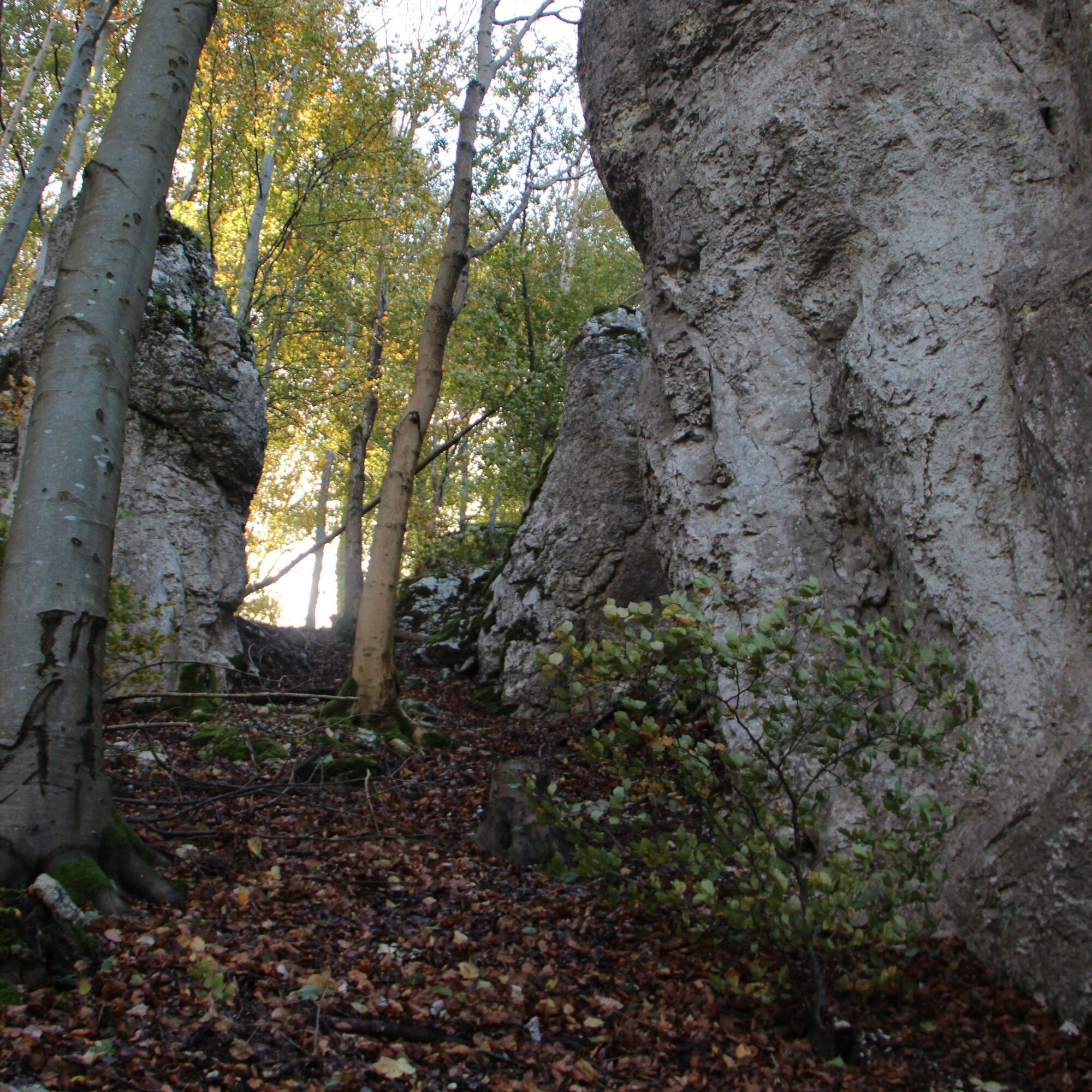
About 150 m after the right bend, the upper Tiergartenberg trail merges on the left. It leads us further uphill through the forest. About 120 m after a left bend, we leave the upper Tiergartenberg trail to the right. A steep, narrow path now leads us zigzagging uphill to the northern Hanner rock (707 m).
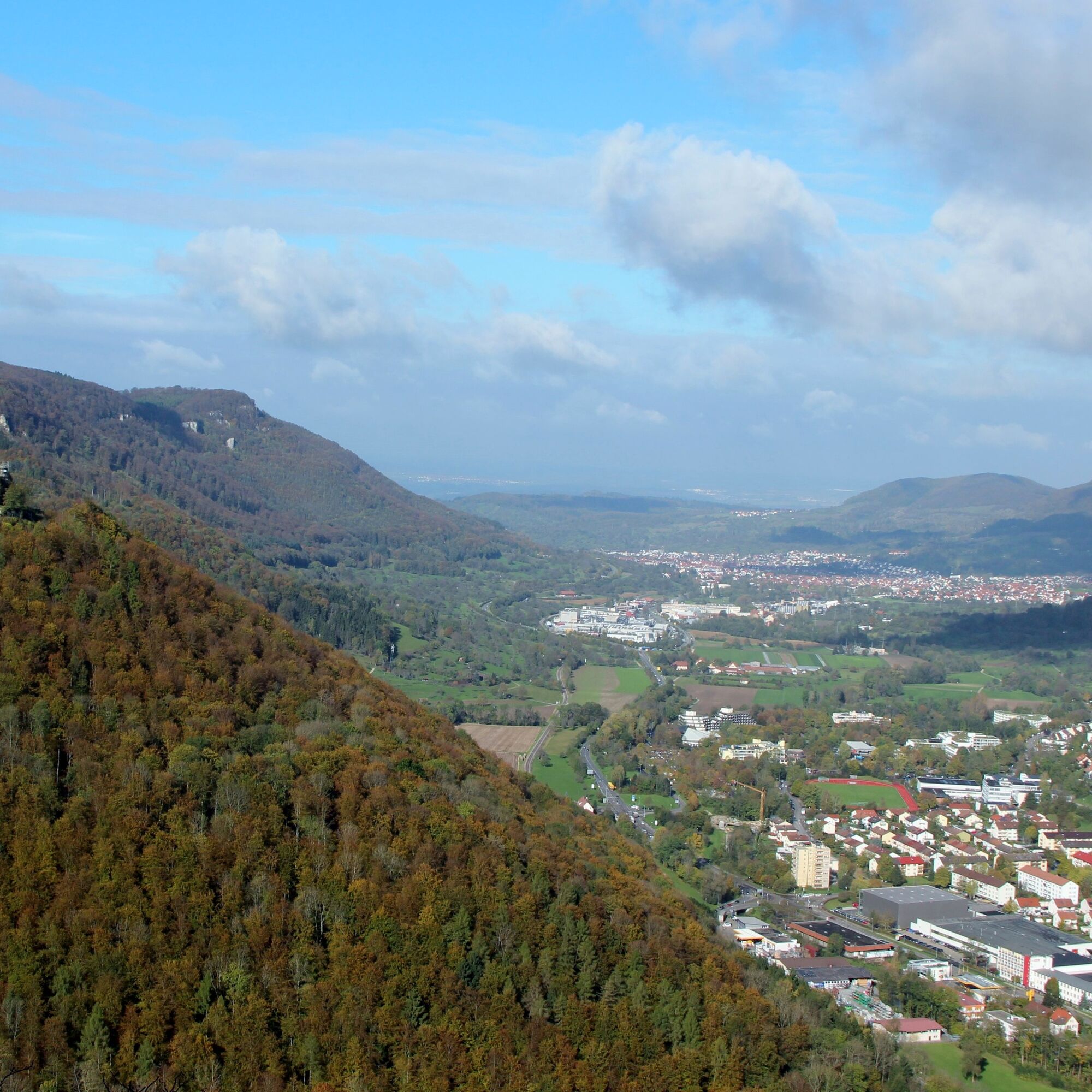
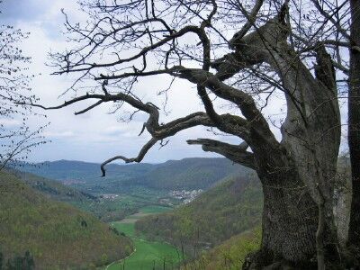
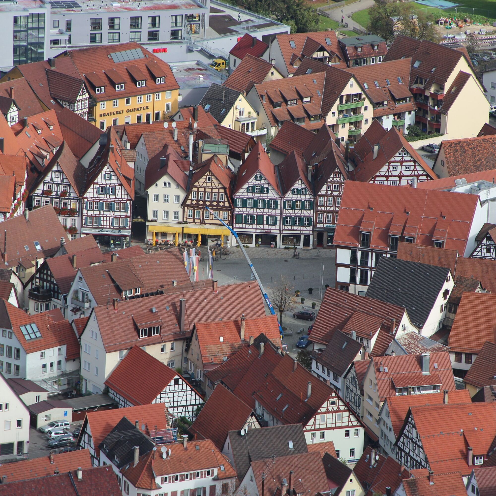
After the ascent mostly through dense beech forest, the view from the rock is surprisingly extensive. The Hohenurach castle ruin (692 m) lies almost within reach, separated only by the Seltbach valley. Below us in the Erms valley lies the town. Opposite, the elongated ridge of the Eichhalde limits our view.
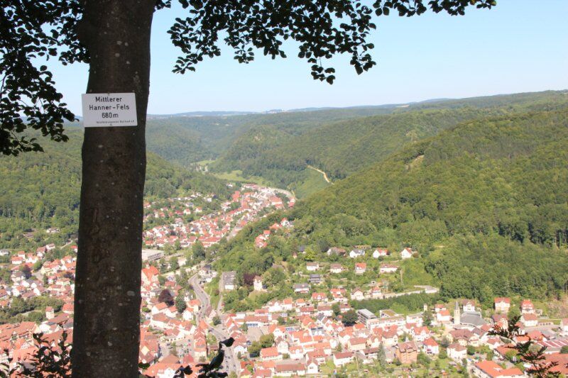
We leave the viewpoint and continue on a flat forest path to the middle Hanner rock.
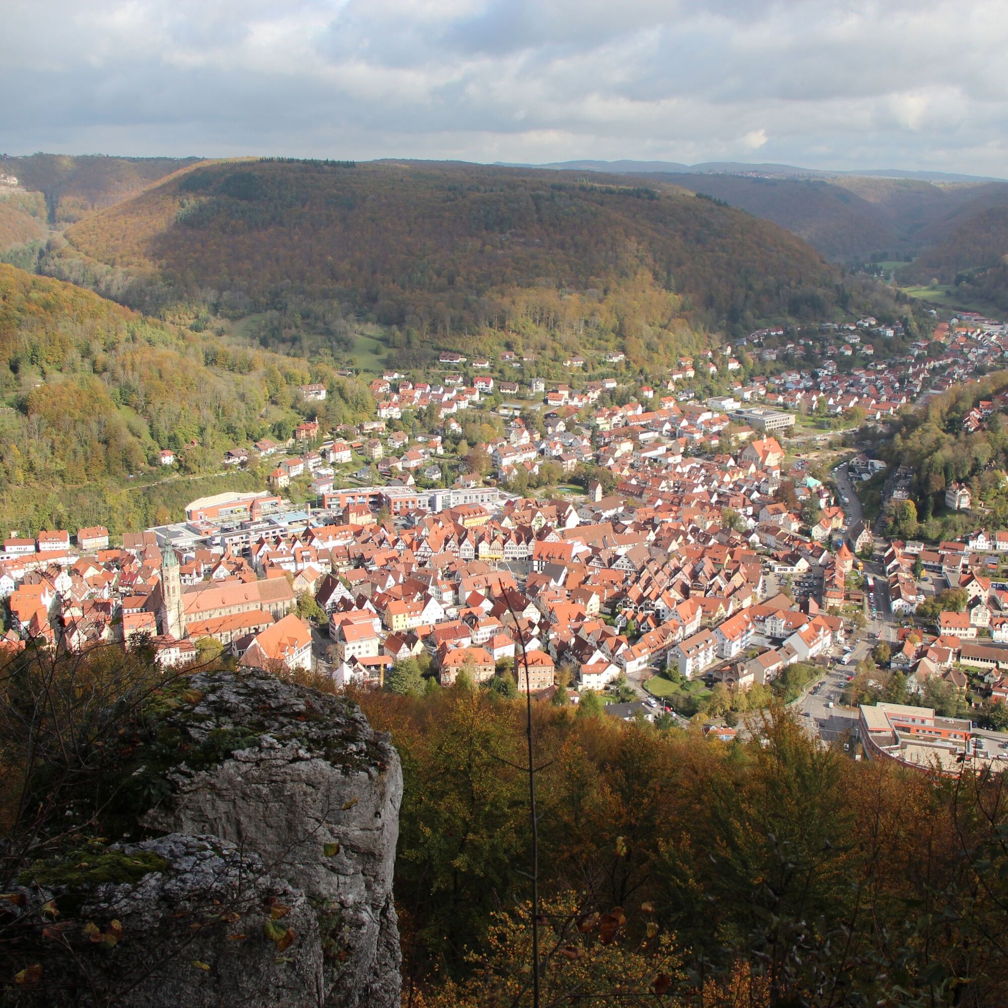
The middle Hanner rock (680 m) offers approximately the same view as the northern Hanner rock. Behind the rock is the Hanner hut. From here, our path continues on flat ground to the eastern Hanner rock (669 m), which offers probably the most comprehensive view of the town and its immediate surroundings.
From the rock, we finally go right, first follow the mountain path, then descend steeply downhill along the rock and continue zigzagging downhill to the upper Tiergartenberg trail. We hike right on this trail to the junction with the Hanner Steige. At the junction, a downhill path begins on the left. It quickly brings us to the middle Tiergartenberg trail and the old Hanner Steige at the forest edge. The road running parallel to the town bypass at the foot of the Tiergartenberg leads back to our starting point at the station.
Sturdy footwear, hiking poles, and sure-footedness are recommended for this route.
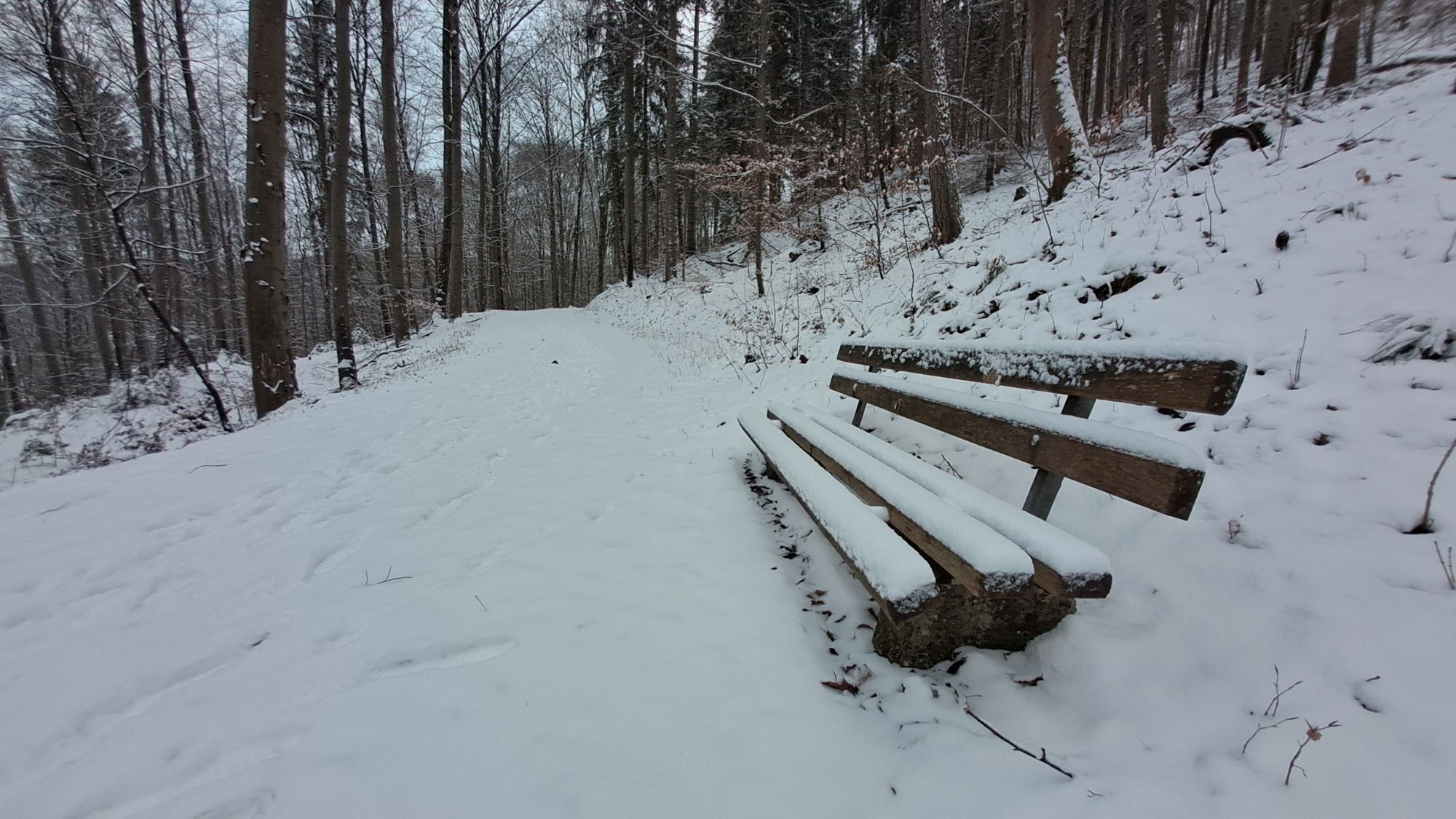
Our circular routes are not promenades but hiking trails. Sturdy footwear, hiking poles, and sure-footedness are recommended for all routes. Especially after and during rainfalls as well as in the winter months, the calcareous rock and the ground, especially on slopes, can be very slippery. Please take appropriate care.
In case of emergency, always dial 112. Please mention if the injured persons are in inaccessible terrain so that the Bad Urach mountain rescue service can be informed and no unnecessary time is lost during the rescue.
On the posts of the directional signposts you will find a plaque with the exact location number. This is known to the control center. Quick help is guaranteed in an emergency.
Near the bus station, through the underpass at Burgstraße to the foot of the slope of Tiergartenberg.
Take the Ermstalbahn to Bad Urach (final stop). About 100 m west of the station, at the railway crossing, the route begins
P+R parking lot – Burgstraße/bus station
Also discover our 5 premium hiking routes Grafensteige: Wasserfallsteig, Hohenurachsteig, Hochbergsteig, Hohenwittlingensteig, or Seeburgsteig. All premium routes are suitable for sporty and sure-footed hikers and lead you to the most beautiful spots in Bad Urach.
http://www.badurach-grafensteige.de

Popularne wycieczki w okolicy
-
4,8
Wasserfallsteig Bad Urach
średniWędrówka 10,2 km -
4,8
Hohenwittlingensteig Bad Urach
średniWędrówka 6,48 km -
4,8
Hohenurachsteig Bad Urach
średniWędrówka 7,65 km -
4,0
Seeburgsteig Bad Urach
średniWędrówka 8,19 km -
5,0
Breitensteinrunde
światłoWędrówka 10,3 km -
Trauf, Höllenlöcher, Wasserfälle und Tal
średniWędrówka 15,8 km -
5,0
16 - Through the Trailfinger Gorge
średniWędrówka 6,16 km -
5,0
Hochbergsteig Bad Urach
średniWędrówka 7,71 km -
4,0
Bad Urach Wasserfall, Runde von Buchhalde
średniWędrówka 12,1 km -
5,0
Lenningen: Weiße Lauter, Wasserfels, Guttenberger-,Gußmannshöhle, Schopflocher Moor, Hohgreutfels, Ruine Wielandstein
średniWędrówka 15,7 km

Wędrówki i tropienie


Nie przegap ofert i inspiracji na następne wakacje
Twój adres e-mail została dodana do listy mailingowej.