


Pfähler Valley and Falkensteiner Cave
Poziom trudności: 3
Friends of cycling will fully enjoy themselves in and around Bad Urach. Relaxed riding on beautiful paths across the Alb plateau. Or active recovery on a longer, signposted route. Whether on your own bike...
Friends of cycling will fully enjoy themselves in and around Bad Urach. Relaxed riding on beautiful paths across the Alb plateau. Or active recovery on a longer, signposted route. Whether on your own bike or one rented spontaneously. The extensive cycle hiking network in and around Bad Urach offers just the right thing for every age and taste. Wherever your personal preferences lie when cycling, an unforgettable experience amidst breathtaking nature is assured. Bad Urach is located at the center of a fully signposted cycle path network of 18 routes with a total length of about 625 km. This route passes the campsite en route to the Falkensteiner Cave.
Dining options include the Schützenhaus, the Pfählhof, and inns in Bad Urach.

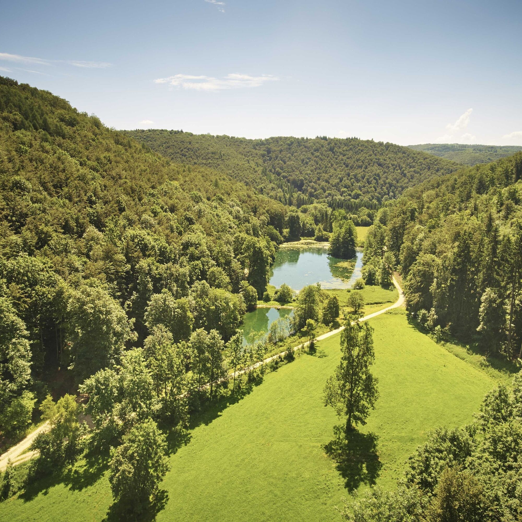
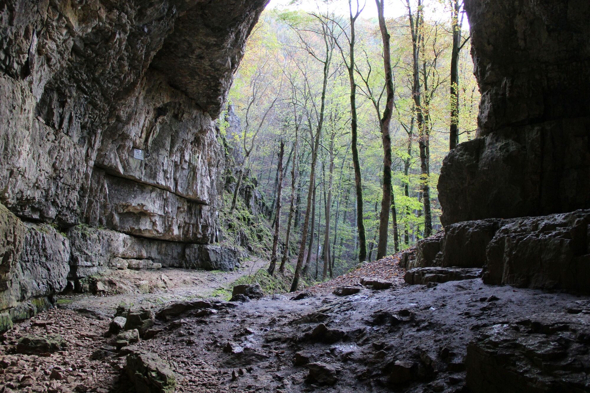
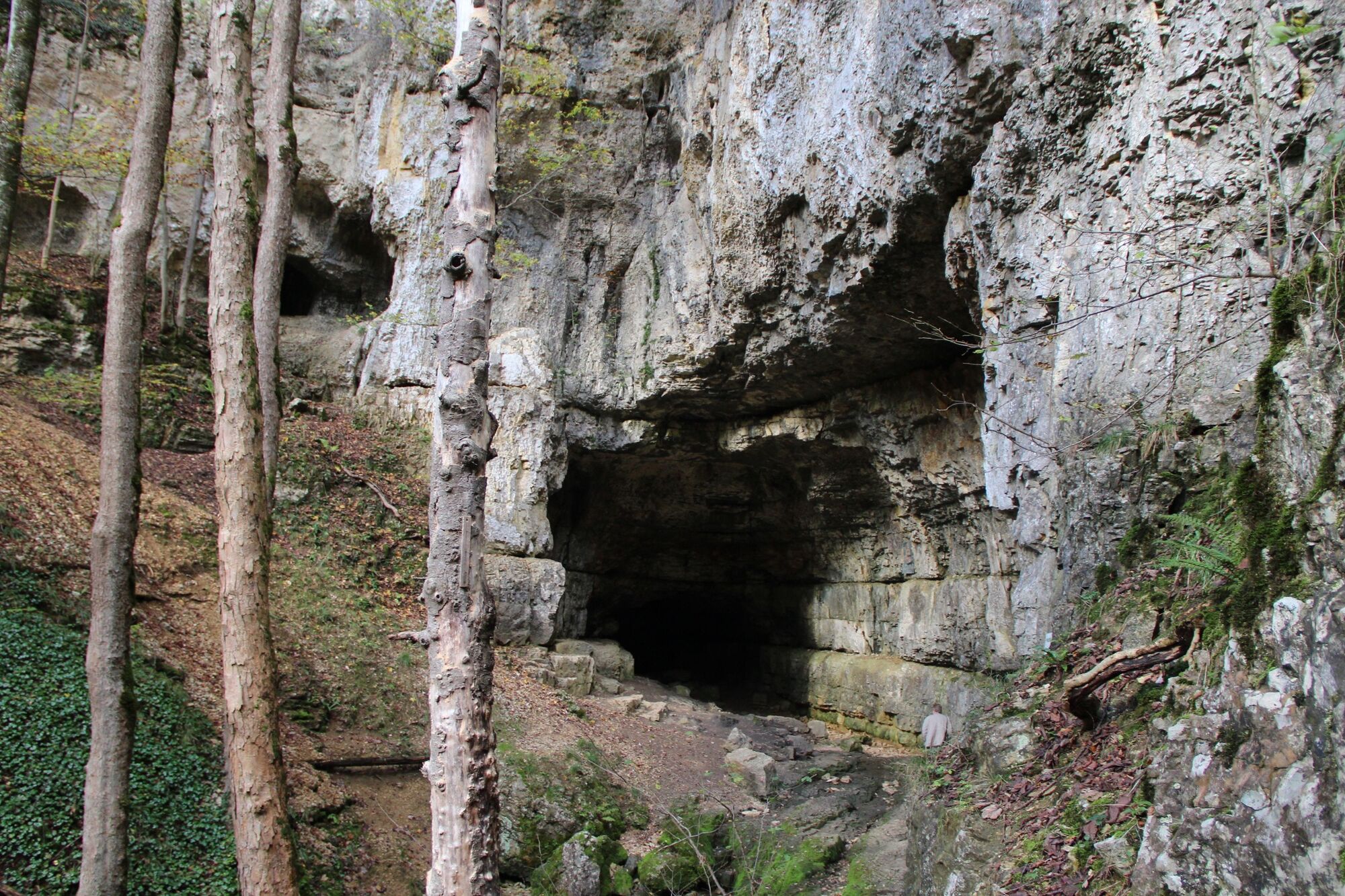
We start from parking lot P 15 on Neuffener Street heading towards Hülben. After about 250 m, we follow cycle path R 14 into Ostend Street. Through the Elsach settlement, we stay on the cycle path, past the campsite into the forest. At the junction R 14-Hülben we leave the cycle path and continue straight ahead to the Kohlteich pond; from there our path leads gently downhill to the left. After about 750 m, the path turns sharply right past the Kaltental house to the Kaltental pond. After leaving the pond behind, we turn left at the next junction and again left at the horse farm until the main road. We travel on this road to the left. After the hiking parking lot we turn right into Büchelbronner Street to the shelter, keep left until we reach the road again. Turning right, we stay briefly on the road and after about 250 m turn right again into the forest towards the Falkensteiner Cave. The path becomes a bit bumpy shortly before the cave, and we leave our bikes to walk up to the cave. Back at the bikes, we take the right path to the parking lot and turn left onto the main road. The first opportunity to turn right leads us back into the forest, again past the campsite towards Bad Urach and our parking lot.
Tak
A8 from the direction of Karlsruhe: exit Stuttgart-Degerloch, then B27/312 to Metzingen and B28 to Bad Urach.
By ICE to Stuttgart or Plochingen, from there use the Stuttgart - Reutlingen - Tübingen railway line, change in Metzingen to the regional train to Bad Urach, stop Bad Urach station.
Parking lot P 15 Festhalle
3
Popularne wycieczki w okolicy
- 4,8
Wasserfallsteig Bad Urach
średniWędrówka 10,2 km - 4,8
Löwenpfad "Filsursprung-Runde" - pure nature around the Reußenstein
średniWędrówka 14,1 km - 4,8
Hohenwittlingensteig Bad Urach
średniWędrówka 6,48 km - 4,8
Hohenurachsteig Bad Urach
średniWędrówka 7,65 km - 4,0
Seeburgsteig Bad Urach
średniWędrówka 8,19 km - 5,0
Lenningen: Weiße Lauter, Wasserfels, Guttenberger-,Gußmannshöhle, Schopflocher Moor, Hohgreutfels, Ruine Wielandstein
średniWędrówka 15,7 km - 4,5
16 - Through the Trailfinger Gorge
średniWędrówka 6,16 km - 5,0
Breitensteinrunde
światłoWędrówka 10,3 km - 4,0
Bad Urach Wasserfall, Runde von Buchhalde
średniWędrówka 12,1 km Trauf, Höllenlöcher, Wasserfälle und Tal
średniWędrówka 15,8 km

Wędrówki i tropienie


Nie przegap ofert i inspiracji na następne wakacje
Twój adres e-mail została dodana do listy mailingowej.