


Baiersbronn T1 Stöckerkopf Tour - Shortcut 2 Höllkopf
Poziom trudności: S2
Well-suited evening tour for technically and physically fit bikers with longer climbs, challenging trails, panorama, and nature enjoyment. At Stöckerkopf, the route goes over the Baiersbronn bikers' cross-country...
Well-suited evening tour for technically and physically fit bikers with longer climbs, challenging trails, panorama, and nature enjoyment. At Stöckerkopf, the route goes over the Baiersbronn bikers' cross-country track and then past the Sankenbachsee up to the heights. A few trails lead downhill into the Ellbachtal and back to Baiersbronn.

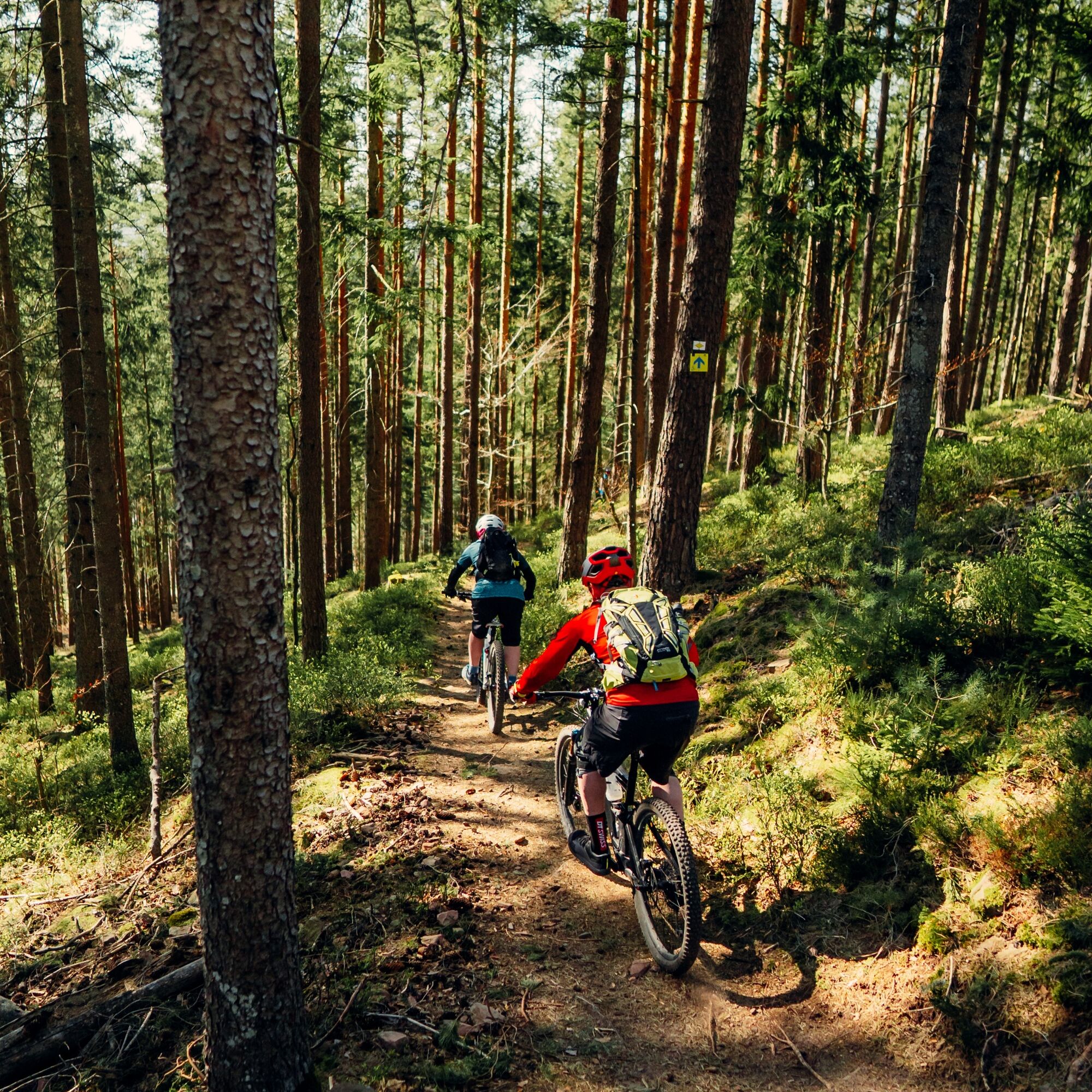
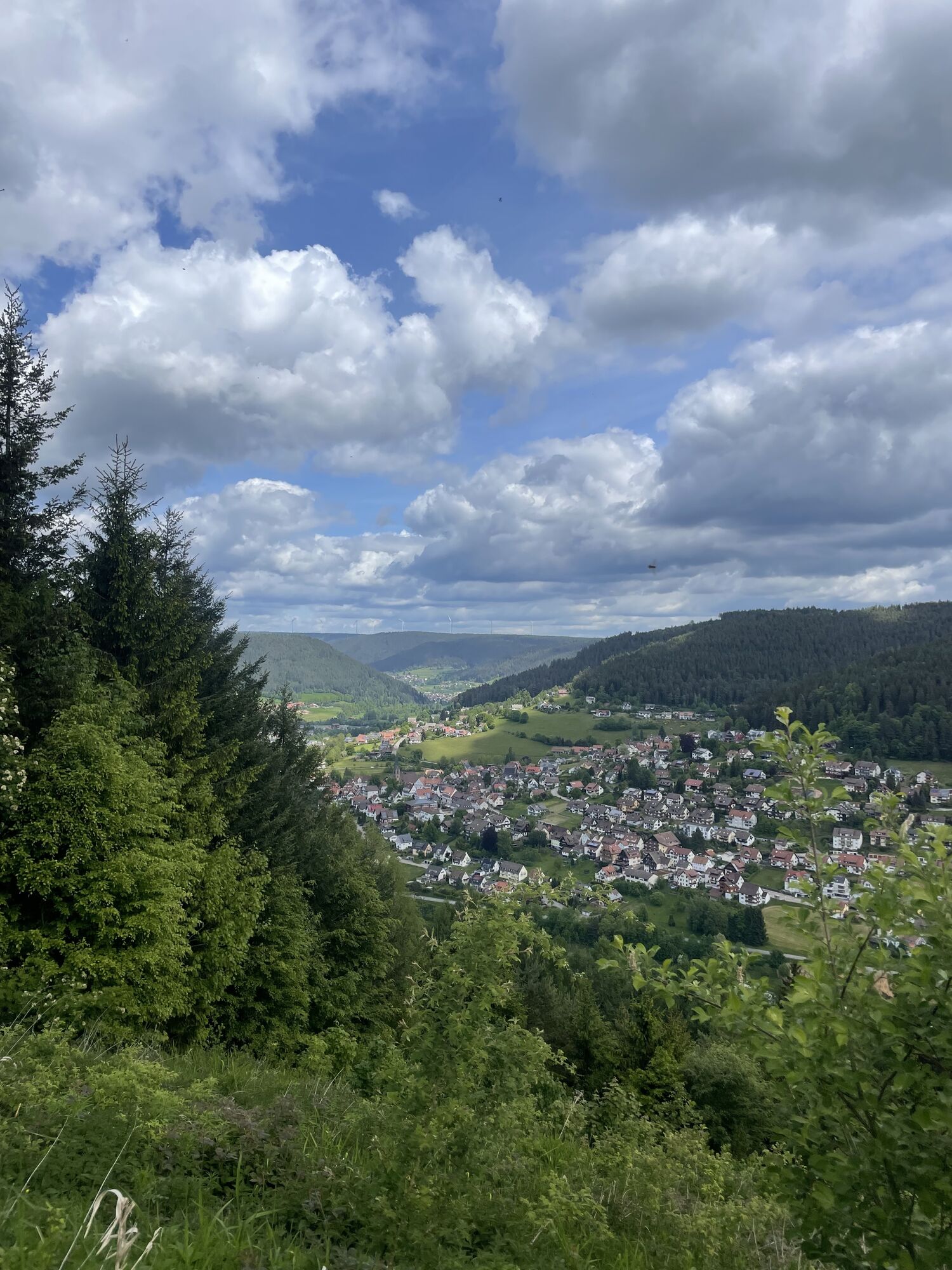
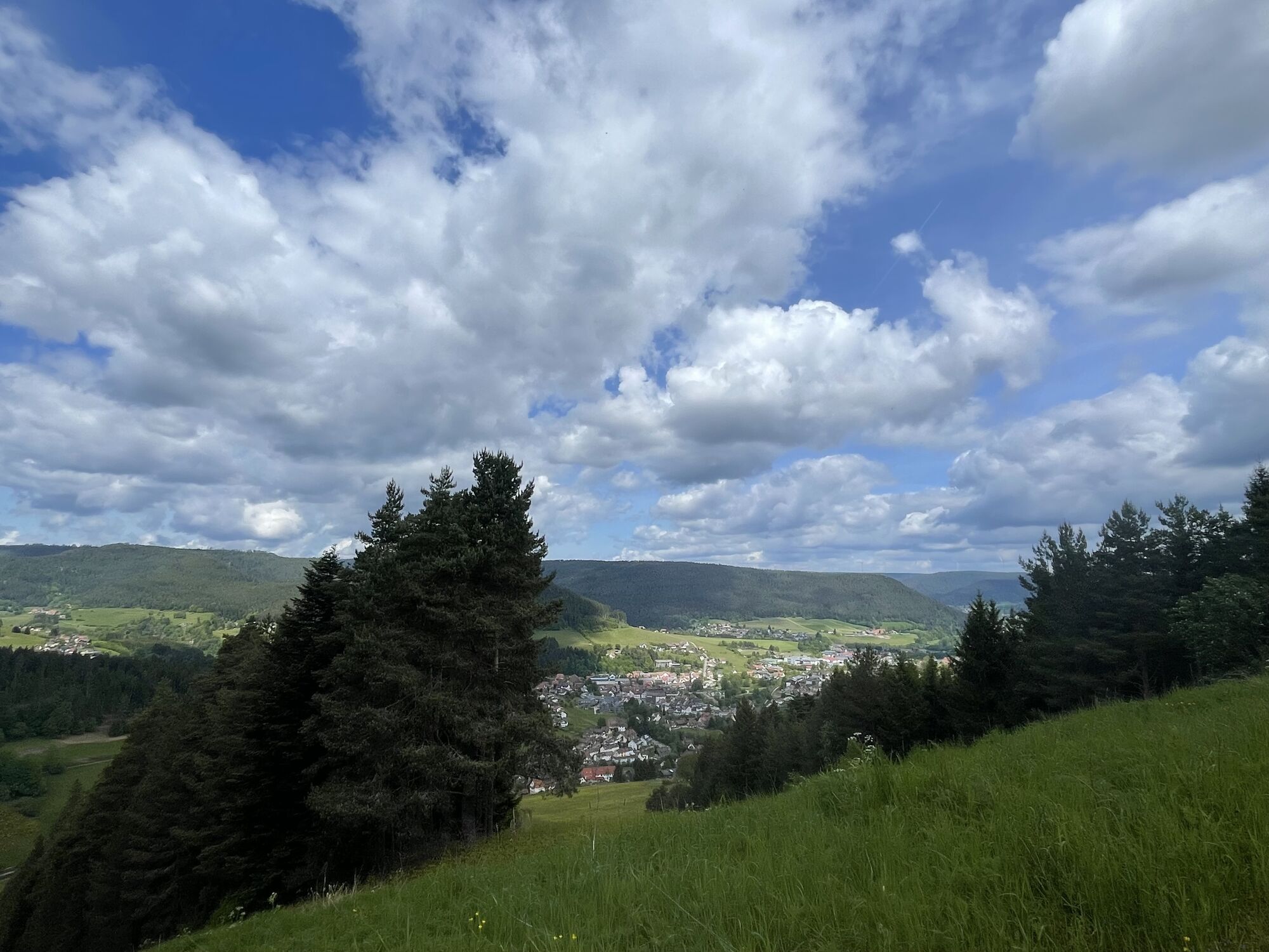
From the starting point at the chairlift parking lot in Baiersbronn, you initially climb the narrow road up the Sankenbach valley to warm up. At the game enclosure, turn left and tackle the first longer climb. The reward is a great view of the center of Baiersbronn.
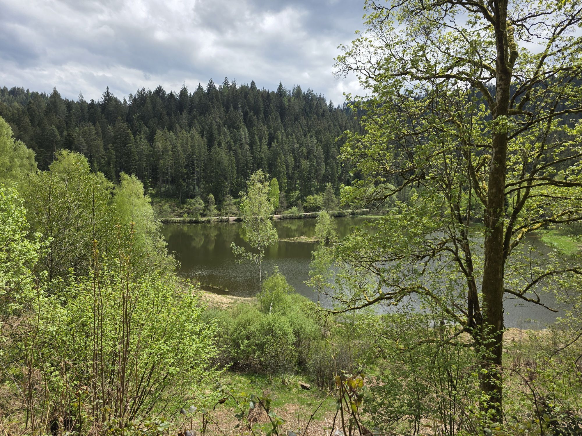
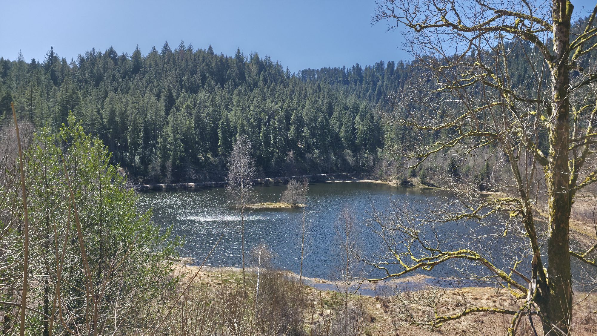
A natural path descent with an extremely steep section follows down towards Friedrichstal. Cheerfully, the route continues halfway along the hillside to Michaelis Church. Then you have to overcome some altitude gain again, first on an untrafficked road, then on a gravel path and finally on natural paths up to Gruberkopf. There is no view here; the reward comes in the form of tricky trails on the Baiersbronn bikers' cross-country track. This ends again at the Sankenbach game enclosure, and the route continues gently uphill to the natural highlight of the tour, the Sankenbachsee.
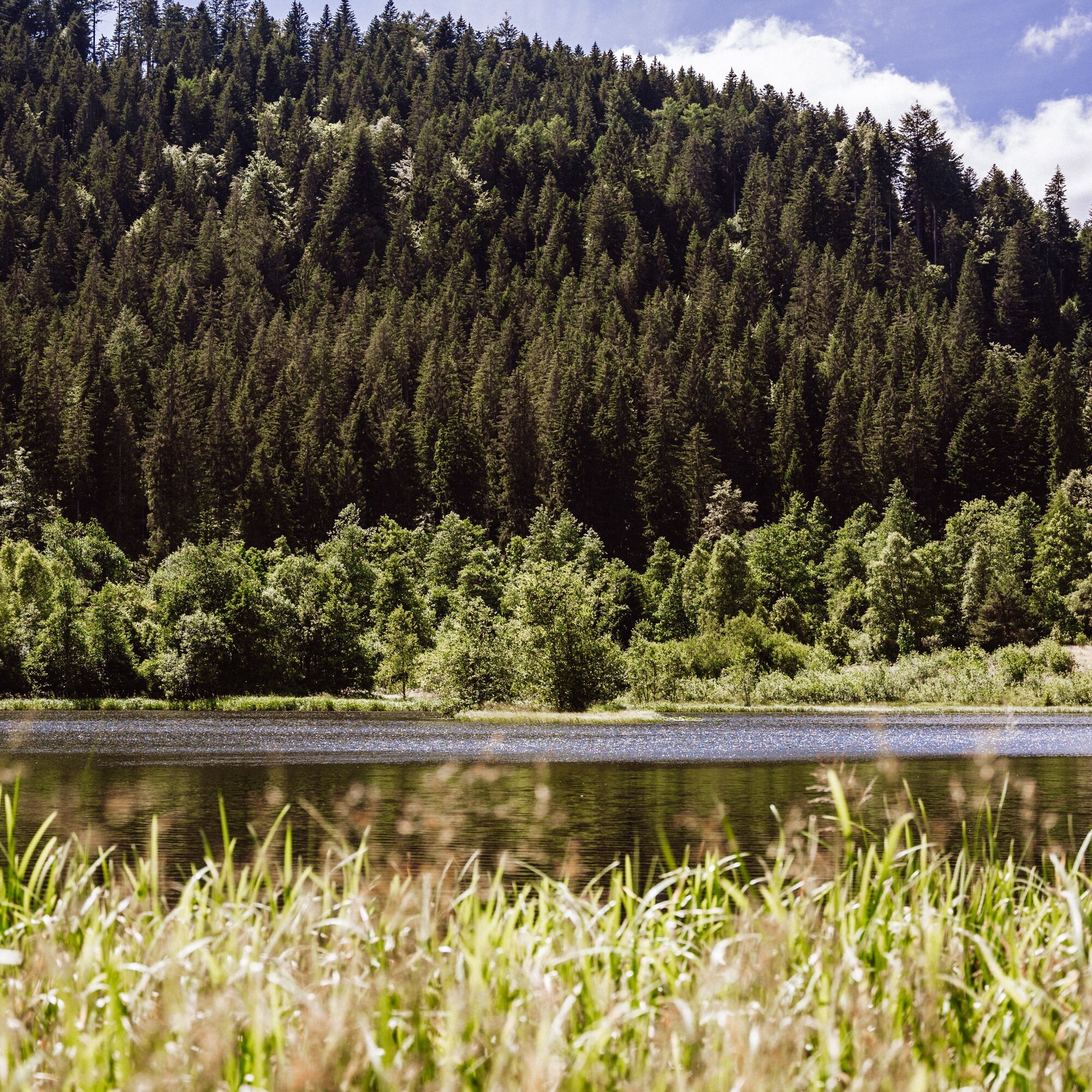
The small detour down to the lakeshore should definitely not be missed. Another highly recommended detour on foot leads about 200 m to the Sankenbach Waterfall. Up the Heinzelberg, you climb to about 860 m. At the Kienberghütte, a scenic break on the HimmelSLiege (sky lounger) is worthwhile before starting the descent on the right.
A wide path takes bikers with great views downhill all the way to the Höllkopfhütte. An initially very steep and then flowy trail leads down to the Höll and then continues on a trail towards the barefoot path on the wooden path. A short trail leads us down to Bergergrund. Via a meadow path, the Stutzweg, you return with wonderful views to Baiersbronn, where a well-deserved refreshment awaits.
There is another shortcut option.
1st shortcut - Stöckerkopf: At the Sankenbach game enclosure, go straight ahead and skip the Baiersbronn bikers' cross-country track.E-Mountainbike:
Use the shortcut 1 - Stöckerkopf (go straight ahead at the Sankenbach game enclosure) as well as the signposted detours on the Höllkopftrail and Bergergrundtrail with the e-mountain bike.
Please check in advance for current trail closures or at the Baiersbronn Hiking Information Center whether the route is open. Tel.: +49 7442 8414-66.
Children:
The tour is suitable for youths from about 12 years old, provided they have good fitness and riding skills. Black trail sections should possibly be bypassed.
Baiersbronn train station, from there follow the mountain bike signs towards Rosenplatz (800m).
Parking garage at Rosenplatz (paid), Rosenplatz, 72270 Baiersbronn
Parking lot at the outdoor pool (free of charge, about 250m to the starting point), Wilhelm-Münster-Straße 26, 72270 Baiersbronn
S2
Tips for this route:
Link to the T1 - Stöckerkopf Tour with the complete route length Link to the T1 - Stöckerkopf Tour - Shortcut 1 Stöckerkopf Everything about mountainbiking in BaiersbronnDining options
Various options in Baiersbronn and in the immediate vicinity of the starting pointInteresting facts about the history on the adventure trail "In the Valley of the Hammers" in Friedrichstal
Atmosphere at Sankenbachsee Sankenbach Waterfall
Barefoot path on the wooden path
Charcoal kiln
Children's playground
Popularne wycieczki w okolicy
- 4,7
Kniebiser Heimatpfad - Wandern mit Genuss
światłoWędrówka 9,07 km - 4,0
Sankenbachwasserfälle und Glasmännlehütte am Stöckerkopf
średniWędrówka 12,8 km - 5,0
Naturgewalten-Tour
Wędrówka 15,6 km - 5,0
Bannwald-Tour
Wędrówka 13,3 km - 4,6
Bad Rippoldsau - Cafe & Restaurant Zum Schlüssel - Klösterle - Burgbachwasserfall
średniWędrówka 11,2 km - 4,8
Bad Peterstal-Griesbach - Himmelssteig für "Höhenverliebte"
ciężkiWędrówka 10,3 km - 5,0
Kniebis-Sankenbachwasserfälle-Sankenbachsee
średniWędrówka 7,98 km - 4,0
Eiszeit-Tour
Wędrówka 11,7 km - 2,6
Genießerpfad zum Panoramastüble
Wędrówka 10,6 km Über die Alexanderschanze zum Ellbachsee
Wędrówka 11,1 km
Wędrówki i tropienie


Nie przegap ofert i inspiracji na następne wakacje
Twój adres e-mail została dodana do listy mailingowej.