


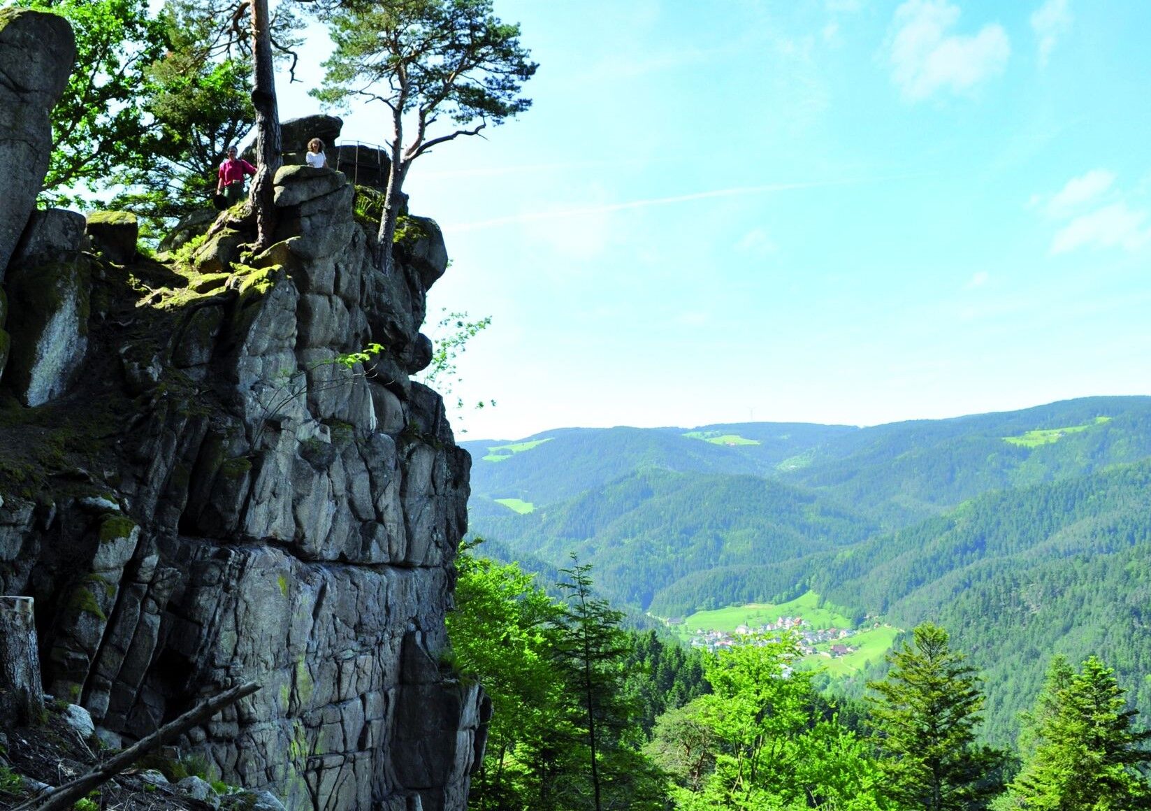
Rock Trail Hornberg
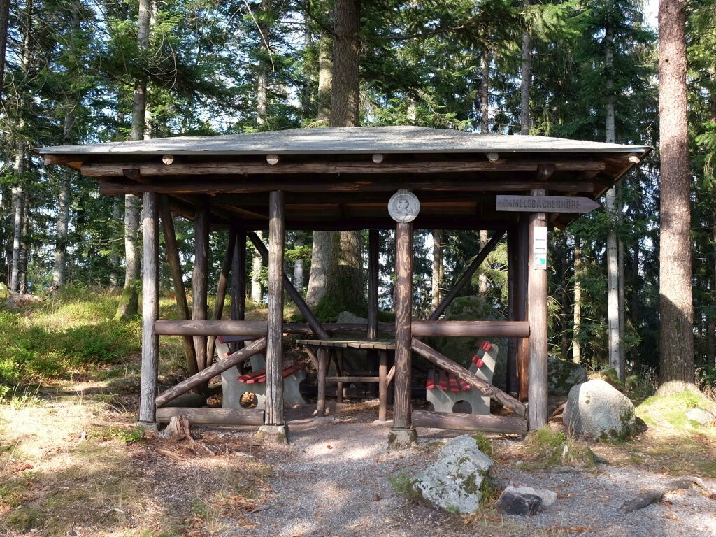
Within the framework of the mountain bike project of the Ortenau district, the rock trail was developed. It lives up to its name and leads for large parts over rocky paths to beautiful viewpoints and picnic huts.

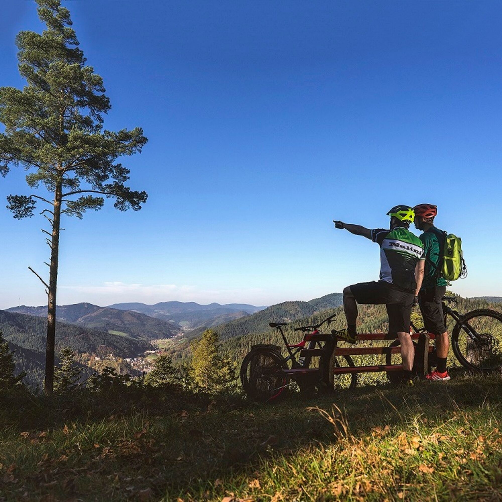
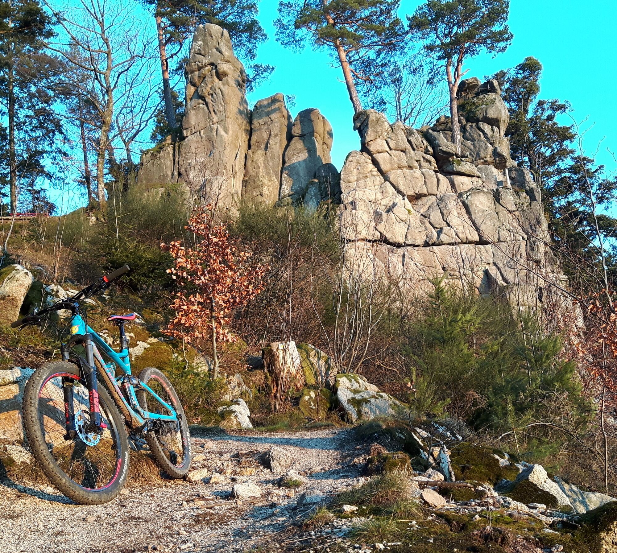
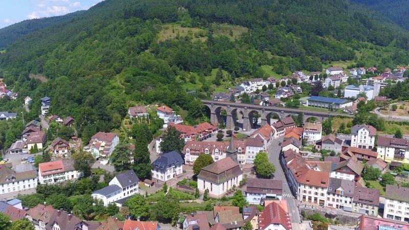
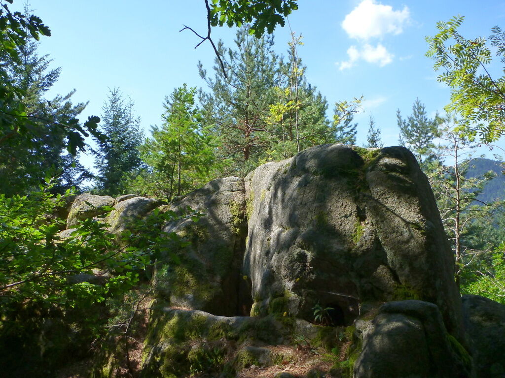
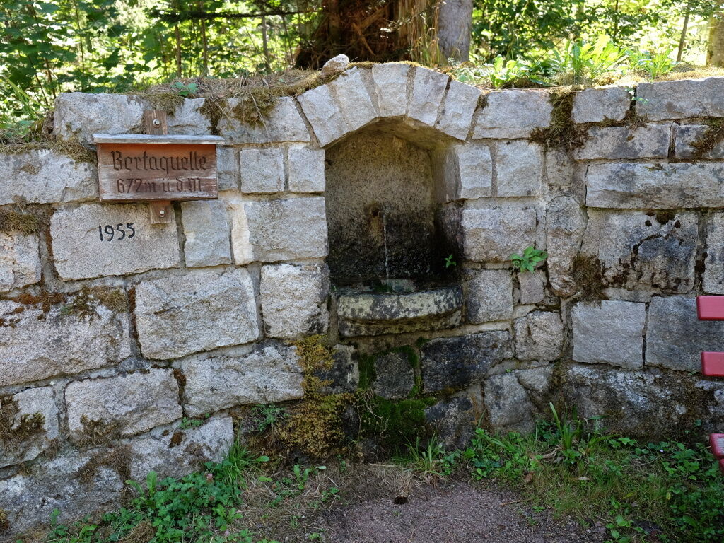
Some sections are quite narrow and inexperienced mountain bikers should push the bike along these parts. This is especially true when wet. The rock trail has a length of 12 km and is rideable in both directions. The starting point is at the viaduct parking lot and leads towards Emilienruhe to Winddeckfelsen, then to Bertaquelle and afterwards back to Hornberg.
Direction clockwise:
Steep, partly technically challenging climb up to Windeckhütte, then forest road to Bertaquelle, then mostly fine trail to Hornberg.
Direction counterclockwise:
Moderately ascending fine trail (partly very narrow) to Bertaquelle, from there forest road to Windeckhütte, then beautiful serpentine trail to Hornberg.
Some sections are very narrow and there is a risk of falling!
Be careful when it's wet!
If you push, you should lead the bike on the valley side!
From the south: Before the tunnel, turn right towards Hornberg until the end of the traffic-calmed area, then turn right to the tourist parking lot at the viaduct.
From the north: Before the tunnel, turn left towards Hornberg until the beginning of the traffic-calmed area, then turn left to the tourist parking lot at the viaduct.
By the Black Forest Railway or the bus to Hornberg
Popularne wycieczki w okolicy
-
4,7
Ortenau legend circular routes: Devil's Pulpit
średniWędrówka 10,2 km -
4,3
Paradiessteig Hofstetten
średniWędrówka 12,8 km -
4,8
AugenBlick-Runde Lauterbach Güntersberg
światłoWędrówka 10,2 km -
Triberger Wasserfälle naar Prizen
średniWędrówka 11,5 km -
4,5
Genießerpfad - U(h)rwaldpfad Rohrhardsberg
średniTrasa tematyczna 8,70 km -
3,0
Lauterbach High Valley Circuit in the hiking paradise Alb - Black Forest
światłoWędrówka 10,7 km -
5,0
Wolfach settlers' loop large round
średniWędrówka 9,04 km -
3,5
Circular hike on the Black Forest Railway Experience Trail
średniWędrówka 6,56 km -
Over the Blindensee lake to Wilhelmshöhe
średniWędrówka 16,0 km -
4,5
Waldsee circular route to the Urenkopf tower
średniWędrówka 7,30 km

Wędrówki i tropienie


Nie przegap ofert i inspiracji na następne wakacje
Twój adres e-mail została dodana do listy mailingowej.