


Mountain bike - hut route at Randen near Tengen
Poziom trudności: S0
The small town of Tengen is the starting point of a family-friendly mountain bike route over the heights of the Randen. At first, the mountain bike route does not seem very spectacular, as it first goes...
The small town of Tengen is the starting point of a family-friendly mountain bike route over the heights of the Randen. At first, the mountain bike route does not seem very spectacular, as it first goes downhill to the district of Blumenfeld. Shortly before Blumenfeld, the Föhrle hut invites you to take the first break. Until its incorporation in 1972, Blumenfeld was considered one of the smallest towns in Germany. The next stage is Beuren am Ried, the southernmost point of the route. From there, strength and stamina are required. It goes uphill and in the forest above Beuren stands the next hut, the Brodlosenhütte. Via Weil, it goes up to the heights just before Watterdingen. After a short descent down to Watterdingen, the last big climb follows up to the Alten Post Weg. The high ridge trail runs there almost without major inclines, with magnificent views into the Hegau and, in clear weather, to the Alps. The Altepostweghütte and the Spitzhütte lie directly on the path. From here it goes downhill again, past the Lochhütte and down to Tengen.

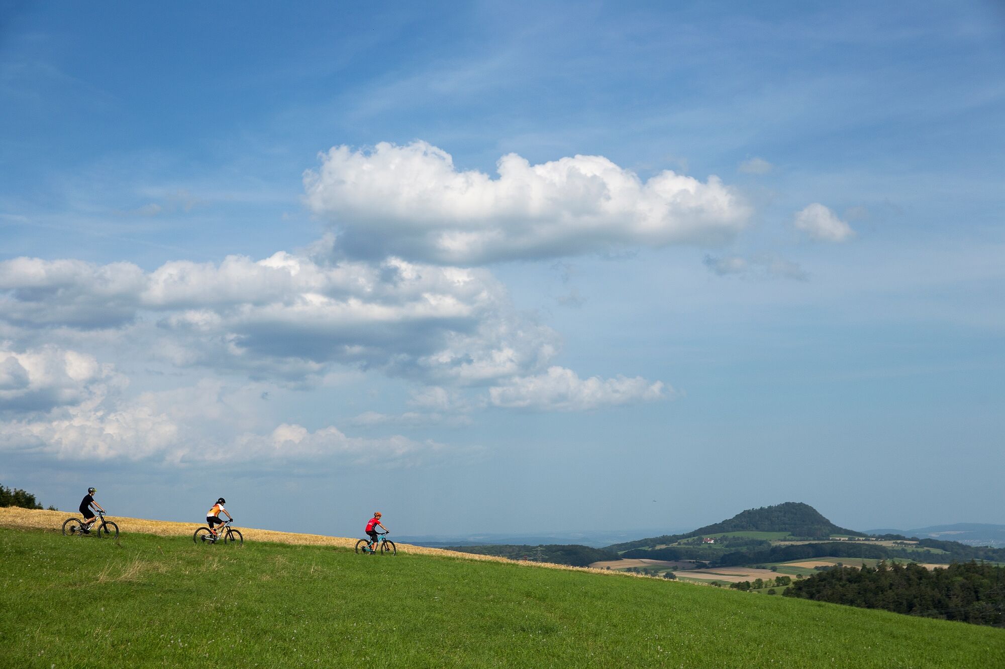


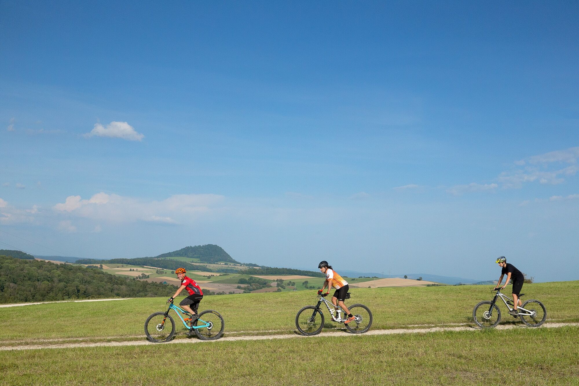
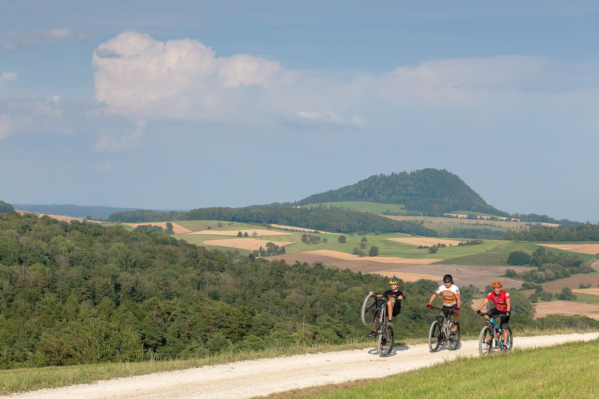

The route marked with the slogan "Vulkan Genuss Hegau" starts at the large parking lot at the festival grounds in Tengen. Enjoying the landscape and the views is the focus of this route. It is suitable for families with children in terms of difficulty and length. The small town of Tengen is the starting point of a family-friendly mountain bike route over the heights of the Randen. At first, the mountain bike route does not seem very spectacular, as it first goes downhill to the district of Blumenfeld. Shortly before Blumenfeld, the Föhrle hut invites you to take the first break. Until its incorporation in 1972, Blumenfeld was considered one of the smallest towns in Germany and is certainly worth a small detour. Further downhill it goes down to the next stage Beuren am Ried, the southernmost point of the route. Attention: In the small district of Tengen, the federal road B314 must be crossed. From there, strength and stamina are required. It goes uphill and in the forest above Beuren stands the next hut, the Brodlosenhütte. A break would also be possible here. From now on it goes uphill on a forest road in the shady forest. You cross the connecting road Blumenfeld - Weil to the left and shortly afterwards return to the right into the forest. At the forest exit, it goes left along the forest edge until shortly before Weil, another district of Tengen. Via Weil, it goes up to the heights to the Willberg, just before Watterdingen. The views down into the Hegau are just as spectacular as the view in the opposite direction, up to the Alten Postweg. That is where the route will lead, the highest point of this route. After a short descent down to Watterdingen and a right turn, the last big climb follows up to the Alten Post Weg. The last big climb on partly paved, partly gravel roads leads to the ridge of the Alten Postweg. The high ridge trail runs there almost without major inclines, with magnificent views into the Hegau and, in clear weather, to the Alps from east to west. The Altepostweghütte and the Spitzhütte lie directly on the path. There is also the possibility to break off the route there again. From here it goes downhill again, past the Lochhütte and down to Tengen to the festival grounds, the starting point of the route.
Tak
Tak
Do not ride without a bicycle helmet. The rapid descents always require the attention of everyone.
Attention: The B314 must be crossed in Beuren. Please dismount and cross the road pushing your mountain bike.
S0
- Stop at the Bibermühle in Blumenfeld https://www.bibermuehle.de/
- Visit the Mühlbach Gorge https://www.tengen.de/pb/home/tourismus+_+kultur/muehlbachschlucht.html
- Swimming fun in the Espelsee near the campsite
- Open-air museum Roman estate between Beuren and Büßlingen https://www.tengen.de/pb/home/tourismus+_+kultur/freilichtmuseum.html
Popularne wycieczki w okolicy
-
4,7
"Hegauer Kegelspiel" Alter Postweg
średniWędrówka 9,26 km -
5,0
"Hegauer Kegelspiel" Stettener Panoramaweg
średniWędrówka 7,62 km -
3,3
"Hegauer Kegelspiel" Wannenberg hike
średniWędrówka 9,35 km -
4,5
Nature trail Merishausen: Brown route
średniTrasa tematyczna 11,4 km -
4,5
SchweizMobil 593: Nordspitze Panoramaweg
średniWędrówka 13,7 km -
5,0
Vulkansee Höwenegg Rundweg
światłoWędrówka 7,05 km -
2,8
"Hegauer Kegelspiel" Hewensteig
średniWędrówka 6,23 km -
5,0
"Hegauer Kegelspiel" Hohentwieler
średniWędrówka 7,21 km -
Aacher Geißbock
średniWędrówka 13,4 km -
5,0
Hegau Waterfall Route
średniWędrówka 9,28 km
Wędrówki i tropienie


Nie przegap ofert i inspiracji na następne wakacje
Twój adres e-mail została dodana do listy mailingowej.