


Méan Martin 3-day hike - Stage 2 - From the Femma hut to the Fonds des Fours hut
2/ During this varied profile stage, you flirt with the neighboring Tarentaise. The mineral atmosphere enlivened by the torrent of the ovens may offer you the visit of some shy chamois. Late snowfields...
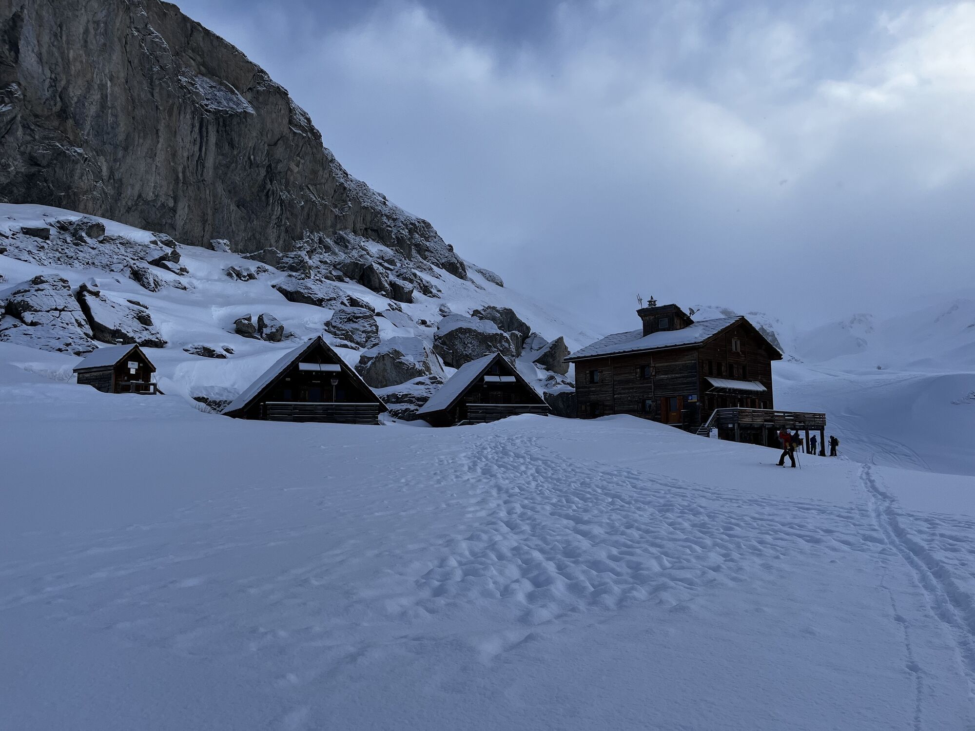
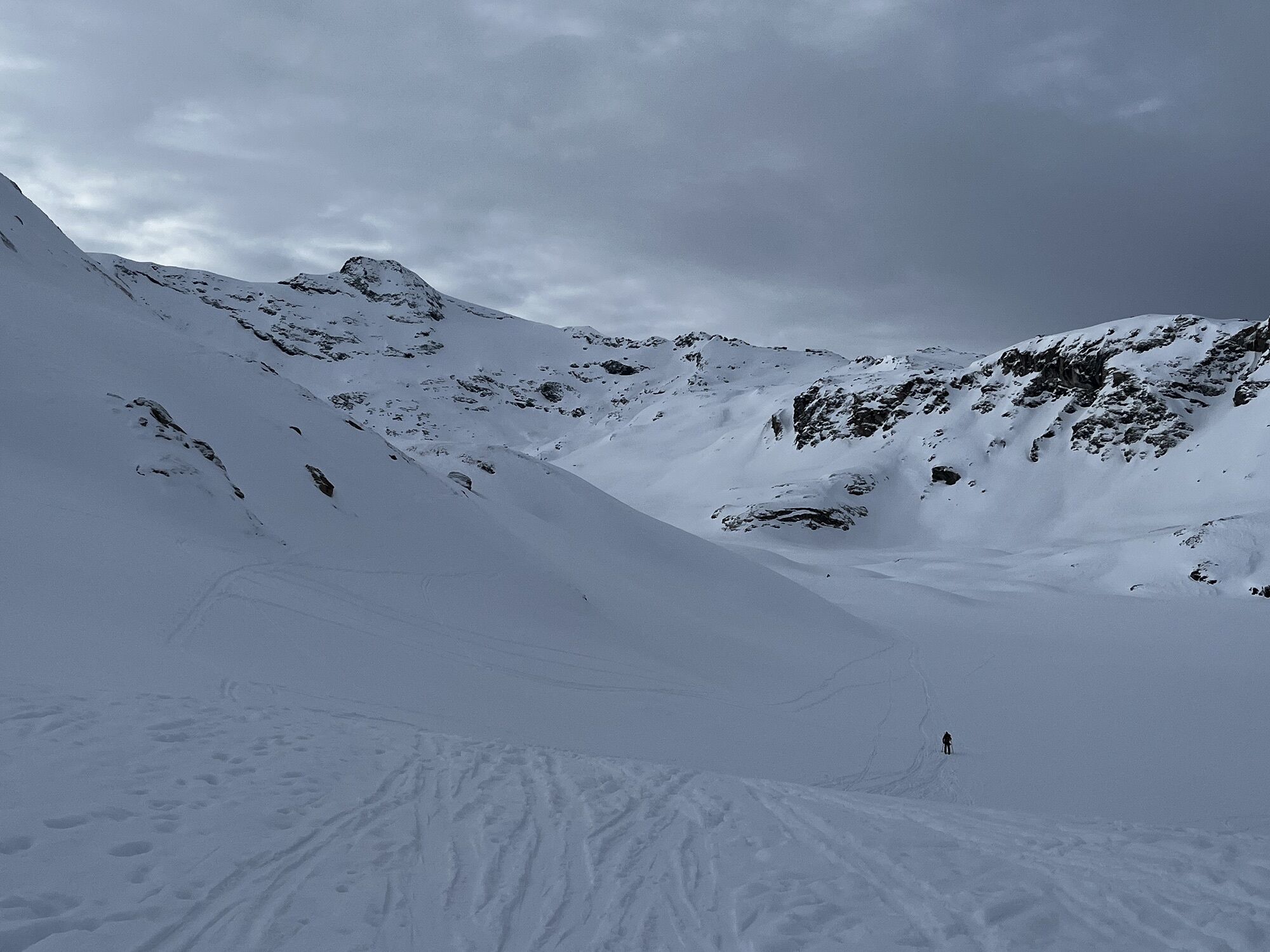
2/ During this varied profile stage, you flirt with the neighboring Tarentaise. The mineral atmosphere enlivened by the torrent of the ovens may offer you the visit of some shy chamois. Late snowfields will be numerous early in the season near the Rocheure pass at 2900m altitude. After a rocky descent, treat yourself to a contemplative break on the Plan des Fours before reaching the refuge. It seems this little high-altitude gem will be your privilege at the end of your day!

2/ On this varied stage, you flirt with the neighboring Tarentaise region. The mineral atmosphere, enhanced by the torrent des fours, may be visited by a few shy chamois. There are plenty of late season névés around the Col de la Rocheure at 2900m altitude. After a rocky descent, take a contemplative break on the plan des fours before reaching the refuge. It looks like this little high-altitude jewel will be the highlight of your day!
You are in a protected area. Pets are not allowed in the Vanoise National Park.
You must book your overnight stay in a refuge in advance.
Stay on the trails and follow the signs, and take your garbage with you.
Popularne wycieczki w okolicy
-
5,0
The Grand Méan lake via the Evettes circus
ciężkiWędrówka 13,6 km -
little 'Haute-Maurienne Vanoise' circuit
ciężkiDroga rowerowa 32,0 km -
The White Lake
światłoWędrówka 4,42 km -
Hike from the Avérole refuge through the hamlet
średniWędrówka 9,36 km -
Col de l'Iseran from Modane
ciężkiDroga rowerowa 59,5 km -
Col du Mont Cenis from Lanslebourg
ciężkiDroga rowerowa 9,84 km -
5,0
Goldtoni - Alpenbogen A067 Le Monal-Refuge de la Leisse
średnidługodystansowy szlak pieszy 27,2 km -
5,0
Goldtoni - Alpenbogen A068 Refuge de la Leisse-Termignon Val Cenis
średnidługodystansowy szlak pieszy 28,7 km -
5,0
Walking tour of the Plan du Lac refuge
światłoWędrówka 4,58 km -
Petit Mont-Cenis pass
ciężkiDroga rowerowa 18,0 km
Wędrówki i tropienie


Nie przegap ofert i inspiracji na następne wakacje
Twój adres e-mail została dodana do listy mailingowej.