Sentier des bacs et des fontaines
średni
Nawigacja
Nawigacja
Pobierz tę trasę na swój telefon komórkowy
Sentier des bacs et des fontaines
średni
Trasa tematyczna
12,42
km
Zeskanuj kod QR i rozpocznij nawigację w aplikacji bergfex.

Wędrówki i tropienie


Sentier des bacs et des fontaines
średni
Odległość
12,42
km
Czas trwania
03:30
h
Ascent
349
hm
Poziom morza
630 -
903
m
Poziom trudności: T1
Ścieżka do pobrania
Sentier des bacs et des fontaines
średni
Trasa tematyczna
12,42
km
From the balconies of Ruffieu offering panoramas of the Valromey valley, the Grand Colombier and the Dent du Chat up to the Pont des Tines, this route can be done on foot or by mountain bike to discover...
Opis
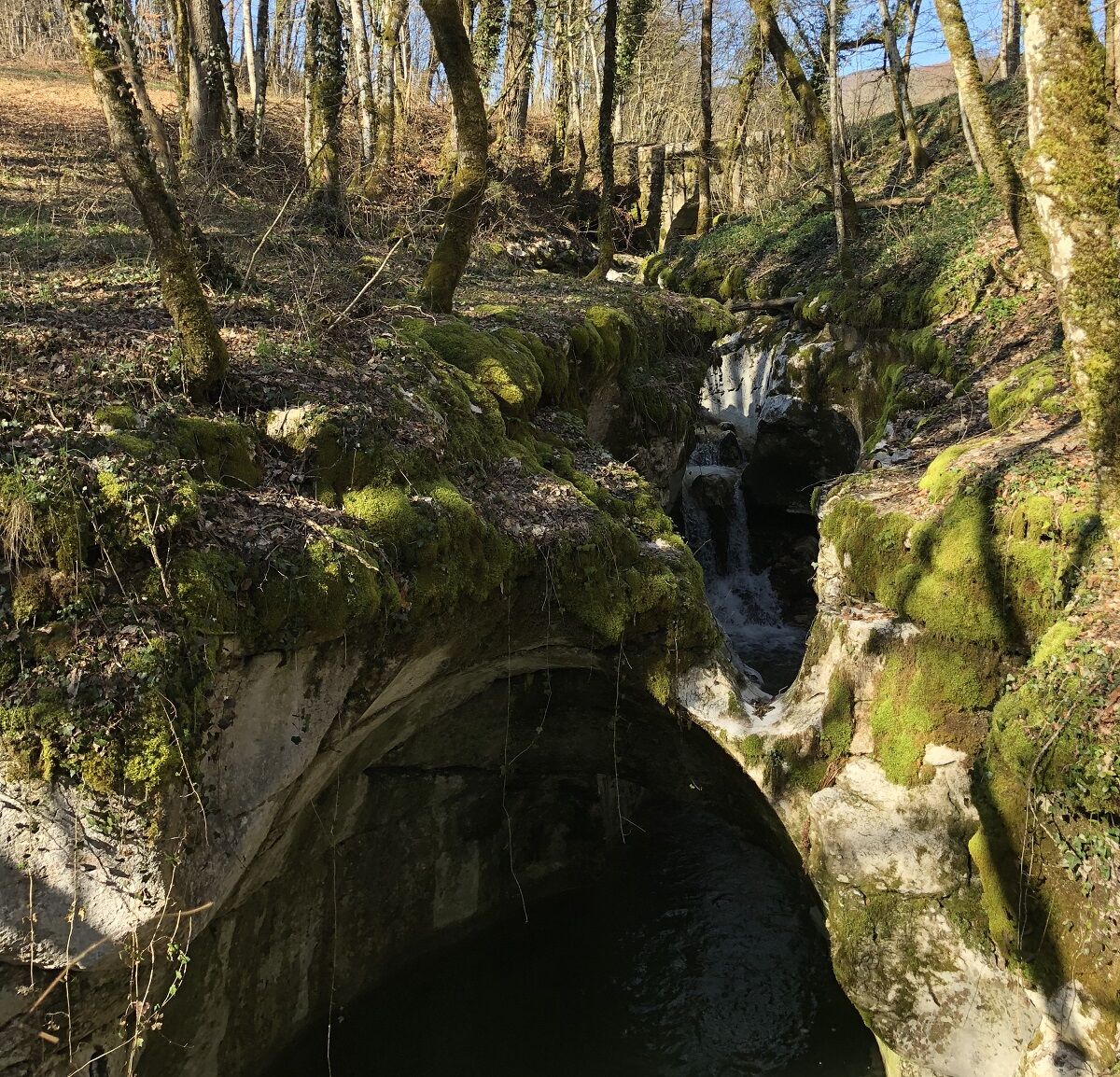
From the balconies of Ruffieu offering panoramas of the Valromey valley, the Grand Colombier and the Dent du Chat up to the Pont des Tines, this route can be done on foot or by mountain bike to discover rural life of the past starting from the center of the post office square. The 2 loops of Chatelard and Roirettes can be done in one go or on two separate outings.
Yellow signage. Follow the RS stickers for the Roirettes loop and CD for the Chatelard loop.
Yellow signage. Follow the RS stickers for the Roirettes loop and CD for the Chatelard loop.
Trasa
Ruffieu
(712 m)
Wioska
0,0 km
L'Auberge de Ruffieu
(717 m)
Restauracja
0,0 km
Église Saint-Didier
(718 m)
Miejsce kultu
0,0 km
Préoux
(688 m)
Rozliczenie
7,6 km
Ruffieu
(712 m)
Wioska
12,2 km
L'Auberge de Ruffieu
(717 m)
Restauracja
12,3 km
Trasa
Sentier des bacs et des fontaines
średni
Trasa tematyczna
12,42
km
Ruffieu
(712 m)
Wioska
0,0 km
L'Auberge de Ruffieu
(717 m)
Restauracja
0,0 km
Église Saint-Didier
(718 m)
Miejsce kultu
0,0 km
Préoux
(688 m)
Rozliczenie
7,6 km
Ruffieu
(712 m)
Wioska
12,2 km
L'Auberge de Ruffieu
(717 m)
Restauracja
12,3 km
Autor
Dostarczone przez Bugey Sud Grand Colombier Tourisme
Wycieczkę Sentier des bacs et des fontaines zapewnia outdooractive.com.

Instrukcje bezpieczeństwa
Defective signage, incidents / safety, use conflicts, illegal dumping? Locate and share the encountered problem on the national alert system using the SURICATE app or via the site https://sentinelles.sportsdenature.fr/
Informacje o przyjeździe
Parking
Several parking spaces are available in the village square of Ruffieu.
Dodatkowe informacje i wskazówki
Poziom trudności
T1
Nie ma jeszcze recenzji
Popularne wycieczki w okolicy
-
3,0
Hike: on the ridge of the Grand Colombier (circuit des crêtes)
średniWędrówka 11,3 km -
4,0
Hike: Golet au loup
światłoWędrówka 7,11 km -
Hike: Gorges de Thurignin
ciężkiWędrówka 14,2 km -
Hike: A wolf life.
światłoWędrówka 7,22 km -
Hike of the Grand Colombier starting from Munet
ciężkiWędrówka 16,0 km -
3 day-hike in Jura: hiking trails through Plateau de Retord and Grand Colombier
ciężkiWędrówka 50,9 km -
MTB track 14 red - Retord - les balcons du Mont Blanc - Espace FFC Ain Forestière
ciężkiMountainbike 29,5 km -
Hike: Tour de Retord
ciężkiWędrówka 18,6 km -
Hike: on the steps of the WW2 French resistance.
ciężkiWędrówka 17,8 km -
Cycling tour: Geological curiosities of Valromey
światłoDroga rowerowa 37,1 km

Wędrówki i tropienie

Ponad 550.000 propozycji wycieczek, szczegółowe mapy i intuicyjny planer tras sprawiają, że aplikacja jest niezbędna dla wszystkich entuzjastów przyrody.

Nie przegap ofert i inspiracji na następne wakacje
Zapisz się do newslettera
Błąd
Wystąpił błąd. Spróbuj ponownie.
Dziękujemy za rejestrację
Twój adres e-mail została dodana do listy mailingowej.
Wycieczki po całej Europie
Austria
Szwajcaria
Niemcy
Włochy
Słowenię
Francja
Holandia
Belgia
Polska
Liechtenstein
Czechy
Słowacja
Hiszpania
Chorwacja
Bośnia i Hercegowina
Luksemburg
Andorra
Portugalia
Islandia
Wielka Brytania
Irlandia
Grecja
Albania
Macedonia Północna
Malta
Norwegia
Czarnogóra
Mołdawia
Kosowo
Węgry
San Marino
Rumunia
Estonia
Łotwa
Białoruś
Cypr
Litwa
Serbia
Bułgaria
Monako
Dania
Szwecja
Finlandia