Carrefour de Chatel - Restaurant - Aix-les-Bains - Église Saint-Blaise
ciężki
Nawigacja
Nawigacja
Pobierz tę trasę na swój telefon komórkowy
Carrefour de Chatel - Restaurant - Aix-les-Bains - Église Saint-Blaise
ciężki
Jazda na rowerze
97,17
km
Zeskanuj kod QR i rozpocznij nawigację w aplikacji bergfex.

Wędrówki i tropienie


Carrefour de Chatel - Restaurant - Aix-les-Bains - Église Saint-Blaise
ciężki
Odległość
97,17
km
Czas trwania
06:30
h
Ascent
1 299
hm
Poziom morza
231 -
622
m
Ścieżka do pobrania
Carrefour de Chatel - Restaurant - Aix-les-Bains - Église Saint-Blaise
ciężki
Jazda na rowerze
97,17
km
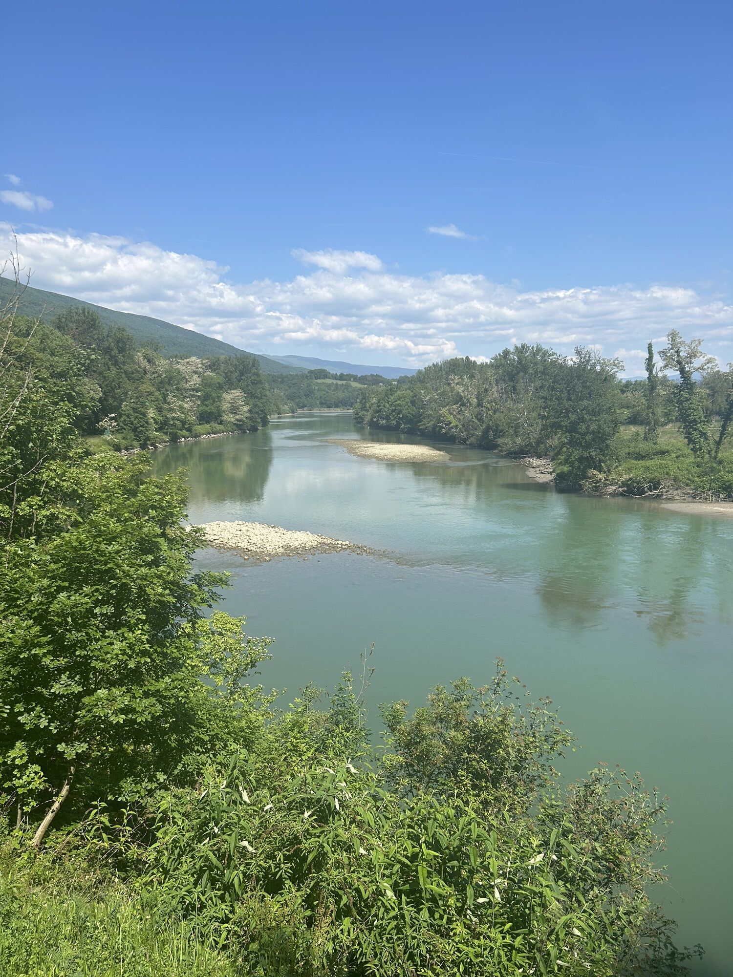
Zdjęcia naszych użytkowników

Trasa
Châtel
(268 m)
Rozliczenie
0,3 km
Chevrier
(268 m)
Rozliczenie
12,1 km
Maurin
(378 m)
Rozliczenie
30,1 km
Ferme Palatin
(622 m)
Rozliczenie
41,9 km
Aix-les-Bains
(266 m)
Miasto
57,3 km
Challière
(243 m)
Rozliczenie
68,6 km
Église Saint-Blaise
(264 m)
Miejsce kultu
92,4 km
Trasa
Carrefour de Chatel - Restaurant - Aix-les-Bains - Église Saint-Blaise
ciężki
Jazda na rowerze
97,17
km
Carrefour de Chatel
(270 m)
Korytarz/teren
0,1 km
Châtel
(268 m)
Rozliczenie
0,3 km
Restaurant
(258 m)
Restauracja
3,9 km
Seyssel
(266 m)
Wioska
4,5 km
La Trille
(335 m)
Rozliczenie
7,1 km
Rhémoz
(377 m)
Rozliczenie
7,9 km
Mieugy
(338 m)
Rozliczenie
9,1 km
Au Vergef
(269 m)
Sąsiedztwo
10,7 km
Au Bourg
(277 m)
Sąsiedztwo
10,9 km
L'Auberge d'Anglefort
(274 m)
Restauracja
11,0 km
Anglefort
(272 m)
Wioska
11,0 km
La Bonnette
(256 m)
Sąsiedztwo
11,2 km
Le Clos
(263 m)
Sąsiedztwo
11,2 km
En Vache
(251 m)
Sąsiedztwo
11,6 km
Sur les Tras
(265 m)
Sąsiedztwo
11,7 km
Chevrier
(268 m)
Rozliczenie
12,1 km
Champriond
(253 m)
Rozliczenie
12,8 km
Châtel
(241 m)
Rozliczenie
16,4 km
Le Brotalet
(238 m)
Korytarz/teren
17,3 km
Les Carrières de Landaise
(261 m)
Korytarz/teren
17,4 km
Landaize
(237 m)
Rozliczenie
17,8 km
Mollard-Dessus
(240 m)
Rozliczenie
21,2 km
La Guinguette
(237 m)
Restauracja
22,0 km
La Muraille
(235 m)
Rozliczenie
22,7 km
La Cour
(304 m)
Rozliczenie
25,5 km
Chanaz
(234 m)
Wioska
25,6 km
Praille
(306 m)
Rozliczenie
25,8 km
Le Couloir
(361 m)
Rozliczenie
26,2 km
Semelas
(350 m)
Rozliczenie
28,6 km
La Côte
(373 m)
Rozliczenie
29,7 km
Maurin
(378 m)
Rozliczenie
30,1 km
Quinfieux
(382 m)
Rozliczenie
30,6 km
Les Échenaux
(384 m)
Rozliczenie
30,7 km
Les Trois Quarts
(398 m)
Rozliczenie
30,9 km
Le Plattet
(392 m)
Rozliczenie
30,9 km
Boissière
(462 m)
Rozliczenie
31,7 km
Billon
(461 m)
Rozliczenie
32,6 km
Belvédère d'Ontex Grumeau
(599 m)
Punkt widzenia
35,1 km
Grumeau
(618 m)
Rozliczenie
35,3 km
Grottes du Communal
(621 m)
Wejście do jaskini
35,6 km
Communal
(552 m)
Rozliczenie
35,8 km
Le Petit Villard
(508 m)
Rozliczenie
38,0 km
Le Grand Villard
(567 m)
Rozliczenie
39,3 km
La Chapelle-du-Mont-du-Chat
(622 m)
Wioska
40,9 km
Le coin du bois
(620 m)
Restauracja
41,5 km
Ferme Palatin
(622 m)
Rozliczenie
41,9 km
Le Col
(589 m)
Rozliczenie
42,5 km
Panorama
(523 m)
Punkt widzenia
44,2 km
Bourdeau
(296 m)
Wioska
44,7 km
La Frasse
(352 m)
Sąsiedztwo
45,9 km
La Cafetière
(326 m)
Rozliczenie
46,3 km
Le restaurant du Port
(235 m)
Restauracja
48,9 km
Le Calypso
(235 m)
Restauracja
49,3 km
La Croix Verte
(237 m)
Rozliczenie
49,5 km
Le varon
(243 m)
Rozliczenie
49,6 km
Les Curiers
(243 m)
Rozliczenie
49,7 km
Le Bourget-du-Lac
(245 m)
Wioska
50,3 km
Terre-Nue
(235 m)
Rozliczenie
52,9 km
Les Pieds dans l'Eau
(234 m)
Restauracja
53,0 km
La Parfumerie
(235 m)
Restauracja
53,1 km
La Grande Molière
(272 m)
Sąsiedztwo
53,2 km
Cap des Séselets
(232 m)
Korytarz/teren
53,7 km
Le Clos des Mésanges
(243 m)
Sąsiedztwo
54,7 km
Restaurant du Lido
(236 m)
Restauracja
55,0 km
Tresserve
(276 m)
Wioska
55,5 km
Aix-les-Bains
(266 m)
Miasto
57,3 km
Cornin
(237 m)
Sąsiedztwo
58,0 km
Puer
(236 m)
Sąsiedztwo
59,1 km
Brison-Saint-Innocent
(287 m)
Wioska
61,5 km
Le Biollay
(282 m)
Wioska
62,5 km
Le Clos Vert
(256 m)
Sąsiedztwo
63,0 km
La Culaz
(234 m)
Korytarz/teren
66,6 km
Les Oliviers
(234 m)
Restauracja
67,4 km
Auberge de Brison
(235 m)
Restauracja
67,4 km
Challière
(243 m)
Rozliczenie
68,6 km
Groisin
(266 m)
Rozliczenie
72,9 km
Chindrieux
(274 m)
Wioska
75,2 km
Auberge du Sapenay
(279 m)
Restauracja
75,4 km
Praz
(248 m)
Rozliczenie
76,6 km
Viuz
(255 m)
Rozliczenie
77,6 km
Chessine
(298 m)
Rozliczenie
77,9 km
Ruffieux
(288 m)
Wioska
78,8 km
Diane de Chautagne
(245 m)
Restauracja
82,2 km
Serrières-en-Chautagne
(246 m)
Wioska
82,2 km
Le Château
(275 m)
Sąsiedztwo
82,9 km
La Léchère
(243 m)
Sąsiedztwo
83,0 km
La Chetraz
(247 m)
Rozliczenie
83,5 km
Mathy
(247 m)
Rozliczenie
83,7 km
Soufflet
(289 m)
Rozliczenie
84,1 km
Les Îles
(248 m)
Rozliczenie
85,5 km
Châteaufort
(300 m)
Rozliczenie
88,0 km
Caillat
(255 m)
Rozliczenie
89,5 km
La Rochette
(260 m)
Rozliczenie
90,6 km
Seyssel
(254 m)
Wioska
92,0 km
Restaurant au Fil de l'Eau
(257 m)
Restauracja
92,3 km
Église Saint-Blaise
(264 m)
Miejsce kultu
92,4 km
Seyssel
(266 m)
Wioska
92,6 km
Restaurant
(258 m)
Restauracja
93,1 km
Châtel
(268 m)
Rozliczenie
96,8 km
Carrefour de Chatel
(270 m)
Korytarz/teren
97,0 km
Nie ma jeszcze recenzji
Popularne wycieczki w okolicy
-
Hiking loop of the Magnine falls
średniWędrówka 4,38 km -
Hiking in Bugey: up to Chanduraz from Charaillin
ciężkiWędrówka 13,0 km -
3,0
Hike: on the ridge of the Grand Colombier (circuit des crêtes)
średniWędrówka 11,3 km -
4,0
Hike: Golet au loup
światłoWędrówka 7,11 km -
Cycling tour : Marshes and vineyards in Bugey
światłoDroga rowerowa 33,1 km -
Hike starting from Parves-et-Nattages: le circuit du Sorbier
światłoWędrówka 11,4 km -
Hike of the Grand Colombier starting from Munet
ciężkiWędrówka 16,0 km -
Hike: mountain pastures of the Grand Colombier
średniWędrówka 5,23 km -
Walking tour at the Lavours swamp
światłoTrasa tematyczna 2,48 km -
Hike: Grand Colombier from Culoz
ciężkiWędrówka 26,1 km

Wędrówki i tropienie

Ponad 550.000 propozycji wycieczek, szczegółowe mapy i intuicyjny planer tras sprawiają, że aplikacja jest niezbędna dla wszystkich entuzjastów przyrody.

Nie przegap ofert i inspiracji na następne wakacje
Zapisz się do newslettera
Błąd
Wystąpił błąd. Spróbuj ponownie.
Dziękujemy za rejestrację
Twój adres e-mail została dodana do listy mailingowej.
Wycieczki po całej Europie
Austria
Szwajcaria
Niemcy
Włochy
Słowenię
Francja
Holandia
Belgia
Polska
Liechtenstein
Czechy
Słowacja
Hiszpania
Chorwacja
Bośnia i Hercegowina
Luksemburg
Andorra
Portugalia
Islandia
Wielka Brytania
Irlandia
Grecja
Albania
Macedonia Północna
Malta
Norwegia
Czarnogóra
Mołdawia
Kosowo
Węgry
San Marino
Rumunia
Estonia
Łotwa
Białoruś
Cypr
Litwa
Serbia
Bułgaria
Monako
Dania
Szwecja
Finlandia