


The Negrentino San Carlo Romanesque church


Discover the picturesque village of Leontica and the popular festival dedicated to its patron saint. Cover the path taking you toward the church and enjoy for a moment the beautiful panorama when you arrive:...
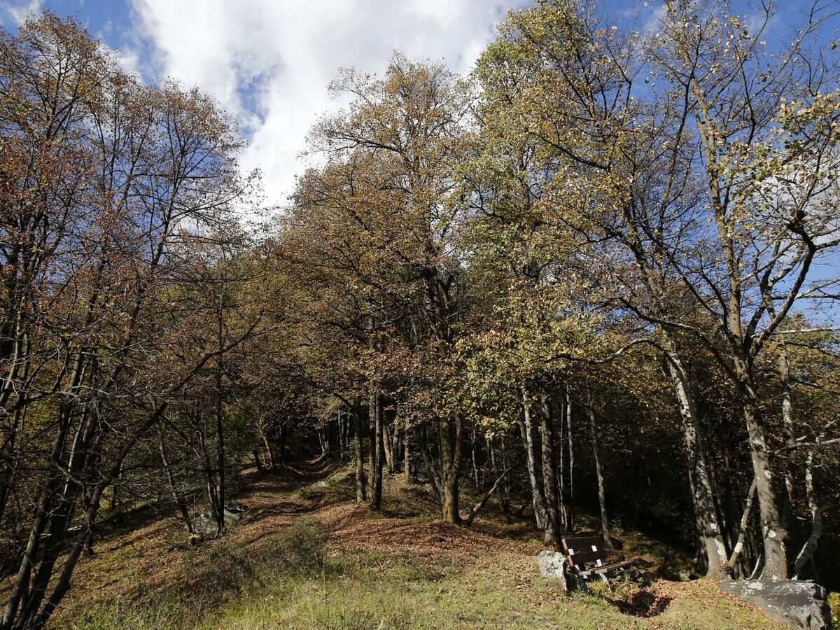
Discover the picturesque village of Leontica and the popular festival dedicated to its patron saint. Cover the path taking you toward the church and enjoy for a moment the beautiful panorama when you arrive: the wide valley floor and the majestic surrounding mountains.
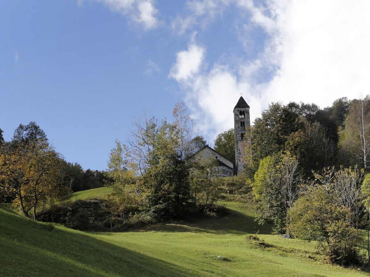
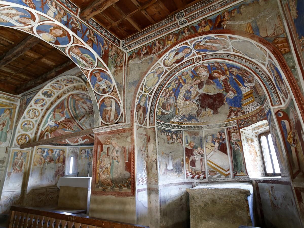
The (11th Century) Negrentino Romanesque church of San Carlo, is located on the old Nara mule-track, and richly deserves a visit. It is indeed one of the most remarkable in Ticino, renowned thanks to its stunning architectural layout as well as its precious Romanesque and late-Gothic frescoes.
The excursion starts in Leontica, a traditional and secluded village, which is enlivened every year by the popular festival dedicated to its patron saint (on the 24th of June, or the closest Sunday). Not to be missed, if you have the chance, is the traditional historical soldiers' parade. History has it that the tradition follows a vow made by people from valley Blenio valley who took part in the Russian campaign with Napoleon's armies. They promised that if they were saved, they would honour their patron saint by establishing a symbolic army.
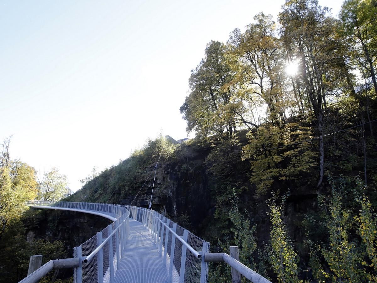
After having picked up the keys of the church that can be found in Acquarossa at the Ristorante Stazione, Ristorante Valsole or Ristorante Rubino, you start walking, through the green pastures, along the road which takes you to the Nara car park, from where you can follow the well-signed path which after an initial incline takes you down to Negrentino. A footbridge has recently been built permitting visitors easier and safer access to the church. Once you have reached the church, you can stop to admire the beauty of not only the church itself, but stunning panorama as well, which opens towards the valley floor and the majestic surrounding mountains. The path carries on downward following a signed path toward Prugiasco. Here, at the foot of the downhill section, you can take the bus to go back or you can stay a bit more for a brief, but rewarding, visit to the parish church of Sant'Ambrogio, built in 1700.


Tak
Hiking boots
Sun cap
Water-bottle
Sunglasses
Sun cream
Hiking map
Camera
Food
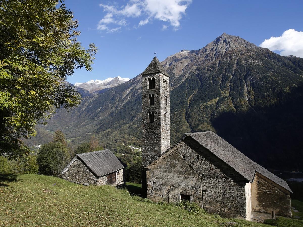
A more challenging and steeper hill route can be climbed by following the path from Prugiasco towards the Negrentino church. This path allows you to admire from far below the beautiful architecture of the apses and the bell tower. If you prefer a longer itinerary, you can start from Acquarossa heading towards Prugiasco, with a stop in Negrentino, returning to Comprovasco via Leontica.
Montagnepulite: This project was born to promote an effective management and sustainable use of mountain huts in Ticino, and in particular the litter management. The responsible management of litter in the mountains is a matter of common sense. We can all contribute: www.montagnepulite.ch
To explore the route, we recommend buying the official maps of the Federal Office of Topography Swisstopo.
In addition, the following website map.geo.admin.ch offers constantly updated data.
Popularne wycieczki w okolicy
-
Lukmanier Alps
średniWędrówka 13,2 km -
5,0
lago retico
światłoWędrówka 9,81 km -
3-Tagestour Greina-Lucomagno: Capanna Bovarina - Lukmanierpass (Etappe 3)
średniWędrówka 7,97 km -
Cima del Simano (2580 m)
Wędrówka 9 km -
5,0
Cusié > Capanna Quarei > Laghetto dei Cadabi > Alpe di poxxo > Cusié
średniWędrówka 13,0 km -
5,0
Hiking to Tremorgio and Morghirolo Lakes
ciężkiWędrówka 24,2 km -
Capanna Quarnei
światłoWędrówka 10,8 km -
4,7
The Source of the Brenno River
światłoWędrówka 6 km -
5,0
Cancorì Bike (SwitzerlandMobility 383)
ciężkiMountainbike 23,8 km -
Via Alta Crio
ciężkidługodystansowy szlak pieszy 106,0 km
Wędrówki i tropienie


Nie przegap ofert i inspiracji na następne wakacje
Twój adres e-mail została dodana do listy mailingowej.