


Alpine Lakes Trekking - Stage 2: Capanna Poncione di Braga-Robiei
Poziom trudności: T4
The vast green slopes of the Alpe Masnee, sunny since the morning, accompany us for the first carefree hour of ascent. A sort of warm-up exercise. Then a long rocky ridge – with, on our right, the small...
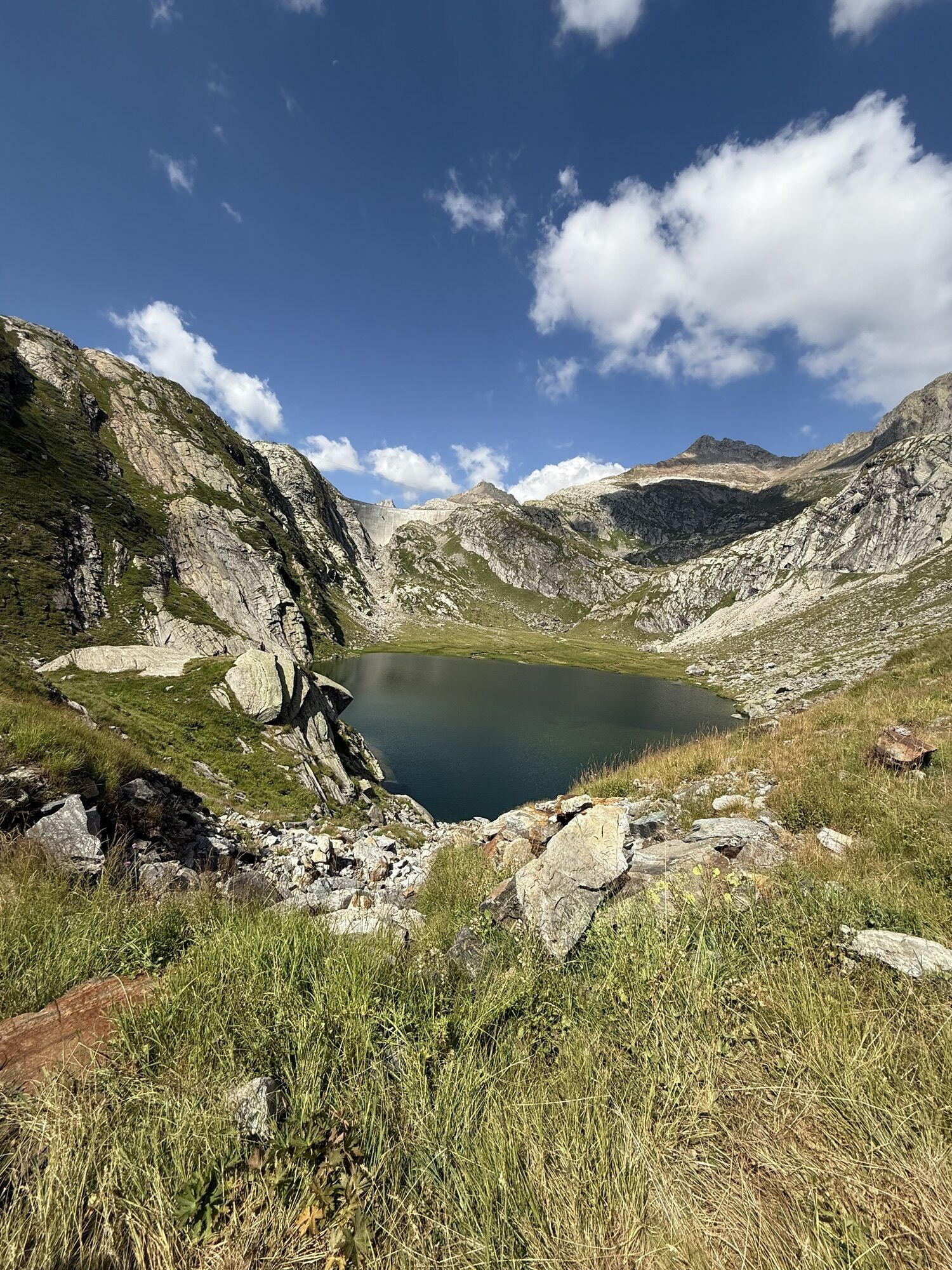
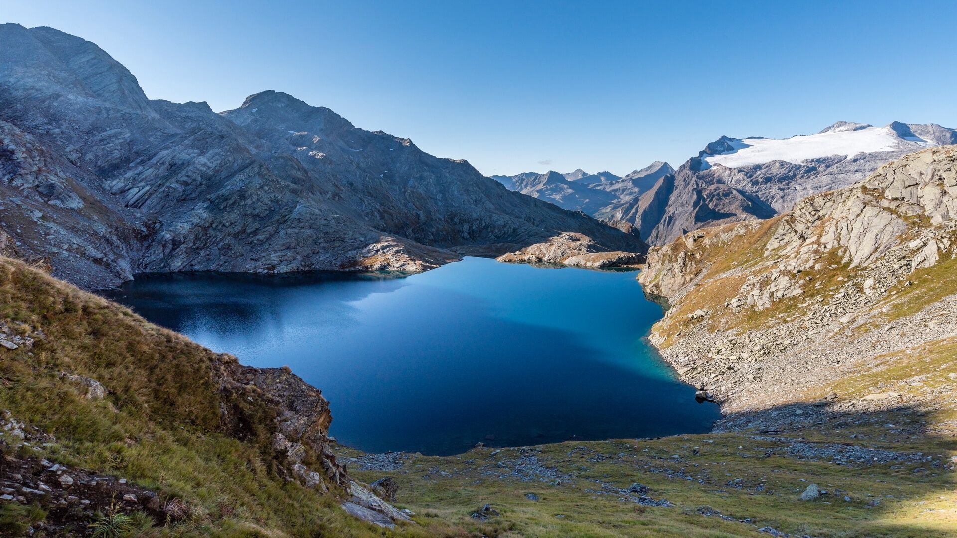
The vast green slopes of the Alpe Masnee, sunny since the morning, accompany us for the first carefree hour of ascent. A sort of warm-up exercise. Then a long rocky ridge – with, on our right, the small gem of Lake Froda – leads the way towards Poncione di Braga.
However, our goal is not the summit, but the Bocchetta della Froda, a wide saddle located to its right. From the pass the view extends over countless peaks, primarily the Basòdino, the second highest massif of the Ticino Alps, crowned by its glacier, the largest in the canton.
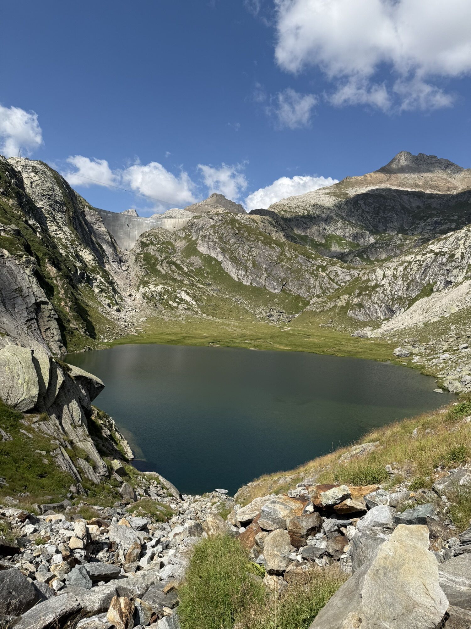
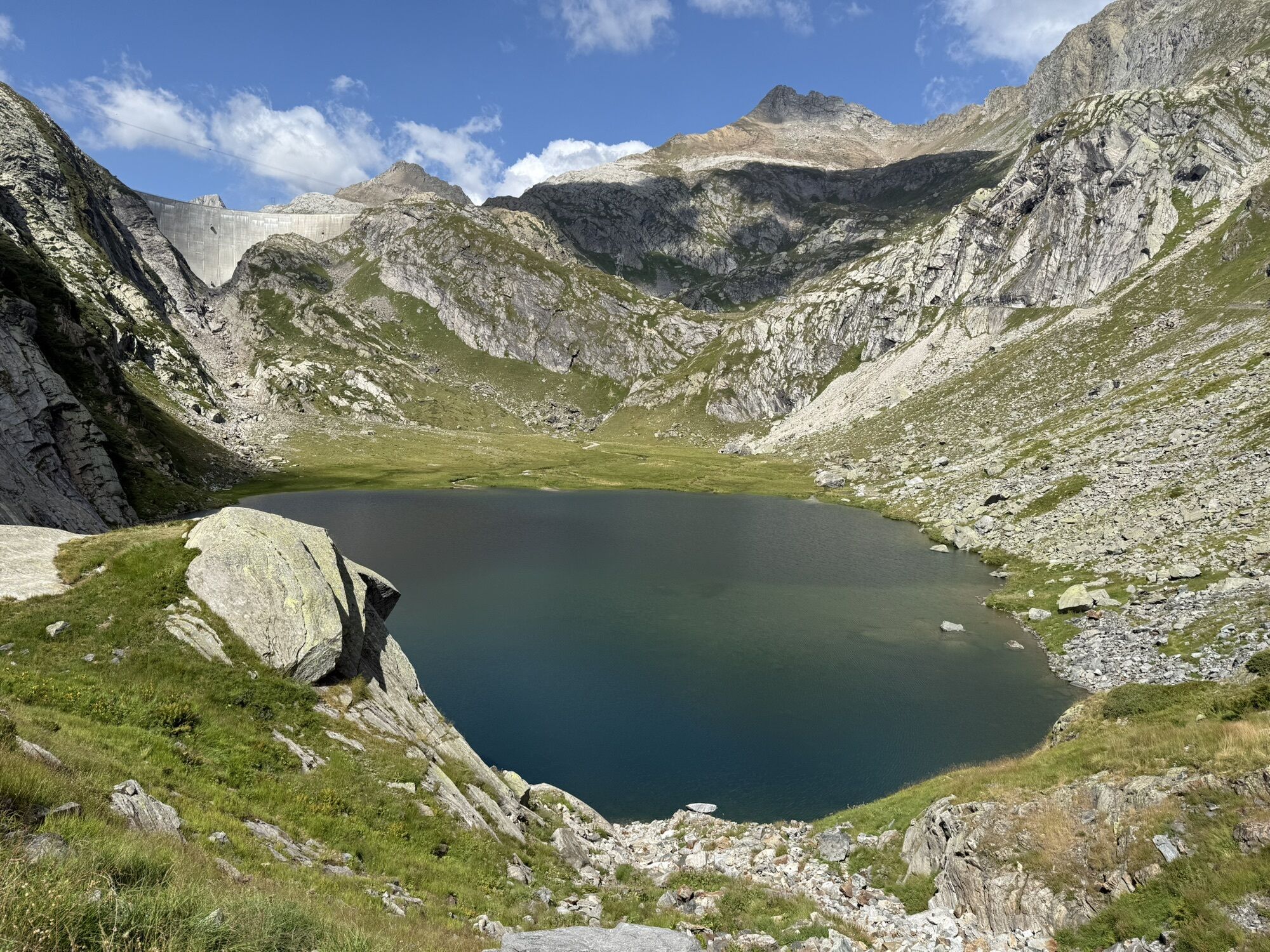
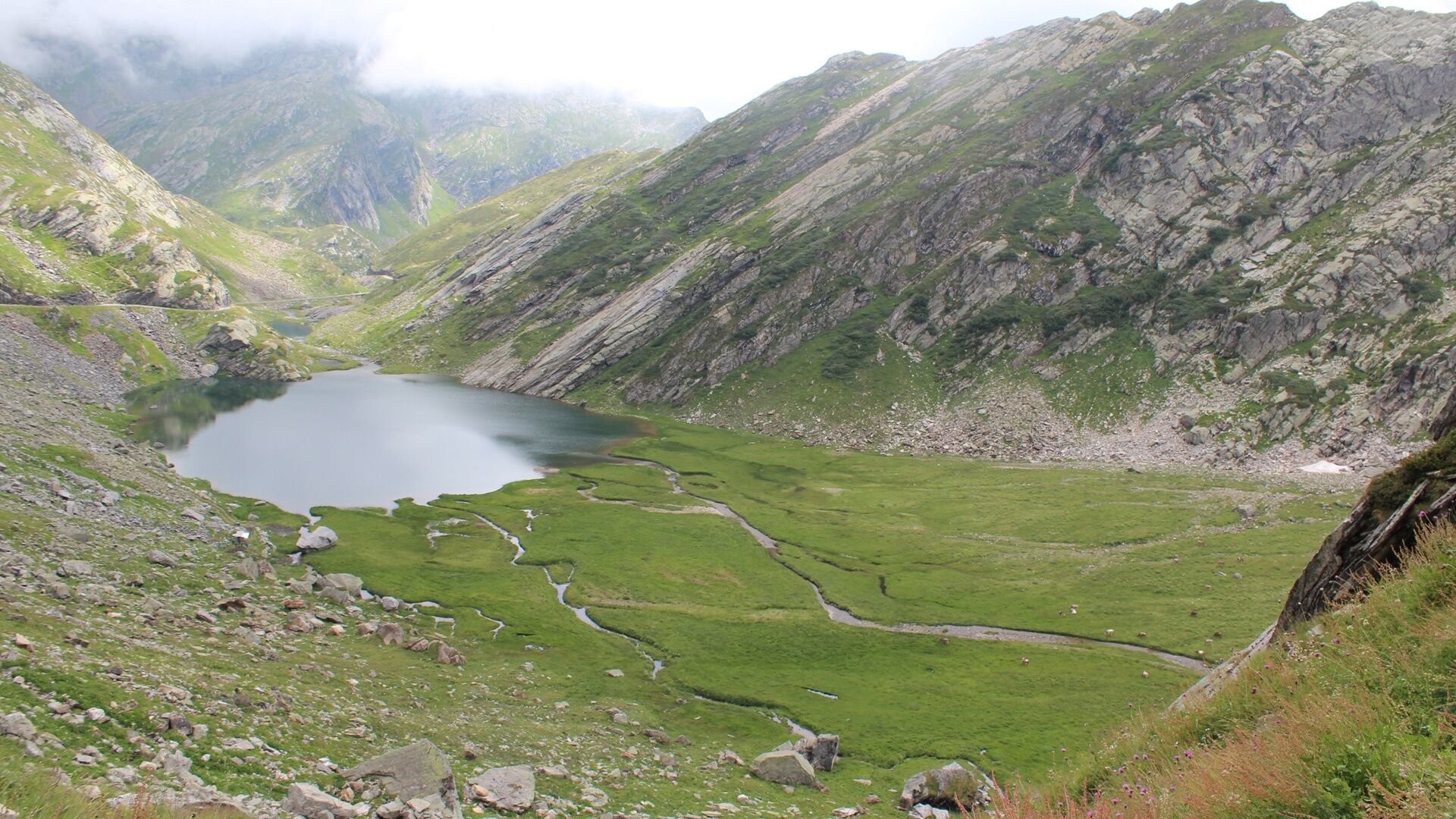
Now we just have to gradually descend towards the Robièi basin. With a bit of luck we can admire herds of ibex grazing up close. The trail, increasingly comfortable, skirts Lake Nero, then it’s the turn of Lake Bianco. And finally we reach Robièi, a place dear to many local and non-local hikers, also thanks to the cable car that goes up from Val Bavona.


Capanna Poncione di Braga-Omino della Costa-Filo della Tanèda-Bocchetta della Froda-Lake Nero-Lake Bianco-Lièlp-Robièi
Tak
good hiking boots
appropriate clothing
sunglasses, sun protection
1:25,000 map, altimeter, ev, GPS
small first aid kit, emergency thermal blanket
enough food and drinks
identity card, cash money (francs and euros)
The Alpine Lakes Trekking mainly follows mountain trails (T3 according to the hiking difficulty scale) with sections of alpine path (T4). It should not be taken lightly, especially due to the length of some stages and the altitude, which sometimes approaches 3000 meters.
Therefore, the following are required:
adequate physical condition detailed planning (current conditions, weather, ...) sure-footedness on uneven terrain (scree, ...)Not to be underestimated:
high altitude rapid weather changes presence of snowfields at the beginning of the season travel times (especially in large groups) often no phone reception lack of potable water sources along some stagesInternational emergency number: 112
112 is the general emergency number. By calling it, your call is transferred directly to the competent rescue unit (ambulance, police, fire brigade). 112 can be called on GSM networks even if the SIM card or the phone is locked. In almost all countries, 112 works on GSM networks. Outside Switzerland, it works even without a SIM card.
T4
https://www.vialtavallemaggia.ch/
https://www.capanneti.ch/ (huts)
https://map.geo.admin.ch/ (topographic map)
http://www.robiei.ch/ (Robièi cable car)
Some huts open their doors already in June, when the connecting stages are usually still snow-covered.
Generally, the best season for trekking is from July to September/October. However, even in the middle of summer it is advisable to contact the wardens to inquire about the passability of the route.
Booking accommodations in advance is mandatory to avoid unpleasant surprises and finding yourself without lodging.
Popularne wycieczki w okolicy
- 4,7
Fusio-Lake Mognola-Fusio
średniWędrówka 8,94 km - 4,5
Lakes Orsino, Orsirora and Valletta Route
Wędrówka 12,8 km - 4,8
Ciaspolata al Rifugio Maria Luisa
średniRakieta do chodzenia po śniegu 11,2 km - 4,0
Foroglio-Calnègia-Foroglio
średniWędrówka 8,37 km Via Alta Vallemaggia
ciężkiWędrówka 169,7 km- 4,0
Capanna Piansecco
światłoRakieta do chodzenia po śniegu 7,26 km Glaciological Path
średniWędrówka 8,18 km- 5,0
Toce Waterfall - Riale - San Giacomo Pass road
średniWędrówka 10,9 km - 4,0
Realp - Witenwasseren - Rotondohütte - Leckihorn - Rottällihorn - Stelliboden - Realp
światłoWycieczka narciarska 19,7 km - 5,0
Bignasco-San Carlo
średniWędrówka 12,8 km

Wędrówki i tropienie


Nie przegap ofert i inspiracji na następne wakacje
Twój adres e-mail została dodana do listy mailingowej.