


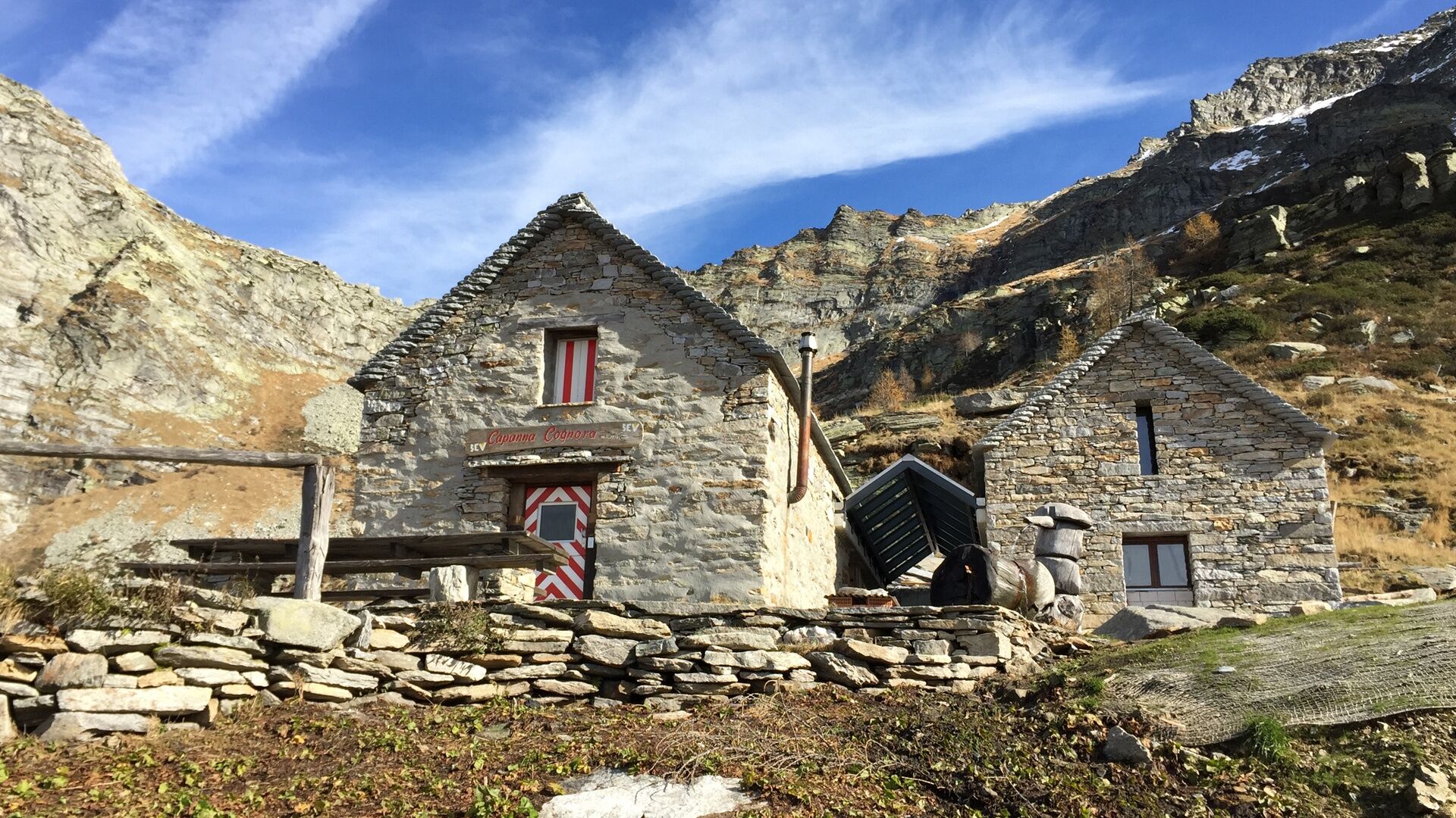
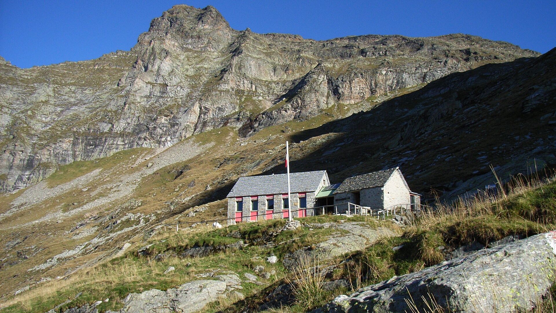
Via Alta della Verzasca - Stage 5: Capanna Cognora-Capanna Barone
Poziom trudności: T4


From Cognora mountain hut (1938 m) the prepared path takes you beneath the majestic Cima Bianca peak going to Passo di Piatto (2111 m). *After Passo Piatto the route goes southward and passes the foot...
From Cognora mountain hut (1938 m) the prepared path takes you beneath the majestic Cima Bianca peak going to Passo di Piatto (2111 m). *After Passo Piatto the route goes southward and passes the foot of Pizzo dei Laghetti, Pizzo della Bedéia and Pizzo di Piancói, a balcony at the top of Val Vegornèss! From near Pizzo di Piancói, you will pass many pastures and screes on your way to Barone mountain hut (2172 m). A slight detour before you get there will take you to Barone lake (2391 m) or, better still, you can wrap up this excellent hike on Verzasca's highest summit, Pizzo Barone (2864 m). It will take you another 1.5 hours to reach the summit.
*“Via Nicola Balestra” variant, difficulty T6 - Time 6 hours
There is an alternative route starting at Passo di Piatto, albeit a very challenging one. A commemorative plaque dedicated to a friend and alpine guide Nicola Balestra who tragically disappeared on Monte Bianco in 2006 signals the start. This route is not prepared and is only for expert mountaineers. The trail is signposted up to Uomo di Campionigo (2572 m), an unmistakeable towering monolith, twenty metres high and standing against the sky like a flame. The descent is not marked and goes south over ledges and screes until you find the path going west to Barone mountain hut.
Capanna Cognora-Passo di Piatto-Capanna Barone
Tak
Tak
Equipment
Alpine equipment is required: good boots and the right clothes (sudden changes in the weather may occur with snowfalls below 2000 metres even in summer). It’s also advisable to carry 20 m of 8 mm rope, two or three clips, a lanyard, webbing and provisions.
Things to remember
- Leave the huts as early as possible (especially for the second and the fourth stage).
- Pay particular attention to the weather forecast, so you can avoid going onto ridges in bad weather or fog.
- Do not underestimate the difficulty of managing a large group.
- If you're unsure, don't do it.
- During heavy storms, beware of materials in the small streams near the mountain huts (they usually return to normal after a few hours).
Level of difficulty
The SEV Società Escursionistica Verzaschese (Verzasca outdoor association) specifies that it is an alpine crossing and not simply a hike: we therefore recommend good training and some experience to negotiate the hardest parts. Via Alta is rated from T4 to T6 in the new classification of the grades of difficulty published by the SAC (Swiss Alpine Club).
T6 - Includes ridges which are very exposed in parts, use of hands required (II° grade maximum).
T5 - Expert hikes with some exposed places.
T4 - Challenging hike.
T4
Popularne wycieczki w okolicy
-
4,3
Sentiero etnografico Revöira (SvizzeraMobile 629)
średniWędrówka 7,97 km -
3,5
Entlang der Verzasca von Sonogno via Brione nach Lavertezzo
światłoWędrówka 14,5 km -
4,3
Sentiero Verzasca (SvizzeraMobile 74) - Stage 1: Sonogno-Lavertezzo
średnidługodystansowy szlak pieszy 13,4 km -
5,0
Lavertezzo-Brione Verzasca
światłoWędrówka 6,50 km -
4,6
BoBosco Kugelbahn
światłoWędrówka 6,30 km -
4,0
Fusio-Lago Mognola-Fusio
średniWędrówka 8,94 km -
Mognola Rock Climbing
Wspinaczka 8,93 km -
5,0
Via Alta della Verzasca - Stage 3: Capanna Cornavosa-Capanna Efra
ciężkiWędrówka 13,3 km -
Lake Efra Trail
ciężkiTrailrunning 13,6 km -
Via Alta Vallemaggia - Stage 6W: Rifugio Alpe Fontana-Fusio
średniWędrówka 8,65 km
Wędrówki i tropienie


Nie przegap ofert i inspiracji na następne wakacje
Twój adres e-mail została dodana do listy mailingowej.