Nawigacja
Pobierz tę trasę na swój telefon komórkowy
Mapa
FFC bike circuit no. 16: the Col de Vence loop
średni
Droga rowerowa
55,24 km
Zeskanuj kod QR i rozpocznij nawigację w aplikacji bergfex.
QR Code
Wędrówki i tropienie
Pobierz dla iOS
Pobierz dla systemu Android

FFC bike circuit no. 16: the Col de Vence loop

średni
Droga rowerowa
Odległość
55,2 km
Czas trwania
05:30 h
Ascent
971 hm
Poziom morza
264 - 1 023 m

Poziom trudności: 3

Ścieżka do pobrania
Mapa
FFC bike circuit no. 16: the Col de Vence loop
średni
Droga rowerowa
55,24 km

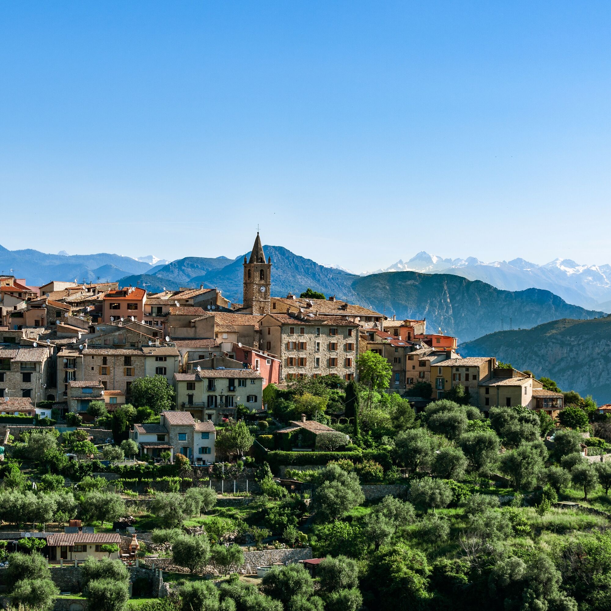
This loop opens on Coursegoules, a village located north of Vence after the pass. It is the first village of the Préalpes d’Azur Regional Natural Park.

The Jardin du vallon du Brec, located on the route,...

Opis

This loop opens on Coursegoules, a village located north of Vence after the pass. It is the first village of the Préalpes d’Azur Regional Natural Park.

The Jardin du vallon du Brec, located on the route, is open from April 1 to June 30 and from September 1 to 30, by appointment. It will surprise nature lovers and those who know how to take their time.

All outdoor activities of the Nice Côte d'Azur Metropole are on https://outdoor.nicecotedazur.org  

Trasa
Vence
(319 m)
Miasto
0,0 km
Chapelle Saint-Jean-Baptiste
(1 010 m)
Miejsce kultu
16,7 km
Chapelle Saint-Roch
(458 m)
Miejsce kultu
35,8 km
Chapelle Saint-Antoine
(448 m)
Miejsce kultu
36,2 km
Gattières
(287 m)
Wioska
44,8 km
Les Fonts
(287 m)
Sąsiedztwo
52,1 km
Chapelle du Rosaire
(331 m)
Miejsce kultu
54,0 km
Trasa
Mapa
FFC bike circuit no. 16: the Col de Vence loop
średni
Droga rowerowa
55,24 km
Sainte-Anne
(312 m)
Sąsiedztwo
0,0 km
Vence
(319 m)
Miasto
0,0 km
La Conque
(329 m)
Sąsiedztwo
0,0 km
Saint-Martin
(319 m)
Sąsiedztwo
0,2 km
Plan de Noves
(364 m)
Sąsiedztwo
0,6 km
Les Termes
(941 m)
Korytarz/teren
10,6 km
La Garussière
(926 m)
Korytarz/teren
10,8 km
Saut du Ray
(886 m)
Wodospad
13,2 km
Chapelle Saint-Antoine
(1 007 m)
Miejsce kultu
16,4 km
Coursegoules
(1 043 m)
Wioska
16,6 km
Chapelle Saint-Jean-Baptiste
(1 010 m)
Miejsce kultu
16,7 km
Le Collet
(965 m)
Sąsiedztwo
16,7 km
Bézaudun-les-Alpes
(884 m)
Wioska
23,6 km
Chapelle Saint-Roch
(643 m)
Miejsce kultu
27,7 km
Bouyon
(641 m)
Wioska
27,8 km
Église Saint-Trophime
(637 m)
Miejsce kultu
27,9 km
Chapelle Saint-Bernardin
(639 m)
Miejsce kultu
28,0 km
Chapelle Saint-Pons
(624 m)
Miejsce kultu
28,1 km
Chapelle Saint-Roch
(458 m)
Miejsce kultu
35,8 km
La mangiuca
(455 m)
Restauracja
35,9 km
Le Broc
(444 m)
Wioska
36,0 km
L'estragon
(453 m)
Restauracja
36,1 km
Chapelle Saint-Antoine
(448 m)
Miejsce kultu
36,2 km
Carros-Village
(393 m)
Rozliczenie
39,4 km
Carros
(183 m)
Miasto
40,3 km
Gattières
(287 m)
Wioska
44,8 km
Mini-Thaï
(302 m)
Restauracja
48,7 km
Avocado
(303 m)
Restauracja
48,9 km
La Coste
(313 m)
Korytarz/teren
49,1 km
Saint-Jeannet
(442 m)
Wioska
49,1 km
Le Cougnet
(365 m)
Sąsiedztwo
52,0 km
Les Fonts
(287 m)
Sąsiedztwo
52,1 km
L’Abey
(378 m)
Sąsiedztwo
52,7 km
Le Suve
(288 m)
Sąsiedztwo
53,2 km
Le Vallon de Garibou
(298 m)
Sąsiedztwo
53,4 km
L’Adrech
(344 m)
Sąsiedztwo
53,5 km
La Fontette
(304 m)
Sąsiedztwo
53,9 km
Chapelle du Rosaire
(331 m)
Miejsce kultu
54,0 km
Le Claoux
(359 m)
Sąsiedztwo
54,1 km
Saint-Martin
(319 m)
Sąsiedztwo
54,4 km
Vence
(319 m)
Miasto
54,4 km
Fonzeri
(331 m)
Sąsiedztwo
54,6 km
La Conque
(329 m)
Sąsiedztwo
55,2 km
Informacje o wycieczce

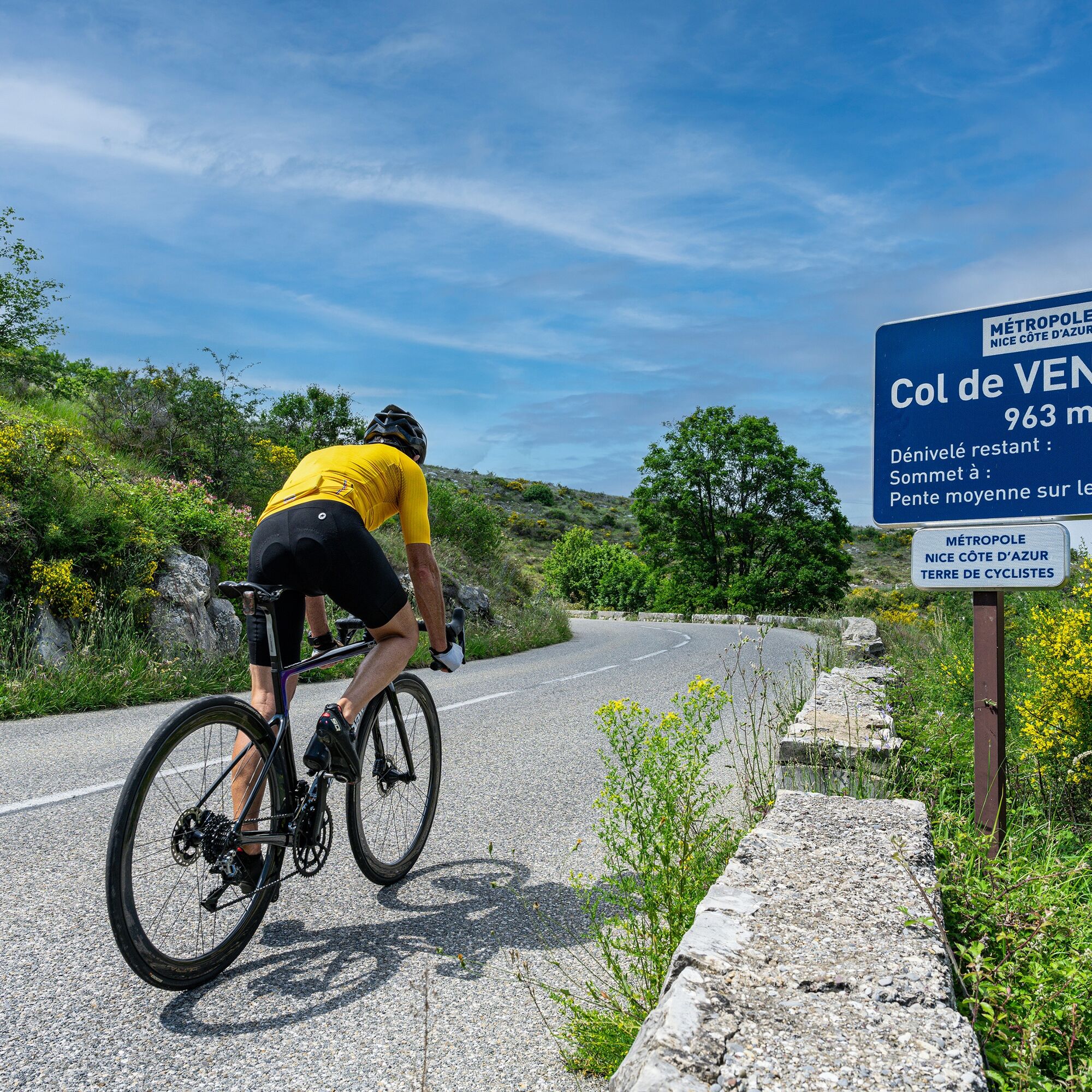
Overlooked by the legendary Col de Vence, it was fitting to trace a sporty loop starting from Vence and leading to the summit of this giant with its wild and lunar landscape (963 m,) with average slopes of 6.63% and a passage at 9%. 

Technologia
3 / 6
Stan
3 / 6
Krajobraz
5 / 6
Doświadczenie
5 / 6
Dostępny przez cały rok
Sty
Lut
Mar
Kwi
Maj
Cze
Lip
Sie
Wrz
Paź
Lis
Gru
Udostępnij trasę
Mapa
FFC bike circuit no. 16: the Col de Vence loop
średni
Droga rowerowa
55,24 km
Błąd
Wystąpił błąd. Spróbuj ponownie.
Informacje o trasie
Trasa
 From the starting sign located at the large roundabout at the entrance to Vence, take Victor Tuby street which leads you directly to the sign announcing the foot of the Col de Vence. Follow the RM 2 towards Coursegoules which leads directly to the pass whose summit reaches 963 m. The Col de Vence is known to be difficult, it has been used many times by Paris-Nice racers. It is 9.7 km long with maximum slopes reaching 9%. The steep slopes are located right from the start and the climb in summer becomes tough due to the heat, the landscape quickly becomes desert-like, without shade as you ascend. Once past the pass, a slight descent brings us to the foot of the village of Coursegoules which you reach by taking the RD 8 towards Bouyon while climbing a short slope. At the top of the hill, below the village, the road descends towards Bouyon. When crossing the village, be cautious of speed bumps which can be very dangerous to pass over. From this point, continue straight on the RD 1 towards Nice-Le Broc (Km 27.5). The route passes through the villages of Le Broc and Carros village. At the traffic light exit, turn right, towards Gattières via the RM2209 (Km 39.4). This road will bring cyclists back to the starting point passing through Gattières and the Peyron de Saint-Jeannet.
Najważniejsze informacje geologiczne

Tak

Wycieczka na szczyt

Tak

Sprzęt
Wear an approved helmet Check the condition of your tires Start with a repair kit in case of puncture Preferably use at least a flashing LED light to fix on the seat post to be seen by motorists

Before leaving:  

Make sure the bike is in perfect mechanical condition, including tires and brakes Ensure the bike is properly adjusted to your body shape Wearing a helmet is strongly recommended Bring a repair kit Remember that the traffic code applies to cyclists at all times Never ride more than two abreast and move into single file when traffic conditions require it Respect other road users as you would want them to respect you Choose a route suited to your physical abilities Inform those around you of your itinerary Check the weather conditions A first aid kit is not essential but can be very useful Inform yourself and keep emergency phone numbers Respect the environment by not throwing your food packaging on the roadside If you must return at nightfall, make sure to see and be seen
Instrukcje bezpieczeństwa

Emergency number: 112

 BASIC RULES

 Choose a route suited to your physical condition, do not overestimate your abilities  Remember to carry an ID and a number to call in case of danger Respect traffic lights  Prefer using bike lanes when they exist In other words: a sign can compel you. If the "bike lane" sign is square: you decide. If it is round, you must use this lane. Respect the environment and other road users

  GOOD PRACTICES FOR GROUP RIDING

  Riding two abreast is allowed, but single file is required: at nightfall or when visibility is poor when a vehicle wishing to overtake signals its approach.  In case of breakdown, move to the bottom side of the road and not on the road At a “Stop”, yellow light, fixed or flashing red light, make a full stop for the entire group. Communicate within the group and use verbal and gestural signals to indicate obstacles or vehicles. A single gesture or word can prevent a fall or accident.
Informacje o przyjeździe
Przybycie

Via the A8 motorway "La Provençale" :

 From Paris, Lyon, Marseille, Aix-en-Provence take exit Villeneuve-Loubet / Cagnes-sur-Mer No. 47

From Nice take exit Cagnes-sur-Mer No. 48

Then take the RM 336, the M 36 expressway and the M 2210 to reach Vence directly

Transport publiczny

The Lignes d’azur network offers a single fare across the entire Nice Côte d’Azur Metropole. Validation is mandatory each time you board the bus regardless of the ticket used.

To consult all fares and routes, click here: www.lignesdazur.com 

Parking

Marie Antoinette Parking near the panoramic starting point – Paid surface parking – 153 spaces

Dodatkowe informacje i wskazówki
Poziom trudności

3

Dodatkowe informacje

To learn more about our destination, visit our site

Wskazówki

Sporty circuit (FFC color: red)

Wędrówki i tropienie

Wędrówki i tropienie

Pobierz dla iOSPobierz dla systemu Android
Wędrówki i tropienie
Ponad 550.000 propozycji wycieczek, szczegółowe mapy i intuicyjny planer tras sprawiają, że aplikacja jest niezbędna dla wszystkich entuzjastów przyrody.
bergfex