


BARDONECCHIA Forte Jafferau Ring
Poziom trudności: S2


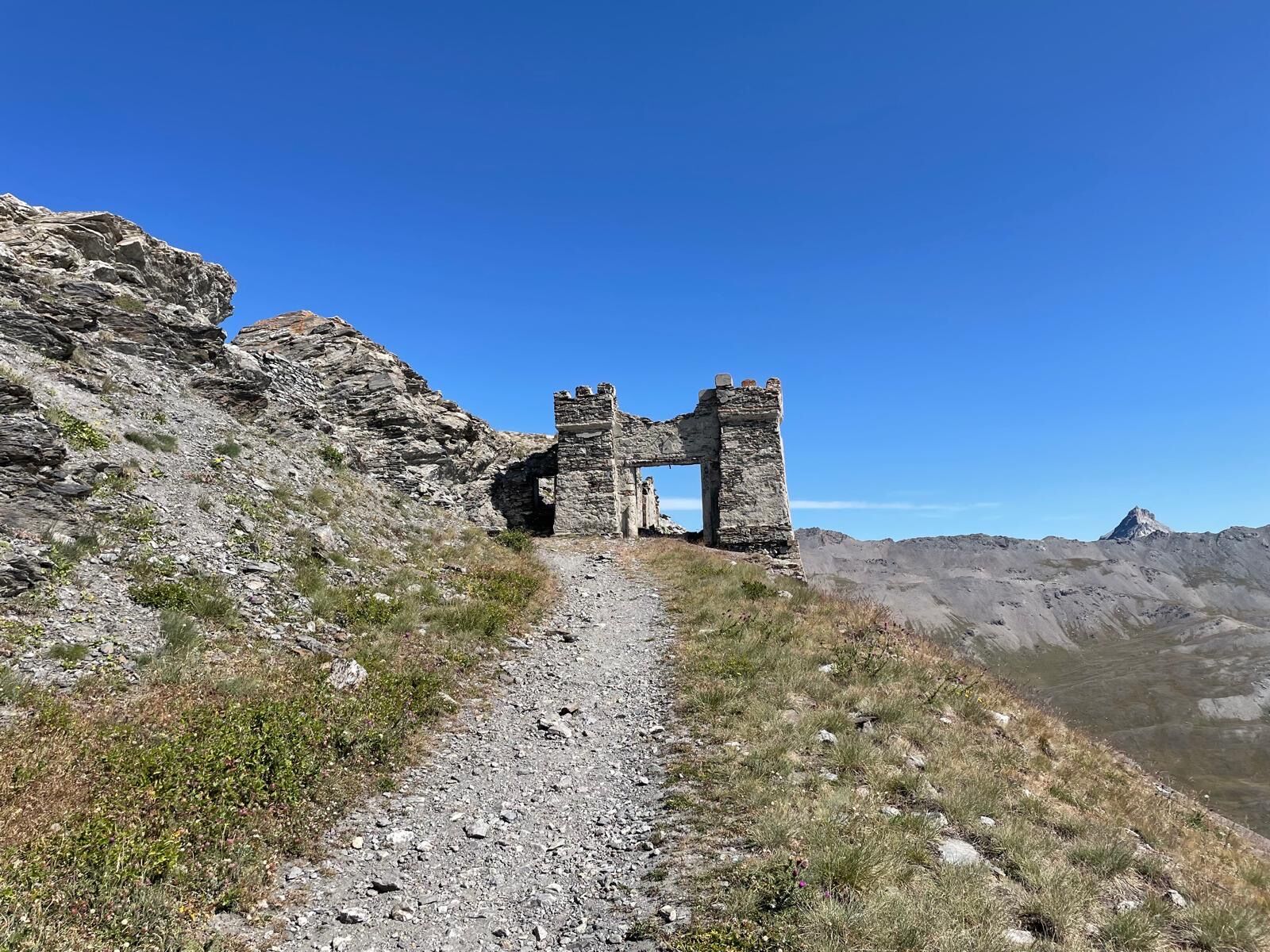
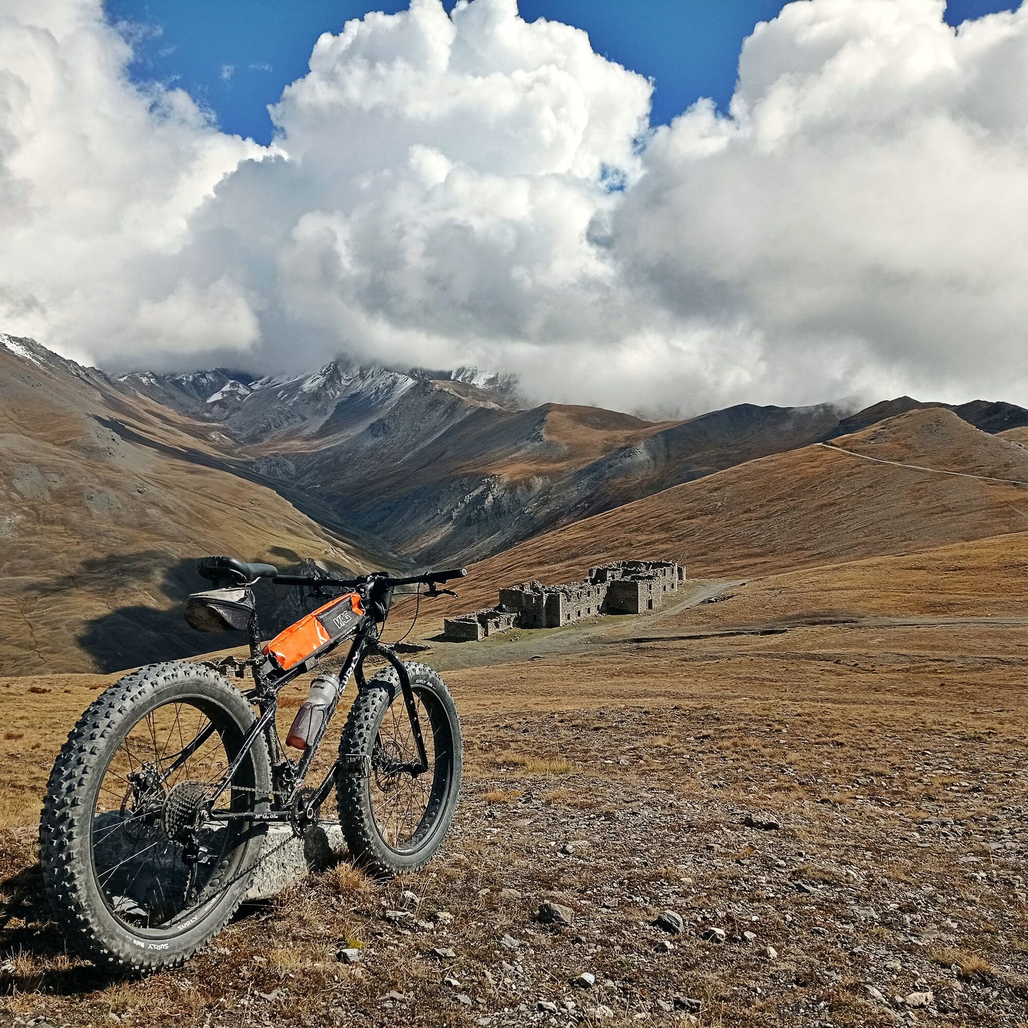
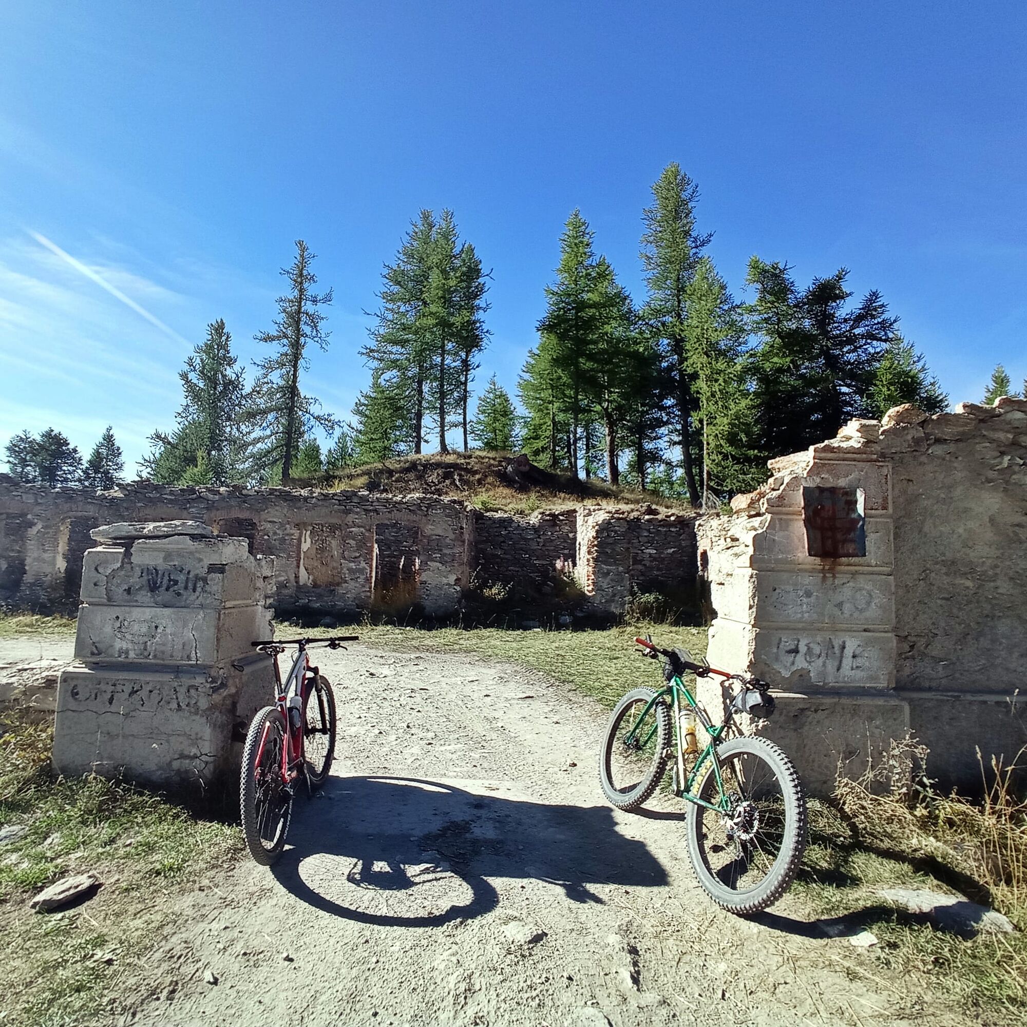
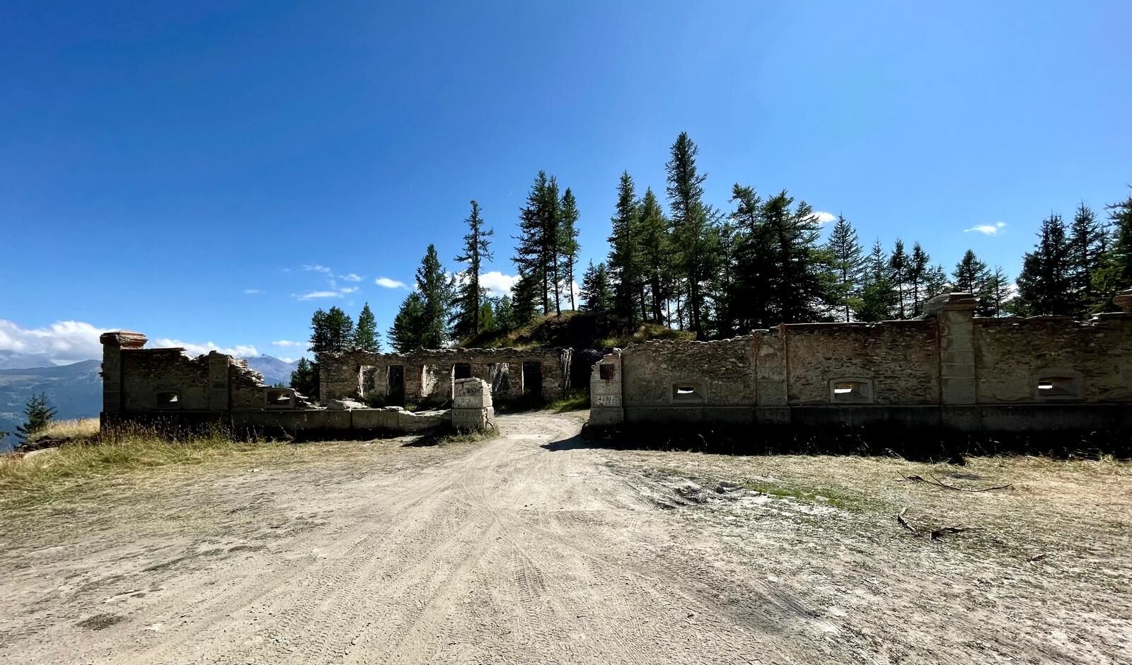
On the summit of Mount Jafferau stands the highest fortification in the Cottian Alps, which can be reached, among others, thanks to a road that you will partly follow, built to connect the Foens, Jafferau...
On the summit of Mount Jafferau stands the highest fortification in the Cottian Alps, which can be reached, among others, thanks to a road that you will partly follow, built to connect the Foens, Jafferau and Pramand forts.
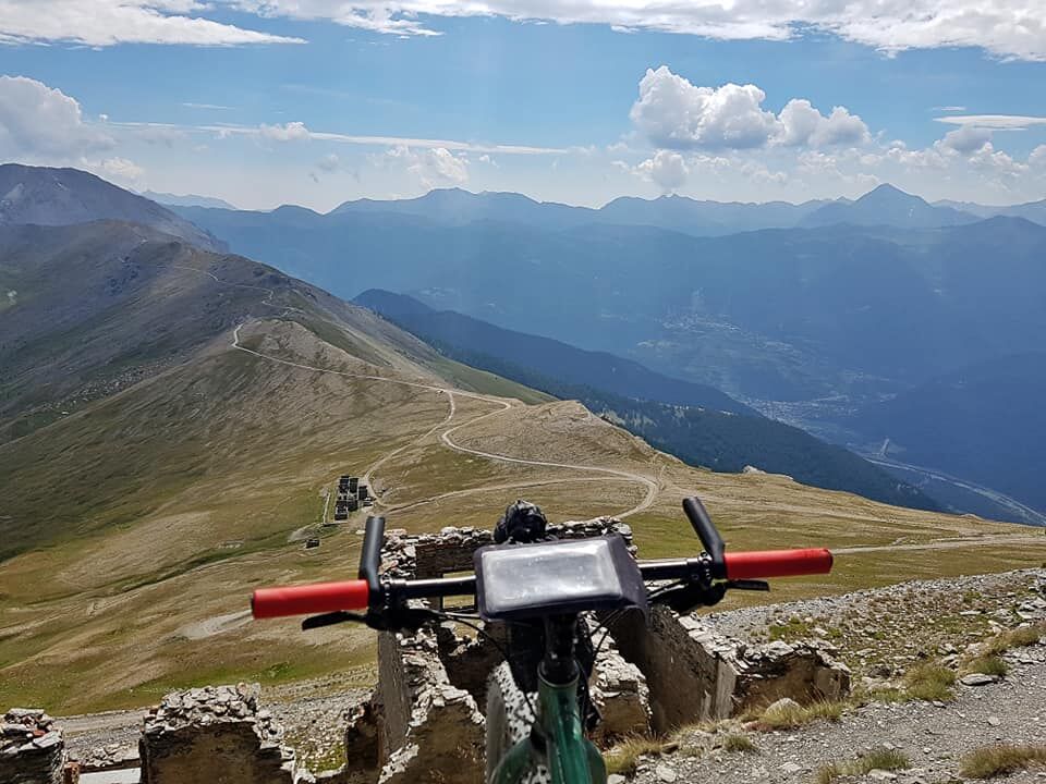
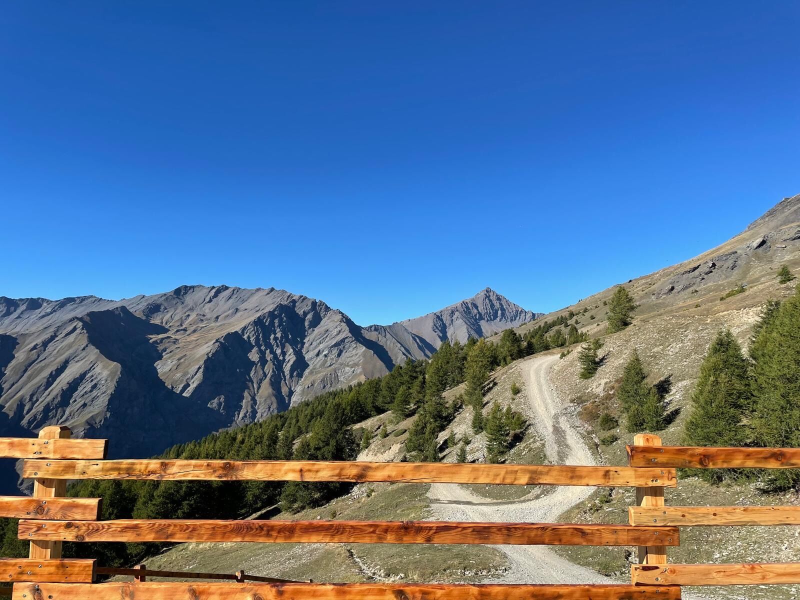
Following the signs for Millaures and Le Gleise, you will find yourself for a few kilometres on the legendary Jafferau climb, climbed several times during the Giro d'Italia, until you come to a dirt road on the right marked 'Fort Foens'. Follow this road to reach the Fort, then proceed halfway up the hillside on a false slope to the junction with the road leading to Col Basset. From here, continuing along the military road first on the level and then in hairpin bends uphill, you reach the summit of Mount Jafferau from where you can descend on the service road to the ski lifts to the Frejusia reservoirs and then continue on the tarmac road.
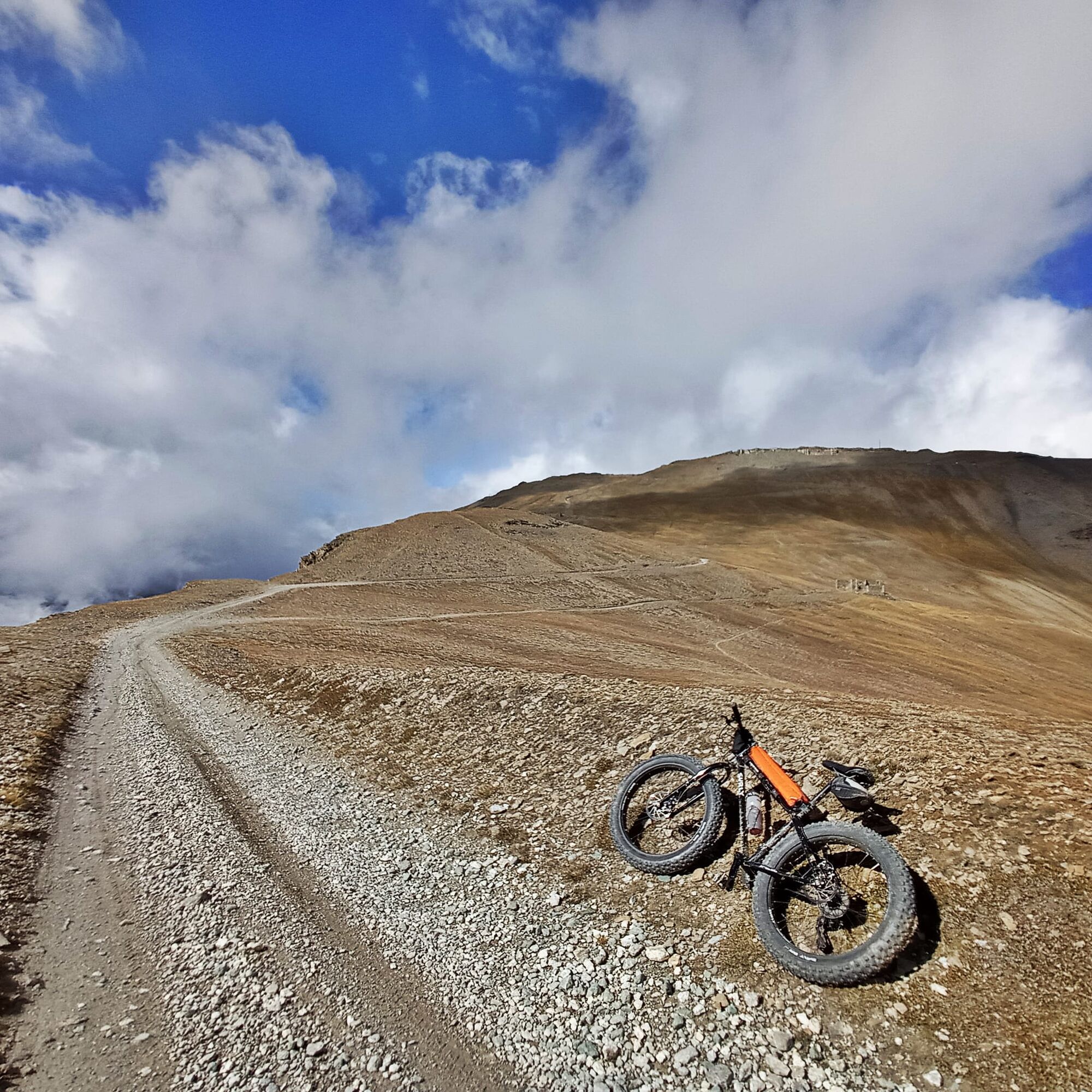
From Piazza Statuto, take Via Sommeiller and then turn right over the bridge, following the signs for Millaures and Gleise. Climb along the tarmac road until you reach the fork to Fort Foens, where the dirt road begins. Climb up with a few hairpin bends and then proceed halfway up to Fort Foens. Continue on level ground and at the fork take the road on the left uphill towards Col Basset. When you reach the pass, a long flat traverse leads to the Baraccamento Colletto Jafferau and then, with a few switchbacks, you will reach Fort Jafferau. From here descend along the service road of the ski lifts until you reach the Frejusia reservoirs from where you retrace your initial route back to Bardonecchia.
Tak
MTB
E-bike
Gravel
Road closed to motorised vehicles on certain days of the week from the junction for Fort Foens to the Frejusia reservoirs
For details of the regulation of motorised traffic on mountain roads click here
How to get to Bardonecchia
by car: in Turin, take the A32 Turin-Bardonecchia motorway and exit at Bardonecchia; by train: Bardonecchia can be reached by regional trains leaving every hour from Porta Nuova station, on which you can load your bike without having to dismantle it; both the TGV and Frecciarossa trains on the Milan-Paris line stop in Bardonecchia
During the summer period, you can think about taking the shuttle line 7bis or the Jafferau cable car to take off a long way.
Piazza Statuto
Piazzale dei Bacini Frejusia
S2
The Jafferau and Foens Batteries were built at the end of the 1800s and are still connected today thanks to a road that was built between Salbertrand and Bardonecchia, with the possibility of entry also from Savoulx.
Stop along the way to admire the view, especially on the stretch from Fort Foens to Fort Jafferau.
Popularne wycieczki w okolicy
- 5,0
BARDONECCHIA Colle Sommeiller
średniMountainbike25,4 km - 5,0
BARDONECCHIA Decauville
światłoWędrówka7,29 km - 5,0
BARDONECCHIA Lago Verde
średniWędrówka4,14 km - 5,0
BARDONECCHIA Col des Acles - Passo della Mulattiera
ciężkiWędrówka6,57 km - 4,5
BARDONECCHIA Sentiero Walter Bonatti - Grange della Rho
średniWędrówka6,12 km - 5,0
CESANA T.SE To Fenils (No. 48)
światłoWędrówka4,29 km BARDONECCHIA Punta Colomion - Passo della Mulattiera - Pian del Colle Ring
ciężkiMountainbike25,1 kmBARDONECCHIA Punta Quattro Sorelle
ciężkiWędrówka8,69 kmSESTRIERE Assietta Road
średniMountainbike43,3 kmBARDONECCHIA Monte Thabor
ciężkiWędrówka8,82 km
Wędrówki i tropienie


Nie przegap ofert i inspiracji na następne wakacje
Twój adres e-mail została dodana do listy mailingowej.