


The soldier's "Casot"


The view is unobstructed throughout this route, where many fountains are located. A picnic table and another fountain await you at the site of the Soldier's Hut. There is a very wide viewpoint over Mas...
The view is unobstructed throughout this route, where many fountains are located. A picnic table and another fountain await you at the site of the Soldier's Hut. There is a very wide viewpoint over Mas Freixe, Pic Estelle (boundary between Montesquieu, Le Boulou, Maureillas, les Cluses). The hut is open and provides shelter if needed.

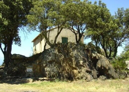
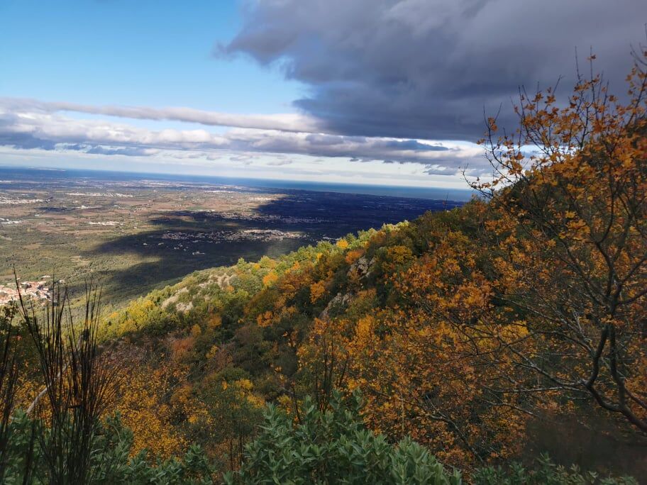
At the entrance of Mas Péricot, either make a round trip to the belvedere, or ignore the track that leads to the Belvedere and take the dirt track, to the left, which goes up towards the Font dels Treze vents. At this point, there is a picnic table and a fountain. At the junction, there are two options: either continue towards the Font Del Sabater and follow the DFCI track, or climb up the steep and narrow path, located to the left of the transformer. This path offers an exceptional panorama. At the top of this steep slope, continue straight on the DFCI track towards the Soldier's "casot". (On the north side of the Soldier's "casot", a trail leads to small rock formations with original shapes, like "the Oyster". Beautiful panorama of the Roussillon plain). For the return, return to this point and descend by taking the DFCI track back to the starting point."
D618, D61
Option to park at the end of the "chemin de l'écluse"
Prepare water, a hat, and sturdy walking shoes. There are no difficulties on the track, but caution is advised if you take the steep path located to the left of the transformer. This route is passable but is not marked or maintained by the CC-ACVI. Use geolocation.
Popularne wycieczki w okolicy
-
[Connection] Elne-Argelès-sur-Mer
średniDroga rowerowa 12,3 km -
Rallye-enquête : Le linteau millénaire de Saint-Genis-des-Fontaines
średniDroga rowerowa 28,6 km -
GR10 Pyrenäenweg Etappe 55
średnidługodystansowy szlak pieszy 23,2 km -
Catalan Getaway in the Pyrenees Mediterranean
średniDroga rowerowa 62,4 km -
Anstrengend aber wunderschön. Nur etwas für MTB
średniE-MTB 24,7 km -
An der französisch spanischen Grenze über drei Berge durch wunderschöne Wälder und tolle Panoramen
średniE-MTB 28,6 km -
Pig del Faig
ciężkiMountainbike 29,8 km -
tournée de deux pays
ciężkiMountainbike 40,0 km -
Mountainous climb close to the french border
ciężkiMountainbike 29,8 km -
From Lavail to Valmy via the Tour de la Massane
średniWędrówka 10,3 km
Wędrówki i tropienie


Nie przegap ofert i inspiracji na następne wakacje
Twój adres e-mail została dodana do listy mailingowej.