


Sauerland-Höhenflug: From Meinerzhagen to Nordhelle


The Sauerland-Höhenflug runs from Altena and Meinerzhagen to Korbach in Hesse. Over 250 fascinating, sporty and impressive kilometers on the ridges of the low mountain range are waiting to be discovered....
The Sauerland-Höhenflug runs from Altena and Meinerzhagen to Korbach in Hesse. Over 250 fascinating, sporty and impressive kilometers on the ridges of the low mountain range are waiting to be discovered. Whether a stroll or a hike: enjoyment and challenge are closely linked here – for long-distance hikers as well as lovers of short height routes, for solo hikers and larger groups.
The long-distance hiking trail passes through 19 towns and municipalities and connects numerous sights, performances, and natural peculiarities on its individual stages.
Nature lovers can look forward to fascinating natural experiences in the deep forests, in the raised bogs on the slopes of the Ebbegebirge, in the extensive pastures of the uplands, on the high heath at the Kahlen Asten, or in the mountain meadows of the European bird protection area Medebacher Bucht.
Possible entry points for the Sauerland-Höhenflug are the Meinhardus ski jump in Meinerzhagen, Altena Castle with the youth hostel, or Korbach with its romantic old town.
But the Sauerland-Höhenflug offers much more than fascinating landscapes and beautiful natural idyll. In the towns along the Sauerland-Höhenflug, the culture and industrial history live on today as do traditional agricultural activities. Museums invite visits to learn about the history, industry, and crafts of the region.
Joy of life and recharging energy on the Sauerland-Höhenflug – this is ensured above all by the incomparable panoramic views. Whether from the heights around Altena, from the Hunau or the Kahlen Pön near Düdinghausen, from the Quitmann Tower near Neuenrade, the Schomberg Tower near Wildewiese, the tower on the Kahlen Asten near Winterberg, the Heidkopf Tower near Hallenberg, or the Georg-Viktor viewing tower near Korbach, the hiker is rewarded everywhere with numerous panoramic views! And when you let your gaze wander over mountains and valleys, over idyllic villages, forests, meadows, streams, rivers, and lakes, you realize: only flying is more beautiful!
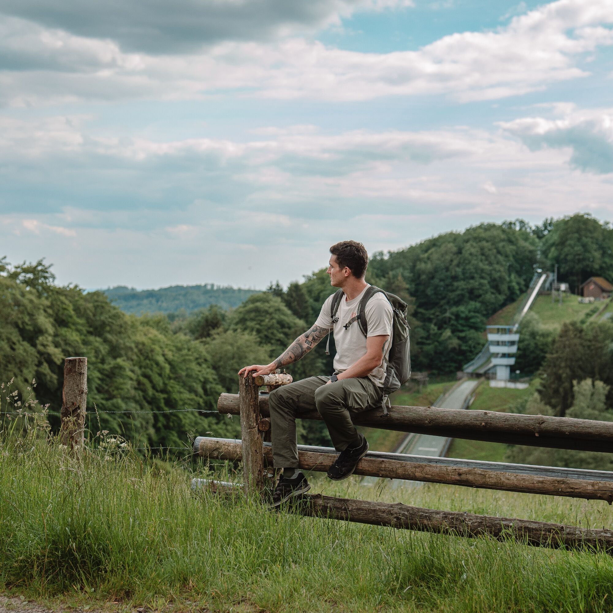
The stage on the Sauerland-Höhenflug from the entry point Meinerzhagen begins at the Schallershaus entry portal. The entry portal is optimally accessible via the well-connected A 45 motorway, Meinerzhagen exit. There are sufficient parking spaces at the entry portal as well as extensive information boards where hikers can learn about the route of the Sauerland-Höhenflug. Right at the entry portal, you can enjoy the first beautiful view of the town's landmark: the Meinhardus-Mattenschanze. Since 1982, the current ski jump has been a training and competition site for various ski associations, with a distance record of 68.6 m.
Through meadows and forests, always with a view of the ski jump, the Sauerland-Höhenflug leads to the Badinghagen water castle, which lies hidden deep in the forest and presents a romantic sight with its moats and ponds, but is not publicly accessible. Behind Badinghagen, the path steeply ascends on a narrow trail, then continues idyllically through meadows and forests to the ridge. The Höhenflug skirts the small village of Kropplenberg and, after a further 2 kilometers, reaches the small village of Hellsiepen, which consists of only two houses. Now the Höhenflug rises again, but the ascent is rewarded with a magnificent view over the Sauerland! Take a seat on a bench and enjoy the panoramic view!
At Buntelichte, you pass an archaeological monument which is part of the historic road from Frankfurt to Amsterdam. Right next to the A 45 motorway, nowhere else can the development from ancient cart paths to today's motorways be observed!
Another highlight of the stage awaits you in Möllsiepen. At the Eckern guesthouse, the Sauerland-Höhenflug airport was created through an educational project of the Nestor education institute. Wooden airplanes in various colors and shapes whirl through the air, making "height" an entirely new experience. Enjoy the view over the Höhenflug airport and the Listertal during a break on a cozy forest sofa. Below Möllsiepen, the hiking trail briefly follows the K 4 road, then turns onto a beautiful meadow path through a nature reserve in the Liesetal. Near Österfeld, the Höhenflug crosses the country road coming from Valbert.
On the way towards Hösinghausen, beautiful views continually open up back to the Liesetal with the Sauerland-Höhenflug route towards Möllsiepen. Shortly after Hösinghausen is the Quellental hiking parking lot. Little hikers can use an Archimedes' screw here to lift water from the Hösinghausen stream and let it flow back over various channels made of natural stones. A Sauerland bench also invites you to take a rest. Narrow paths, lush fern vegetation, and the nearby Ochsenmoor transport the hiker to earlier geological times. The Höhenflug continues uphill to the Koppenkopf, where there is a shelter and a memorial stone.
Fascinating and untouched nature awaits the hiker when crossing the narrow wooden bridge through the "Wilde Wiese" moor area. The nature reserve is part of the Ebbemoore, which is designated as an FFH area due to its rarity. Many rare animal and plant species can be found in these hillside and spring moors, such as sphagnum moss, cranberry, marsh lily, or the high moor pearl butterfly (listen to the Sauerland-Höhenflug podcasts for more information!).
The Höhenflug continues steadily uphill through the romantically wild nature reserve. Below the Nordhelle, the path encounters a boundary tree over 250 years old. The gnarly beech tree served as a border marker for the Herscheider Mark boundary.
The Sauerland-Höhenflug reaches the Nordhelle via a natural path. At 663 m above sea level, it is the highest mountain in the Ebbegebirge. Next to a hiking guesthouse stands the Robert-Kolb Tower on the summit, which was built in 1913 and named after the then head path warden of the Sauerland Mountain Association. From here you have a wonderful view far across the Märkischer Kreis. Also on the Nordhelle stands the 130 m high WDR transmission tower. Here the stage ends.
No special equipment required; sturdy footwear, rain protection and provisions are recommended
Information about the emergency boards on the Sauerland-Höhenflug
Hiking trails usually run away from villages and settlements, and every hiker has wondered what would happen in an emergency. How can I be found here? Where am I exactly? Can the rescue service reach me?
In an emergency, time is of the essence! Therefore, the Sauerland-Höhenflug is continuously equipped with so-called emergency signs. On the green and white plaques mounted on the posts of the signposts is a number that you must give when making your emergency call. This way, the rescue forces know exactly where you are, saving valuable time.
Meinerzhagen: The town of Meinerzhagen is located very close to the A 45, has its own motorway exit, and can be reached from the Ruhr area as well as the greater Cologne/Aachen area within one hour by car. Coming from the Ruhr area, turn left at the first traffic light to get onto the southern bypass L 306 n, then keep right onto Heerstraße past the Hotel-Restaurant "Am Schnüffel". From there, it is about 800m to the Schallershaus entry portal.
Coming from Olpe on the A45, turn right at the first traffic light, line up left at the second traffic light, and then keep right on the southern bypass L306 n past the Hotel-Restaurant "Am Schnüffel".
The turnoff to the Schallershaus hiking parking lot is signposted.
Nordhelle: From Meinerzhagen, take the L 539 towards Attendorn. Shortly before Valbert, turn right onto the L 707 towards Herscheid.
In Meinerzhagen:
Visitors from the Cologne area can take the RB25 hourly from Cologne Main Station to Meinerzhagen. Since December 10, 2017, guests from the Ruhr area can take the RB52 every two hours from Hagen Main Station to Lüdenscheid-Brügge and then continue with the RB25 to Meinerzhagen, restoring the connection from the Ruhr area via the Volme valley.
The central bus station (ZOB) in Meinerzhagen offers connections to Olpe (R52), Attendorn (R61), Kierspe (city bus 282), Drolshagen (R52), and Lüdenscheid (R58). From the ZOB, follow the signposted access path. The hiking bus line 252 runs on Sundays and public holidays during the season from May to October between Meinerzhagen (stop "Fumberg", follow the road along the shooting range to reach the Sauerland-Höhenflug), Nordhelle, and Lüdenscheid.
At Nordhelle: The hiking bus line 252 runs on Sundays and public holidays during the season from May to October between Meinerzhagen, Nordhelle, and Lüdenscheid. The bus stop at Nordhelle is located on the L 707 in close proximity to parking lot P5. From the parking lot, an access path leads to the Robert-Kolb Tower and thus to the Sauerland-Höhenflug.
More information at http://www.mvg-online.de/.
In Meinerzhagen: At the Schallershaus hiking parking lot directly at the entry portal of the Sauerland-Höhenflug (Google Maps coordinates: 51.099453,7.65324). For long-term parkers (only Fridays with parking disc), parking is also available behind the town hall in the town center of Meinerzhagen (Google Maps coordinates: 51.108022, 7.640709).
At Nordhelle: At the P5 hiking parking lot below Nordhelle. From here, a black-marked access path leads to Nordhelle. Google Maps coordinates: 51.144315,7.746989
Tak
www.sauerland-hoehenflug.de
Service and booking hotline of the Sauerland-Höhenflug: 02974 - 202 199
Overnight accommodation tips:
Landhaus Nordhelle
Zum Koppenkopf 3
58540 Meinerzhagen - Valbert
Phone 02358 - 80090
info@landhaus-nordhelle.de
www.landhaus-nordhelle.de
Popularne wycieczki w okolicy
-
5,0
Nature trail & walking path Fürwigge Reservoir - marvel & discover
średniTrasa tematyczna 4,09 km -
4,7
Hike: On the KuLTour in Drolshagen
średniWędrówka 7,01 km -
Talsperren Genkel und Agger
światłoMountainbike 22,5 km -
Valberter Rundweg (V)
ciężkiWędrówka 45,6 km -
4,0
Rundweg an der Versetahlsperre
średniWędrówka 10,9 km -
5,0
Wanderung: Von der Aggerquelle zur Genkeltalsperre in Meinerzhagen
średniWędrówka 11,6 km -
Wilkenberg circular hiking trail (A3) - Nature experience and Nordhelle panorama
średniWędrówka 5,90 km -
5,0
Genkeltalsperre walking and hiking path
średniWędrówka 9,81 km -
Ice cream and café route Plettenberg-Herscheid with Oestertalsperre
średniJazda na rowerze 31,8 km -
Wanderbares M - Discover Meinerzhagen's most beautiful spots
średnidługodystansowy szlak pieszy 49,6 km
Wędrówki i tropienie


Nie przegap ofert i inspiracji na następne wakacje
Twój adres e-mail została dodana do listy mailingowej.