







Alpe Granda with Joëlette

The hike runs along a forest road in excellent condition, it is a simple route also suitable for families, able to offer a splendid panorama of the mountains and the Valtellina valley floor. For refreshments,...
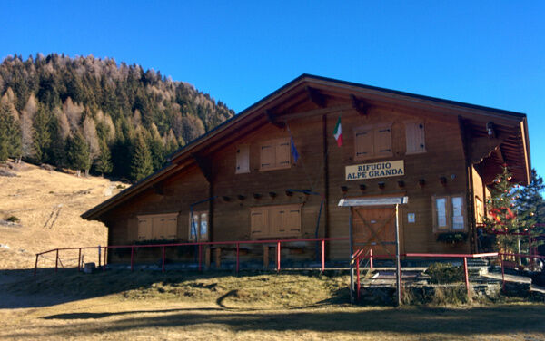
The hike runs along a forest road in excellent condition, it is a simple route also suitable for families, able to offer a splendid panorama of the mountains and the Valtellina valley floor. For refreshments, you can stop at the Alpe Granda refuge, located on the eastern part of the alpine pasture. For the approach by car, you should head to Ardenno and then continue towards Buglio in Monte. From this point, continue towards the locality of Our, along a rather narrow road that allows, in some sections, passage only for one vehicle at a time. PARKING: A small parking area is present at the start of the dirt road at coordinates N 46 11.911' E 009 40.191'. Since the parking lot is often full, it is suggested to leave the car in the first available widening on the sides of the road, starting from the locality Our of Fondo.

Tak
Joelette
STARTING POINT: Directly from the parking lot
USEFUL LOCAL ENTITIES AND REFERENCES: Morbegno Mountain Community, Alpe Granda Refuge
TIME WITH JOELETTE: 1 hour to the alpine pasture plus another 10 minutes to the Alpe Granda refuge
GROUND: fairly wide dirt road, passable with a small 4x4 vehicle
EXPOSURE, DANGERS: none in particular
WATER WHERE: fountain at the beginning of the route
RETURN: same route as the outward journey
REFUGE, REFRESHMENTS: Alpe Granda refuge
ACCESSIBILITY Alpe GRANDA (tel. 39 3407953688 - 39 347 75 66 960 -https:www.rifugi.lombardia.itsondrioardennorifugio-alpe-granda.html - https:www.facebook.comrifugioalpegranda) ENTRANCE two fairly spaced steps TOILETS to be verified OVERNIGHT STAY to be verified.

Popularne wycieczki w okolicy
- 5,0
Hike in Val Codera Novate - Rifugio Brasca ( Sentiero Roma first stage)
średniWędrówka 10,7 km - 3,0
Zu der Albignahütte
średniWędrówka 10,5 km - 5,0
Val Codera
średniWędrówka 13,6 km - 4,5
Porro and Ventina Shelters
światłoWędrówka 3,12 km - 5,0
Sentiero Roma in Val Masino
ciężkiWędrówka 33,8 km - 5,0
Chiareggio-rifugio grande camerini
średniWycieczki górskie 13,8 km - 5,0
Bosio-Galli Refuge (from Piasci)
światłoWędrówka 4,58 km - 5,0
Dazio's Colmen - A Mediterranean oasis in the midst of the Alps
światłoWędrówka 5,62 km Rifugio Bosio-Galli (from Primolo)
średniWędrówka 8,35 kmVia Ferrata at Torrione Porro
średniVia ferrata 2,31 km

Wędrówki i tropienie


Nie przegap ofert i inspiracji na następne wakacje
Twój adres e-mail została dodana do listy mailingowej.





