


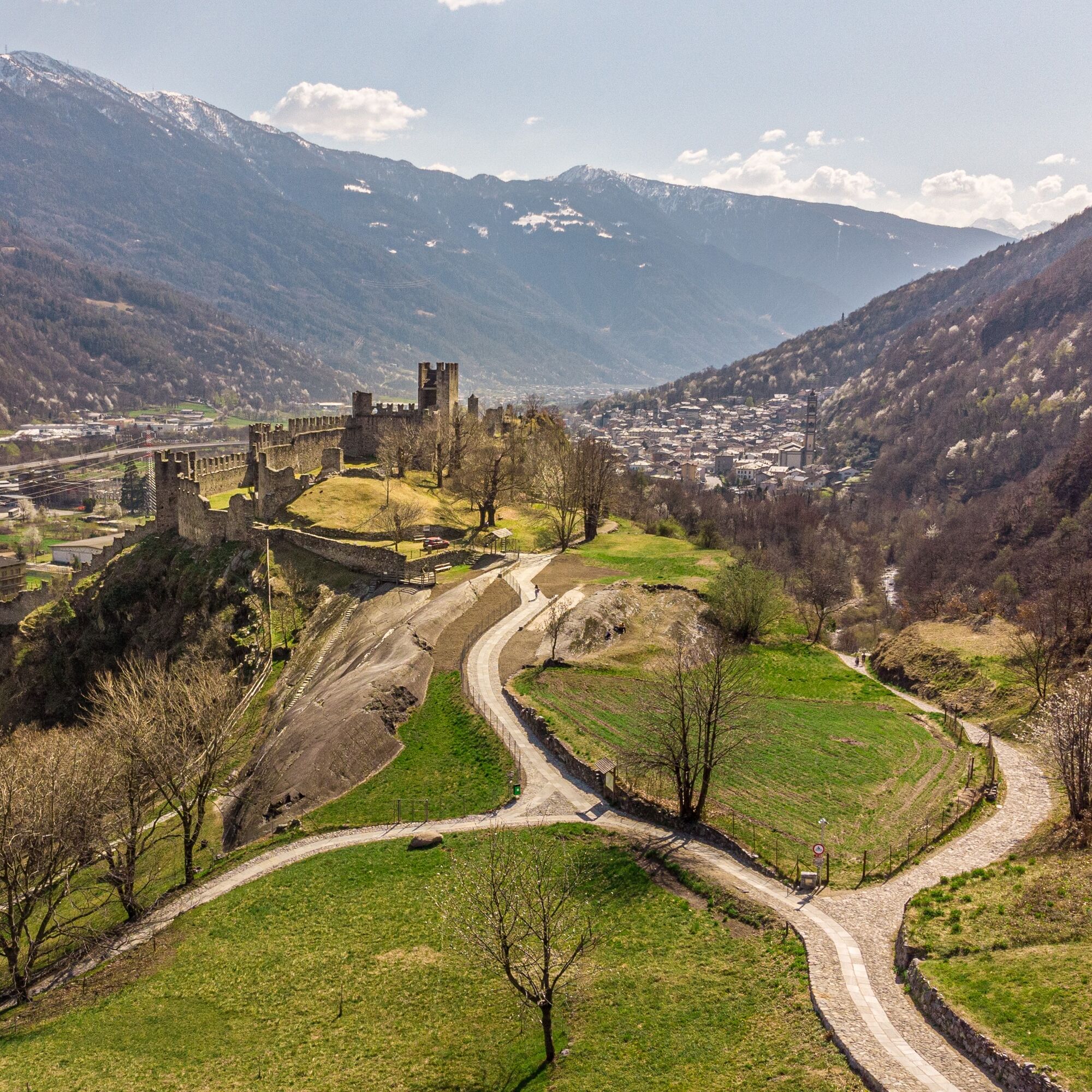
Castles Trail


It winds along the slopes bordering the valley floor, crossing apple orchard and vineyard lands, chestnut groves, and once cultivated terraces that testify to the architecture and work done by local people...
It winds along the slopes bordering the valley floor, crossing apple orchard and vineyard lands, chestnut groves, and once cultivated terraces that testify to the architecture and work done by local people in governing the land. The trail can interact with the Sentiero Valtellina bike/pedestrian path, allowing for loop routes that offer multiple possibilities, adapting to the different needs of the hiker. Signage in the circuit: the entire route is supported by informative vertical signage with notice boards, panels, and signage tables, and by horizontal or comfort signage with red and white trail marker flags and directional arrows, conforming to national hiking signage. The Castles Trail Circuit is characterized by numerous beauties that allow you to experience the Valtellina mountain territory. The trail is grafted between apple orchards, hardwood forests halfway up the mountainside, allowing direct contact with culture and tradition typical of our territory. Churches, castles, towers are a virtuous riccone heritage characterizing this portion of Valtellina.
Popularne wycieczki w okolicy
Adamello - Val Grande - Biwak
średniE-MTB22,8 kmBergwanderung zum «See des Verrückten» - Kurz Version
Wędrówka11,4 kmGiro del Lago - Le prese - Miralago
światłoWędrówka7,43 km- 4,0
Giro del Lago
światłoWędrówka7,28 km 33.10 Le Prese - Tirano, Via Albula / Bernina
średniWędrówka14,6 kmBotanischer Wanderweg Sassalbo
Wędrówka2,42 kmMiralago - Tirano Durch via Valposchiavo talauswärts nach Italien
Wędrówka11,7 kmValgrosina Trail 70k
ciężkiTrailrunning71,3 kmMarian Way of the Alps Eastern Route - Grosotto Tirano Stage
średniTrasa pielgrzymki17,8 kmMarian Way of the Alps Eastern Way - Cepina Grosotto Stage
ciężkiTrasa pielgrzymki29,2 km
Wędrówki i tropienie


Nie przegap ofert i inspiracji na następne wakacje
Twój adres e-mail została dodana do listy mailingowej.