


72 Praettigau High Trail: in 3 days from Klosters to Fanas (3 stages)


The well-marked trail leads from Klosters across lush alpine meadows to St. Antönien, where the slogan "behind the moon, to the left..." is advertised with a wink. Along the way you will encounter grazing...
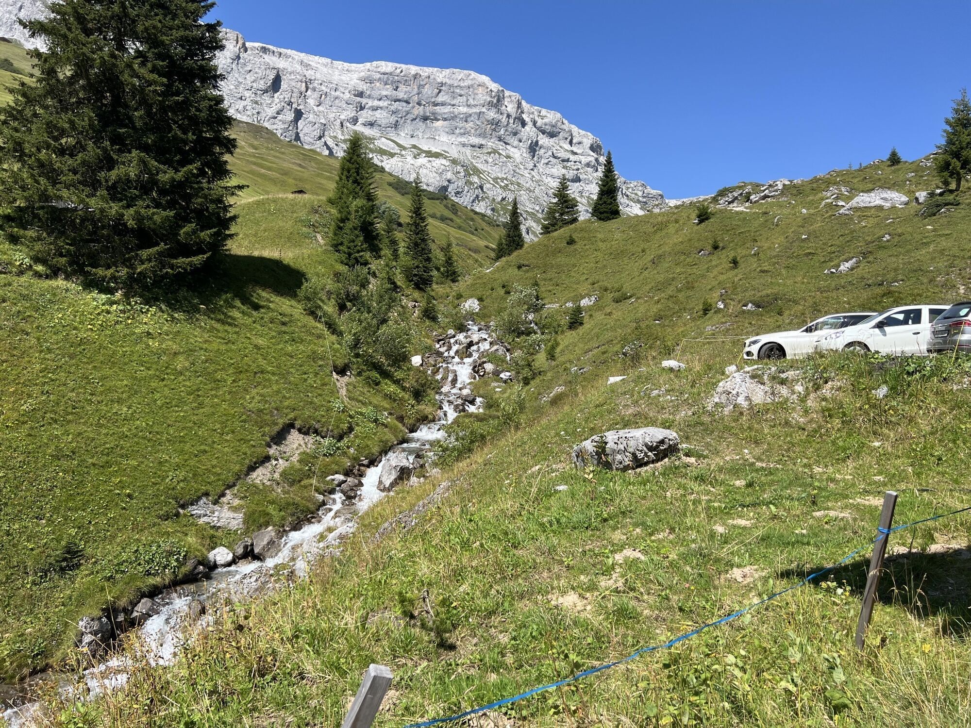
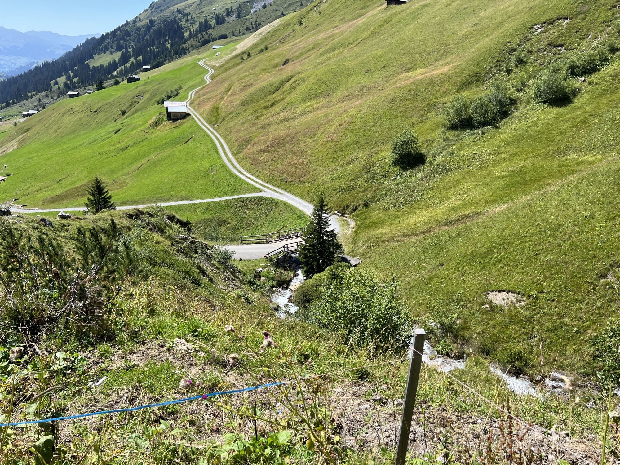
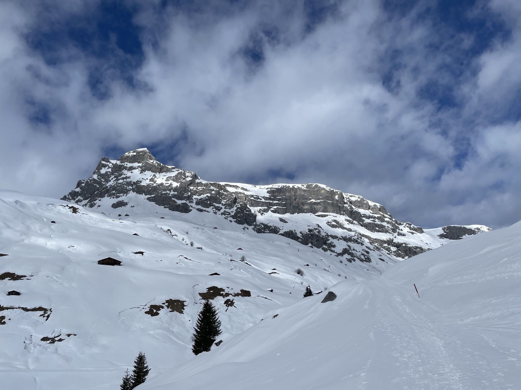
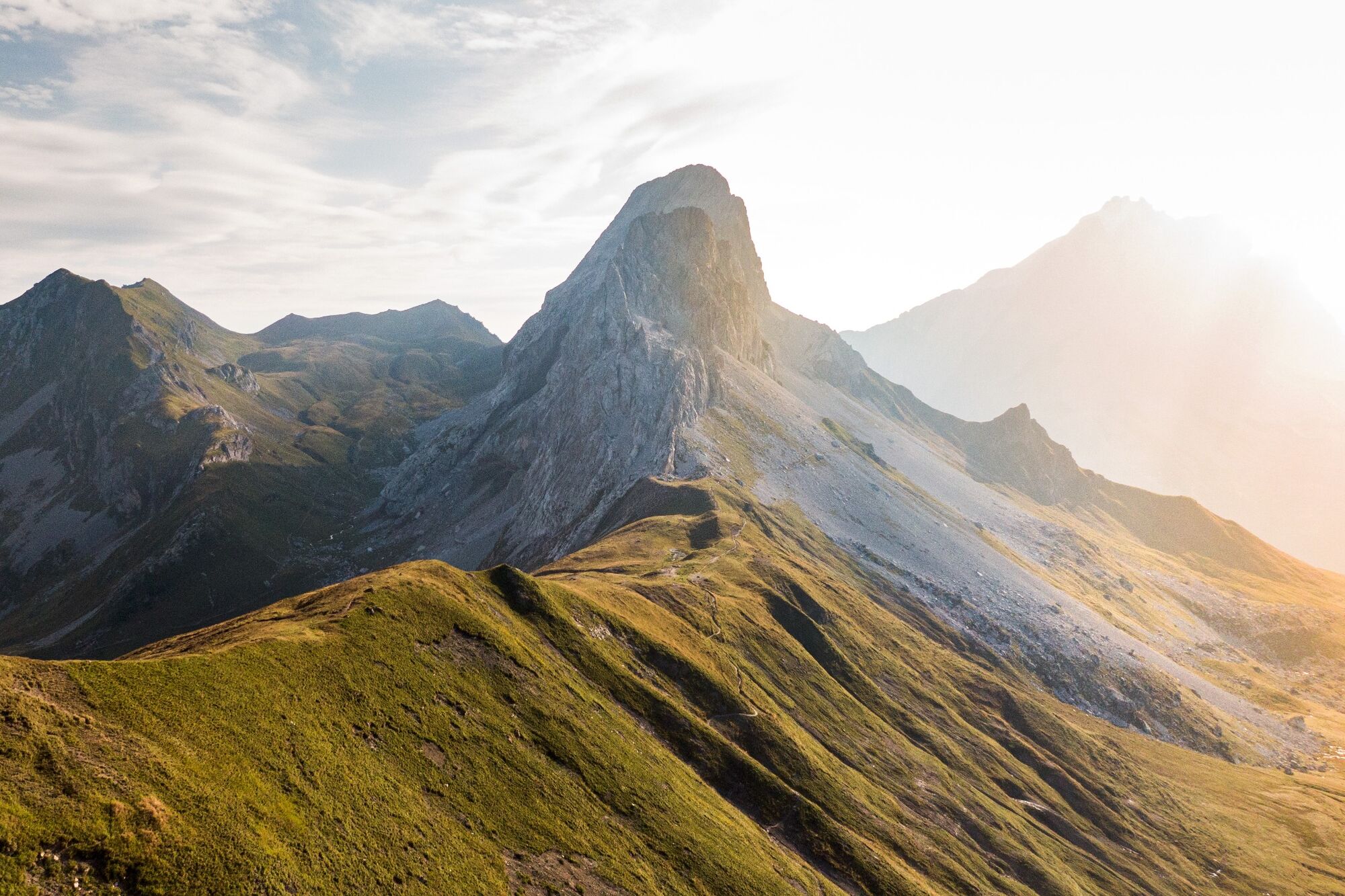
The well-marked trail leads from Klosters across lush alpine meadows to St. Antönien, where the slogan "behind the moon, to the left..." is advertised with a wink. Along the way you will encounter grazing cows enjoying the fine alpine herbs. Below the limestone walls, which are up to 500 meters high, the well-signposted path continues along the national border. At Gafalljoch you leave the high-altitude trail and branch off in the direction of Sassauna, where the last meters of altitude are "destroyed" with the Fanas cable car.
The tour can be booked as a package and is also suitable as a family tour. And with a few additional summit ascents, the hike also puts a long-lasting smile on the faces of ambitious mountain hikers.
Stages:
Stage 1: Klosters - St. Antönien
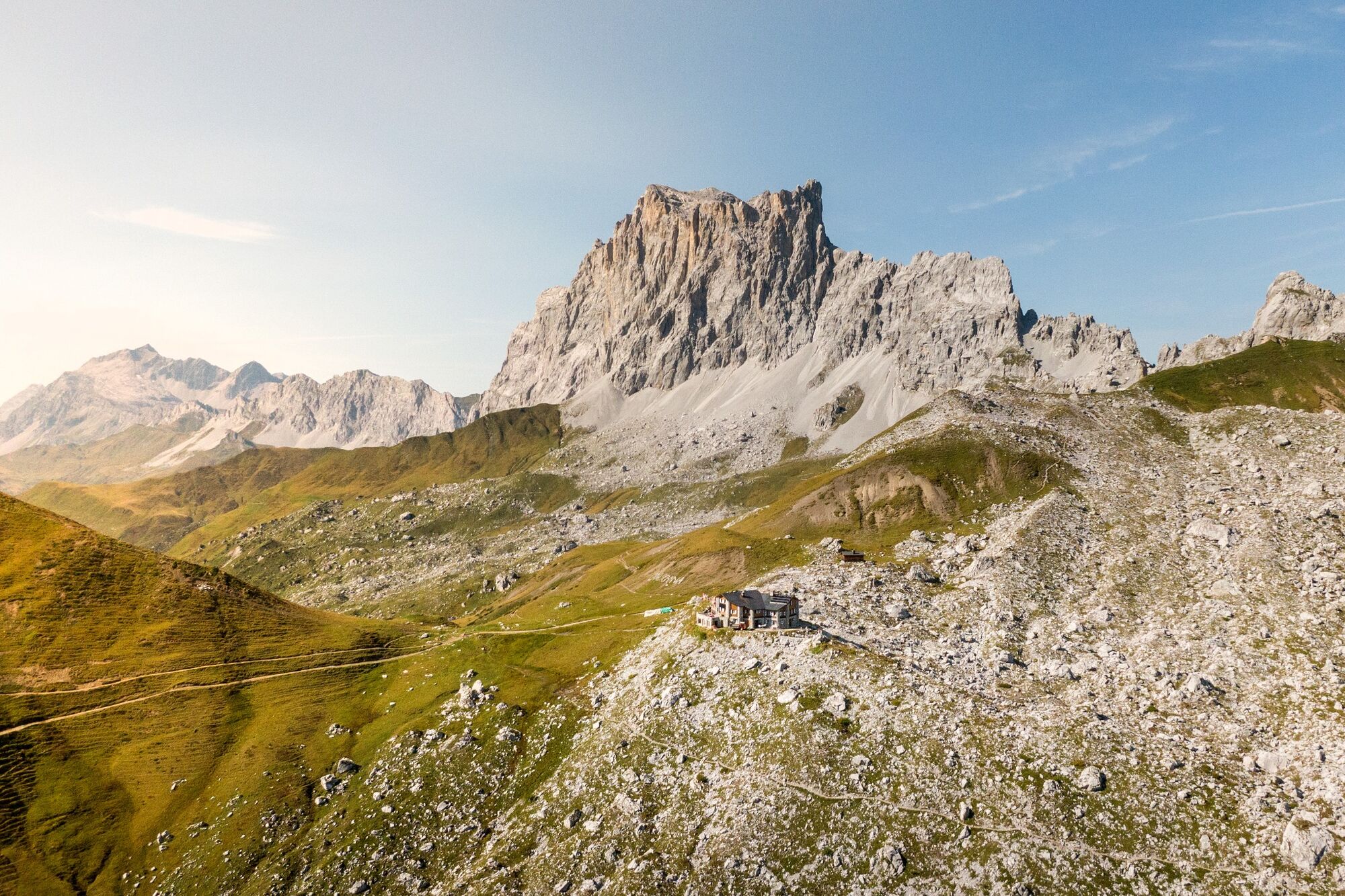
Stage 2: St. Antönien - Carschina hut SAC
Stage 3: Carschina hut - Fanas cable car

Am 1. Tag bringt Sie die Madrisabahn von Klosters Dorf auf die Saaser Alp (1887 m ü. M.), von wo aus die Wanderung über die Mässplatten und die Aschariner Alp (2025 m ü. M.) nach St. Antönien (1420 m ü. M.) führt.
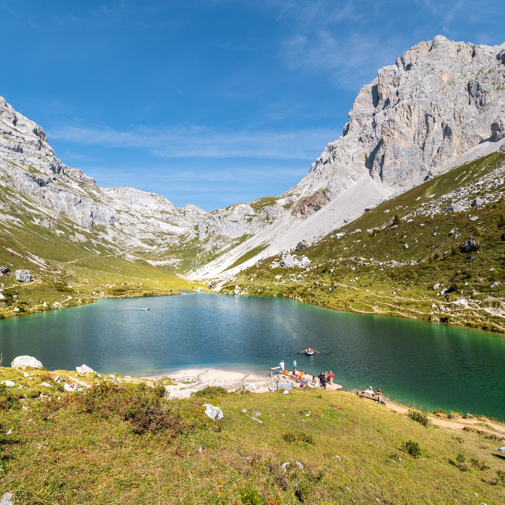
Am 2. Tag wandert man über Carschina Untersäss (1637 m ü. M.) Richtung Partnun. Am kristallklaren Partnunsee (1869 m ü. M.) empfiehlt sich eine Abkühlung, bevor es hoch zur Carschinahütte SAC (2221 m ü. M.) geht.
Am 3. Tag folgt man dem Prättigauer Höhenweg bis zum Cavelljoch. Anschliessend geht es via Fadurer Fürggli zur Bergstation der Seilbahn Fanas.
Tak
Tak
Tak
Tak
The trail is classified as T2/T3 (mountain hiking) according to the SAC hiking scale. Definition of trail/terrain: Path with continuous route and balanced gradients. If marked: white-red-white. Terrain partly steep, danger of falling not excluded. Definition requirement: some surefootedness. Trekking shoes are recommended. Elementary orientation skills.
Attention for dog owners:As often seen in Graubünden, there are also several alpine pastures in the Rätikon which are protected by guard dogs. Please note the official recommendations and the zones.
Bis Landquart mit der Schweizerischen Bundesbahn, dann umsteigen auf die Rhätische Bahn in Richtung Davos, Vereina.
Ihr Auto parken Sie kostenlos auf dem Parkplatz der Madrisabergbahn. In Klosters Platz sind sämtliche Parkplätze gebührenpflichtig.
Prättigau Marketing
Feldweg 19
CH-7233 Jenaz
Tel. +41 81 325 11 11
info@praettigau.info
praettigau.info
Buchen Sie die Weitwanderung hier bequem als Package.
Kamery internetowe z trasy
Sportzentrum Klosters
Bergstation Sassauna - Fanas
Sportzentrum Klosters
Sportzentrum Klosters
Sportzentrum Klosters
Sportzentrum Klosters
Sportzentrum Klosters
Sportzentrum Klosters
Bergstation Kristallbahn - Gargellen
Madrisa Bergstation / Kinderland
Madrisa Bergstation / Kinderland
Madrisa Bergstation / Kinderland
Madrisa Bergstation / Kinderland
Madrisa Bergstation / Kinderland
Golm - Rätikonbahn
Madrisaland
Madrisaland
Madrisaland
Madrisaland
Madrisaland
Pany - Freibad
Pany - Freibad
St. Antönien - Skilift
Skilift St. Antönien
Madrisa Bergstation / Kinderland
Tilisunahütte
Tilisunahütte
Hueter Hütte
Hueter Hütte
St. Antönien - Bord / Aschüel
Popularne wycieczki w okolicy
- 4,7
Smuggler’s path
średniTrasa tematyczna8,60 km - 5,0
Douglasshütte, Lünersee, Gafalljoch Brand bei Bludenz, Vorarlberg
światłoWędrówka9,16 km - 4,4
Golm-Rundwanderweg im Rätikon
średniTrasa tematyczna7,28 km - 4,8
Klettersteig Madrisella
ciężkiVia ferrata8,52 km - 4,3
Golmer, Höhenweg und Golmer Seenrundweg
średniWycieczki górskie7,62 km - 3,5
Golmer Höhenweg Geißspitze
ciężkiWędrówka13,8 km - 5,0
Schesaplana (15.07.2018)
ciężkiWędrówka8,68 km - 4,0
Golm, Seenweg
światłoWędrówka7,43 km - 4,8
BLUDENZ | Lünersee
światłoWędrówka6,20 km - 4,4
Summit trail Madrisella (to Versettla summit station)
średniTrasa tematyczna10,8 km
Wędrówki i tropienie


Nie przegap ofert i inspiracji na następne wakacje
Twój adres e-mail została dodana do listy mailingowej.