


The Carsus Trail, Stage 6: Jamlje / Jamiano – Miren
Poziom trudności: T2
Two landmarks stand out on the final stage from Jamlje / Jamiano back to Miren: Lake Doberdò and the remains of the First World War.
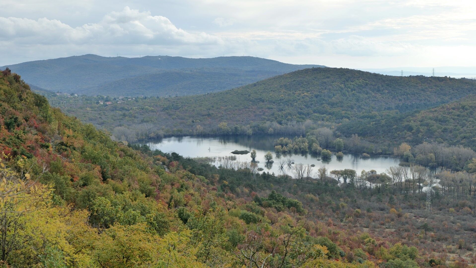
Lake Doberdò is an intermittent karst lake that changes constantly but...
Lake Doberdò is an intermittent karst lake that changes constantly but never dries out completely. In dry periods, the lake area becomes marshland with pools up to 40 m wide. In rainy periods, the water can expand to 1,200 m in length and 400 m in width. The lake is the central feature of the regional nature reserve.
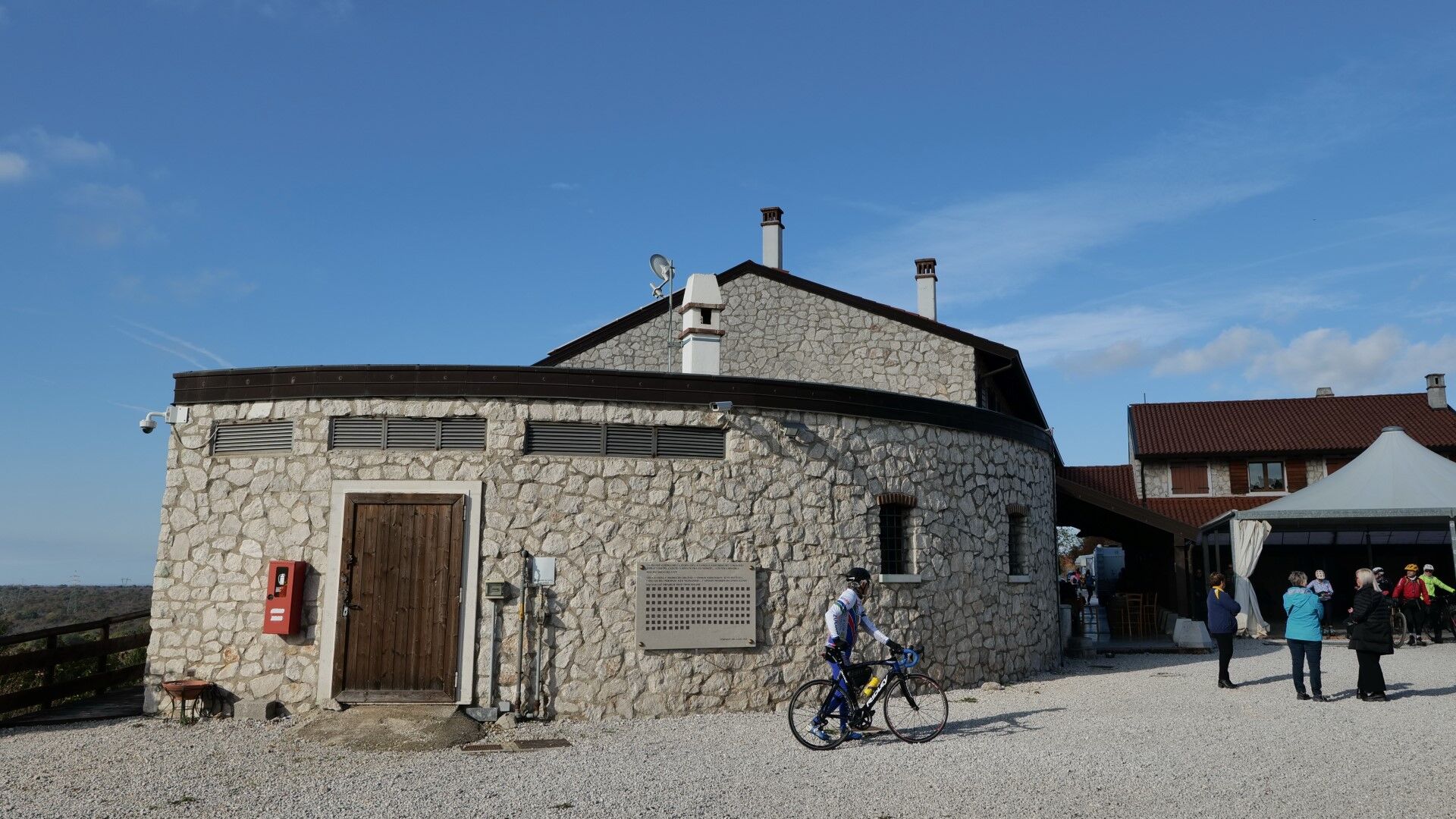
High above Doberdò, on a scenic terrace, stands the Gradina Visitor Centre. Its historical and natural history exhibition tells the story of the reserve, and thirsty hikers can also stop here for refreshments.
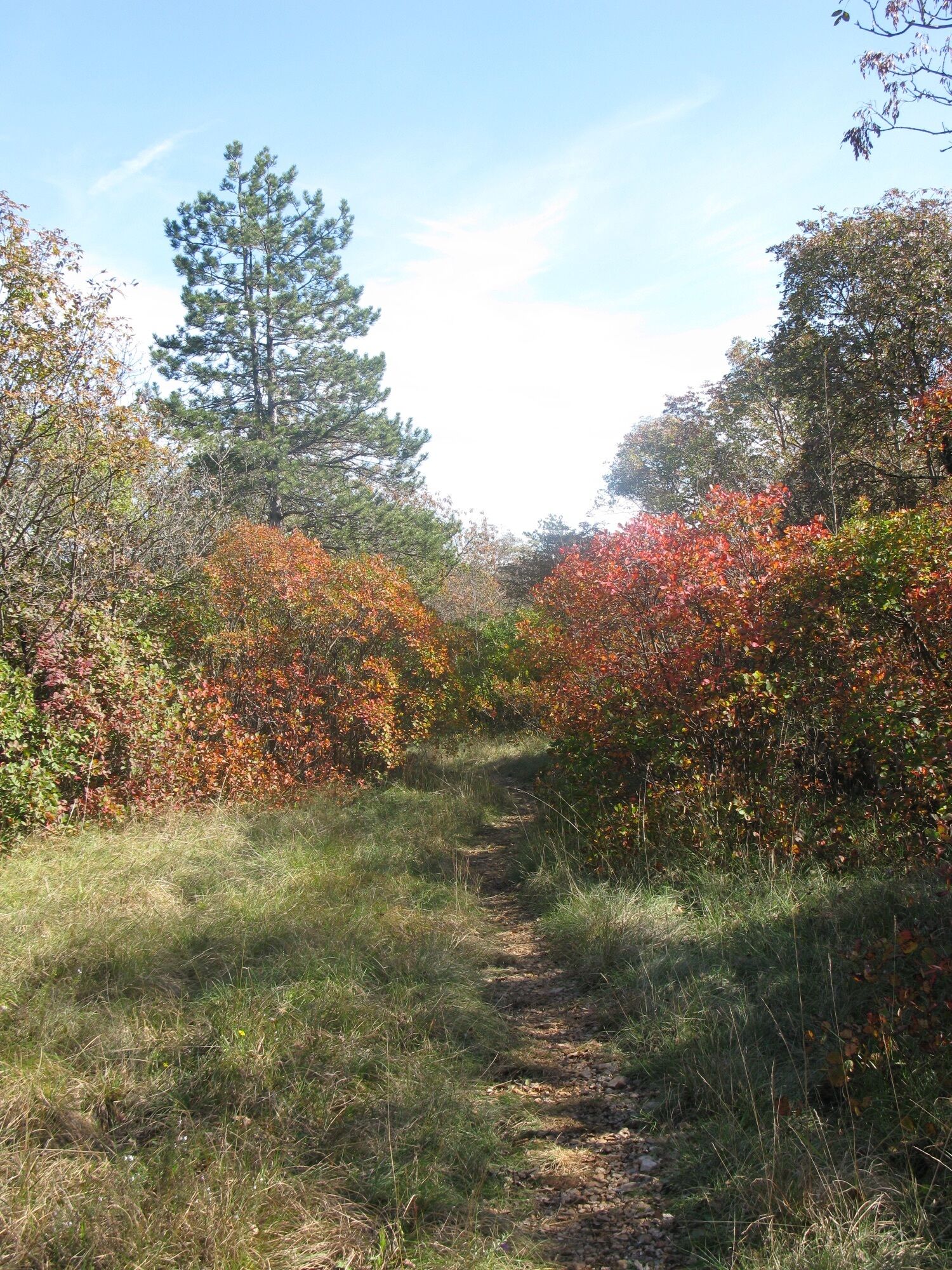
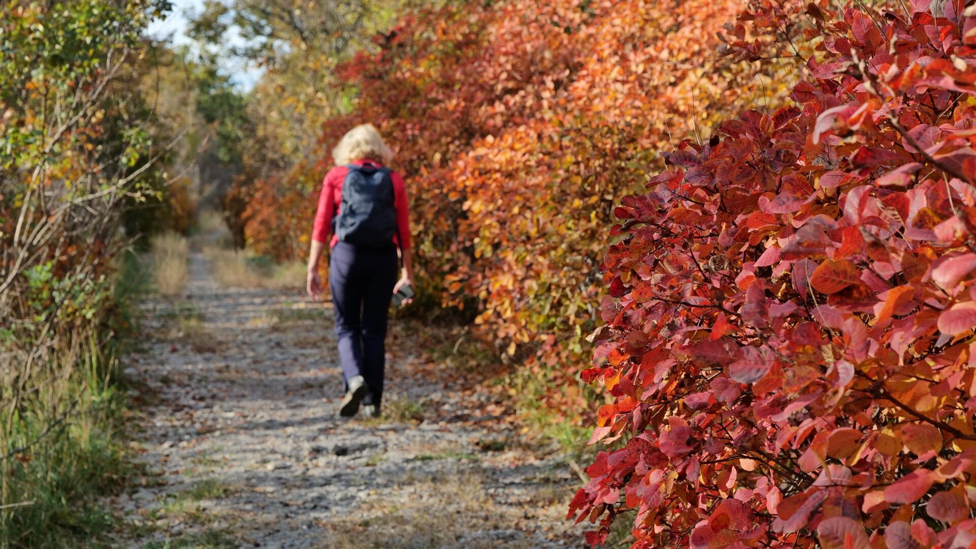
You encounter traces of the First World War at every step. The stage ends with a short walk along the Vipava River back to Miren.
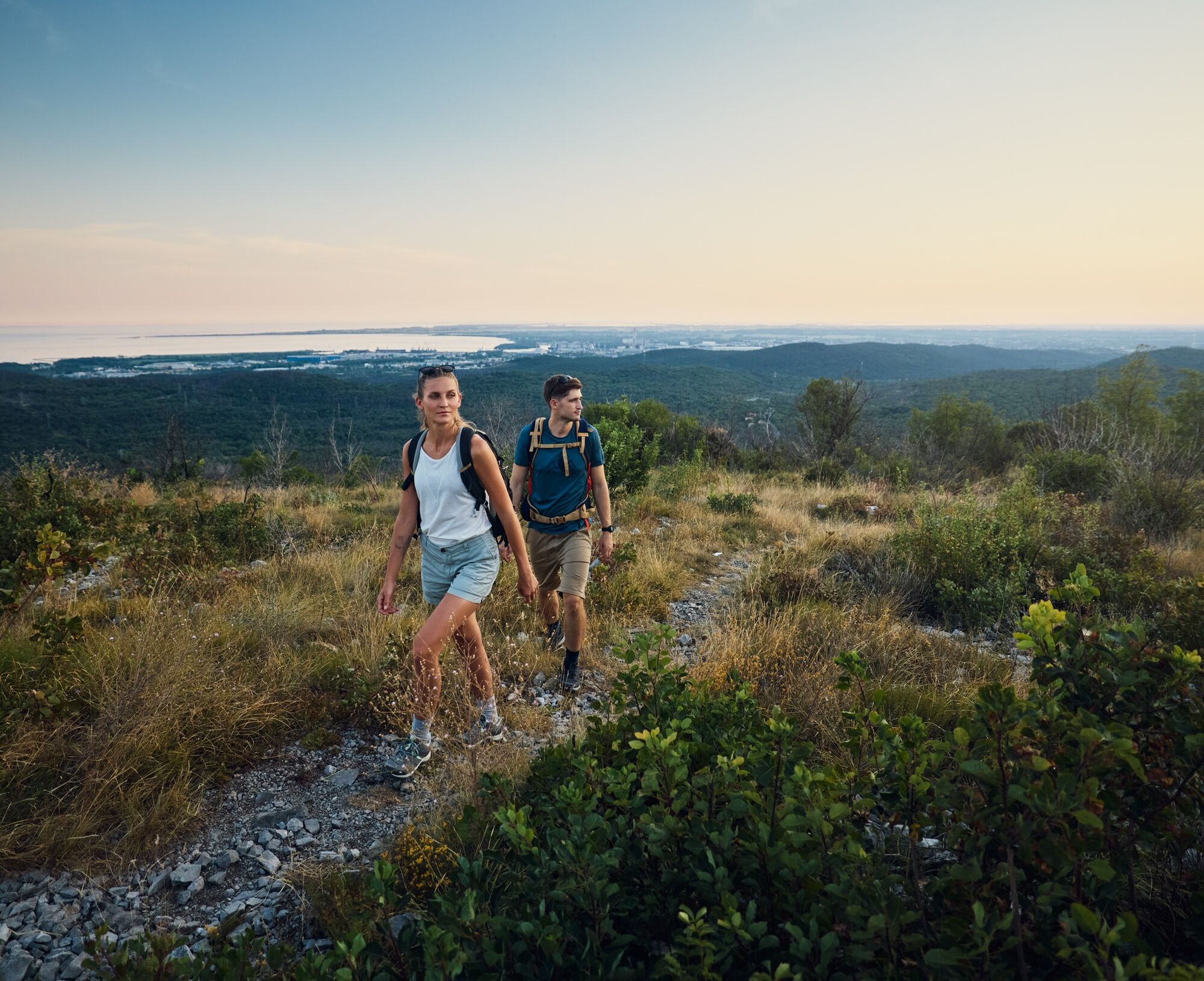
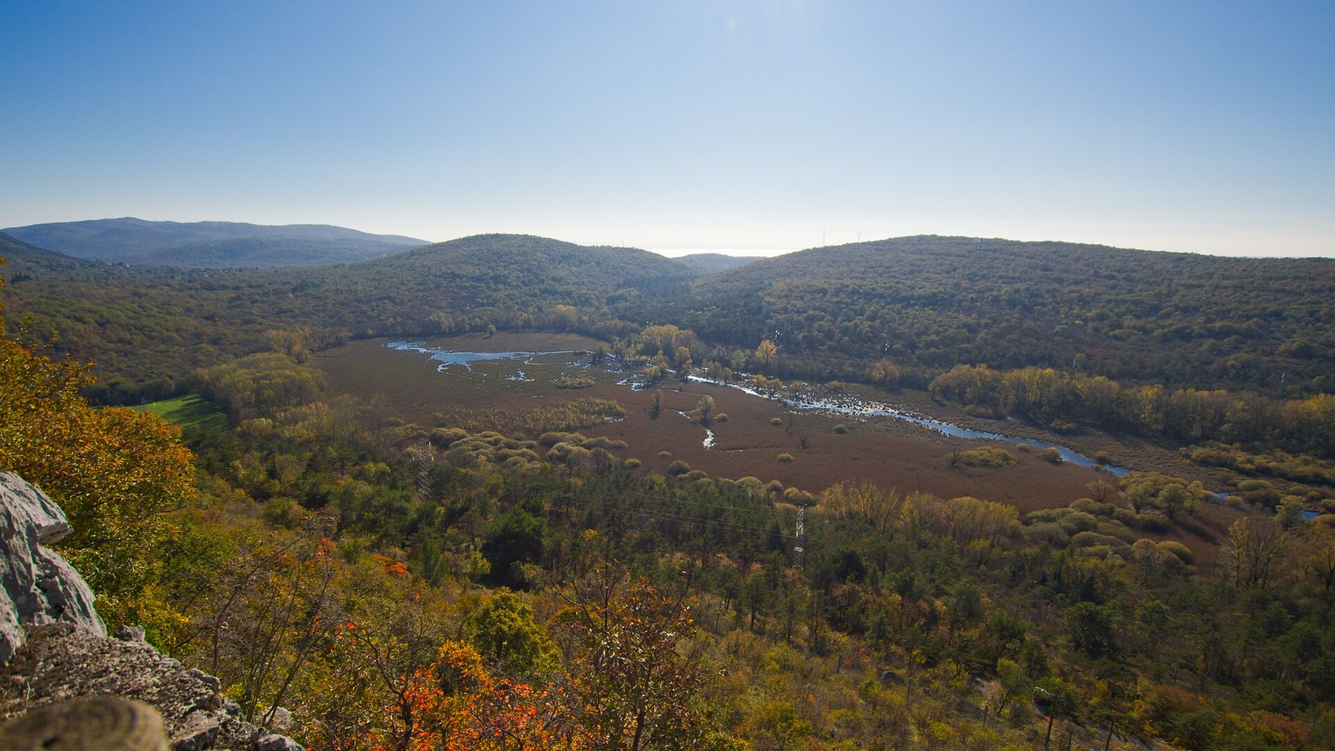
At the second junction, take the right turn to the top of Gorjupa kupa. At the summit, where a memorial to fallen soldiers stands, a fine view opens over the Gulf of Trieste.
Descend from the summit to Lake Doberdò / Lago di Doberdò. Reach the lake at the viewpoint, which floods and becomes inaccessible when water levels are high. Follow the eastern shore of the lake to the path junction where the CAI trail climbs towards Gradina.
Before you turn uphill, you can continue straight ahead for another 200 m to the paludarium at Lake Doberdò. The building still awaits full restoration, but just behind it you can admire the mysterious springs that feed the lake. Then return to the CAI path junction.
Climb up to Rifugio Casa Cadorna, then continue left on the level path along the edge of the escarpment to the Gradina Visitor Centre.
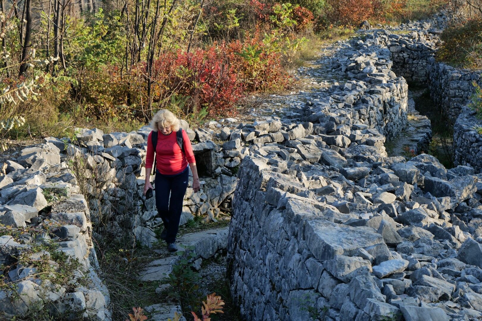
Continue uphill and across the karst grasslands of Ograde to the far side, where the route descends to PalkišÄe / Palchisce. The terrain here is not easy to read and there are many junctions, so follow the waymarks and the GPX track carefully.
From PalkišÄe, continue to Devetaki / Devetachi on a minor asphalt road. In the hamlet of Vižintini / Visintini, you can visit the Hungarian chapel from the First World War.
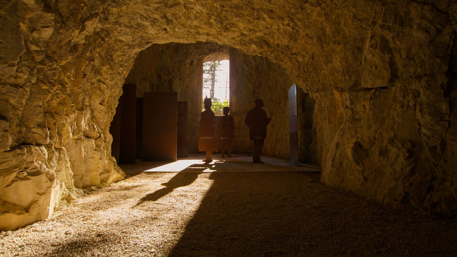
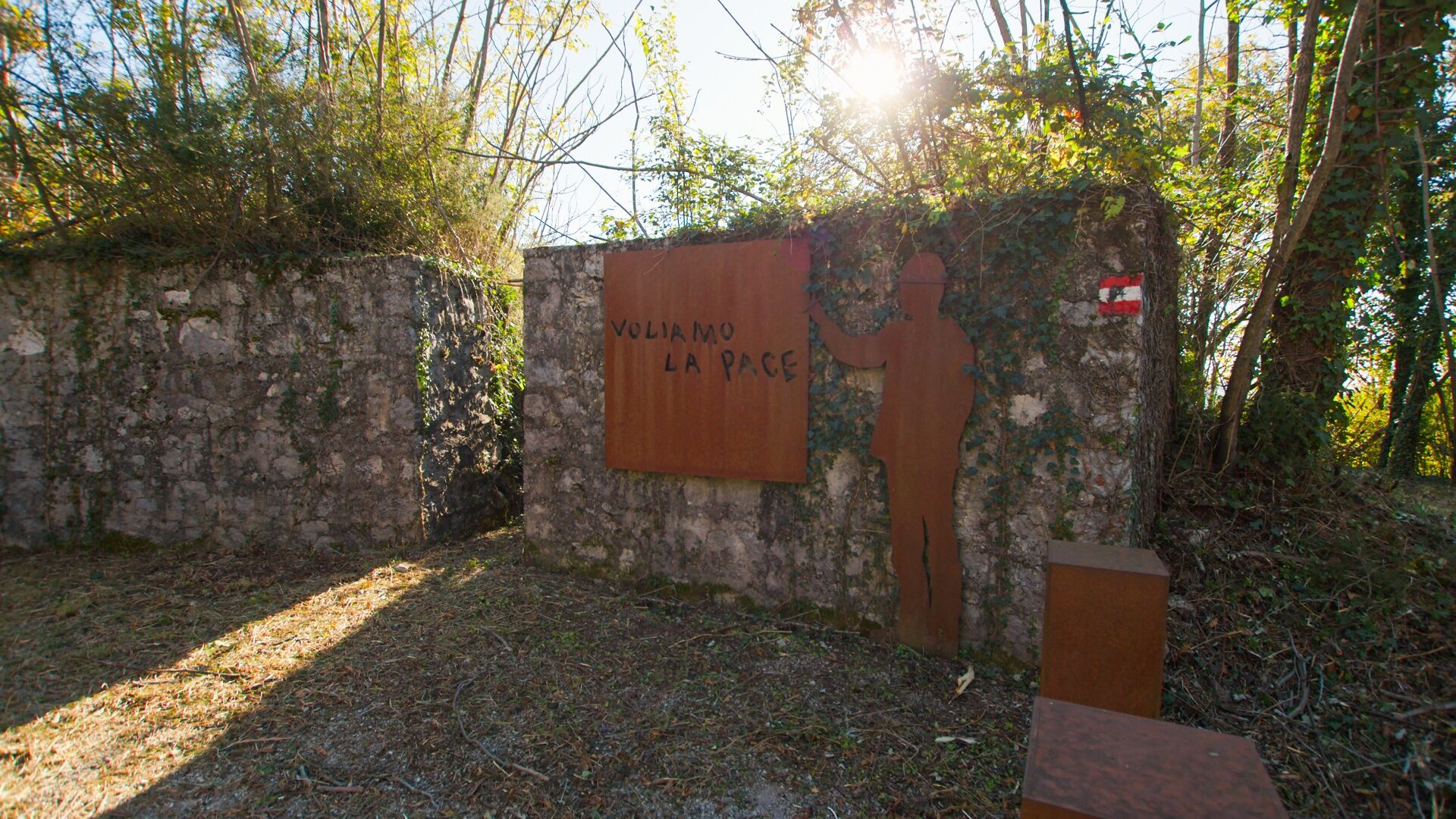
Before entering Devetaki / Devetachi, where the route crosses the main road, a cart track branches uphill left and leads to the top of Brestovec. It is worth spending time here. Visit the highest point, which is both a memorial and an excellent viewpoint, and above all do not miss the former artillery tunnel, where the open-air museum of the Walk of Peace presents stories and messages from First World War soldiers.
Descend through the forest past the remains of defensive lines to the village of Gabrje / Gabria. Continue to the main road, cross it, and then follow the bank of the Vipava River to Miren.
Below Miren Castle, before entering the central part of the town, return to the river along the eastern edge of the settlement. Cross the bridge to the other side and continue on the riverside path to the next bridge, which leads back to the town centre and to the car park by the municipal building, where the Carsus Trail officially begins.
Tak
Tak
Standard hiking equipment, light hiking shoes and clothing suitable for the season.
The trail is passable all year round, but the best and most beautiful times are during spring and autumn. It will not disappoint even in winter, but in summer the temperatures may be uncomfortably high.
You can reach Jamlje / Jamiano by car on the regional road from the direction of Trieste or Nova Gorica / Gorizia.
There is no public transport linking the area along this stage. A bus runs through Jamlje / Jamiano towards Nova Gorica / Gorizia, and you can also reach Miren by bus.
Park in the car park in front of the Drejče tourist farm.
T2
At Brestovec, do not miss the artillery tunnel, now arranged as an open-air museum on the Walk of Peace.
On this stage, too, you follow monuments from the First World War. Before your walk, read at least a little about the horrors of the Isonzo Front.
Popularne wycieczki w okolicy
-
4,9
Rilkeweg
światłoWędrówka 6,19 km -
2,0
Grado - Triest (C204)
średniKolarstwo długodystansowe 68,2 km -
4,0
Rundgang von Cormons
światłoWędrówka 7,31 km -
1,0
Die Isola della cona
światłoWędrówka 12,7 km -
The Doberdò and Pietrarossa Lakes Nature Reserve Loop Trail
średniWędrówka 11,2 km -
Szlak Vigne Alte: pełna pętla z Pradis, Spessa i Subida
średniWędrówka 14,0 km -
A nature walk on Mount Ermada
światłoWędrówka 4,93 km -
The Carsus Trail, Stage 2: Renče – Lipa
średnidługodystansowy szlak pieszy 22,7 km -
The Carsus Trail, Stage 1: Miren – Renče
światłodługodystansowy szlak pieszy 7,80 km -
Carsus Trail - a long-distance trail through the Karst region of Slovenia and Italy
średnidługodystansowy szlak pieszy 102,2 km
Wędrówki i tropienie


Nie przegap ofert i inspiracji na następne wakacje
Twój adres e-mail została dodana do listy mailingowej.