© Pascal Gertschen - Zermatt Tourismus

© Pascal Gertschen - Zermatt Tourismus

- Krótki opis
-
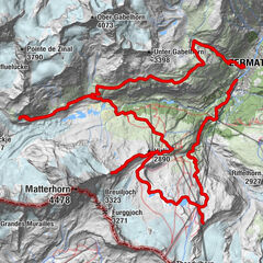
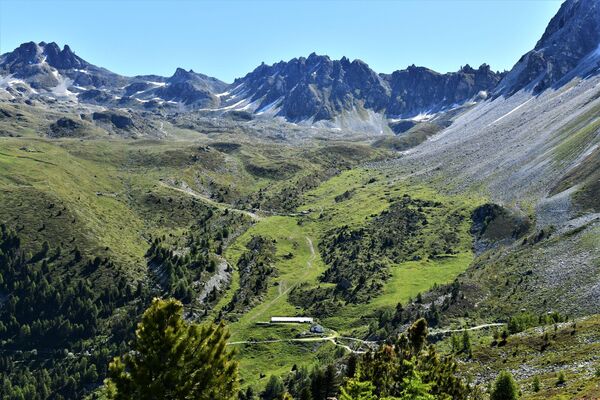
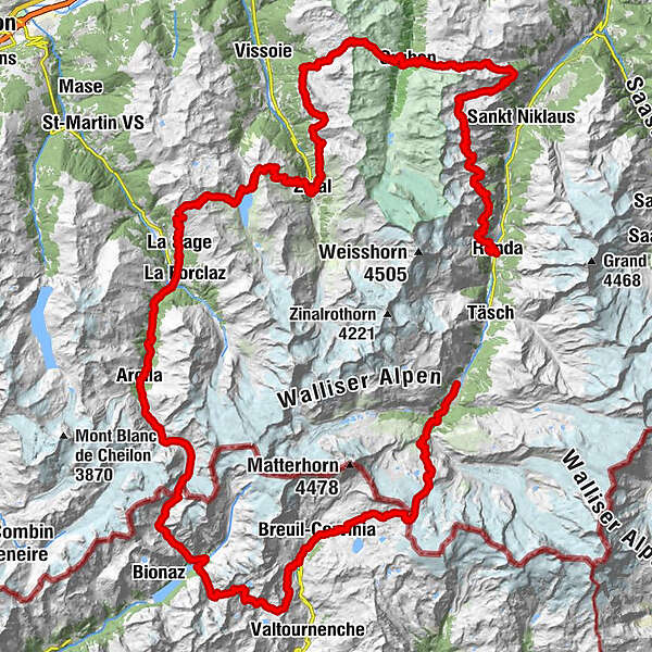
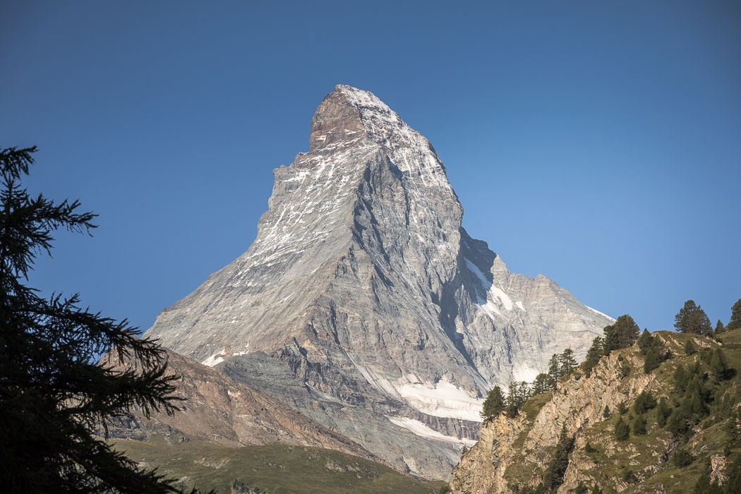
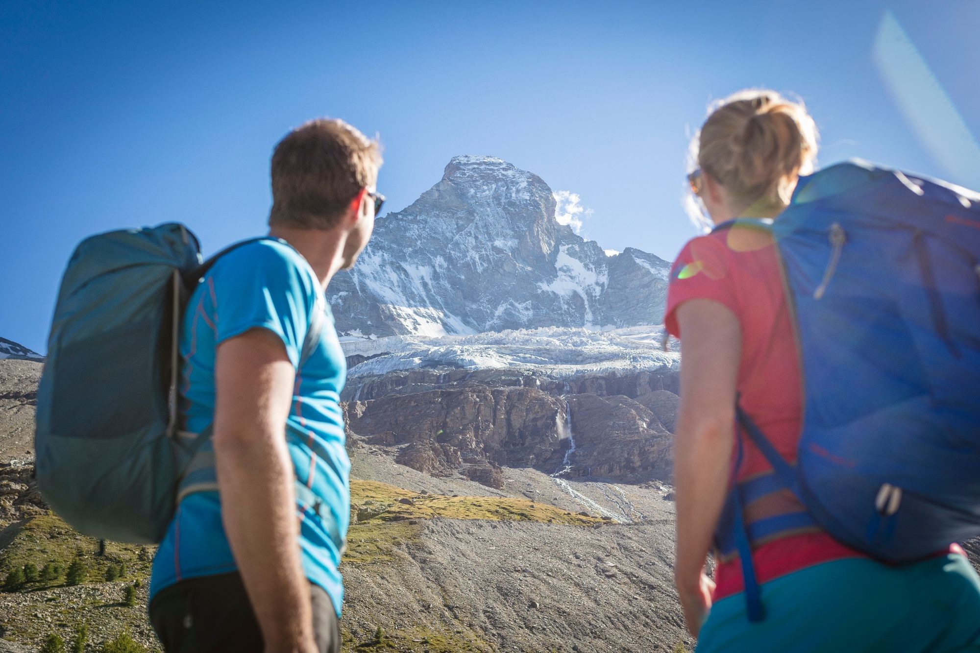
This is the ultimate hike around the world’s most beautiful mountain, the Matterhorn. The tour begins in Randa and leads anticlockwise around the pyramid-shaped peak, revealing the iconic mountain’s many different facets.
- Stopień trudności
-
ciężkie
- Ocena
-
- Trasa
-
RandaTopalihütte13,2 kmStelline (2.765 m)14,9 kmP258420,0 kmÄbiheiji (2.488 m)24,6 kmGrüobu Oberstafel (2.370 m)31,4 kmP215132,6 kmGruben34,0 kmRestaurant Schwarzhorn (1.825 m)34,1 kmMeide36,3 kmHôtel Weisshorn44,8 kmPralonzet55,5 kmZinal (1.675 m)56,4 kmSorebois60,5 kmLa Vouarda (2.687 m)62,4 kmClems & Fabs66,5 kmPrés de Villaz77,8 kmVilla (Evolène) (1.742 m)78,3 kmLe Borza78,5 kmPlace de jeu79,0 kmLes collines79,1 kmLa Sage79,3 kmL'Ecureuil - Café-restaurant et gîte alpin79,3 kmTaillau79,8 kmPlan de Boë80,0 kmLes Coulayes80,2 kmLes Haudères (1.454 m)81,7 kmCafé-Restaurant la Cordée81,8 kmPralovin82,3 kmOuartsé85,8 kmLa Gouille85,9 kmPension du Lac Bleu85,9 kmSatarma86,8 kmPramousse87,8 kmLa Lé88,0 kmPra Grassette88,1 kmLa Monta88,9 kmTsalion89,1 kmHôtel du Glacier89,7 kmArolla (2.006 m)89,8 kmMont-Collon90,1 kmCascades d'Arolla (2.260 m)90,1 kmLes Magines90,3 kmGarda106,0 kmGrand Oren106,5 kmPraz Mondzou Damon106,7 kmPraz Mondzou Desot107,2 kmPrarayer (2.005 m)107,9 kmRifugio Prarayer (2.005 m)107,9 kmNoalle108,8 kmPian dell'Arp109,0 kmValcornera (2.170 m)109,7 kmRifugio Perucca-Vuillermoz114,4 kmBivacco Duccio Manenti115,2 kmChevalley (2.323 m)117,9 kmBelvedere sulla Finestra di Cignana118,9 kmBelvedere119,2 kmAvouil124,0 kmChiesa della Regina della Valle125,6 kmLe Breuil - Cervinia (2.050 m)125,6 kmVieille126,6 kmTza De Vieille (2.438 m)128,0 kmPlan Maison (2.555 m)128,7 kmTuk Tu128,7 kmBar Ristorante Bontadini132,0 kmRefuge du Théodule134,0 kmGandegghütte136,9 kmFuri143,8 kmZum See144,6 kmBlatten144,9 kmKirche St. Mauritius146,7 kmZermatt (1.608 m)146,8 km
- Najlepszy sezon
-
stylutmarkwimajczelipsiewrzpaźlisgru
- Najwyższy punkt
- 3.301 m
- Miejsce docelowe
-
Zermatt (1,620 m)
- Profil wysokości
-
 © outdooractive.com
- Autor
-
Wycieczka Matterhorn Tour jest używany przez outdooractive.com pod warunkiem.
GPS Downloads


Informacje ogólne
Przystanek odświeżania
Flora
Fauna
Obiecujący
Więcej wycieczek w regionach
-
Unterwallis
1196
-
Mattertal
555
-
Zinal
277