
- Krótki opis
-
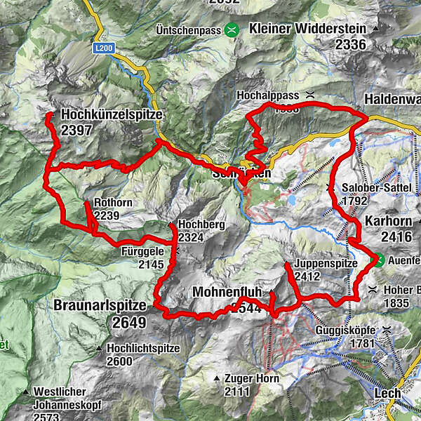
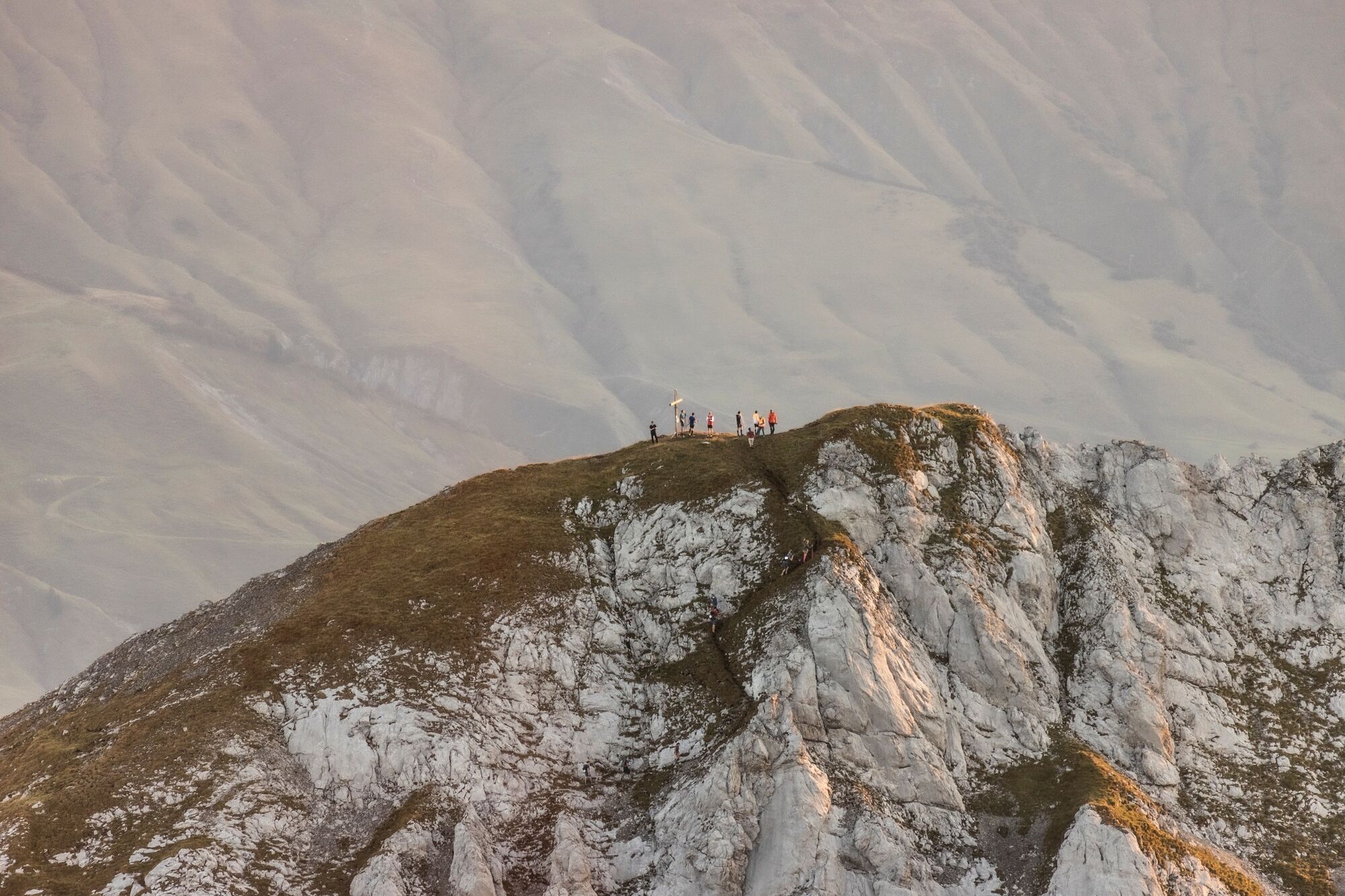
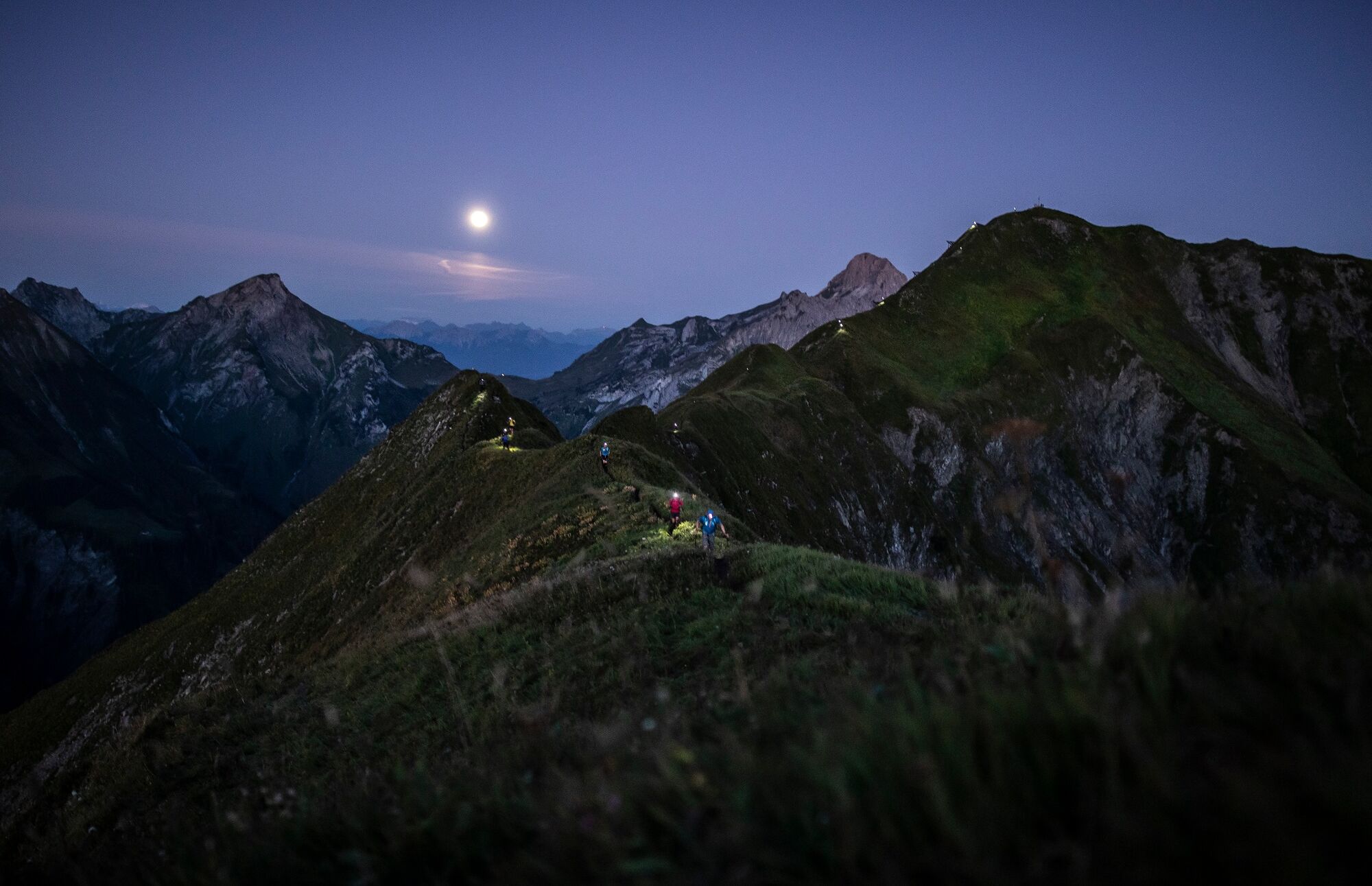
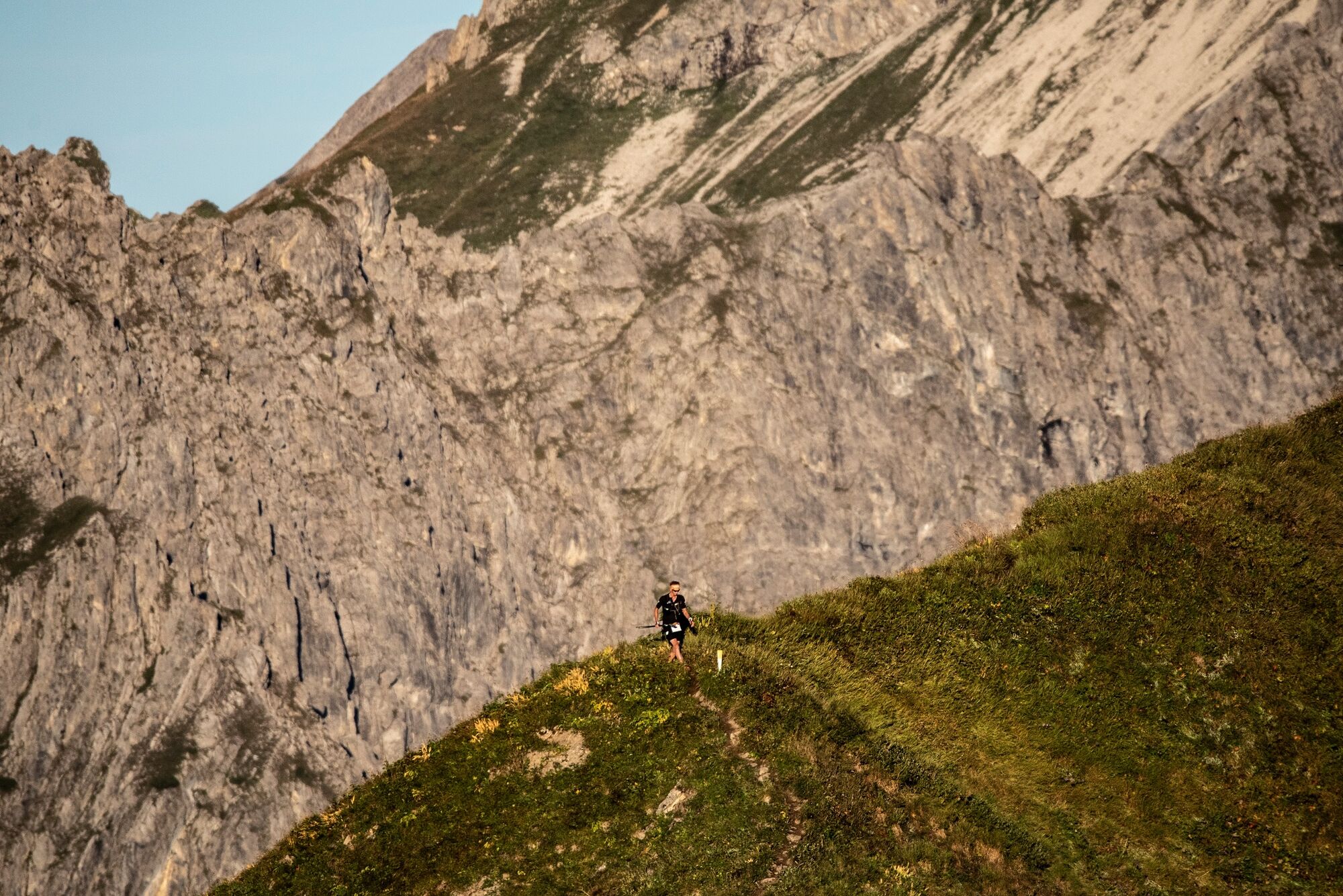
The 50-kilometer-long tour spans 4,500 metres of altitude, which the participants have to conquer. Only very few manage to finish the tour in less than ten hours. Those who make it more comfortable reach the finish line after about 20 hours over the last steep descent. The challenge for most participants is not the race, but the endurance, because even ambitious hikers come to their limits here. The Seven Summits Tour runs over the seven mountains that surround the small village of Schröcken in the Bregenzerwald: Höferspitze (2.131 m), Juppenspitze (2.412 m), Mohnenfluh (2.542 m), Braunarlspitze (2.649 m), Hochberg (2.324 m), Rothorn (2.239 m) and Hochkünzelspitze (2.397 m). The entire circuit runs on marked alpine hiking trails without great technical difficulties, only stamina is required. Participants start at different starting times, depending on the participant’s fitness level: 2.00 am, 3.30 am, 5.00 am and 6.00 am. Even for the first start times a very good physical condition is required. The last group completes the course in mountain running mode.
- Stopień trudności
-
ciężkie
- Ocena
-
- Trasa
-
TannbergSchröcken (1.269 m)0,0 kmMaterialseilbahn Körbersee0,1 kmRitters0,5 kmHöferspitze (2.131 m)4,8 kmAlpekörb8,3 kmSB-Restaurant Salober8,4 kmS18,6 kmSalober-Sattel (1.792 m)9,9 kmObere Auenfeld Alpe (1.732 m)11,3 kmUntere Auenfeldalpe12,1 kmJuppenspitze (2.412 m)17,1 kmMohnenfluh (2.544 m)20,0 kmBraunarlspitze (2.649 m)24,9 kmFürggele (2.145 m)26,9 kmKilchli (2.185 m)27,0 kmHochberg (2.324 m)27,9 kmRothorn (2.239 m)31,5 kmBiberacher Hütte (1.846 m)34,7 kmSchadonapass (1.836 m)34,9 kmHochkünzelspitze (2.397 m)37,2 kmSchadonapass (1.836 m)39,5 kmRothenplatz39,7 kmLandsteg44,7 kmUnterboden45,8 kmIm Heimboden46,7 kmTannberg47,0 kmSchröcken (1.269 m)47,1 km
- Najlepszy sezon
-
stylutmarkwimajczelipsiewrzpaźlisgru
- Najwyższy punkt
- 2.629 m
- Miejsce docelowe
-
Schröcken village square
- Profil wysokości
-

-

-
AutorWycieczka Seven Summits Tour Schröcken jest używany przez outdooractive.com pod warunkiem.