


San Pellegrino Pass - Fuciade - San Pellegrino Pass
from Moena go up to the San Pellegrino Pass (1,919 m), then go down the other side for 200 m until you come to a bridge where the ski-run goes over the road. Turn left here onto the road which leads to...
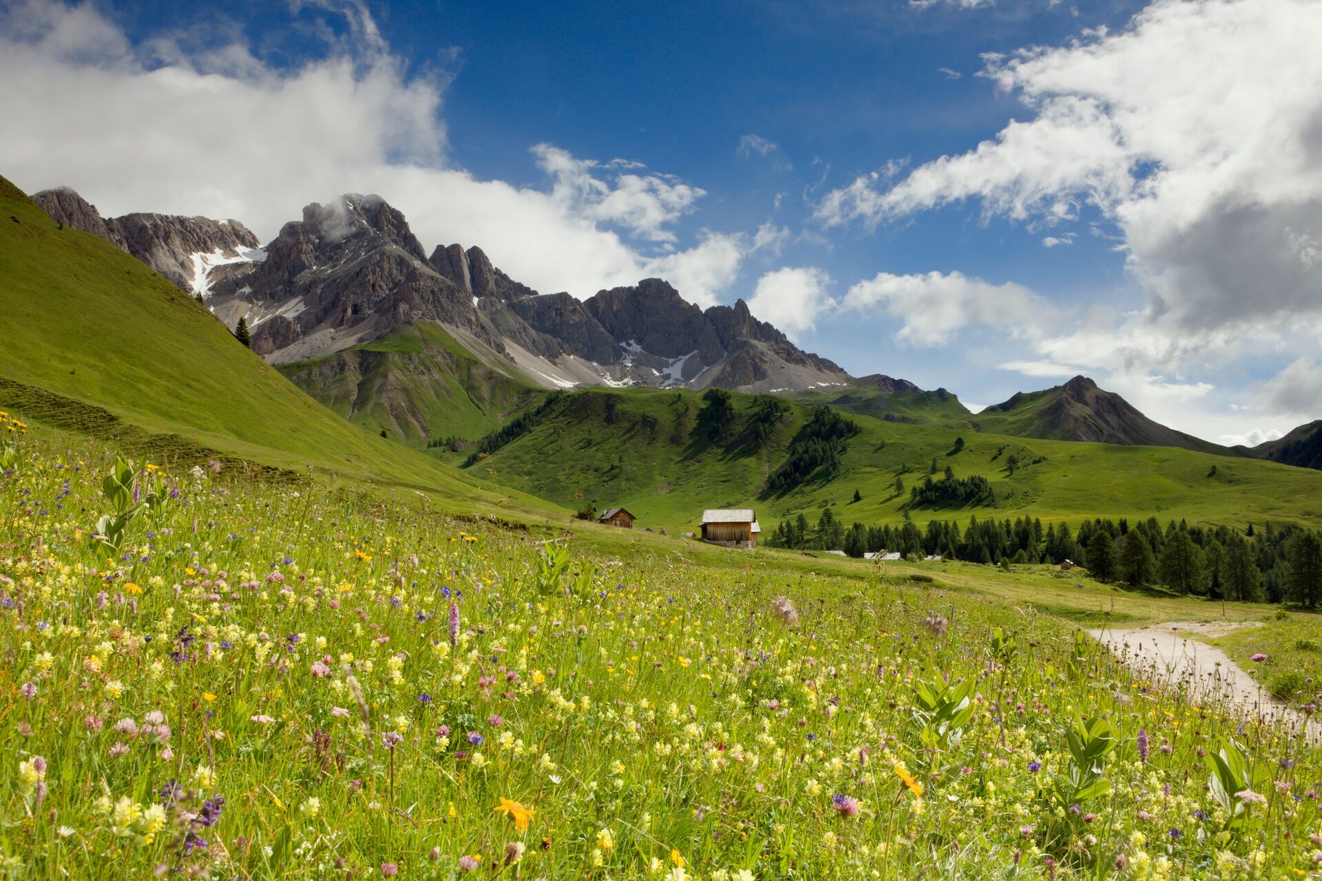
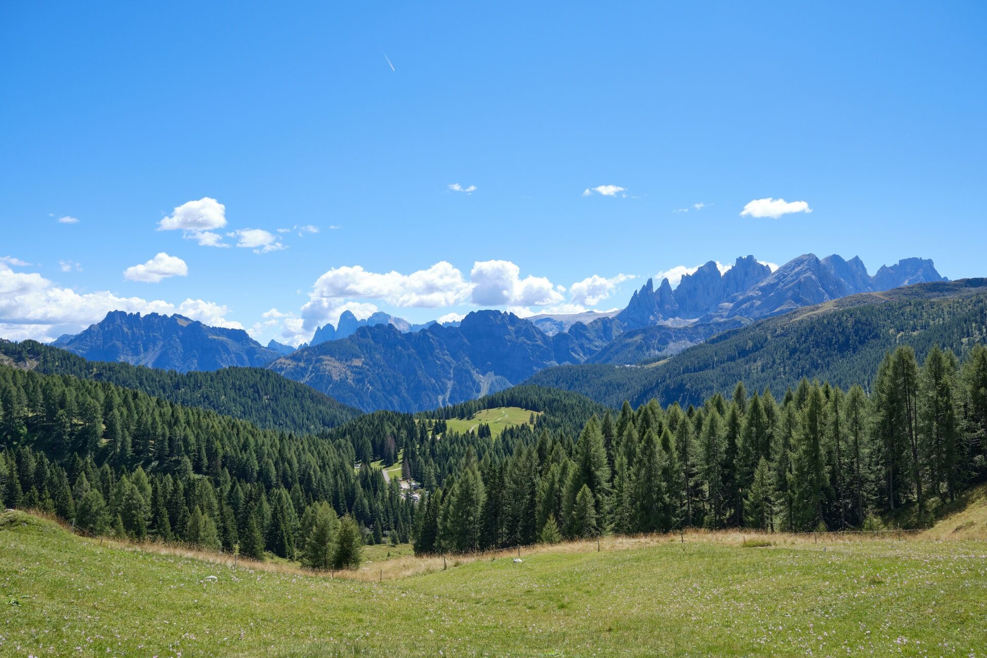
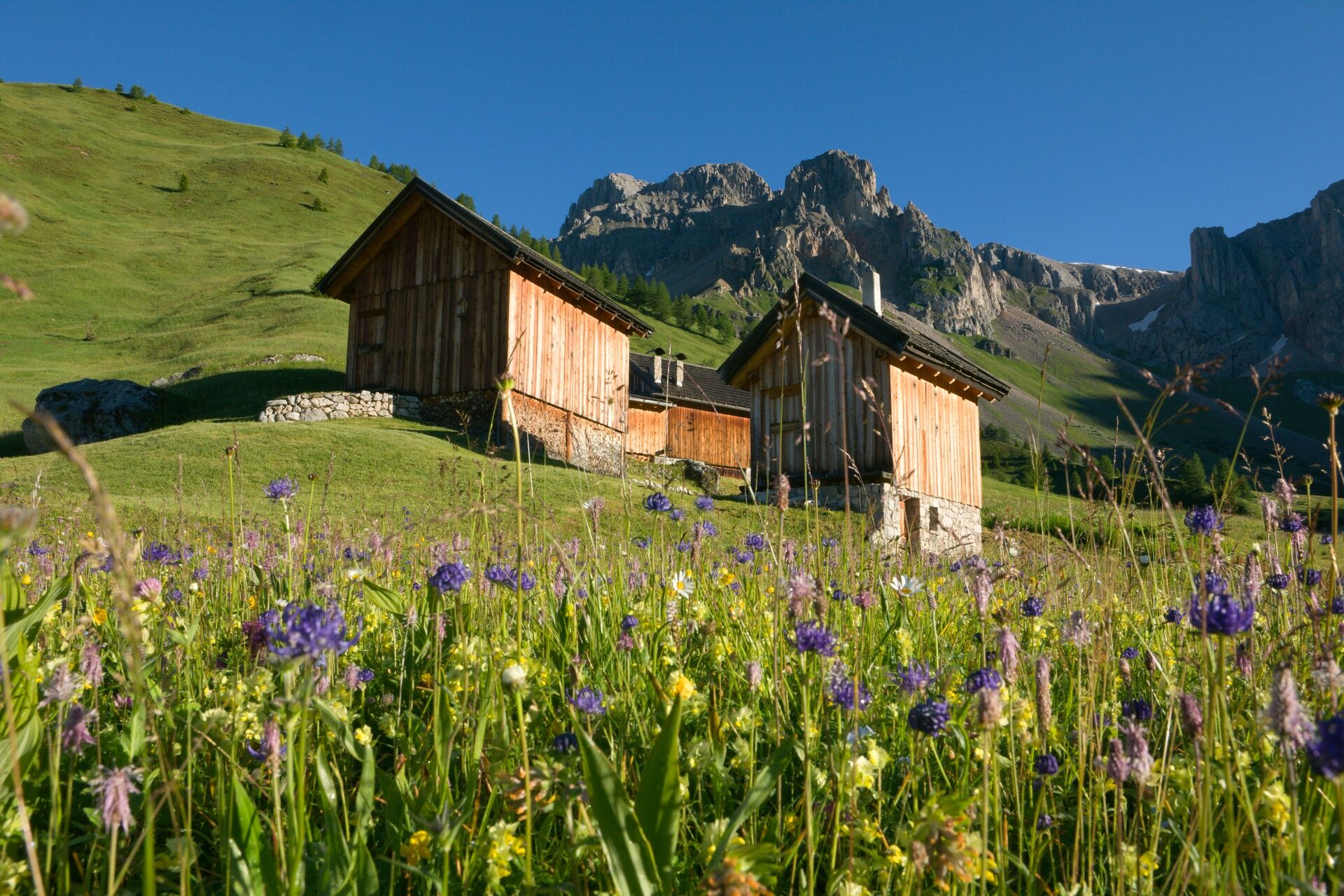
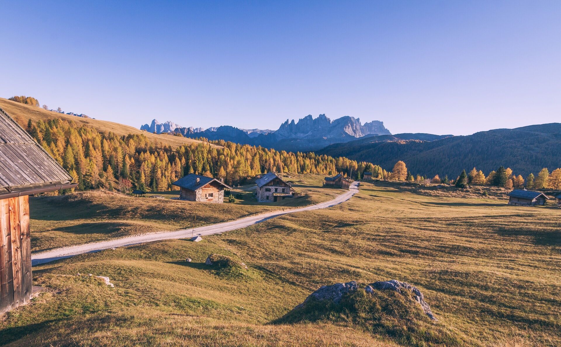
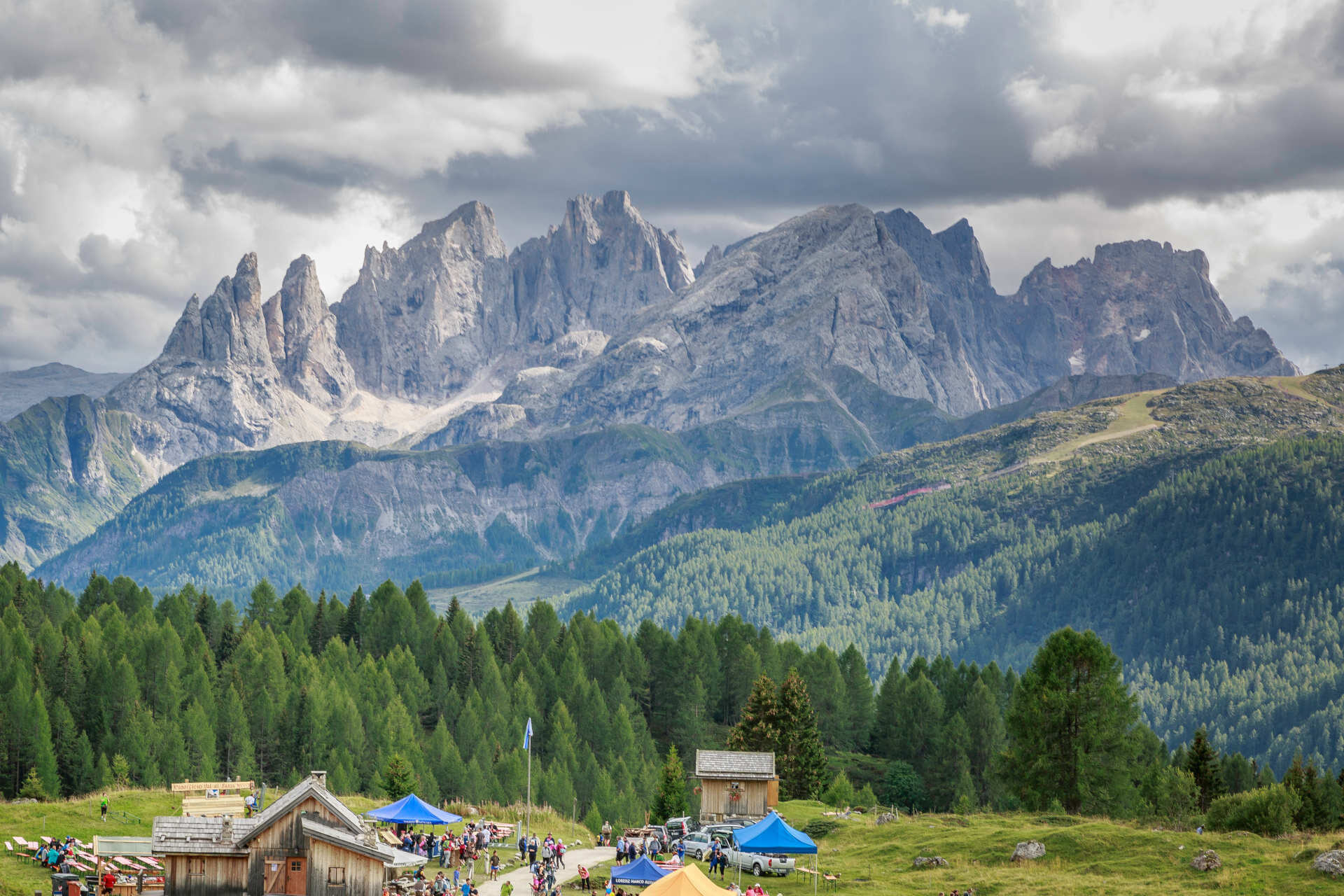
from Moena go up to the San Pellegrino Pass (1,919 m), then go down the other side for 200 m until you come to a bridge where the ski-run goes over the road. Turn left here onto the road which leads to the parking area nearby Miralago Hotel. Leave the car in the car park and set off along the more or less flat dirt road which will take you to the "Fuciade" basin. This spectacular amphitheatre is dominated by magnificent peaks ("Sas de l’Om", "Jigolé", "Sas de Valfreida"). It is particularly interesting to the botanists due to the presence of plants and flowers unique to this area. The itinerary ends at the Fuciade Refuge (1,972 m; 1 hour). Go back along the same path.

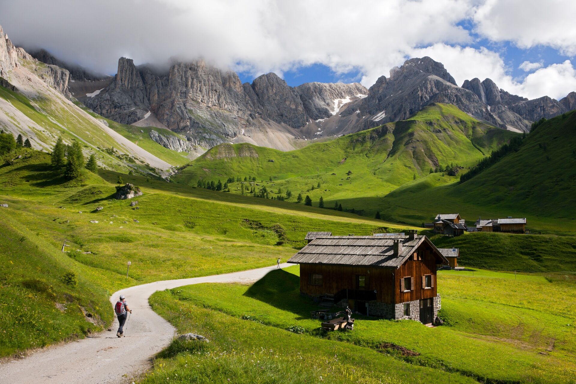
The itinerary leaves from San Pellegrino Pass (1,919 m); it is reached by car or public transport (bus) from Moena (11 km). Parking is near the Miralago Hotel or in front of the "Ospizio" (an old building near the small church).
The itinerary ends at the Fuciade Refuge (1,972 m). Go back along the same path. The walk is suited for trekking-strollers.
Tak
Tak
Tak
Tak
Tak
Carry in your backpack the necessary to face possible emergency situations, and a first aid kit.
2.Walk slowly, enjoy the landscape and the silence.
3. Inform somebody about your itinerary, return time and possible changes.
4. Rely on professionals (mountain and hiking guides).
5. Help those in need. Call 112 only in case of real necessity.
6. Make sure you have suitable clothes and equipment + some water and snacks.
7. Respect the environment around you and its inhabitants. Bring back your rubbish.
8. Follow the marked trails avoiding those in the bikepark.
9. To protect the wonders of nature, leave everything in its place.
10. Bring your pet along, but keep it on a leash.
Other accesses to the Val di Fassa:
from the A27 motorway (Venice), Belluno/Ponte nelle Alpi exit, then take S.S. 203 to Agordo and S.P. 346 to San Pellegrino Pass - Moena (Val di Fassa). At the roundabout in Moena, follow the direction of Canazei upwards from the A27 motorway (Venice), exit Belluno/Ponte nelle Alpi, S.S. 203 to Agordo/Alleghe/Rocca Pietore first and S.P. 641 to Fedaia Pass - Canazei coming from Arabba, S.S. 48 Pordoi Pass - Canazei from Val Gardena, S.S. 242 Sella Pass - CanazeiRegular bus service operated by the bus company SAD in Val di Fassa:
bus line n. 180 Vigo di Fassa - Passo Carezza - Bolzano- Nearest bus stop (Trentino Trasporti): San Pellegrino Pass > Ospizio/Chiesetta Sant'Anna
Parking is near the Miralago Hotel, in front of the "Ospizio" (an old building near the little church), or at the "Col Margherita" cable car valley station.
Strèda Roma, 36
38032 Canazei (TN)
Phone +39 0462 609500
info@fassa.com
www.fassa.com
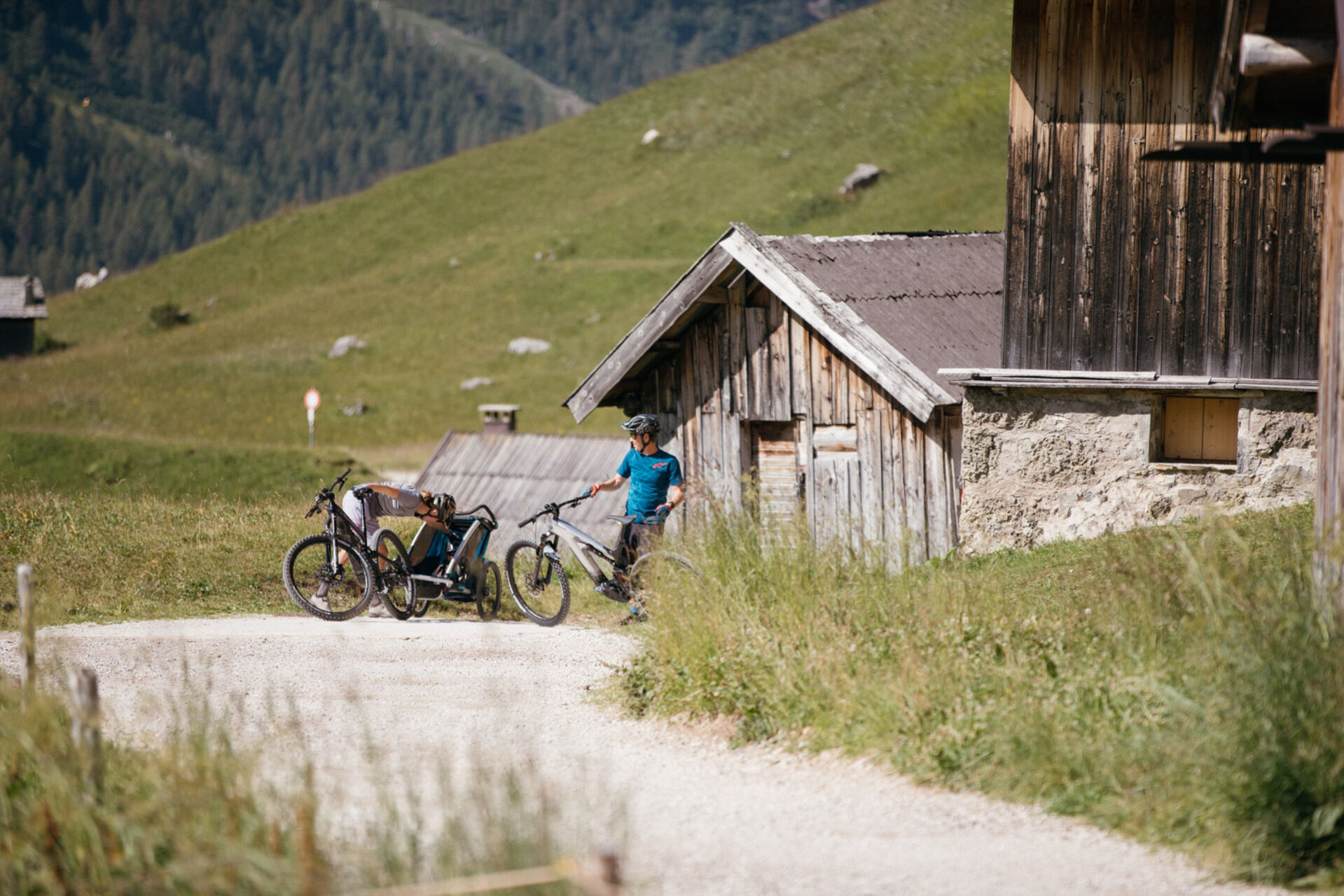
In addition to walking, you can reach the Fuciade Rifugio by horse-drawn carriage (paid service provided by Michele Defrancesco - Phone +39 346 2156047; suspended for summer 2025).
Kamery internetowe z trasy
-
Marmolada
-
Col Margherita
-
Col Margherita
-
Col Margherita
-
Falcade
-
Arrivo funivia col Margherita
-
Lago Cavia
-
Seggiovia Lago cavia Col Margherita
-
Col Margherita
-
Col Margherita
-
Col Margherita
-
Col Margherita
-
Moena - San Pellegrino Pass / Chalet Isabella
-
Cima Uomo
-
Cima Uomo
-
Cima Uomo
-
Cima Uomo
-
Cima Uomo
-
Cima Uomo
-
Cima Uomo
-
Cima Uomo
-
Col Margherita Sud
-
Col Margherita Sud
-
Col Margherita Sud
Aktywności na trasie
-

Soraga di Fassa, Trentino-Alto Adige/Italia
01.05.2026 – Wędrówka -

Soraga di Fassa, Trentino-Alto Adige/Italia
04.09.2025 – Wędrówka -
Soraga di Fassa, Trentino-Alto Adige/Italia
04.09.2025 – Wędrówka -

Moena, Trentino-Alto Adige/Italia
07.08.2025 – Wędrówka -

Soraga di Fassa, Trentino-Alto Adige/Italia
02.04.2024 – Wędrówka
Popularne wycieczki w okolicy
-
4,6
Pordoi Pass - Sass Pordoi - Forcella Pordoi - Piz Boè - Boè Refuge - Forcella Pordoi - Pordoi Pass
ciężkiWędrówka 8,39 km -
5,0
Langkofel Klettersteig/Ferrata Furcela de Saslonch
ciężkiVia ferrata 7,07 km -
4,4
Dolomiten Sellagruppe, Alb. Col di Lana, Sas de Pordoi, Piz Boé retour 22.06.2016
średniWędrówka 5 km -
5,0
Ciampedie - Gardeccia - Refuges Vajolet and Preuss - Refuge Re Alberto I - Gardeccia - Ciampedie
ciężkiWędrówka 11,8 km -
5,0
Ciampedie - Gardeccia - Principe Pass - Antermoia Refuge - Val Duron - Campitello
ciężkiWędrówka 18,7 km -
4,2
Viel dal pan
światłoWędrówka 6,60 km -
5,0
Via Ferrata "Cesare Piazzetta"
ciężkiVia ferrata 9,07 km -
4,4
Cavallazza Peak
średniWędrówka 7,82 km -
5,0
Rosengarten: Cigoladepass und Fassaner Höhenweg
średniWędrówka 15,6 km -
4,5
San Pellegrino Pass - Fuciade - Val Fredda - Malga Boer - San Pellegrino Pass
średniWędrówka 11,1 km

Wędrówki i tropienie


Nie przegap ofert i inspiracji na następne wakacje
Twój adres e-mail została dodana do listy mailingowej.