


Along Mancabrot Ridge to Lake Montesel
Zdjęcia naszych użytkowników
Along the trail, 13 points of special interest, 'stations', have been identified at which important natural, landscape, historical and cultural features can be observed. These stations are indicated on...
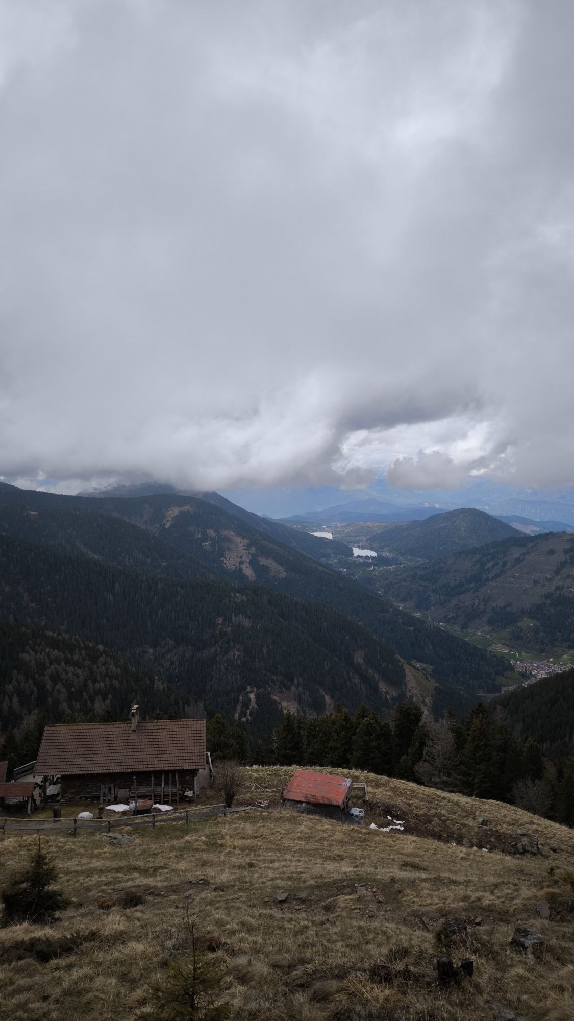
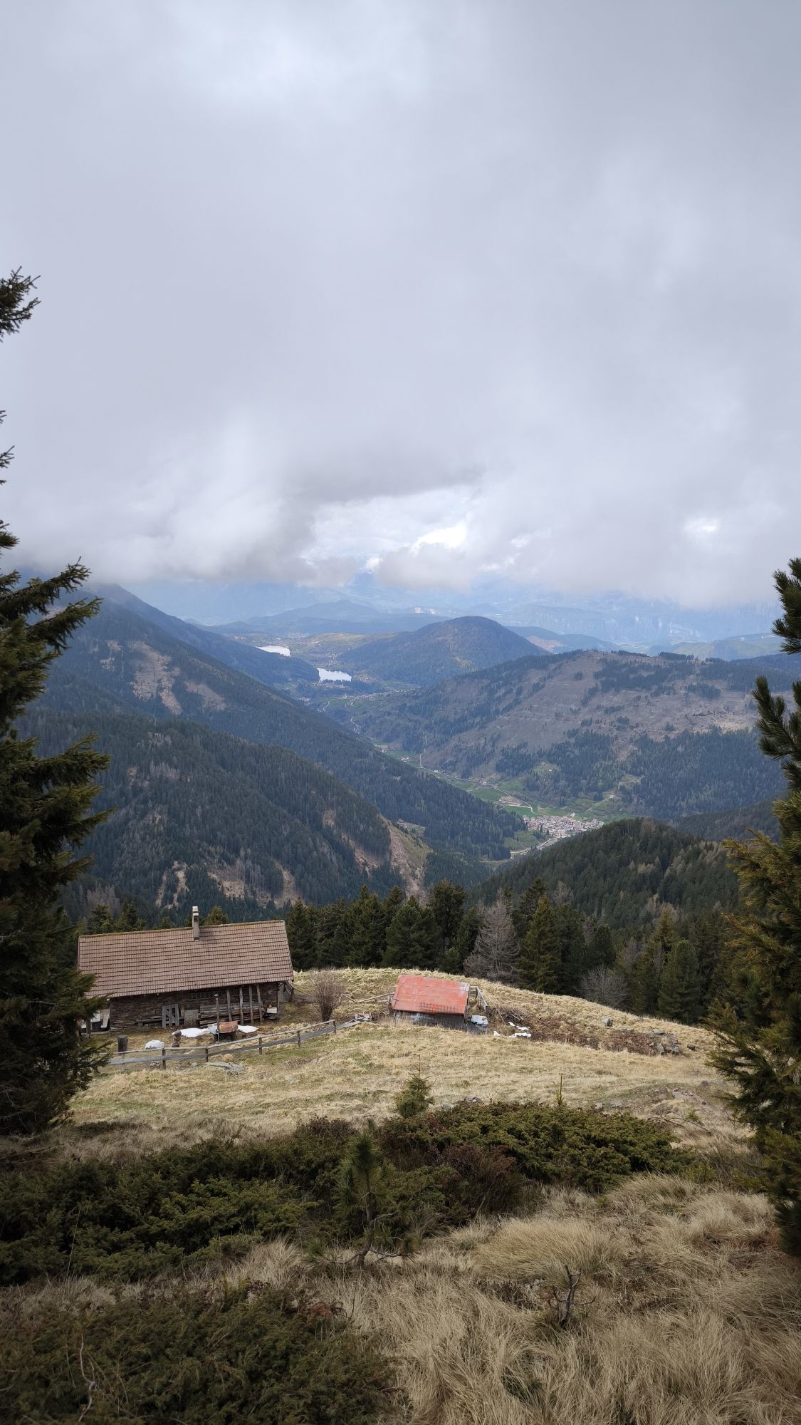
Along the trail, 13 points of special interest, 'stations', have been identified at which important natural, landscape, historical and cultural features can be observed. These stations are indicated on the ground by wooden markers with numbers that refer to the information on the notice boards. Some short steep sections require a minimum of attention, particularly if one proceeds in the opposite direction to that presented. The station's low altitude and thermophilic nature allow it to be visited even during most of the winter season. It is a loop trail that begins and ends at the Valternigo civic centre in the municipality of Giovo (information board, fountain and car park), at an altitude of approximately 650 metres. The path, which is rich in naturalistic, historical and archaeological points of interest, runs along the various pine-covered rises that make up the Mancabrot ridge and finally reaches the small, picturesque 'Lac de Montesel' wetland, located within the Maric Woods (812 m). From the pond we descend to the Pian del Lac saddle below, where we find another interesting marsh, apple orchards and meadows where it is not uncommon to spot deer and roe deer grazing. Through an evocative path that unravels among the various crops, we return to the starting point. The itinerary's kilometre development is modest, quantifiable at around 4.5 km, with a contained uphill difference in height of less than 200 metres; it is therefore a route suitable for many, which can be covered at a leisurely pace, taking into account a few stops at the information and viewpoints, in 2-3 hours, apart from any further exploration.

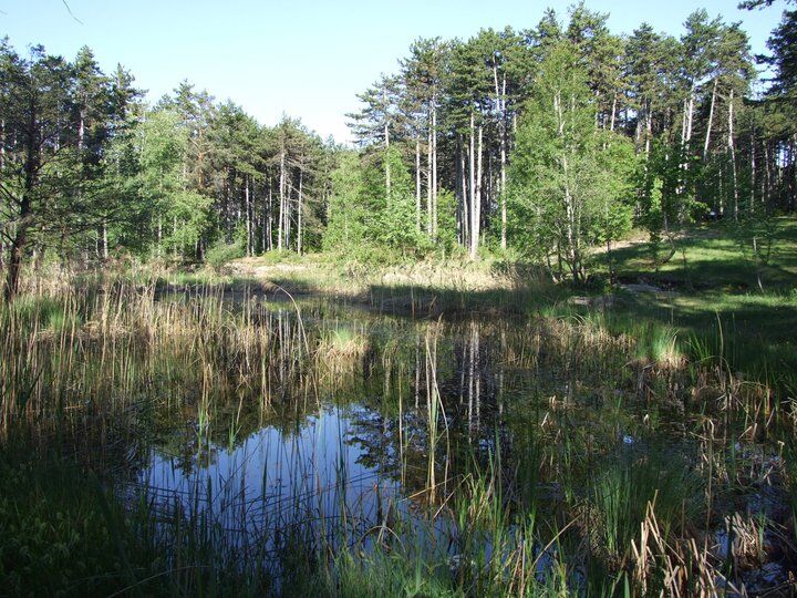
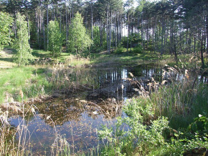
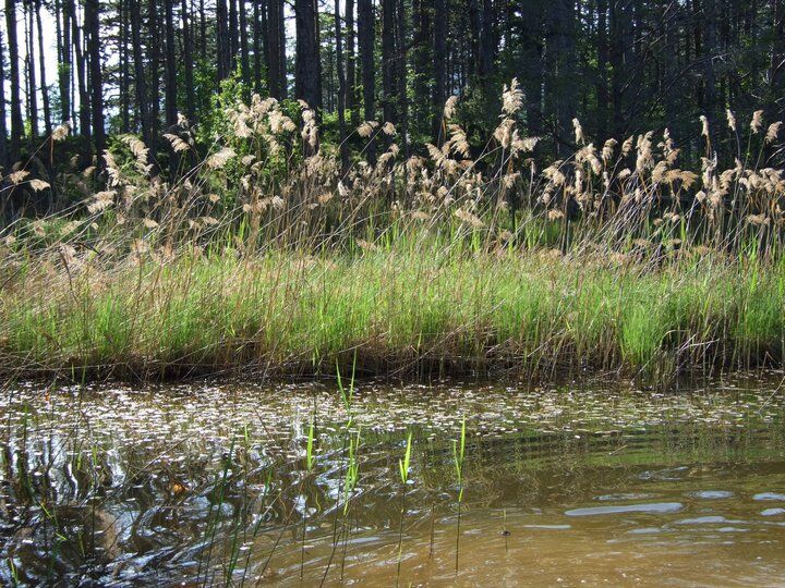
The walk starts from the civic centre of Valternigo. During the first stretch, you follow the 'sentiero naturalistico Mancabrot e Lac de Montesel' (Mancabrot and Lake Montesel naturalistic path) which runs through a centuries-old pinewood along the porphyry ridge of Dos Mancabrot. Leave the small blue-faced civic centre building behind you and take an uphill path on the right that takes you to the top of Dos San Floriano, where there is a small church of the same name (the current building dates from the 14th–16th century). To the east of the church, there is a wooden parapet from where one enjoys a nice view of the Avisio River and of the cultivated terraces of Valle di Cembra. Head north past a saddle with centuries-old chestnut trees into a forest of Austrian pine trees that extends over the whole ridge of Dos Mancabrot. The path follows the undulations of the terrain and then reaches the basin of a biotope called 'Lac de Montesel'. Head north and downhill along a forest road that runs past two small hills on your right: Dos Fornei and Dos Fogolin. The meanings of these local place names ('furnaces' and 'small fire') are a reminder of past intense silver mining activities. The road leaves the wood and reaches a wide depression known as 'Pian del Lac' (lake plain): the lake itself may have disappeared, but in its place there is still a marshy area bordered by hygrophilous wood. Upon reaching the communal dirt road linking Valternigo with Masen, turn right towards Masen. At a place just above Masen called 'La Croce delle Serre', the most courageous walkers should consider making a detour in order to follow the Mondagiò botanical path which runs through a dense network of shallow pits ('cadini') dating from the 12th century, i.e. from the time when minerals first began to be quarried in this area. From Croce delle Serre, follow the signage for Monte Corona. After climbing along a mule path dug like a trench across the terrain, you reach a forest road. Turn left and head for Ville di Giovo. The forest road now dives towards Ville across a nice beech wood. The surface turns to asphalt as the road emerges from the wood and crosses an area planted with Müller Thurgau vineyards. The altitude of these vineyards (700–750 m/2,300–2,450 ft) is the highest at which vines can be grown in this area. As you walk through the old centre of the village of Ville, you go past the ancient tower of Castle ‘della Rosa’. This tower dates from the 14th century. It has five storeys and is 24 m/78.7 ft high. After the Castle, head east down an agricultural road across a stream ('Rio dei Molini') and then up a slope planted with orchards and vineyards until you reach a panoramic terrace at a place called 'Mur'. The route runs along a ridge before diving towards Valternigo and the starting place.
Tak
Hiking shoes, rain-jacket, hiking poles, water, snack and sun cream.
THE 10 RULES FOR HIKERS
Prepare your itinerary beforehand Choose an itinerary that suits your physical abilities Choose suitable clothes and equipment Check the weather forecast Hiking by yourself is more risky; if this is the case, take a mobile phone with you Leave information about your itinerary and your expected return time If you are not sure about your itinerary, contact an Alpine Guide Pay attention to signposts and directions that you find along your way Do not hesitate in going back if you feel too tired In case of emergency call 112By car: From south or north, on the A22 Brennero motorway, leave the motorway at the Trento Nord exit (22.5 km from the toll gate), continue northwards on the Main Brennero Road SS12 until the turn-off for Lavis, then take the Lavis - Castello di Fiemme Main Road SS612 which will take you to the Cembra Valley.
Popularne wycieczki w okolicy
- 4,8
Burrone Klettersteig (B)
Via ferrata 4,30 km - 3,4
Rio Secco (D)
Via ferrata 2,42 km - 4,5
Prati di Prada and the Lakes of Lamar
światłoWędrówka 8,05 km - 4,7
Klettersteig Val del Ri
średniVia ferrata 4 km - 5,0
From Cembra to Lago Santo
światłoWędrówka 13,8 km - 4,5
Klettersteig Fennberg
światłoWycieczka wysokogórska 11,6 km - 4,3
Baselga di Piné - Marini - Ricaldo - Serraia
światłoWędrówka 9,34 km - 5,0
Tour of the Lases Lake and its sorroundings
światłoWędrówka 4,71 km Terlago Variant
średniMountainbike 21,3 kmLake Terlago Loop
światłoWędrówka 3,36 km

Wędrówki i tropienie


Nie przegap ofert i inspiracji na następne wakacje
Twój adres e-mail została dodana do listy mailingowej.