
- Krótki opis
-
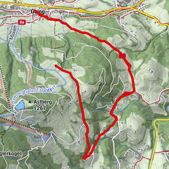
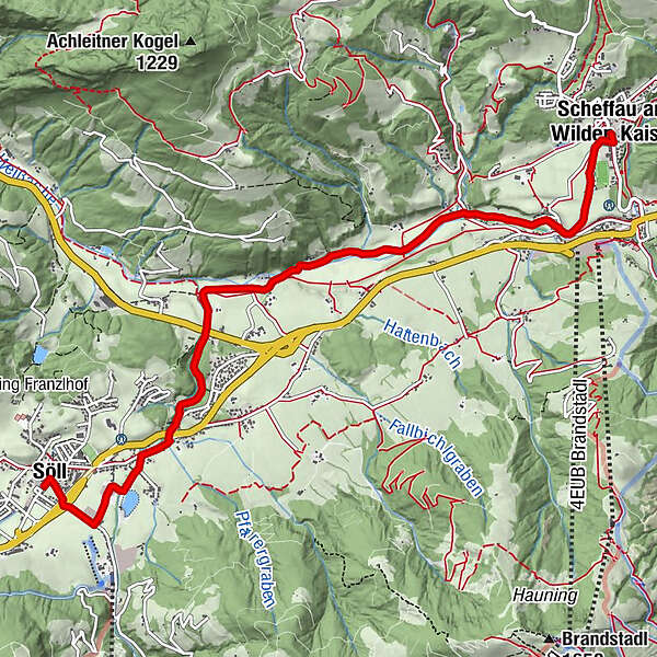
A winter hiking route connects the villages of Söll and Scheffau.
- Stopień trudności
-
średni
- Ocena
-
- Trasa
-
Scheffau am Wilden KaiserBlaiken0,9 kmWurzach (661 m)1,8 kmUnterhauning4,9 kmLechnersiedlung4,9 kmGänsleit5,6 kmBach5,9 kmSöll7,0 km
- Najlepszy sezon
-
siewrzpaźlisgrustylutmarkwimajczelip
- Najwyższy punkt
- 734 m
- Miejsce docelowe
-
Hiking starting point Tourist Info, Söll (689 m)
- Profil wysokości
-

- Autor
-
Wycieczka Connection Scheffau-Söll hiking route jest używany przez outdooractive.com pod warunkiem.
GPS Downloads


Więcej wycieczek w regionach
-
Wilder Kaiser
189
-
Söll
69