
- Krótki opis
-
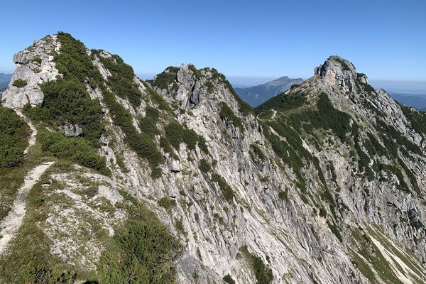
Panoramic hike above Salfelden - through the shady forest over the Teufelsgraben (ditch) with a stop for refreshments and a gondola ride with the Donnerkogel cable car.
- Stopień trudności
-
średni
- Ocena
-
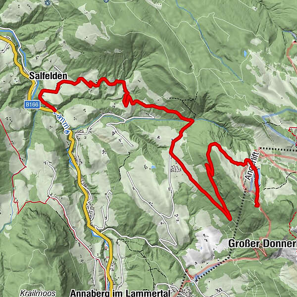
- Trasa
-
Salfelden0,8 kmEdt0,8 kmKlockau2,8 kmBraunötzhof5,3 kmRottenhofhütte9,7 km
- Najlepszy sezon
-
stylutmarkwimajczelipsiewrzpaźlisgru
- Najwyższy punkt
- 1.422 m
- Miejsce docelowe
-
valley station Donnerkogelbahn
- Profil wysokości
-

-

-
AutorWycieczka Salfelden to Astauwinkl via Rottenhofhütte (hut) jest używany przez outdooractive.com pod warunkiem.
GPS Downloads


Informacje ogólne
Przystanek odświeżania
Obiecujący
Więcej wycieczek w regionach