


National Park Dream Loop "Kirschweiler Festung"
Poziom trudności: T2
At 9.1 and only 300 metres in altitude, the Dream Loop Kirschweiler Fortress National Park can be hiked comfortably in a good three hours. Good footwear is recommended because more than half of the trail...
At 9.1 and only 300 metres in altitude, the Dream Loop Kirschweiler Fortress National Park can be hiked comfortably in a good three hours. Good footwear is recommended because more than half of the trail leads along newly created paths and criss-crosses the Ringskopf heap and the Kirschweiler fortress. The trail is marked “untraceable” throughout and can be hiked in both directions.
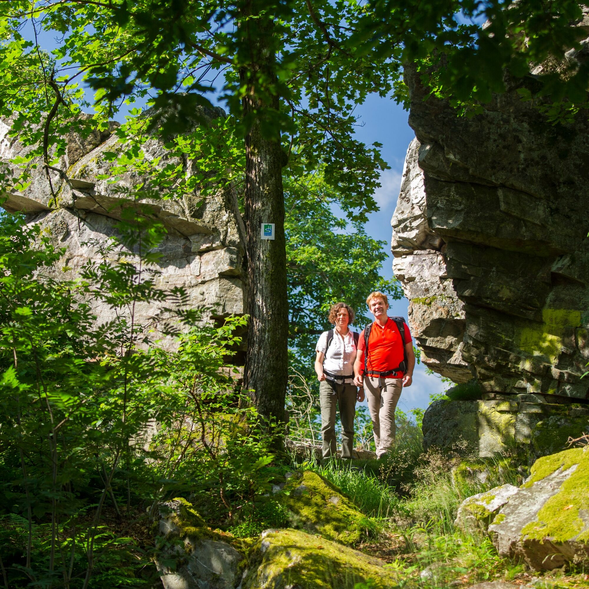
The scenically varied tour in the eastern part of the Hunsrück-Hochwald National Park impressively shows the beauty of the gemstone region. Highlights of the hike are the natural quartzite rock formations of Kirschweiler Fortress with breathtaking viewpoints and the Ringskopf, a Celtic fortification.
The dream loop is connected to the Saar-Hunsrück-Trail premium hiking trail. Access routes are marked from Hettenrodt and Allenbach.

A scenically very varied tour that leads through the middle of the Hunsrück-Hochwald National Park. Highlights of the hike are the Kirschweiler Fortress, a natural quartzite rock formation with breath-taking viewpoints, the Ringskopf, a Celtic fortification, and the old border stone “Dreiherrenstein”. Extensive forest sections far away from any traffic noise make the hike a path in harmony with nature.
The dream loops leads through the middle of the Hunsrück-Hochwald National Park, the only national park in Rhineland-Palatinate. The forest is the dominating part of the hike.
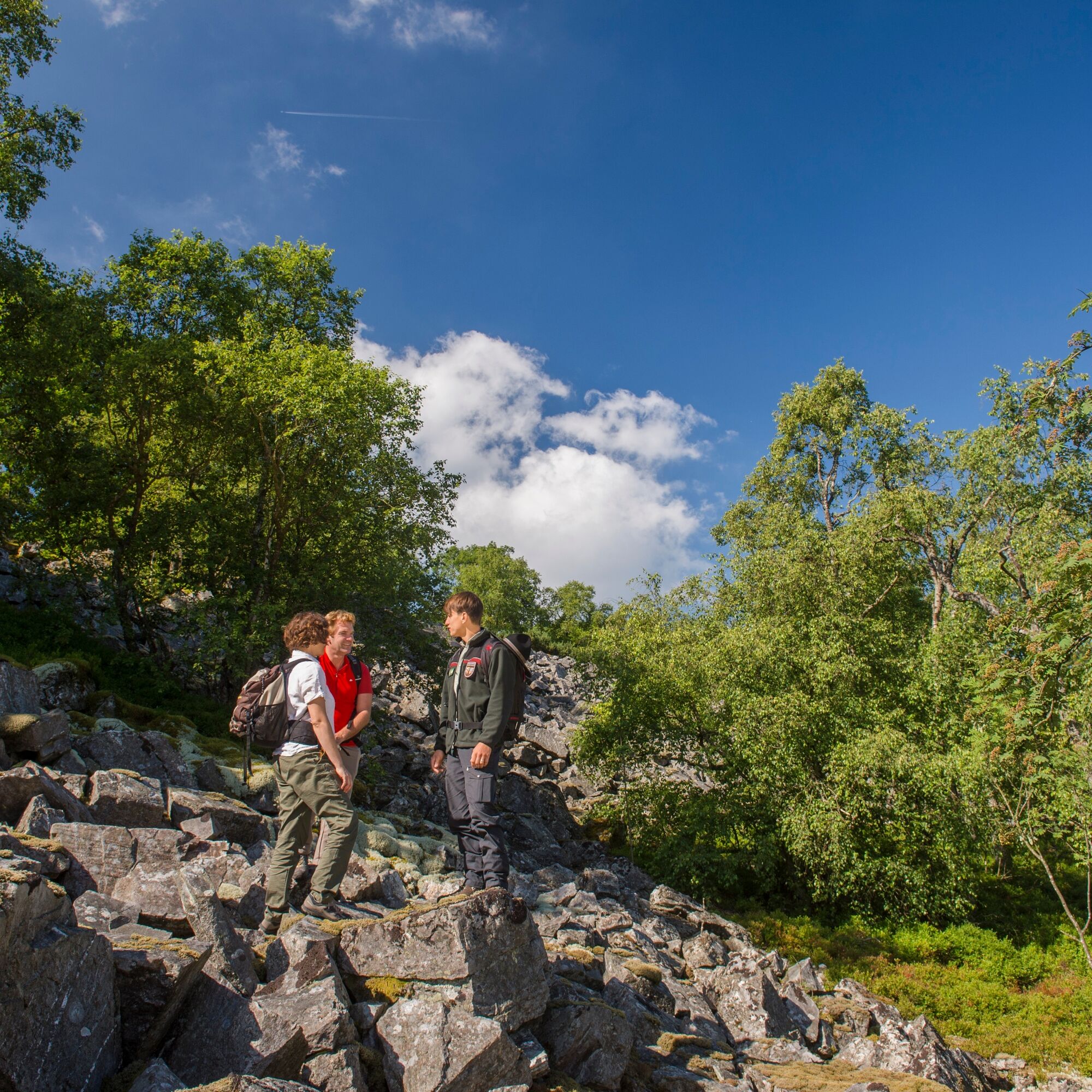
The hike begins at the hikers’ car park near the golf course at the wooden path portal. After passing a small forest biotope, you reach the Dreiherrenstein a little later. Since the late Middle Ages, the historical boundary stone stood between three medieval dominions: The back county of Sponheim, the Rhine counts of Kyrburg and the dominion of Oberstein. Since 1840, the boundary stone has been in its present location. The stone marked the border between the Kingdom of Prussia and the Grand Duchy of Oldenburg. Between giant trees and deadwood with colourful tree sponges, on a hill at the Ringskopf, lies a Celtic refuge whose dimensions are still clearly recognisable. From the edge of the slope, a picturesque Hunsrück view of the Idarkopf and various Hunsrück villages.
The Kirschweiler fortress high above the Idarbach - also called Hunschrank or Silberich - is possibly an early Celtic cult site. The fortress again offers exceptional views over the Hunsrück.
The trail has a very high proportion of nature trails, ideal for lovers of nature and silence.
Tak
Hiking footwear essential!
Our tips for carefree hiking fun
Hiking is the perfect sport. With the right clothes and shoes, it's twice as much fun. Functional clothing, poles and breathable backpacks are good choices when hiking. But good footwear is indispensable. Sturdy jogging or leisure shoes are at best only suitable for short distances on flat paths. For longer walks, we recommend sturdy hiking boots with non-slip soles. Also remember to take sunscreen and a drink. A litre of water is best.
The dream loops do have some steep, difficult and, in rainy conditions or in winter, some slippery sections. Therefore, hiking boots, a sure footing and good physical condition are essential requirements for hiking these premium circular trails.
A62: Exit at Birkenfeld, B41 towards Idar-Oberstein to Rötsweiler-Nockental. In the village, head for Leisel/Hettenrodt to Hettenrodt. In the village centre, turn left towards Kirschweiler. In Kirschweiler, follow the signs to the golf course.
A61: Exit at Bad Kreuznach, B41 towards Idar-Oberstein. In Idar-Oberstein, take the B422 in the direction of Bernkastel-Kues until Kirschweiler. In Kirschweiler, follow the signs to the golf course.
A1: Exit at Reinsfeld onto the B327 (Hunsrückhöhenstraße) towards Morbach. Before Morbach, take the B269 towards Idar-Oberstein. After Katzenloch, turn right to Hettenroth/Kirschweiler. In Kirschweiler, follow the signs to the golf course.
B327/B50: After Morbach, take the B269 towards Birkenfeld/Idar-Oberstein. After Katzenloch, turn right to Hettenroth/Kirschweiler. In Kirschweiler, follow the signs to the golf course.
Walk 1200 metres (approx. 200 m to Wasserschieder Straße, turn left into Wasserschieder Straße, after approx. 500 m turn right) to Kirschweiler golf course.
Daily updated timetable information at www.rnn.info
Please use the DESIGNATED PARKING PLACES FOR DREAM LOOP “Rund um die Kama” - IN DER KAMMER!
Please do not use the car park for the “Kammerhof” restaurant. These are private car parks reserved for the restaurant guests.
T2
Tourist information EdelSteinLand:
Office Herrstein
Brühlstrasse 16
55756 Herrstein
Phone +49 6785 - 79 1400
Fax +49 6785 - 79 81400
info@edelsteinland.de
www.edelsteinland.de
Office Idar-Oberstein
Hauptstraße 419
55743 Idar-Oberstein
Phone +49 6781 - 64 6040
Fax +49 6781 - 64 9514
info@edelsteinland.de
www.edelsteinland.de
The gemstone workshops in Kirschweiler, which are open to visitors, bring the traditional craft of gemstone cutting to life.
Popularne wycieczki w okolicy
- 4,6
Dream Loop "Köhlerpfad am Steinbach"
średniWędrówka 13,4 km - 4,3
Dream loop "Medieval Path"
średniWędrówka 8,46 km - 5,0
Traumschleife Hunolsteiner Klammweg
ciężkiWędrówka 11,9 km - 4,0
Dream loop "Nahe Rock Trail"
ciężkiWędrówka 8,98 km - 4,3
Hunsrückhaus - Erbeskopf - Gottlob - Springenkopf
średniWędrówka 7,29 km - 4,5
Dream loop "Around the Kama"
światłoWędrówka 6,18 km - 2,5
Dream Loop "Between the Forests"
średniWędrówka 10,7 km Dream Loop "Gemstone Grinder's Path"
średniWędrówka 16,0 km- 4,0
Dream Loop "STUMM Ironworks Route"
średniWędrówka 15,5 km - 5,0
Hunsrückhaus - Gottlob - Erbeskopf - Windklang
światłoWędrówka 7,09 km

Wędrówki i tropienie


Nie przegap ofert i inspiracji na następne wakacje
Twój adres e-mail została dodana do listy mailingowej.