- Krótki opis
-
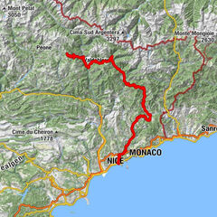
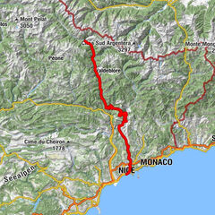
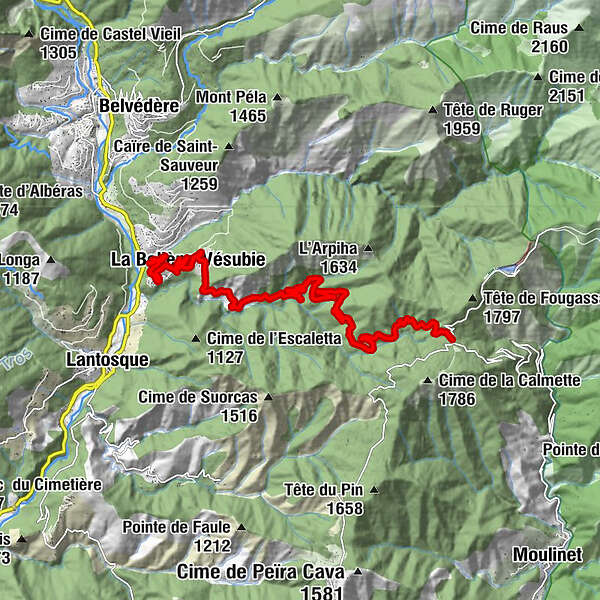
An impressive series of pingles and a beneficial forest of conifers that will shelter the cyclos in the final part up to the Col de Turini à 1604 m of altitude.
- Stopień trudności
-
ciężkie
- Ocena
-
- Trasa
-
La Ribaya0,3 kmLe Puey1,3 kmFerraya2,2 kmBollena3,0 kmMarmite de la Bollene5,3 kmLes Chamois15,0 kmLes Trois Vallées15,0 km
- Najlepszy sezon
-
stylutmarkwimajczelipsiewrzpaźlisgru
- Najwyższy punkt
- 1.599 m
- Miejsce docelowe
-
Hamlet of the Pass
- Profil wysokości
-
 © outdooractive.com
-

-
AutorWycieczka Climbing the Col de Turini jest używany przez outdooractive.com pod warunkiem.
GPS Downloads


Więcej wycieczek w regionach