


CLAVIERE Claviere - Montgenevre - Bois de Sestriere
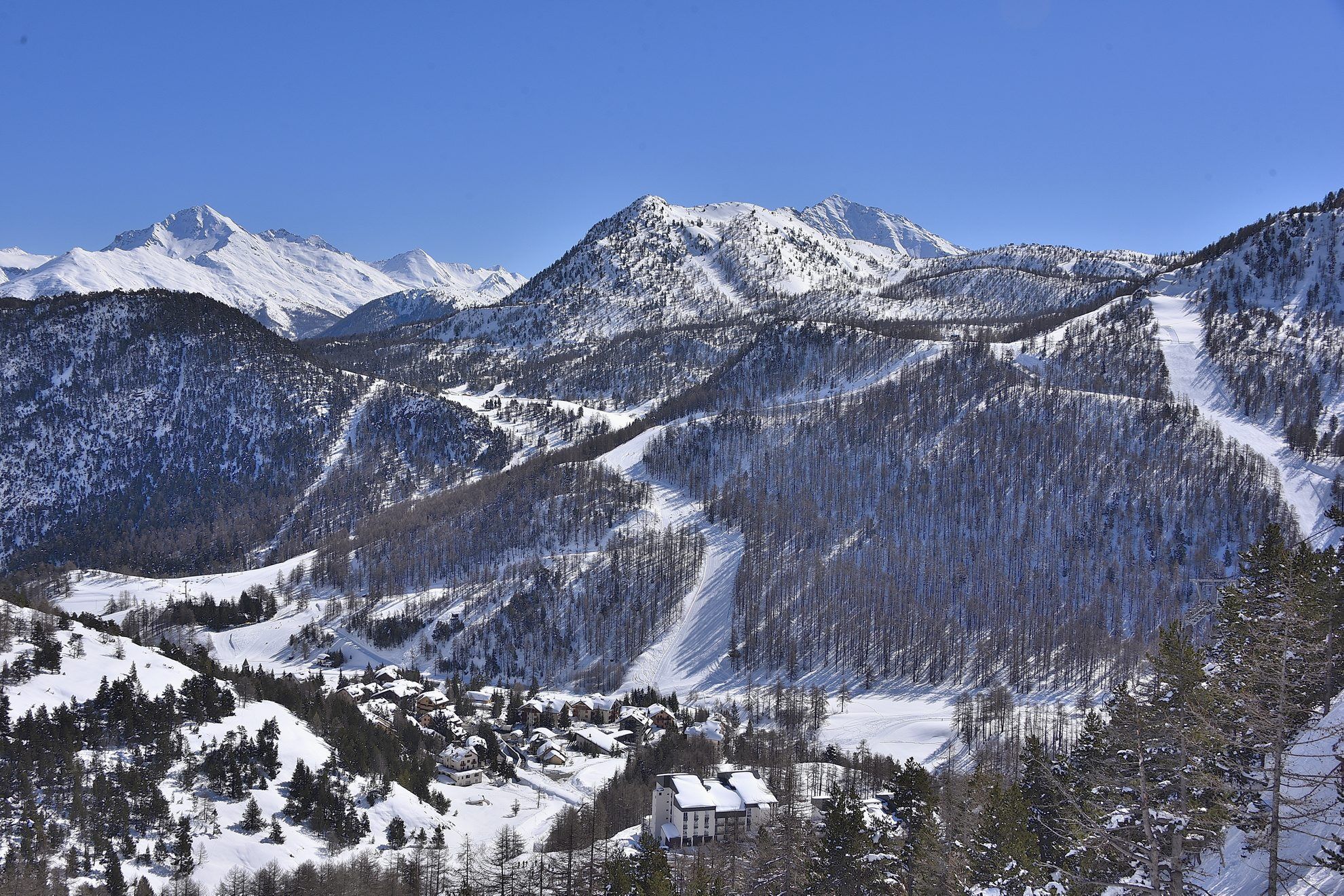
The easy and regularly groomed trail connects the village of Claviere with the nearby French town of Montgenevre through a beautiful route that runs above the famous golf course.
Once in Montgenevre, by...
The easy and regularly groomed trail connects the village of Claviere with the nearby French town of Montgenevre through a beautiful route that runs above the famous golf course.
Once in Montgenevre, by crossing a beautiful larch forest, you reach the viewpoint with a breathtaking view over the Briançon valley with its fortifications.

Tak
Appropriate clothing and footwear for the winter mountain environment: snowshoes – poles – ARVA, shovel and probe
Snow hiking activities in snowy environments require the use of electronic signaling and search systems as established by Legislative Decree no. 40/2021 art. 26
Warning: crossing ski slopes
Before undertaking any hike it is recommended to:
Check the weather and avalanche bulletins from ARPA Piemonte, http://www.arpa.piemonte.it/bollettini
Get information from local Tourism Offices, Ski Schools, or Alpine Guides.
The route is usually groomed by snow grooming vehicles but there is no daily or periodic surveillance or maintenance service.
In case of high avalanche risk, undertaking any hike is not advised.
Snow hiking activities in snowy environments require the use of electronic signaling and search systems as established by Legislative Decree no. 40/2021 art. 26
Warning: crossing ski slopes
From Turin, follow signs for the North bypass towards the Frejus Tunnel. Take the A32 towards Bardonecchia and exit the motorway at Monginevro/Sestriere. After the tunnel exit, continue right for 11 km towards Cesana; at the roundabout take the first right and continue straight for 6 km until reaching the village of Claviere.
Turin-Bardonecchia railway line. Stop at Oul-Cesana-Claviere-Sestriere station.
Bus line no. 285 Arriva
Unattended paid parking in the village center - Piazza Europa. Season tickets available for purchase at the Claviere tourism office.
Do not litter; take your waste with you, also picking up any left by others.
The indicated travel times are approximate and can vary depending on weather conditions and personal ability.
Under certain conditions, the route can be undertaken wearing hiking boots and crampons.
The route is usually groomed by snow grooming vehicles but there is no daily or periodic surveillance or maintenance service.
Kamery internetowe z trasy
Popularne wycieczki w okolicy
- 5,0
BARDONECCHIA Col des Acles - Passo della Mulattiera
średniWędrówka 6,23 km - 5,0
SESTRIERE Monte Rognosa
ciężkiWędrówka 6,42 km BARDONECCHIA - Loop Colle della Scala - Col de Montgenèvre - Colle del Sestriere
ciężkiDroga rowerowa 91,9 km- 5,0
CESANA T.SE Cesana - Fenils
światłoWędrówka 4,60 km - 5,0
CESANA T.SE Thures - Cima Bosco
ciężkiRakieta do chodzenia po śniegu 3,94 km - 5,0
BARDONECCHIA Chesal nature route
światłoWędrówka 3,48 km CESANA T.SE Lago Nero - Seven Colors Lake
średniWędrówka 3,51 kmGR® 5 La grande traversée des Alpes
średniWędrówka 95,6 kmCESANA T.SE Val Thuras
średniWędrówka 7,58 kmAscension du Col du Granon (2413 m)
średniMountainbike 11,3 km

Wędrówki i tropienie


Nie przegap ofert i inspiracji na następne wakacje
Twój adres e-mail została dodana do listy mailingowej.