
© Unbekannt
- Krótki opis
-
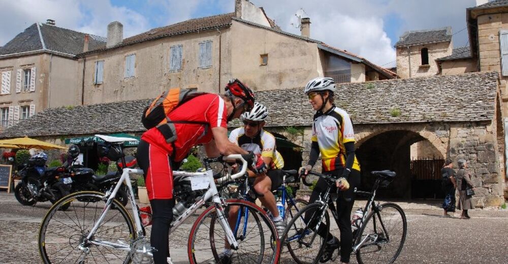
En couple, en famille ou entre amis, laissez-vous surprendre tout au long de votre parcours par la diversité et la beauté des paysages.
- Stopień trudności
-
łatwe
- Ocena
-
- Trasa
-
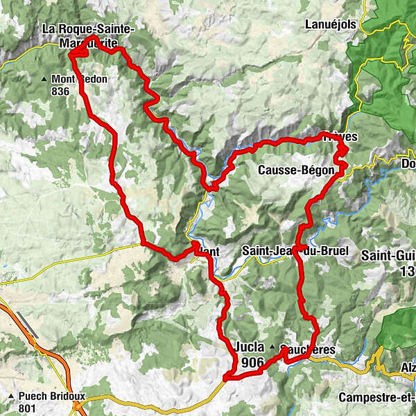
NantLe Faubourg Haut0,1 kmMontredon8,4 kmPierrefiche du Larzac14,8 kmÉglise Saint-Pierre14,9 kmAuberge du Roc Banut19,9 kmÉglise Sainte-Marguerite-d'Antobe19,9 kmLa Roque-Sainte-Marguerite20,0 kmSource du Moulin de Corp22,2 kmLe Poujol24,3 kmAven-grotte Émilie29,3 kmGrotte Gothique32,5 kmBaume33,9 kmCantobre34,4 kmTrèves43,6 kmLa gavotte43,7 kmÉglise Notre-Dame-de-la-Purification43,7 kmFaubourg du Vieux Pont54,5 kmSaint-Jean-du-Bruel54,8 kmSauclières60,9 kmLe Frayssinet-Haut69,0 kmLe Frayssinet-Bas70,3 kmLe Camp de la Fon70,5 kmDevez du Maire72,9 kmMaillac de Brevinque73,7 kmLa Mouline74,6 kmLe Valat75,0 kmLe Faubourg Bas75,1 kmLe Sanglier Hilare75,1 kmNant75,4 kmLe Faubourg Haut75,6 km
- Najlepszy sezon
-
stylutmarkwimajczelipsiewrzpaźlisgru
- Najwyższy punkt
- 885 m
- Miejsce docelowe
-
Nant
- Profil wysokości
-
 © outdooractive.com

- Autor
-
Wycieczka Circuit Dourbie Larzac jest używany przez outdooractive.com pod warunkiem.
GPS Downloads


Informacje ogólne
Przystanek odświeżania
Kulturalny/Historyczny
Flora
Obiecujący
Więcej wycieczek w regionach