© OÖ. Tourismus/Erber
Dane wycieczki
13,86km
547
- 1.579m
1.341hm
1.309hm
06:07h

- Krótki opis
-
Mountain tour on well-marked and signposted trails, surefootedness required from the ascent to the Törl incl. some rope belays. An immensely rewarding day tour for mountain enthusiasts with stamina.
- Stopień trudności
-
ciężkie
- Ocena
-
- Trasa
-
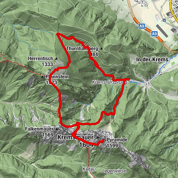
Törlspitze (1.510 m)3,3 kmTörl (1.457 m)3,4 kmKremsmauer (1.604 m)4,5 kmPyramide (1.599 m)4,6 kmNackter Kalbling (1.368 m)7,7 kmRauer Kalbling (1.381 m)7,9 kmGradnalm8,8 km
- Najlepszy sezon
-
stylutmarkwimajczelipsiewrzpaźlisgru
- Najwyższy punkt
- 1.579 m
- Miejsce docelowe
-
Micheldorf/parking near Kremsursprung
- Profil wysokości
-


- Autor
-
Wycieczka Mountain tour on the Kremsmauer jest używany przez outdooractive.com pod warunkiem.
GPS Downloads


Informacje ogólne
Przystanek odświeżania
Obiecujący
Więcej wycieczek w regionach