© Unbekannt - ARDT23

- Krótki opis
-
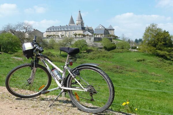
The "tour de Creuse" by bike is 100% discovery and the assurance of not being bored on a varied itinerary, adapted to all types of practitioners, families or experienced sportsmen. There is something for everyone!
- Stopień trudności
-
łatwe
- Ocena
-
- Trasa
-
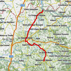
Châtelus-Malvaleix0,1 kmMontagaud4,0 kmLe Monteil6,2 kmCoussat7,6 kmLes Contredis10,2 kmBonnat11,2 kmLe Rateau14,0 kmVillesigne15,5 kmHéret18,0 kmLe Fournioux19,6 kmLa Tuilerie Saint-Martin23,2 kmLes Fougères24,3 kmLe Bourg-d'Hem27,7 kmLe Bistrot des Arts27,7 kmLe Moulin de Guévigneau29,6 kmBeausoleil31,5 kmLes Chiers33,0 kmRestaurant Barrège Laurent37,7 kmAuberge des Pêcheurs37,9 kmÉglise Saint-Pierre-ès-Liens38,0 kmLa Celle-Dunoise38,1 kmLavaud40,1 kmPuyduris42,2 kmLa Bussière45,4 kmLes Forges46,4 kmL'Age47,8 kmLa Charpagne49,8 kmLa Pouge50,7 kmFresselines50,8 kmLa Chaise Peignin53,7 kmLa Minaudière54,1 kmChatre54,2 kmLe Pescher55,0 kmLa Chebreau55,7 kmLe Montsarrazin57,1 kmCrozant58,6 kmL'Auberge de la Vallée58,6 km
- Najlepszy sezon
-
stylutmarkwimajczelipsiewrzpaźlisgru
- Najwyższy punkt
- 418 m
- Miejsce docelowe
-
Crozant
- Profil wysokości
-
 © outdooractive.com
-

-
AutorWycieczka Tour de Creuse : Châtelus Malvaleix > Crozant jest używany przez outdooractive.com pod warunkiem.
GPS Downloads


Informacje ogólne
Przystanek odświeżania
Kulturalny/Historyczny
Flora
Obiecujący