


Parcours entre Leyre et L'Eyre
Poziom trudności: 2
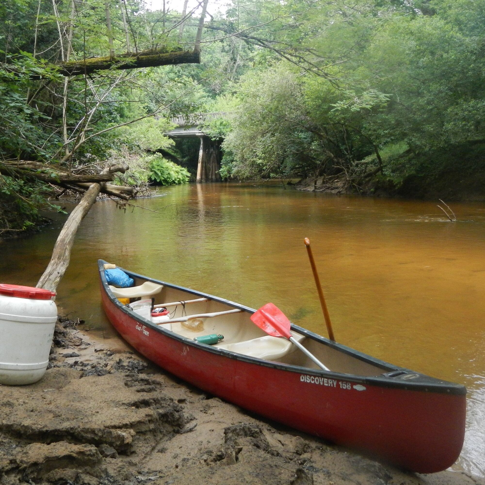
The Grande Leyre and the Eyre are real waterways with banks lined with royal osmunda. The water, of rust color, slides on the undulating sand. The place is studded with dragonflies. Alder and oak trees...
The Grande Leyre and the Eyre are real waterways with banks lined with royal osmunda. The water, of rust color, slides on the undulating sand. The place is studded with dragonflies. Alder and oak trees form a vegetal canopy.
The Leyre, of amber color, flows on a bed of sand. Clearly identifiable by the deciduous vegetation which contrasts with the maritime pine forest of the plateau, this river is rich and fragile.
Route from Pissos to Saugnacq-et-Muret passing by Moustey.
Tak
Tak
Wear a life jacket.
In case of emergency, dial 112
On the Leyre navigate calmly: by canoe or paddle, get information beforehand (difficulty of the route, weather), respect the rules in force such as wearing a life jacket.
Consider carpooling
Contact the canoe rental companies, otherwise go to Pissos at the Testarouman nature station (Regional Natural Park Values) for guided descents
Park at the Testarouman nature station in Pissos and rent your canoe
2
Popularne wycieczki w okolicy
A Belhade, un château, une fontaine guérisseuse et un arbre magique
światłoWędrówka 0,88 kmEglises et fontaines guérisseuses, un retour aux sources !
światłoWędrówka 10,6 kmVTT - Eglises et fontaines guérisseuses, un retour aux sources !
średniMountainbike 10,6 kmSore à pied, histoire d'un village médiéval au bord de la petite Leyre
światłoWędrówka 12,4 kmSore en VTT, histoire d'un village médiéval au bord de la petite Leyre
światłoMountainbike 12,4 kmGrande Leyre landaise de Commensacq à Pissos
średniKajak / Canoe 27,9 kmA Belin-Béliet, des murs qui parlent et des fontaines qui soignent
światłoJazda na rowerze 33,6 kmParcours journée entre Leyre landaise et L’Eyre Girondine
średniKajak / Canoe 27,0 kmDe Biganos à Labouheyre via les GRP, GR6 et GR655 en écomobilité
światłoWędrówka 86,9 km

Wędrówki i tropienie


Nie przegap ofert i inspiracji na następne wakacje
Twój adres e-mail została dodana do listy mailingowej.